
| |||||
| Wexford | Kilkenny | Waterford | Getting There | Tours | Gallery |
| Cork | Kerry | Clare | Tipperary | Galway | Mayo |
|
Places of Interest
Home Page
|
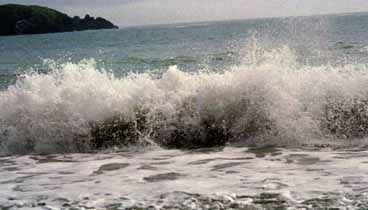
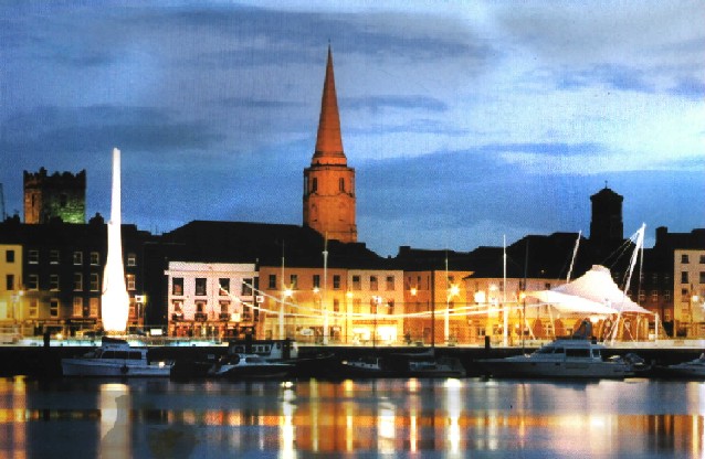 The Plaza Waterford - mouth of the estuary
Cheekpoint is a nice little fishing village, set on a headland above the confluence of the Suir and Nore-Barrow rivers. It is an area that is well adorned with river and forest walks. Particularly Faithlegg forest from where you can see beautiful vistas of the Suir and Barrow Rivers. Here there are extensive forest walks through Sitka spruce, noble fir and some Japanese larch. Rhododendron can be seen among the bracken and bramble. Guests include many species of song birds, as well as the ubiquitous rabbit, fox and badger. The twin stacks on the opposite bank mark the Great Island electricity generating plant at Campile in Co. Wexford. As it is a fishing village there are plenty sights of angels fishing both for pleasure and for a living. The village traditionally depended on fishing as a source of income. And today there are some very nice sea food restaurants in the village.
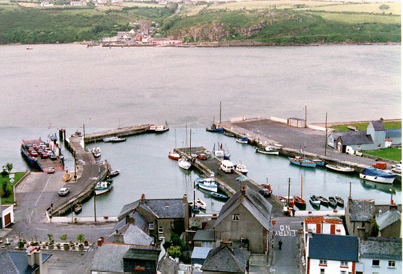 Passage East Passage East is an ancient port and that played a crutial role in Irish history. It was here Strongbow came ashore in 1170 to invade our shores. It was in essence the start of the English occupation of Ireland. Although the real brutality and annexation did not occur until Cromwellian times. He arrived with 200 knights and 1,000 men in preparation for his attack on Waterford. Henry II landed with 4,000 men in 1171 and Cromwell's son in law took the fort in 1649. With its turbulent past now in its history it is now a peaceful village where one can take the ferry across to Ballyhack. Or just enjoy a quiet afternoon in a local bar, watching the fisherman as the come and go out on the boats. To Ballyhack - Sailing’s all year, April to September from 7.20-22.00 weekdays and 9.30-22.00 Sundays; October to March from 7.20,20.00 weekdays and 9.30-20.00 Sundays. No reservations necessary. Fare payable on ferry. Tel.: 051 382480 or 051 382488.
Woodstown Woodstown is the next port of call. The Beach is about a mile long and is bordered on one side by Woodstown Woods. Wide up hill through the woods and you come to the imposing Woodstown house which was once owned by the Wadding family in the 1700s. (Fr. Luke Waddings statue stands opposite Reginalds Tower in Waterford). The beach is very tranquil and some very nice winter sunsets can often be witnessed here. The hill nearby is called Knockadirragh, where there is a megalithic tomb. (Harrison). From the hill you can see very nice views – Belle Lake, Woodstown, Creaden Head and Dunmore East. The tomb is said to be on an ancient roadway which ran all the way to Cork. It is called Boirin na mban Gorm – the road of the Black woman. (Was this some Moorish woman who survived a shipwreck on the coast???) Fornagh Strand is nearby. Dunmore is the next village, which is described in more detail on its own link.
 Ballymacaw Ballymacaw is a small pretty village, with a cove and some nice coastal scenery. Nearby is a promontory fort and a standing stone. Portally Cove is very pretty. I don’t know too much about the history of this village, but its just a nice place to grab a few hours rest and a quiet read on the beach. Tramore is the next main center. I have dedicated a seperate link to Tramore. 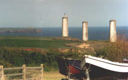 Metal Man Tramore's most famous personality has been standing on top of his 61-foot pillar since 1824, warning mariners of the dangerous Tramore Bay. The origin of this impressive figure dates from the early years of the 19th century when a sailing vessel passed on the wrong side of a reef of rocks off Rosses Point and foundered with the loss of all hands. The wife of the Captain of the ill-fated vessel was so appalled by the tragedy that she petitioned the Authorities to place some sort of warning signal on the dangerous rocks, and as the authorities seemed to address the matter with a lot more wages than actions, the good lady decided to do something about it herself. Being a woman of some means she commissioned the sculptor, Thomas Kirk, to design some form of warning signal, and so was created the small model of a Metal Man which Kirk exhibited at an exhibition in London in 1817. That catalogue described it as the figure of a British Tar, a sketch designed for a colossal statue to stand on a dangerous rock in the sea near the harbour of Sligo as a beacon. Two years later the Ballast Board commissioned John Clarke to cast a metal figure from Kirk's model at a cost of 80 pounds. It was one of four gigantic figures cast at that time, our man being one of them. The whereabouts of the other two remain a mystery. Many suggestions have been bandied around - Sydney Harbour, Montevideo, Norway and even Boston in the USA. However, Tony Caulfield, an avid Marine enthusiast, wrote to the Library in Sydney, Australia, and they assured him that there was never any such statue in Sydney. Personally, I would image that they were probably lost in transit to some foreign destinations and are now lying at the bottom of Davy Jones' Locker. Thankfully Tramore and Sligo have that old man of the sea still in their midst. (From a long history of Tramore)
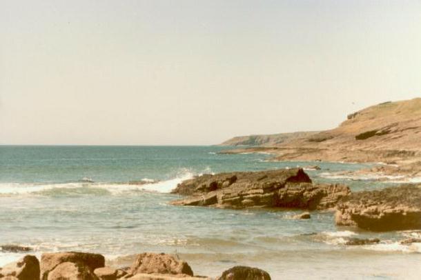
 Garris Waterford A prehistoric earthen fortress once stood stand on top of the hill where the ruins of the castle now stand, hence the name, Dunhill. The castle was once the chief seat of the Barons of Dunhill. The castle was captured and blown up by Cromwell in 1649. The last Baron to reside there with eighteen of his kinsmen was transported to Connaught and his lands forfeited and given to an ancestor of the Earl of Enniskillen. The ruins of the castle fortress still exist today. The area near Fenor hosts some beautiful coves and beaches. My favorite has always been Garris. It’s a small cove off the beaten path. It is here that I often used to take my books on a sunny day and read or study. When the wind blows hard, you can sit at the entrance to some of the caves and just look out to the raging sea. Lots of pinnacle rocks protrude from the sea, giving a dramatic effect during stormy times. Kilfarrassey lies 2 miles further on. This beach is about 400m long with a nice sandy beach. Again you can shelter from the wind in the caves. When the tide is out, you can cross the rocks to a smaller cove and enjoy the solitude of it all. Walking along the cliffs overhead you can view the spectacular rocky coast, each turn revealing a hidden beach or a new dramatic seascape. The closest village is Fenor. The church in Fenor was build in 1894. About 2 miles north of here you can find Knockeen and Gaulstown dolmens and the passage grave at Matthewstown. Fenor itself is part of a Neolithic complex. The powers were the principle landowners for centuries. Again North of Fenor is Ballyscanlon Forest and Lake. Its a pretty nice area to walk, complete with Norweigan Spruce and Sitka.
 Annestown Just before the village of Annestown, you reach the beach. At the entrance to the beach is a lime kiln. A perfectly formed sea arch stretches out from the cliffs. And to the west lies a promontory fort. The beach is a popular local spot for bathers and surfers. The beach, with its castellated lime kiln, sea arch and island, is most attractive and is popular with surfers as well as bathers. To the west of the beach is another promontary fort. The river Anne flows from a cross the road among the reeds to the bottom of the village. West of Annestown, near Boatstrand, is the beautiful Dunabrattin head with another promontary fort which can be reached from a scenic cliff walk. The views from the head are spectacular. And you can just image how it fortified the locals during those ancient invasions. There is a nice pottery outlet just above Boatstown. The road turns into a hairpin and there you can see a dramatic view of Kilmurrin cove. Just beyond this is the ruin of the old Cornish engin house that in the last century pumped out copper from a depth of 400m from the local mines. This stretch of coast line is locally known as the Copper Coast. Bunmahon is a village that is popular with campers and caravans. A weekend retreat for Waterford, Tipperary and Cork people. There are headlands at either end of the beach. And the cliffs reveal small isolated coves and sea stacks. This was the central town for the labouring copper miners.  Annestown |
