


| The Greek Islands | Skyros HOME | Skyros Hotels | Skyros Sights | Skyros Beaches | Skyros Travel |


|
|
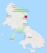
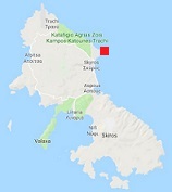
The monastery of Agios Georgios is located in the castle above the Chora of Skyros and was probably founded in the year 960. The church was built between 1599 and 1602. Inside the church are well preserved frescoes. In 2001 the monastery was significantly damaged by an earthquake and after that it was renovated for 15 years. In 2015 the monastery was opened for the public again. The Byzantine castle above the chora of Skyros is situated at the highest point and overlooks the whole area. According to mythology this was the place where King Lycomedes murdered the Athenian hero Theseus and later Achilles hid himself in order not to participate in the Trojan War. The fortress was built in defense against the attacks of pirates and the people that lived below in the village had a second home here. Much of the castle has fallen into decay in the course of time. The later Turkish and Venetian occupiers of the island probably did not think Skyros was important enough to restore the castle again. Above the entrance of the fort a lion is depicted in marble. This marble lion is still part of the old acropolis that once stood on the same site and was placed here by the Byzantine owner. The fort is surrounded on four sides by the remnants of the four towers that the castle had. |
 1 -The Chora of Skyros with its narrow cobbled streets, its monastery, the statue of the poet Rupert Brooke, churches and castle. There are nice squares and pretty houses that are typical for the island of Skyros. The Archeological Museum of Skyros has a collection of findings on the island dating from 2800 BC up to the Roman times. Many of the finds are from the ancient town of Palamari in the north of Skyros. The museum is next to the The Manos Faltaits Museum, the local historical and folk art museum.
|
|
 2 -The ponies of Skyros - because of its isolated location of the island there lives a unique kind of pony here. This pony was already around in the ancient days when the breed was quite common. Because these ponies have never been crossed with other kinds of horses they are unique and they only live on the island of Skyros, mainly in the mountainous south. They are an endangered species that used to live all over Greece in antiquity. Now about 150 still live on the island of Skyros (most of them in the wild) and are mainly in the winter it is very hard for them to survive. Some farmers give extra food to these ponies. The ponies are very small (90 centimeters to 1.15 meter) and they have different colours such as brown, reddish brown or gray. The areas where they can graze are slowly getting smaller because of the increase in the number of sheep on Skyros.
The ponies are in all likelihood descendants of horses who were taken by colonists from Athens to the island of Skyros in the 5th to the 8th century BC and it is possible that Alexander the Great used them during his conquests.
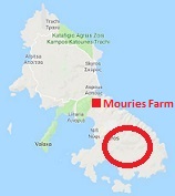
On the narrow part of the island of Skyros, on the route from Achilli to Kalamitsa, you find Mouries Farm, where a number of volunteers take care of a few dozen of these small horses with a view to the preservation of this special breed.
2 -The ponies of Skyros - because of its isolated location of the island there lives a unique kind of pony here. This pony was already around in the ancient days when the breed was quite common. Because these ponies have never been crossed with other kinds of horses they are unique and they only live on the island of Skyros, mainly in the mountainous south. They are an endangered species that used to live all over Greece in antiquity. Now about 150 still live on the island of Skyros (most of them in the wild) and are mainly in the winter it is very hard for them to survive. Some farmers give extra food to these ponies. The ponies are very small (90 centimeters to 1.15 meter) and they have different colours such as brown, reddish brown or gray. The areas where they can graze are slowly getting smaller because of the increase in the number of sheep on Skyros.
The ponies are in all likelihood descendants of horses who were taken by colonists from Athens to the island of Skyros in the 5th to the 8th century BC and it is possible that Alexander the Great used them during his conquests.
On the narrow part of the island of Skyros, on the route from Achilli to Kalamitsa, you find Mouries Farm, where a number of volunteers take care of a few dozen of these small horses with a view to the preservation of this special breed.
|
|
 3 -The grave of Rupert Brooke is situated in a remote area in the southwest of the island of Skyros, in Tris Boukes Bay. Previously you could get there by boat from for instance Linaria, but the route was closed by the Greek Navy and the grave can now only be to reached over land. From Chora take the road south to Linaria and than take the exit on the left that says "Achili. This road eventually leads to Kalamitsa. After Kalamitsa the road becomes unpaved and here the island is virtually uninhabited. You have to drive to the south. There are signs that say that you are entering a miltaire zone but the zone starts after the grave of Rupert Brooke as the road descends to the bay. The grave is on the left side approximately 45 meters from the road in a field of olive trees. The grave was made by a Greek sculptor and inscribed on the grave is Brooke's most famous poem.
|
|
 4 -The old prehistoric site of Palamari is situated in the northeast of the island of Skyros at 13 kilometer distance from the capital Chora, not very far from the airport. This ancient town of Palamari dates from 2500 to 1800 BC and it was a large city that was important for the island of Skyros itself and for the whole area. The city had a port which connected it to other islands in the Cyclades, the North Aegean and the mainland of Greece. There are remains of houses, large buildings, roads and fortified walls that surrounded the town of Palamari. A large part of the city has vanished in the sea. Artefacts that have been found on Palamari are on display in the Archeological Museum in Skyros Chora.
The nearby and unorganized beach of Palamari (just south of the excavation) has no umbrellas or sunbeds and is usually fairly quiet.
4 -The old prehistoric site of Palamari is situated in the northeast of the island of Skyros at 13 kilometer distance from the capital Chora, not very far from the airport. This ancient town of Palamari dates from 2500 to 1800 BC and it was a large city that was important for the island of Skyros itself and for the whole area. The city had a port which connected it to other islands in the Cyclades, the North Aegean and the mainland of Greece. There are remains of houses, large buildings, roads and fortified walls that surrounded the town of Palamari. A large part of the city has vanished in the sea. Artefacts that have been found on Palamari are on display in the Archeological Museum in Skyros Chora.
The nearby and unorganized beach of Palamari (just south of the excavation) has no umbrellas or sunbeds and is usually fairly quiet.
|
|
 5 - The shipwreck at Agalipa beach is located in the northwest of the island of Skyros, close to the airport. Agalipa beach consists of two beaches. They are located just south of the beach of Agios Petros in a bay surrounded by oak trees that reach out to the coast. While the one beach is larger and has golden sand and clear water, the smaller beach with the shipwreck has a darker sand colour. The beaches are not organized and because they are difficult to reach by road it is usually very quiet. You can only get there over the water by boat or on foot over a narrow path through the woods (this leads to the larger beach). The boat itself is a remnant of a stranded boat in which nearly a hundred immigrants / refugees were on their way from Turkey to the port of Kimi on the island of Evia, where they planned to arrive during the night. The boat got caught in a storm and the captain decided to strand the boat on the shores of the island of Skyros instead.
|
|
 6 -
The church of Agios Nikolaos is a picturesque and unique church which is built into a rock on the cape near the sea in Akra Pouria, not far north of the beach of Molos in the northeast of the island of Skyros, and just north of the capital of the island, Skyros Chora. It faces the small Vrakhonisidhes Vrikolakonisia islets that lie off the coast. On one of these islets you can see another photogenic church, the Agios Ermolaos chapel. Nearby is also a special rock in the shape of a mushroom and there is an old windmill. The rock in which the Agios Nikolaos church was built is made of limestone and was in ancient times a quarry for the reddish stone that it consists of. This is clearly visible at the back of the church / rock. There you can see where blocks of stone have been cut out of it. The Agios Nikolas church itself is very small and only a few people fit in.
6 -
The church of Agios Nikolaos is a picturesque and unique church which is built into a rock on the cape near the sea in Akra Pouria, not far north of the beach of Molos in the northeast of the island of Skyros, and just north of the capital of the island, Skyros Chora. It faces the small Vrakhonisidhes Vrikolakonisia islets that lie off the coast. On one of these islets you can see another photogenic church, the Agios Ermolaos chapel. Nearby is also a special rock in the shape of a mushroom and there is an old windmill. The rock in which the Agios Nikolaos church was built is made of limestone and was in ancient times a quarry for the reddish stone that it consists of. This is clearly visible at the back of the church / rock. There you can see where blocks of stone have been cut out of it. The Agios Nikolas church itself is very small and only a few people fit in.
|
|
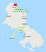
 7 - Atsitsa is a village located in the northwest of the island of Skyros. The distance to the capital Skyros Chora is about 17 kilometers and the connection with Atsitsa by road is good. The village is named after a small island that lies off the coast and that bears the same name. Atsitsa has a pebble beach and is surrounded by a pine forest that grows to the coast. There are fields with olive trees and there are fruit trees in the area. Striking are the abandoned ruins of buildings on the coast and the remains of pillars in the sea. There are remnants of the railway that were built here around 1900 by a German company that exploited metals found in the area in the mines. In the vicinity of Atsitsa are many small bays where you can swim in peace and not far are other beaches such as Agios Petros, Theotokos and Agios Fokas. Since 1982 there is an alternative holiday center in Atsitsa where yoga classes are given.
|
|
 8 - The Agios Dimitrios monastery is located in the mountains in the interior of the island of Skyros at about 6 kilometers from the capital Skyros Chora. According to an inscription the wall around the monastery was built in the year 1611. The Agios Dimitrios church stands on the site of an even older church and this was built on the spot where in ancient times there was a temple. The temple was dedicated to the goddess Dimitra. The church as it stands now dates from an earlier period than the wall, and was probably built in the late 16th century. Remarkable is that in the church you can see murals with images of both Christianity and mythology. These frescoes were applied in 1691 by a monk from Ioannina.
During the construction of the church pieces of the temple were incorporated into the wall at the entrance, such as the relief of a reclining lioness.
8 - The Agios Dimitrios monastery is located in the mountains in the interior of the island of Skyros at about 6 kilometers from the capital Skyros Chora. According to an inscription the wall around the monastery was built in the year 1611. The Agios Dimitrios church stands on the site of an even older church and this was built on the spot where in ancient times there was a temple. The temple was dedicated to the goddess Dimitra. The church as it stands now dates from an earlier period than the wall, and was probably built in the late 16th century. Remarkable is that in the church you can see murals with images of both Christianity and mythology. These frescoes were applied in 1691 by a monk from Ioannina.
During the construction of the church pieces of the temple were incorporated into the wall at the entrance, such as the relief of a reclining lioness.
|
|
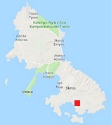
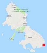 9 - The beautiful traditional lighthouse of Skyros is located on a remote location in the southeast of the island on the Lithari Cape. It is round in shape, made of rough stone, with a lantern on it. The roof of the lighthouse is painted green. Down below the lighthouse is a house for the lighthouse keeper. The Lithari lighthouse is (of course) visible from the sea, but it can not be reached via a road across the island. The nearest road is 5 kilometers away and the area around the lighthouse is very rough. The lighthouse was built in 1894 and is twelve and a half meters high. It gives three white flashes per minute. In 2012 the lighthouse was declared a historical monument by the Greek Ministry of Culture.
© Hans Huisman, https://www.angelfire.com/super2/greece/ 2018