
Inspired by sites cataloging the ends of state highways in other states, Dale Sanderson's US Highway Ends page, and AARoads.com's Interstate Ends, I decided to try and start my own. Anyone who happens to pass by and have a picture, contributions are (of course) welcome.
Routes and historical endings for state highways are those that exist(ed) after the Great Decommissioning of 1980 and were in the 1981 route log, with a few exceptions. Also included are business routes, some of which remain under state control.
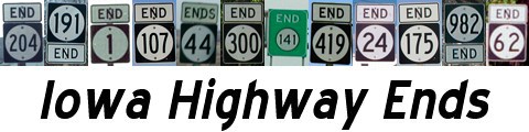
A sign gallery is now available here. Be sure to check the updates page once in a while, because that may be the only time I get to it.
The Iowa Highway Ends Annex is another place of mine you might want to consider visiting. It includes road trip photo galleries, a county road shield gallery, city highway history maps, history of Iowa's congressional districts, Iowa map quirks, and a project I've been working on for five years - a table and maps showing the reach of all television stations in Iowa. And just in time for the 50th anniversary of the interstate highway system: A comprehensive month-by-month list of every four-lane segment built in Iowa.
A "Miscellaneous Page" includes information about the dates for certain numbers, least- and most-changed routes, and other facts. The Super Secret 900s pages are available here, including all secret routes from the past 25 years.
Attention viewers: I am keeping track of new larger county signs as they appear on Iowa roads. If you see one not listed, chime in.
For decommissioned routes, those with pictures of signs still standing are in green. Those without are in gray. (Exceptions: IA 156 and 273 are green although no signs are shown.) Business US 34 in Glenwood is in gray because signs were taken down in 2003. A word of warning: Some of the longer routes have lots of pictures, and aren't for the faint of bandwidth.
| 1 | 2 | 3 | 4 | 5 | 7 | 8 | 9 | 10 | 12 |
| 13 | 14 | 15N | 16 | 17 | 21 | 22 | 23 | 24 | 25 |
| 26 | 27 | 28 | 31 | 32 | 37 | 38 | 39 | 44 | 48 |
| 51 | 56 | 57 | 58 | 60 | 62 | 64 | 70 | 76 | 78 |
| 81 | 83 | 85 | 86 | 92 | 93 | 96 | 98 | 100 | 110 |
| 116 | 117 | 122 | 127 | 128 | 130 | 136 | 137 | 139 | 140 |
| 141 | 143 | 144 | 146 | 148 | 149 | 150 | 152 | 160 | 163 |
| 165 | 173 | 175 | 182 | 183 | 187 | 188 | 191 | 192 | 196 |
| 202 | 210 | 212 | 220 | 224 | 281 | 316 | 330 | 333 | 346 |
| 370 | 376 | 415 | 438 | 922 | 926 | 930 | 934 | 946 | 965 |
| 15S | 23 | 46 | 49 | 57 | 72 | 90 | 91 | 99 | 101 |
| 102 | 103 | 105 | 107 | 114 | 131 | 142 | 145 | 154 | 161 |
| 162 | 184 | 193 | 223 | 234 | 244 | 258 | 263 | 276 | 347 |
| 363 | 386 | 394 | 403 | 412 | 424 | 432 | 920 | 921 | 923 |
| 925 | 927 | 928 | 931 | 939 | 940 | 941 | 945 | 949 | 956 |
| 976 | 977 | 978 | 979 | 982 | 986 | 988 | BONUS: 402 | ||
| Unsigned | 1981-2002 | 2003 & later | |||||||
| 36 | 40 | 41 | 42 | 45 | 50 | 55 | 66 | 68 | 77 |
| 79 | 82 | 87 | 94 | 95 | 97 | 109 | 111 | 113 | 115 |
| 118 | 124 | 125 | 133 | 134 | 147 | 155 | 156 | 157 | 164 |
| 166 | 181 | 186 | 195 | 197 | 198 | 199 | 200 | 201 | 204 |
| 205 | 206 | 207 | 213 | 214 | 215 | 217 | 219 | 221 | 225 |
| 226 | 227 | 229 | 231 | 233 | 236 | 237 | 238 | 239 | 240 |
| 242 | 243 | 245 | 246 | 249 | 252 | 253 | 259 | 266 | 272 |
| 273 | 274 | 279 | 282 | 283 | 285 | 286 | 287 | 294 | 297 |
| 299 | 300 | 301 | 303 | 305 | 306 | 311 | 313 | 314 | 315 |
| 322 | 324 | 325 | 326 | 327 | 328 | 339 | 340 | 341 | 344 |
| 349 | 351 | 352 | 356 | 359 | 362 | 364 | 365 | 371 | 382 |
| 383 | 384 | 385 | 389 | 390 | 395 | 397 | 401 | 404 | 405 |
| 406 | 410 | 419 | 428 | Late 1980 | 1981-2002 | 2003 | |||
| IA 2 (Clarinda) | IA 60 (Sheldon) | IA 92 (Knoxville) | IA 163 (Pella) | US 18 (Mason City) |
| US 18 (Marquette) | US 20 (Sioux City) | US 20 (Fort Dodge) | US 30 (Marshalltown) | US 34 (Glenwood) |
| US 34 (Chariton) | US 34 (Ottumwa) | US 34 (Mt. Pleasant) | US 61 (Muscatine) | US 61 (Keokuk) |
| US 63 (New Hampton) | US 63 (Ottumwa) | US 71 (Storm Lake) | US 71 (Clarinda) | US 75 (Le Mars) |
| US 75 (Sioux City) | US 151 (Cascade) | US 151 (Monticello) | US 151 (Cedar Rapids) | US 169 (Fort Dodge) |
| US 218 (Charles City) | US 218 (Waverly) | US 218 (Mt. Pleasant) | Loop I-35 (Ames) | Loop I-35 (Clear Lake) |
| 6 | 18 | 20 | 30 | 32 | 34 |
| 52 | 55 | 59 | 61 | 63 | 65 |
| 67 | 69 | 71 | 75 | 77 | 136 |
| 151 (N) (S) | 161 | 163 | 169 | 218 | 275 |
| Numbers decommissioned in 1930s | |||||
| 29 | 35 | 74 | 80 | 129 |
| 235 | 280 | 380 | 480 | 680 |
| US 20, Newport OR and Boston MA | US 30, Astoria OR and Atlantic City NJ | ||||
| US 34 West, Granby CO | US 52, Portal ND and Charleston SC | ||||
| Old US 63 South, Turrell AR | US 65 North, Albert Lea MN | ||||
| US 69 North, Albert Lea MN | US 75 South, Dallas TX | ||||
| US 77 North, Sioux City IA | US 151 South, south of Amana IA | ||||
| US 218, Owatonna MN and Keokuk IA | US 275, O'Neill NE and Rock Port MO |
Disclaimers and whatnot: This site is not affiliated with the Iowa Department of Transportation. Dates are based on maps, newspaper articles, or the best information otherwise available. State transportation maps (county and state) copyright Iowa DOT unless noted. Pictures and images are copyright their respective authors and may not be used on other Web sites without permission. Some shield graphics on state-line and US end pages created by Timothy Reichard. Opinions are those of the site's author and do not reflect anyone else's. Any inaccuracies are the author's as well and said author would appreciate corrective e-mails. Why did they put US 8 in Hill Valley, California?
Ads are not endorsed by the author. Pop-up ads certainly aren't endorsed by the author.
Beta launch 11/30/01 -- Announced launch by Jeff Morrison 12/16/01
Most recent index page created 1/1/09
