|
Cahokia Mounds
2,200 acres
Shawnee National Forest
270,000 acres
~ "Garden of the Gods"
~ River To River
Little Grand Canyon
Trails:
Little Grand Canyon Trail, 3.6 miles
Cedar Lake Trail,
10 miles
Kincaid~Cedar Lake Trail
Pomona Natural Bridge
Giant City State Park
Trail of Tears State Forest
5,114 acres
Trails:
Ozark Hills Nature Preserve
222 acres
Randolph Wildlife Area
Devils Backbone
Pere Marquette State Park
Big River State Park
Delabar State Park
|
Illinois Department Of Natural Resources. enjoy illinois & explore chicago!
Cahokia Mounds
30 Ramey Street Collinsville, IL 62234 618-346-5160
The Mississippians who lived here were accomplished builders, this is the most sophisticated prehistoric Native American society north of Mexico. A cluster of mounds that appear to define a plaza make up thes area. Perino, explorer, found many non-local materials: fancy pottery, copper, galena, shark's teeth and sea shells. There are numerous oval-shaped pits seemed to be arranged in arcs of circles. These posts set in these pits lined up with the rising sun at certain times of year, serving as a calendar, a WOODHENGE. The Birdman Tablet was found at Monks Mound, Western Palisade. The tablet images of each side are a human as an eagle/falcon and a snake skin. Great River Road
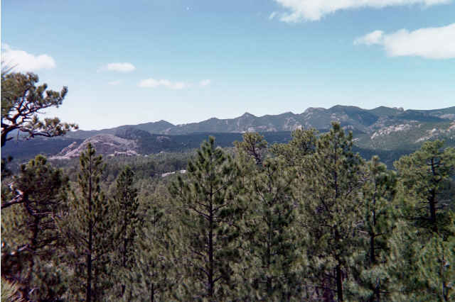
Shawnee National Forest
Shawnee National Forest (west side, Murphysboro Ranger Station 618-687-1731
The Shawnee National Forest, between the Mississippi and Ohio Rivers, the Ozark and Shawnee Hills, has 7 wilderness areas, Bald Knob Wilderness, Bay Creek Wilderness, Burden Falls Wilderness, Clear Springs Wilderness, Garden of the Gods Wilderness, Lusk Creek Wilderness, Panther Den Wilderness, and Ripple Hollow Wilderness. The wooded countryside of the Shawnee National Forest is a wonderful place to enjoy the outdoors on a beautiful autumn day.
Shawnee National Forest Trails, Shawnee Lakes
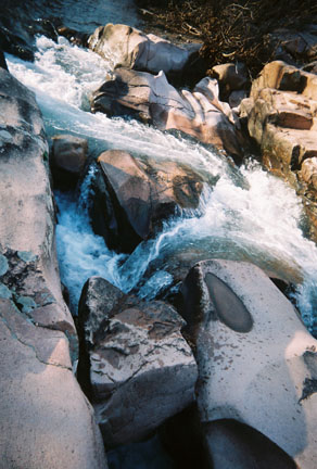
Little Grand Canyon
HWY 127 Etherton Rd. 20th Street for 1.5 miles. Hickory Ridge Rd. Murphysboro, IL (Jim & Shawn. 1999)
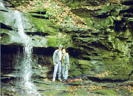 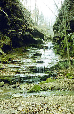 
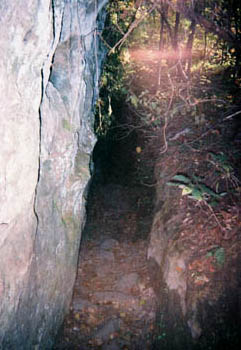
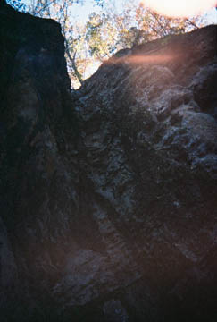
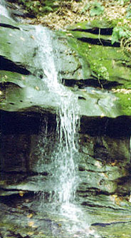 Erosion has carved a canyon and exposed scenic bluffs. The trail is 3.6 miles and travels through the bottomland to the canyon floor. The canyon floor consists of seasonal waterfalls, rock overhangs, and beech and sycamore trees. At the upper portions of the trail there are expansive views of colorful cliffs, Big Muddy River, and the Mississippi floodplain. The wildlife diversity this area is also a haven for many songbirds during the spring and fall. From the scenic overlooks vultures and hawks may be soaring over the trees. The rock ledges serve as habitat for many species of animals, including snakes. Little Grand Canyon Trail is a 3.6 mile loop in the Shawnee National Forest. Shorter paths lead to scenic vistas and overlooks before the trail travels into the canyon. A unique feature of this trail is the steps caraved in the rocky creekbeds to the canyon. The canyon is known for its plant and animal wildlife and diversity.
Nearby in Murphysboro is the Pomona Natural Bridge, Cedar Lake, Oakwood Bottoms, LaRue-Pine Hills, Clear Springs Wilderness and Bald Knob Wilderness.
Kincaid~Cedar Lake Trail
State Highway 127 south of Murphysboro. Left on to Dutch Ridge Road, #17. Turn right at the second gravel road on the right, entering into the Cove Hollow Trailhead.
Cedar Lake Trail is a 10 mile primitive hiking trail that encircles Cedar Lake. The trail is moderate. At the north end of the trail is a rock bluff feature. The trail begins at Cove Hollow at 540 feet altitude and travels 3.7 miles to Pomona Road. The trail is 1.75 miles from Pomona Road to the Newbolt Site. The Pomona Road southeast section of the trail is part of the River to River trail. This portion of the trail extends east of Little Cedar Lake to the Blessing Site and continues through the forest to within 3 miles of Giant City State Park. From Newbolt to the loop of Little Cedar Lake Trail is 4.25 miles. The hike ends at Cedar Lake Trail or at Newbolt Site, Pomona Road or returning to the beginning point, at Cove Hollow.
Return to Top
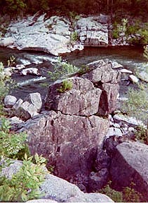
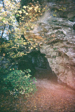
 Pomona Natural Bridge
Murphysboro, HWY 127. Pomona Rd. 618-687-1731.
The Pomona Natural Bridge stone arch was formed by the forces of erosion millions of years ago. This natural bridge and other rock in the area consist of sandstone, soft bedrock. Water erosion gradually washed away softer rock, leaving a 90 ft. natural bridge. Pomona Natural Bridge Trail is a short loop of 1/3 mile through oak-hickory and beech forest. It descends to the creek bottom and has an overlook of the natural bridge.
Nearby, Lake Murphysboro State Park.
(Jim & Shawn 2005.)
Return to Top
Giant City State Park
I 57 or 40[64] to 127. to Carbondale

 There are many wilderness trails and the Giant City Nature Trail for hiking. The “Giant City Streets” were formed 12,000 years ago by huge bluffs of sandstone. In the Shawnee National Forest the area was named for the unique impressions made by its massive sandstone structures. Eons of geological faulting and folding have molded this rock landscape, a must for outdoor lovers. The plantlife consists of lush garments of fern, moss, large flowering mints, hundreds of species of wild flowers and many towering trees.
(Jim & Shawn 2005.)
Trail of Tears State Forest
Route 127. or Route 3. Northwest of Jonesboro. 20 miles south of Murphysboro. 3420 State Forest Road. Jonesboro, IL. 618-833-4910.
(Jim 2002.)
 Trail of Tears State Forest is one of five forests in Illinois. The areas history is that it was once inhabitated by the native americans and they were pushed south to reservations in 1838-39, the Cherokee, Chicksaw and Creek Indians.(Along with the Osage) Trail of Tears State Forest is one of five forests in Illinois. The areas history is that it was once inhabitated by the native americans and they were pushed south to reservations in 1838-39, the Cherokee, Chicksaw and Creek Indians.(Along with the Osage)
The forest is divided into 27 management areas where different timbers are harvested and effects upon ecosystems are studied.
The Great River Road.
Return to Top
Randolph State Fish & Wildlife Area
5 miles northeast of Chester, IL. RR #1, Box 345, Chester, IL 62233. 618-826-2706.
The park lies in the rolling hill countryside of southern Illinois. There are shaded picnic areas, hiking trails, and scenic forests. There is a lake of 65 acres, Randolph County Lake, a clearwater lake that is stocked.
Trails in the wildlife area are known for its wooded forests, abundance of songbirds and wildlife. There are 8 miles of foot/horse trails. The picnic areas are surrounded by oak, hickory, sweet-gum and tulip trees. Randolph County Lake Area.
Nearby nature walks are
Turkey Bluffs~State Fish & Wildlife,Fults Hill Prarie and Kidd Lake Natural Area.
Piney Creek Nature Preserve, Rock House Creek and historic sites, such as, Pierre Menard Home, Marys Covered Bridge and Fort Kaskaskia Kaskaskia River - State Fish & Wildlife Area.& The Great River Road.
Return to Top
Devil's Backbone Park
HWY 3. Between Chester and Jonesboro.
Devil's Backbone is an unusual rock ridge that runs along the Mississippi River at Grand Tower in Jackson County. Devil's Backbone Park in Grand Tower is part of the River-to-River Trail, American Discovery Trail,, along the banks of the Mississippi River. Devil's Bake Oven is another formation with many caves, at the north The Oven once harbored river pirates in 1803. Also the park was the site of an Indian massacre in the early 1800s. The foundation walls of a house are still standing at the top of Devil's Bake Oven. Nearby, Cedar and Kinkaid lakes.
Return to Top
Pere Marquette State Park
HWY 270 to 367 N. across the Missouri River. Over the Mississippi River, the Clark Bridge, Left to Route 100. Great River Road west/north 20 miles. 618-786-3323.
One of Illinois' largest state parks, this 8,000 acre preservation area. A nature walk in Pere Marquette State Park has exceptional beauty of its fall colors and for its bald eagles during the winter. Enjoy the scenic view of the Illinois and Mississippi Rivers from several points atop the bluffs. Recreational activities include horseback riding, camping, fishing, boating, and hiking. There are 12 miles of marked trails, in the forests, towering bluffs, and wildlife.
"The Piasa bird legend" is said to have flown over the "Great Father of Waters" thousands of moons before the white man came. See The Great River Road.
Return to Top
Big River State Forest
Henderson County. 8 miles N. Oquawka. RR 1, Box 118.
Keithsburg, IL 61442. 309.374.2496.
200-acre Oquawka Refuge is a vast prairie woodland.
Lincoln's Trail at Big River State Forest is a 1.5-mile trail with history, Abraham Lincoln traversed here in 1832 when he led militiamen to fight in the Black Hawk War. Wilderness Trail at a half-mile and Big Pine Trail at 1.4, bring trail totals to right at 3.5 miles. In addition, the 60-mile network of firebreaks is used by hikers, backpackers, birders and nature study groups.
Delabar State Park
1.5 miles N. of Oquawka. Illinois Rte. 164. R.R. #2, Box 27. Oquawka, IL 61469. 309.374.2496.
Located on the Big River, the Mississippi River, Delabar State Park offers outdoor experiences for anglers, hikers, campers and picnickers. The park’s 89 acres are forested with sturdy oaks, along with some birch and hickory trees. These forested areas serve as natural habitat for a variety of wildlife species and more than 50 species of birds. Trails: Two marked trails covering nearly two miles through the woods are available for nature lovers and wildlife observers. The Mills Slough Trail, has old black oak trees and assorted wildflowers, it is an enjoyable hike.
Nearby, Gladstone Lake, in Henderson County Conservation Area, is a 27-acre lake, depth of 25 feet and 1.5 miles of shoreline.
The Waters :: The Great Lakes & Navy Pier
SOFA~Chicago
Lake Michigan, Huron, Erie, Superior and Ontario - the largest surface freshwater system on Earth.
The Great Lakes.
Chicagos Lakefront - Leonne, Belmont & North Ave.,
Lake Caryle.
Return to Top
See :: Historic ~ Southern Illinois
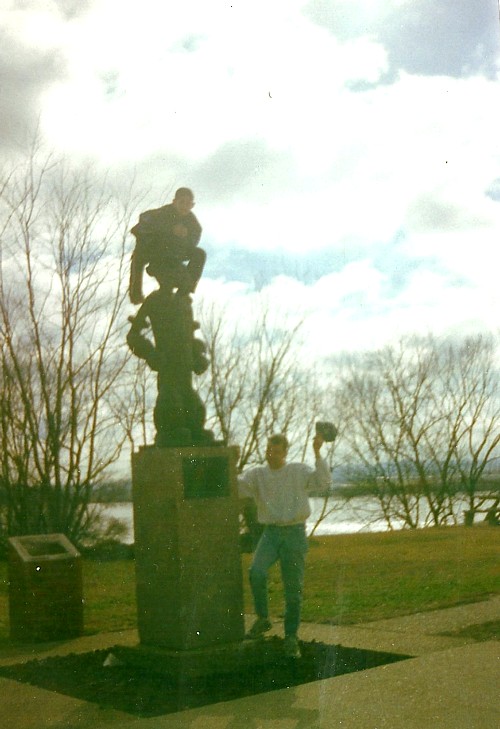 Elzie C. Segar Park - Chester Elzie C. Segar Park - Chester
IL-150 or MO-51 to the Mississippi river.
This 6 foot tall, 900 pound, bronze-metallic statue of Popeye was inspired by the fact that Segar, Popeye’s creator, was born in Chester and that many of the Popeye characters were modeled after real residents of the town. Each year the city of Chester organizes the Popeye Picnic to celebrate its famous citizens.
The Popeye Statue is located at the foot of the Chester Bridge that crosses the Mississippi River in Elzie C. Segar Memorial Park. The Great River Road.
Scenic Illinois~NatureWalks
Return to Top
|