|
St. Francois
Mountains
Natural Area
Missouri Mountain
Peaks & Summits
|
Taum Sauk Mountain State Park
Ironton. HWY 21 or HWY 49/72 to JCT CC. 573-546-22450
Located in the rugged and scenic St. Francois Mountains. It is one of the most outstanding wild areas. 7,448 acres of wilderness and solitude. The park offers camping, backpacking, hiking, and picnicking in this wilderness setting. The hiking trails offer many scenic views of the country side and hiking is the best way to experience the wilderness of this area.
This area has many forests of oak-hickory and rocky glades. Taum Sauk Mountain is the highest point in Missouri, elevation of 1,772 feet. The mountain and several other igeneous mountains in the park, are located in the heart of the rugged 5,000 square mile St. Francois Mountains, which are the core of the Ozark Highlands. Interspersed through the mountains are woodlands and rocky glade openings.
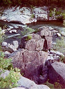
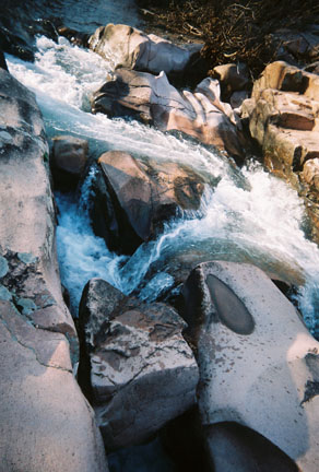
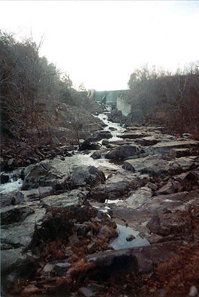
Mina Sauk Falls Trail (3 miles). Begins as a relatively easy walk to the top of Taum Sauk Mountain. From this point Mina Sauk Falls Trail becomes rugged. Mina Sauk Falls cascades 132 feet down over a series of rocky ledges into a rock bottom pool, this waterfall is the tallest in Missouri.
Taum Sauk section of the Ozark Trail, (12.8 Miles), a portion of Mina Sauk Falls trail is part of this trail. Further down the trail is the geological feature of Devil's Tollgate, an eight-foot wide passage through rhyolite standing 30 feet high. The Ozark Trail continues to the Johnson Shut-Ins State Park.
Trails: Mina Sauk Falls Trail (3 Miles), The Ozark Trail (13 miles) to the Johnson Shut-Ins.
Elephant Rocks State Park
HWY 21 or 32 to JCT W. 573-546-3454.
A 129 acre park, is noted for its "string of elephant" rocks, giant red granite rounded boulders in unusual formations. These granite rocks are weathered into rounded boulders which can be explored and climbed. Elephant rocks are sculpted by time, they are ancient dating back to the Precambrian Era, 1.2 billion years ago. The largest boulder is 127 feet tall, 35 feet long, 17 feet wide and weighs 680 tons. There is a 7 acre natural area within the park. This St. Francois Mountain area has plenty of shaded woodland picnic sites and quarry fishing. There are many visible user paths. The Elephant Walk trail is an easy geological walk. Braille Trail is a 1 mile loop, paved and handicap accesible trail with 22 interpretive stations.
Return to Top
Ketcherside Mountain Conservation Area
HWY 21. State Route CC. 573-546-3454.
This area is 3,276 acres and it features The St. Francois Mountains and Royal Gorge Natural Areas. A segment of the Ozark Trail passes through Ketcherside Conservation Area. Primitive camping available. Handicapped accessible.
Bell Mountain Wilderness
HWY MO 21 to Hwy 32 West. HWY A turn left to FS2228. or to Route 1 to Country Rd. 61. HWY A to Ottery Creek trailhead
Bell Mountain, elevation of 1,702ft, is an oblong-oval shape of igneous knob rock of granite glades of 9,027 acres. The trail climb is worth the scenic views of Taum Sauk Mountain, 1,772 ft., Proffit Mountain, High-Top Mountain and Lindsey Mountain.(hike trail). Several thousand feet below the Bell Mt. crest is Shut-In Creek, 1,000 ft. There are two trails: 2 mile (one-way) Mountain hike, 12 mile mountain loop and the Ozark Trail-Otttery Creek & Trace Creek of the Taum Sauk Section. To be seen is also the Shut ins Creek. Taum Sauk Mt., Proffitt Mt., High-Top Mt., and Lindsey Mountain. The wilderness provides unique habitat of forest, glades and a diversity of plant species.
Bell Mountain Trail Loop is shared with Taum Sauk Section. Travel uphill the glade segment and south for a mile at the junction is the trail fork and walk left to the Bell MT. Loop. (A right turn will lead you to the Johnson Shut-Ins State Park.) Keep walking right to the Bell Mountain high point. At the mountain crest there are boudlers, open glades, and scenic overlooks. Between Bell Mountain and Lindsey Mountain, east, below lies the Shut-in Creek. The eroded trail descends Bell mountain, and curves back to the junction.
Joes Creek bottoms-Lower Bell Mountain is the second trail and is a northern wilderness access (FS2228). Continue west on this loop and descend the ridge to Joes Creek bottoms. Follow the creek for a mile and the trail ascends to lower Bell Mountain and rejoins the original Bell Mountain loop.
The Ozark Trail is downhill and right from the original loop. Switching back to Ottery Creek Trailhead.(HWY A)
Lindsey Mountain is east FS2228 to FS2359. Nearby Bell Mt.Lindsey Mountain trail is a 2mile trail one way to Lindsey Mountain.
Return to Top
Crane Lake Recreation Area
MO21/49 to Chloride. Left CR 120/FH69. or 12 miles south of Arcadia, CR 131. on Crane Pond Road
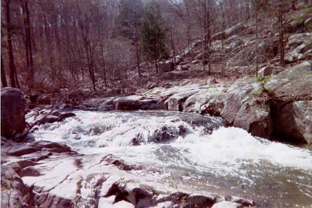
 Crane Lake Recreation Area features the 100 acre Crane Lake and trails all within the Mark Twain National Forest. It also contains Crane Lake Trail (3 mile) and the Crane Pond Trail (2 mi), 5 mile double loop, and 8 mile section of the Ozark Trail, Crane Lake to Marble Creek, Point to Point, and the Crane Pond Shut-Ins.
U.S.F.S. created the dam on Crane Pond. Picinic along the lakeshore, fish from the gentle banks, canoe the waters and hike the coves. Crane Lake (North loop) and Crane Pond (south loop) trails are peaceful.
Crane Lake (3 mi. North trail loop). The path is level as it circles the lakeshore.Near the dam it descends and crosses Crane Pond Creek Shut-Ins and back to lake level. There are several small coves and the forest is filled with solid white oak trees.due to the USFS.
Crane Pond (2 mi. south loop). This trail begins at the dam. Travel through the rocky glades, the trail will leave the glades toward the forest and meadow on an old farm lane. The loop crosses Crane Pond Creek and continues along the land to the forest and rocky glades opposite the bluff of the shut-ins.
Ozark Trail The Crane Pond, south loop trail curves back to cross the Crane Pond Creek. At this point the Ozark trail departs the loop and travels east 8 miles to the Marble Creek Recreation Area beginning and ending at Crane Lake picnic area. The cedar glades, forest and field of the loop trails are shared by the Ozark Trail, within the Mark Twain National Forest.
Return to Top
Royal Gorge Shut-Ins Natural Area
HWY. 21.
Contact: Route 1. Box 1002. Hwy 34. Piedmont. 573-223-4525
The floor of the Royal Gorge is a limestone canyon and is a beautiful sight when the leaves change color.
Shepherd Mountain
Nearby, Shepherd and Pilot Knob Mountains in Arcadia Valley offer spectacular views of the valley. Shepherd Mountain Lake is a 30 acre lake and there is a two mile hiking trail that will take you to the summit of Shepherd Mountain.
Return to Top
Buford Mountain Conservation Area
HWY U, to Grider Rd.
Trail: 10-mile loop
Buford Mountain is an elevation of 1,740 foot that consist of open rhyolite glades in cluster of knobs, in 3,743 acres. A scenic view of the Belleville Valley. Bald Knob elevation of 1,674 ft. is the most scenic glade on the mountain. This part of the St. Francois Mountains once was inhabited by mound builders. The Buford Mountain trail is 10 miles.
|
Tom Sauk Mountain
State Park
7,448 acres
wilderness and solitude
Elevation 1,772 feet
Mina Sauk Falls-132 feet
Devils Tollgate
Trails: Mina Sauk Trail
(3 miles)
Ozark Trail (13 miles)
Sections
Contact:
HCR 1, Box 126, Middlebrook, MO 63656
573-546-2450

Elephant Rocks
State Park
129 acres of red granite
Trail: 1 mile Braille trail
Contact:
RFD 1, Box 114,
Pilot Knob, MO 63663
573-546-3454
Ketcherside Mountain
3,276 acres
Trail: Ozark Trail Section
St. Francois Mountain Natural Area and
Royal Gorge Natural Area
Missouri Mountain Peaks & Summits
Bell Mountain Wilderness
Mark Twain National Forest
9,027 acres
3 Trails: Bell Mountain, Joes Creek, (11.9 miles) and the Ozark Trail Section
Lindsey Mountain
HWY MO 21 to Hwy 32 West. HWY A turn left to FS2228. or to Route 1 to Country Rd. 61. HWY A to Ottery Creek trailhead
Crane Lake Recreation Area
Mark Twain National Forest
100 acre lake
Trails: Crane Lake, 3 miles
Crane Pond, 2 miles
Ozark Trail
MO 21/49 to Chloride. Left CR 120/FH69. Crane Pond Road. or CR 131 (12 miles south of Arcadia)
Royal Gorge Shut-Ins & Natural Area
Missouri Mountain Peaks & Summits
Shepherd Mountain
Buford Mountain
3,743 acres
Trail: 10-mile loop
1,740 foot Mountain
HWY U, Grider Rd.
|