| FIND A VILLA | Ariana's Place | Ariana's Place movies | The Villa | The Apartment | The Studio | Things to do |
| EXCURSIONS - DAY TRIPS THAT YOU CAN MAKE FROM ARIANA'S PlACE |
|
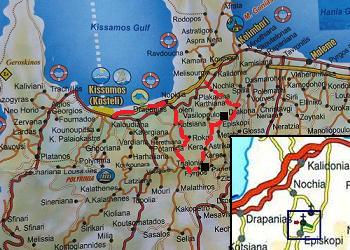
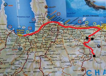
Below I have described a couple of day trips you can make from Ariana's Place. If you want to know more about a certain village, beach or church, then click on the link to read more about it and see all the pictures. These are just some examples of tours and walks you can do in this area, because there are a lot more. For some trips (eg to Elafonissi, Sougia or Paleochora) is useful to leave early and keep track of how much time you need to drive back. |
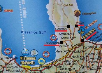
| Trip 1: Rodopos peninsula: Kolimbari - Afrata Beach - Rodopos - Ravdoucha Beach |
 |
 |
 |
 |
 |
|
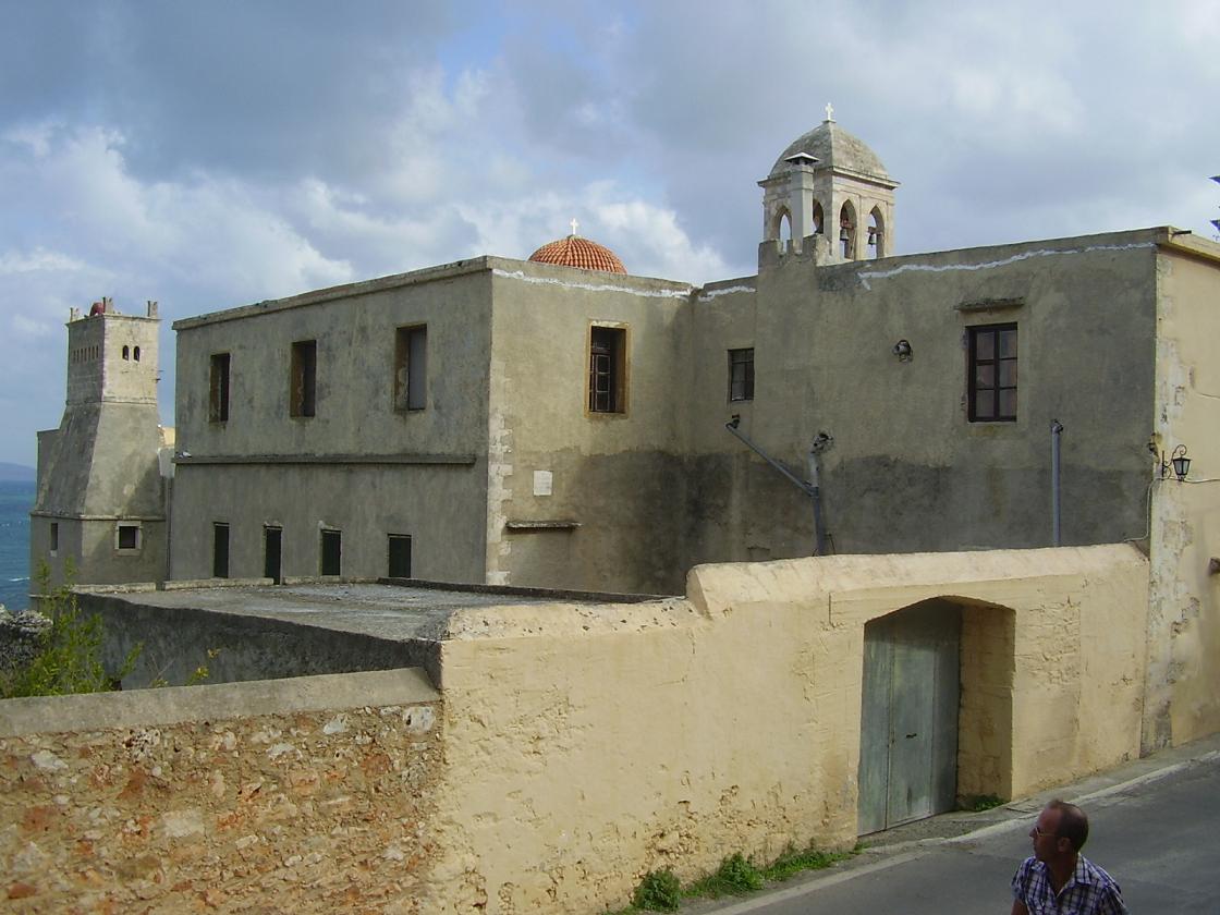
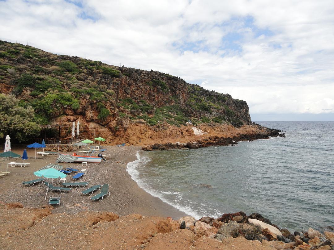
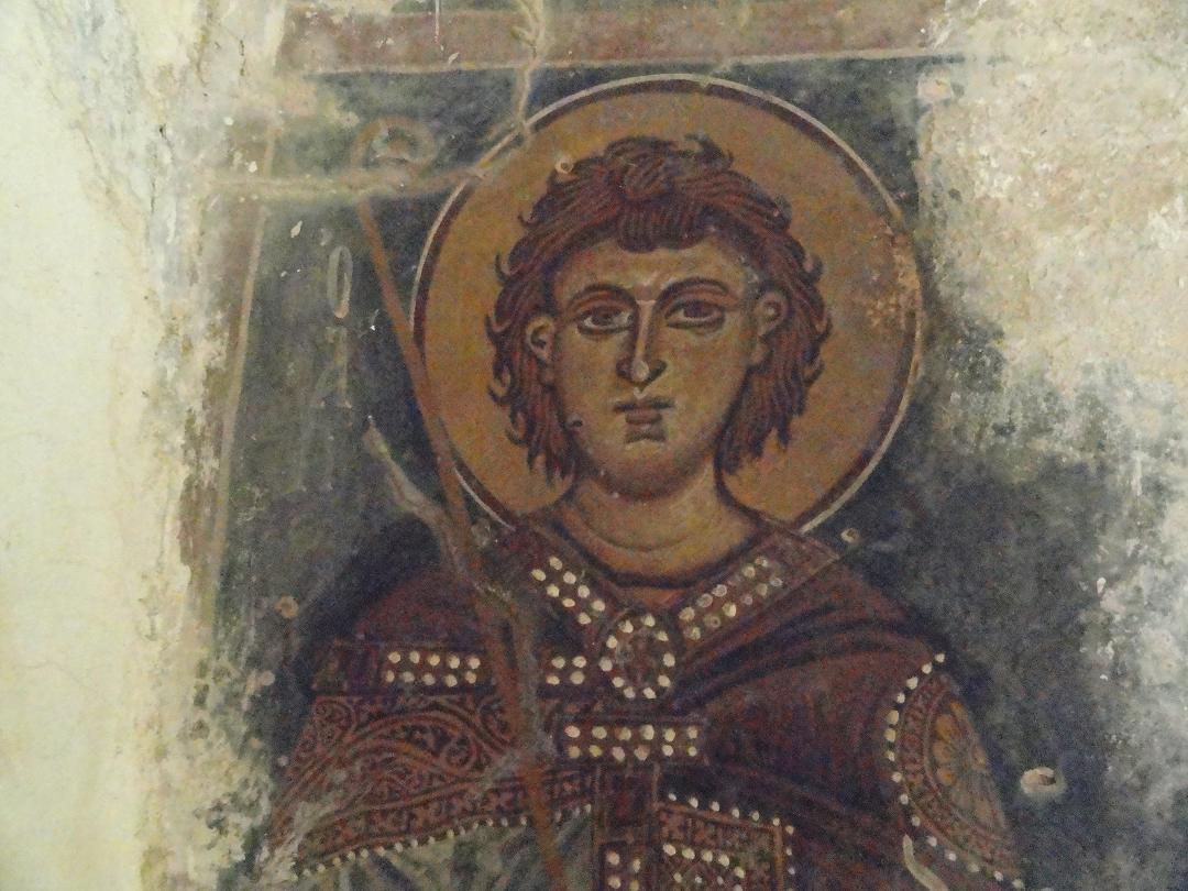
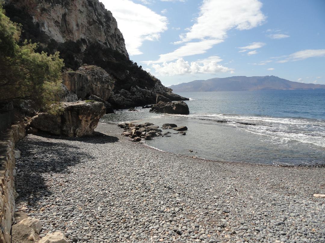
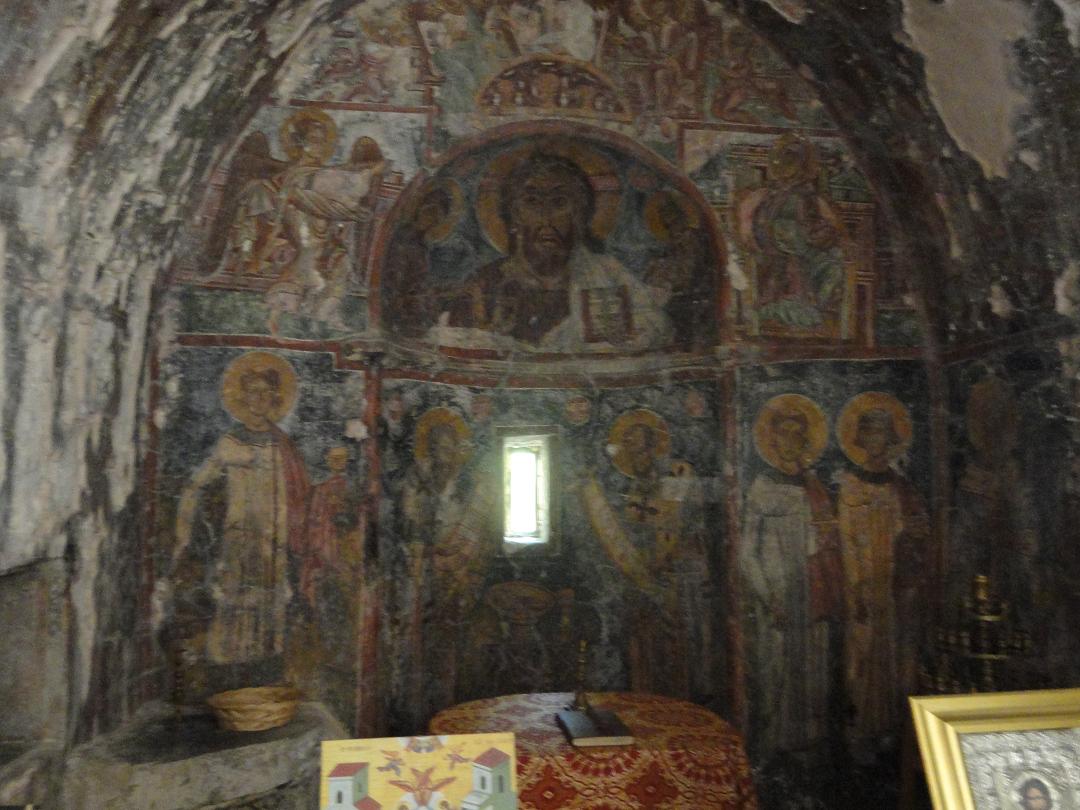
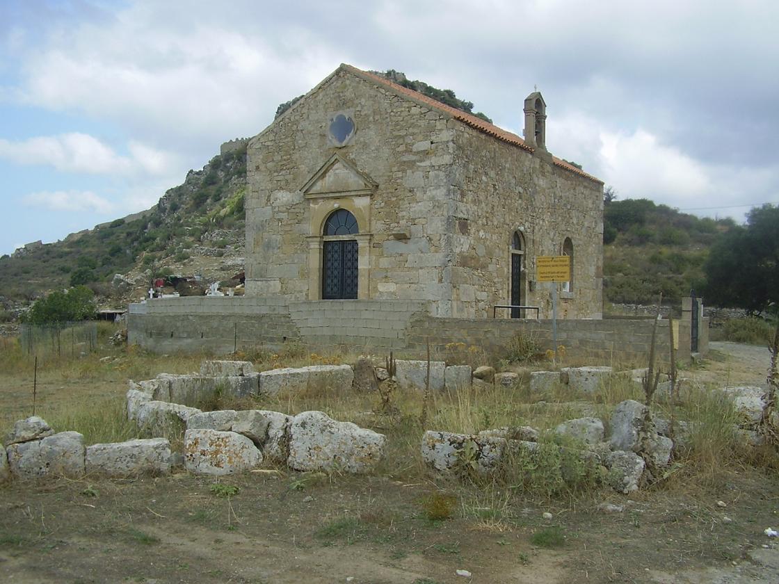
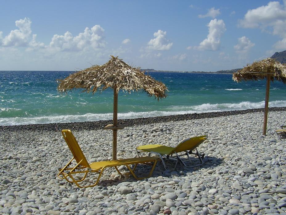
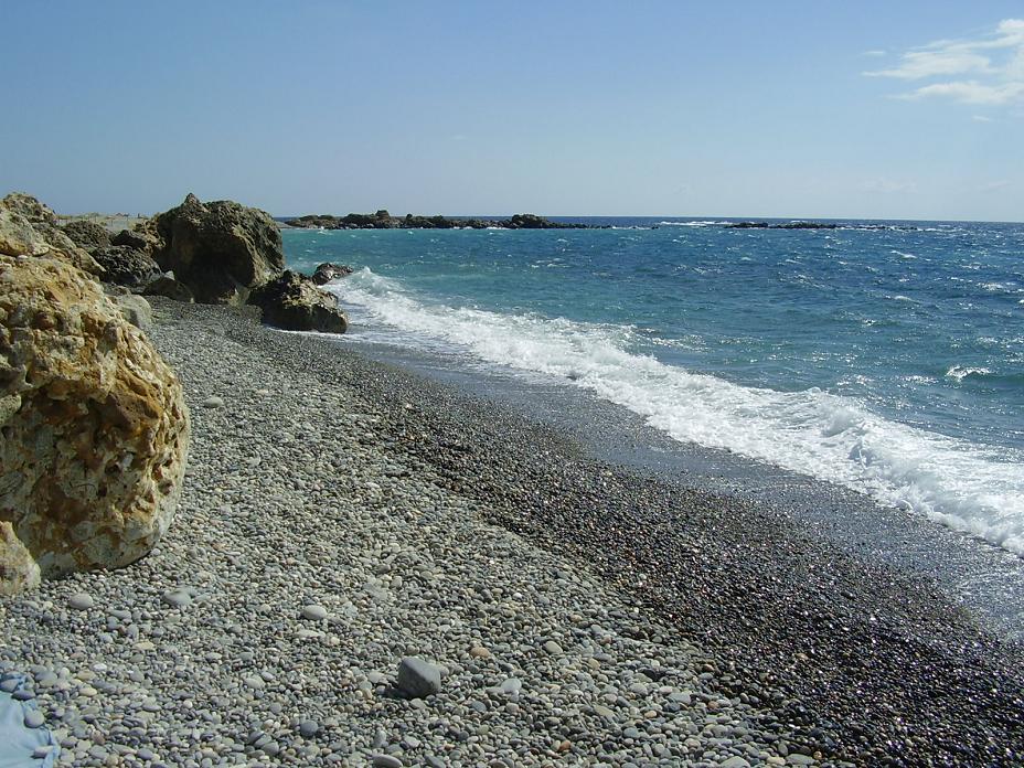
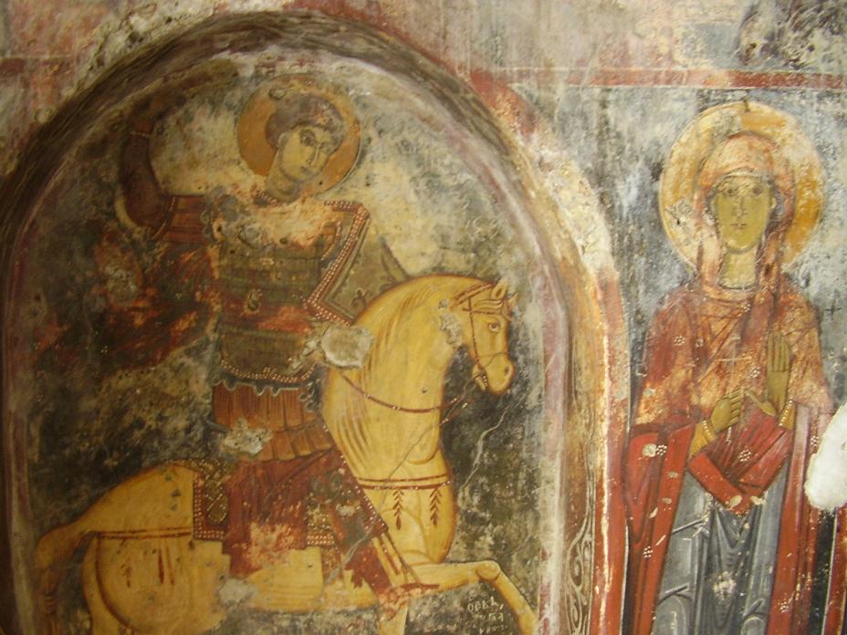
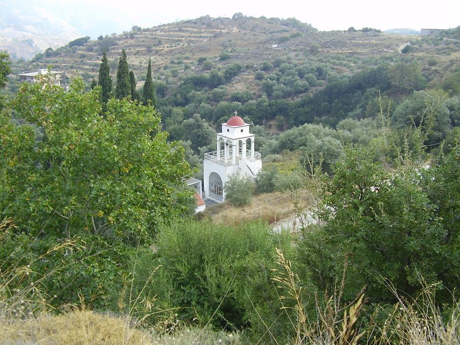
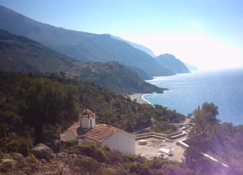
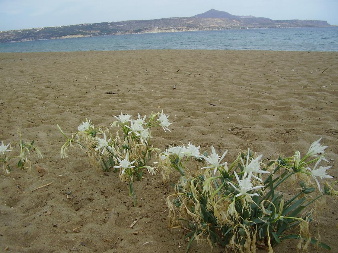
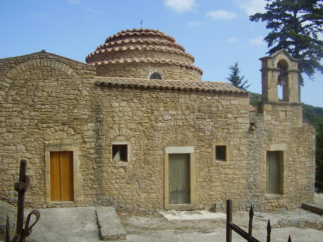
Afrata is situated 4 kilometer north of Kolimbari. The beach is at one and a half kilometers distance from the village and there is a taverna. There are also sun beds and umbrellas for rent. In Afrata there is a very sweet tavern called I kali kardia (the good heart), which is run by two elderly people. Rodopos is the village where you can start the walk to the Diktynna sanctuary in the north of the peninsula (about 3 hours up and 3 hours back), but it is also a nice village just to take a look. On the village square is also an ancient Roman column with inscriptions, dating from the time of Emperor Hadrian (119-138 AD). It gave the distance to the Diktynna Sanctuary which is situated in the north of the peninsula. In Latin is written that the road to the sanctuary was funded by the emperor Hadrian and the rich Diktynna sanctuary itself. The column was excavated in the 19th century and until the beginning of 2002 it stood next to the Agios Georgios church. In 2002 it was moved to the main square (where it is more noticeable). The Agios Georgios church is an old church. I myself think that it dates from the Byzantine period, but I can't find any further information about it. You can find it a bit further down into the village on the right hand side of the road. Unfortunately it is closed. Ravdoucha is a village at about 10 kilometer distance from Kolimbari on the west side of the Rodopos peninsula. From the village there is a road that leads to the picturesque beach of Ravdoucha. On the way to Ravdoucha Beach you'll pass by another, larger church (left) and a beautiful old white church with a cemetery (right). Here you can make a stop to enjoy the magnificent view over the Gulf of Kissamos. At this white church there is a fork in the road and here you go further down where after a few hundred meters on the right side of the road you will see the Byzantine church of Agia Marina (with beautiful frescoes). After the Agia Marina church the road goes further down and not far from the church down there is another fork in the road. If you take the road to the left you will drive along a nice church after a few hundred meters. This church is built partially into the rock. Inside is a whole collection of icons and you can burn a candle here. At the end of the road lies the beautiful pebble beach of Ravdoucha. The beach of Ravdoucha is not large, about 300 meters long, but it's a beautiful sight, with a high cliff at the end and with very clear water. It looks like a lagoon and the water is of a beautiful color. On the beach there is a very nice tevern where you can have something to eat or to drink. |
| Trip 2: Topolia Gorge - Agia Sophia cave - Elos - Sfinari Beach |
 |
 |
 |
 |
 |
|
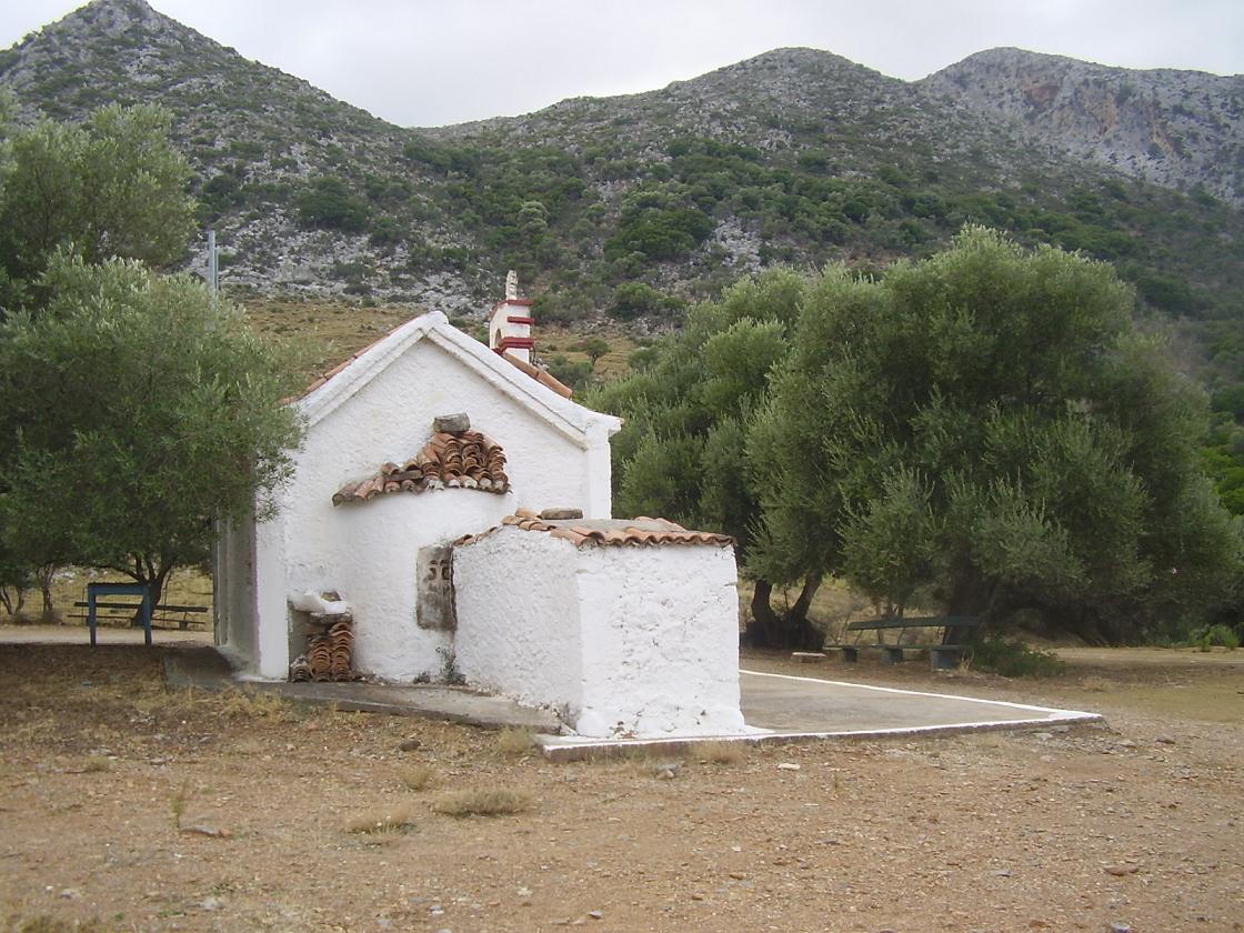
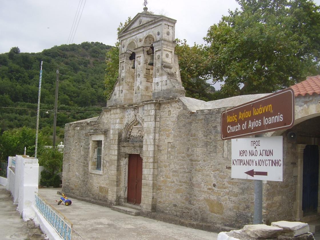
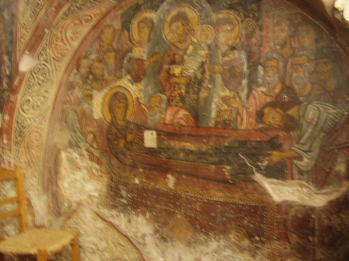
The Agia Sophia cave is situated a bit more south in between Topolia and Kartsomatado (Koutsamatados). The Agia Sophia cave is a cave with a history. The chamber of the cave is very large and measures 100 by 100 meter and it is 20 meter high with beautiful (and some enormous) stalagmites and stalactites that come in different shapes. There is also a small church in the cave with an icon. According to tradition this icon came from Constantinople. Artefacts from the Neolithic times were found in the cave. Elos is a village at 24 kilometer distance south of Kissamos. Elos is a good place to stop for a lunch or a cup of coffee. It is a cosy village set in a beautiful nature reserve. In the village of Elos you can find an old Turkish aqueduct, the remains of a large old mill and the Byzantine church of Agios Ioannis, which dates from the 14th century. Inside the church are well preserved frescoes of Christ and of saints. A sign from the central square points you to the direction of the church. It is not a long walk and you will also pass the aqueduct. From Elos you drive to Kefali and than to Keramoti and further back north. Sfinari is a nice small village on the west side of Crete. Down in the bay there is a "sandy beach" (that's what the inhabitants call it), but actually it is more a mixed beach with pebbles and sand. Around the beach there are lots of greenhouses with vegetables inside. |
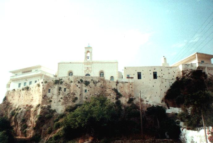
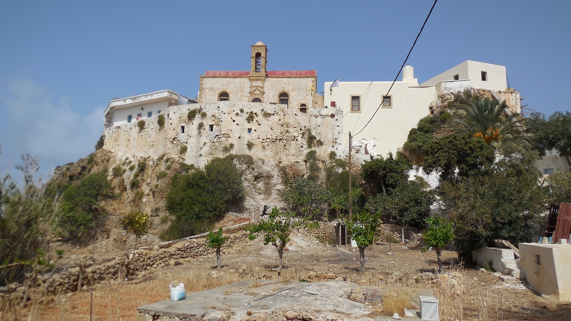
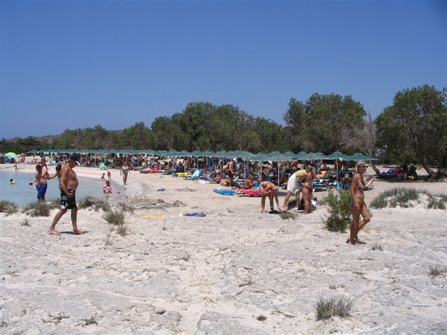
| Trip 3: Chrisoskalistissa monastery - Elafonissi Beach |
 |
 |
 |
 |
 |
|
Elafonissi Beach - Elafonisi / Elafonissi is the name of the second largest beach in the west of Crete which is advertised almost everywhere (likewise for Vai beach) as "the most beautiful beach of Crete" and "it looks like a tropical beach". The beach is situated on a small islet which is separated from the mainland by a small canal, but it is possible to reach it on foot. On part of the beach there is space for people that prefer to sunbathe without textiles. |

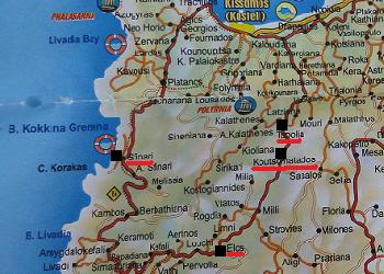
| Trip 4: Polyrrinia - Tsichliano Gorge |
 |
 |
 |
 |
 |
|
Several remains from antiquity can be seen inside the "modern" village of Polyrrinia. At the entrance of the village there are remains of a Roman tower. A few hundred meters at the end of the cobbled street is the Roman aqueduct (set down below the street) and there are a couple of Venetian arches. Just before the arches is a creamy yellow colored house and on the right had side of this house are steps down to a small chapel that is built into the rocks. If you follow the signs to the Acropolis you will see houses that are cut into the rocks on your right hand side. On the outskirts of the village lie water cisterns and burial chambers from early Hellenistic times and remains from Hellenistic walls. At the site of an ancient temple that dates from the 4th century A.D. the Church of 99 Saints was built. When building this church in 1894 material from the old temple was used and on some of the stones you can see Latin inscriptions. On the eastern side of the church wall the temple altar was incorporated. Here you find the beginning of the path leading up to the acropolis and the ruins of a Byzantine fort. The Acropolis is set on the top of the hill at an altitude of 420 meter above sea level and has views over the Gulf of Kissamos. The Tsichliano gorge runs from the (Byzantine?) church of Agios Ioannis in the north (just south of the ancient town of Polyrrinia) to the village of Sirikari in the south. On the way you will also encounter an interesting bridge (Roman by the looks of it). Best is to start your walk in Sirikari from the Agios Konstandinos church and than walk down instead of going up from Polyrrinia. On your way you will see nice nature, nice flowers and fruits. In the middle of the gorge there is a brook and you are surrounded by steep cliffs, singing birds and lush vegetation. The Tsichliano Gorge has been declared a national park. The walk through the gorge takes about three hours and is 11 kilometers long in total. |

| Trip 5: Kastelli Kissamos - Kissamos museum - Nopigia Beach walk |
 |
 |
 |
 |
 |
|
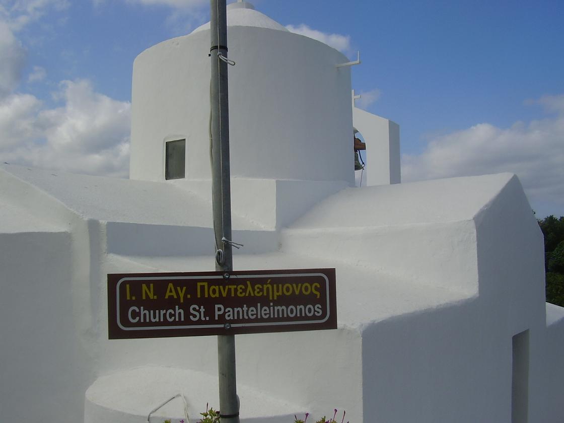
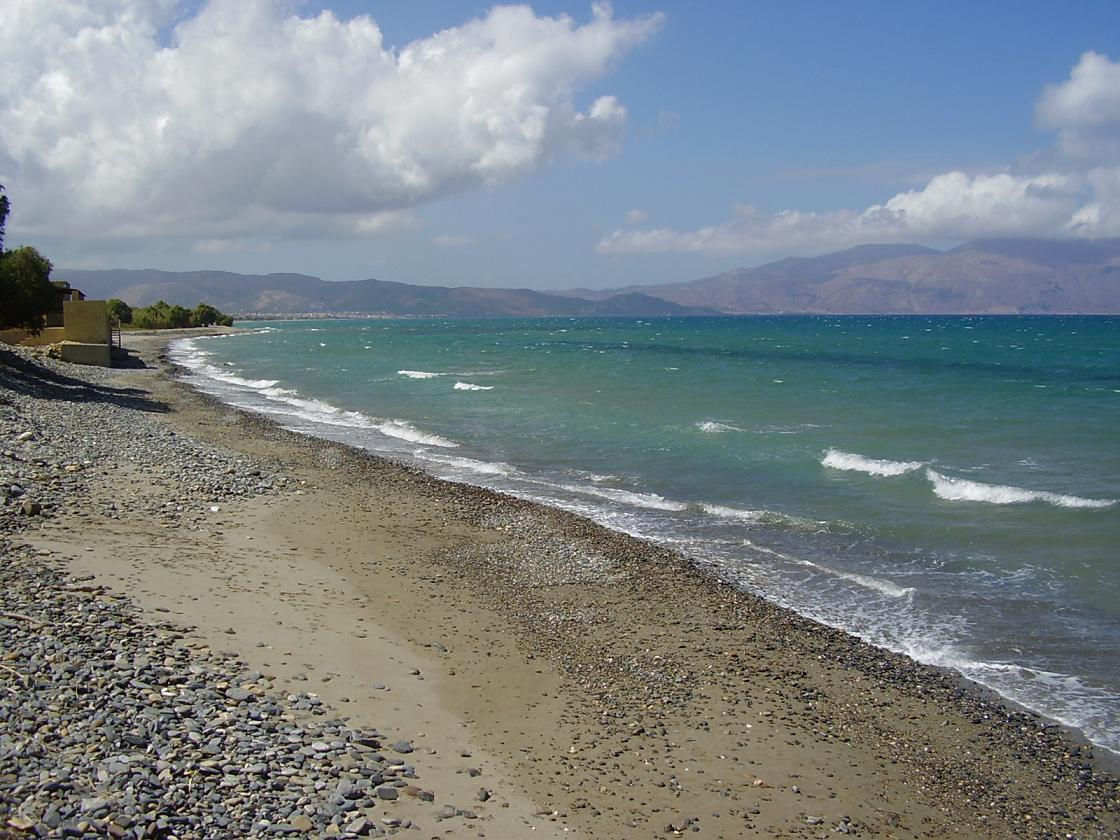
If you vist the town of Kissamos it is very interesting to take a look at the objects displayed at the Archaeological Museum. This museum is housed in a Venetian-Turkish monument and houses artefacts that were found in the Kissamos district. The finds go from prehistoric times through to late antiquity (Early Christian Period) and is really interesting. The building has two floors and the material is displayed according to chronology and geography. Besides the vases, beautiful statues, glass, jewelry and coins there are also two beautiful large colorful (and almost intact) mosaic floors on display. This is something not to be missed and puts a new light on any of the visits you will later make to the archaeological sites in the area. Nopigia is one of the oldest villages in the area and used to be a center for wine distribution. Now it is surrounded by farmland. There is a good beach and there is a camping site in this Nopigia. The village used to be the location of an ancient city. In the village are Byzantine churches like the Byzantine church of Agios Pandeleimonas. You can easily reach this church from the highway to Kastelli if you turn south towards Koleni. You will see it at your right hand side. The church has the shape of a cruciform with a dome. The road to the beach of Nopigia ends in a "T". On the left is a small pebble beach and further westwards is a larger sandy beach with behind it orange tree groves. There is a dirt track leading eastwards. You can go here by car, but it is also nice to make the trip along the rocky coastline on foot. You will pass a nice little taverna, the "Taverna Café Porto Alegre" where you can have a drink or a nice meal (update: this tavern is now closed but there is a fish tavern at the beach). Further to the east the path takes you along a hollow olive tree (up on a hill), a small chapel and plenty of goats, small pebble beaches and rocks where you can sit down to look at the sea. |
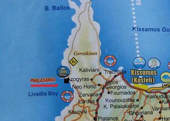
| Trip 6: Falassarna Beach and Ancient Falassarna |
 |
 |
 |
 |
 |
|
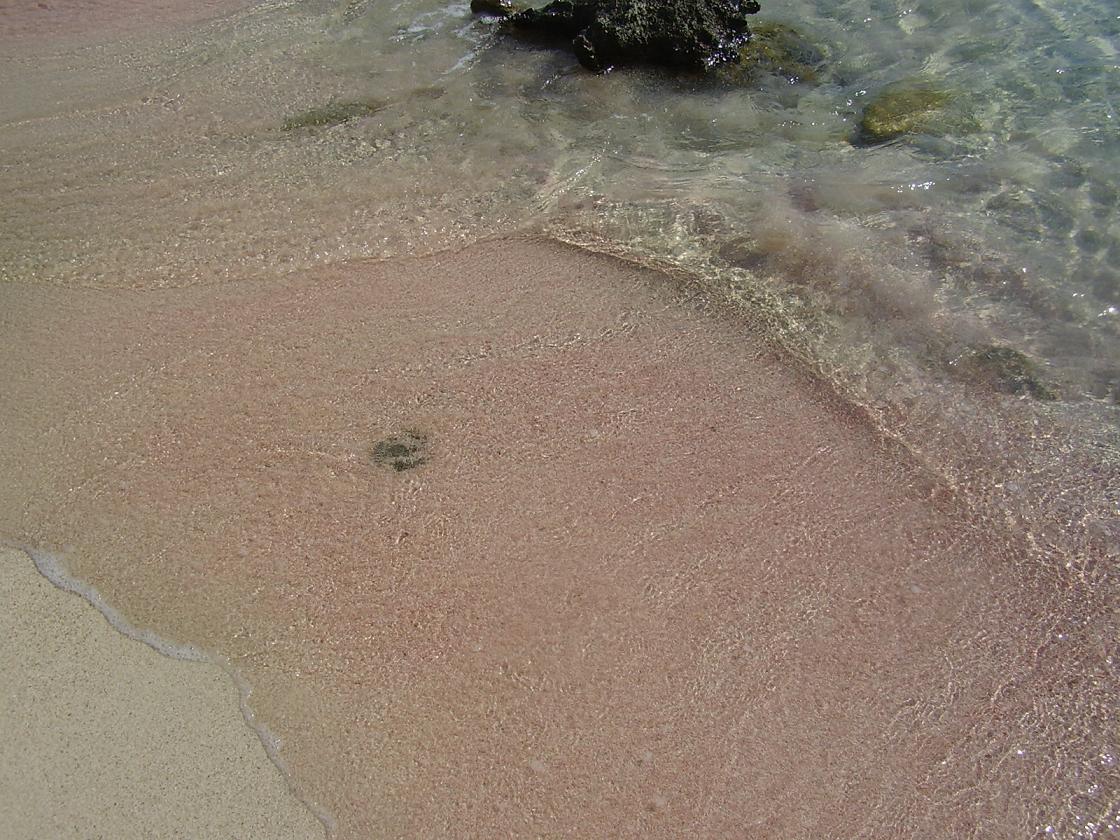
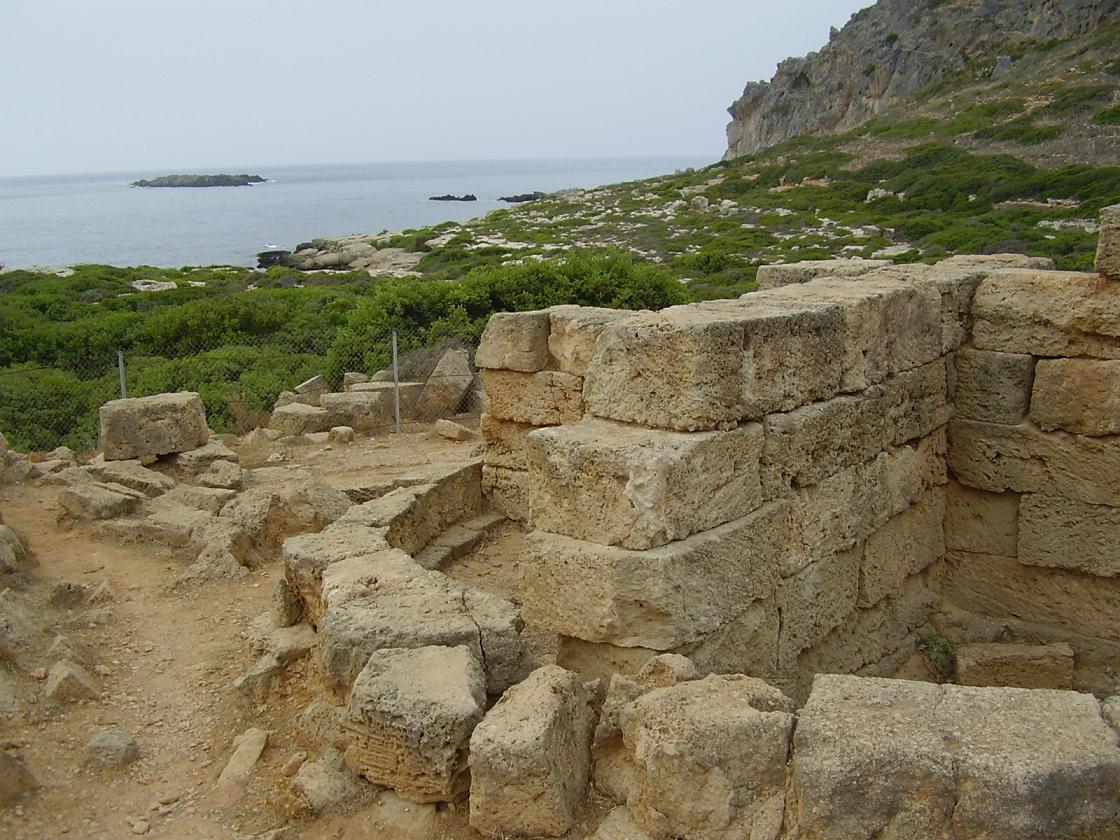
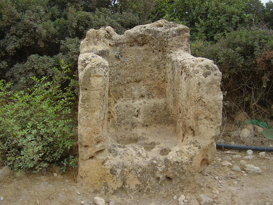
The beach is a fine sandy beach and the water is of a beautiful colour and crystal clear. Some parts of Falassarna have umbrellas and sunbeds for rent but the beach is not really super-commercial. It is long and wide, and there is always a nice quiet place where you can lie down. There is an exit "Big Beach" to the large beach and when you drive further you will come to the next beach, which is also large. At the end of the beach it is a bit rocky. This is also the place where you can lie down if you are a naturist. Further away there are some small coves where you can also lie down. The beach of Falassarna is one of the prettiest beaches of the island of Crete, and its fine and sometimes red or pink sand give the beach a tropical look. On the north side of the beach Falassarna about 2 kilometer away are the remains of "Ancient Falassarna. Falassarna was the major port of the city Polyrrinia. They are now busy with excavations (2009) and not everything is exposed yet. The old Falassarna was found not so long ago. Because the west of the island of Crete is slowly moving up, the port is now around 6 to 9 meter above sea level. It is also suspected that during a massive earthquake and tsunami in 365 AD the city was suddenly elevated conciderably in one single stroke. Besides the remains of walls (including walls of an Acropolis) and towers, a rock carved stone throne can be seen and there are tombs, cisterns, storerooms and the ruins of houses. |
| Trip 7: Kandanos - Paleochora - Gialiskari Beach - Anidri |
 |
 |
 |
 |
 |
|
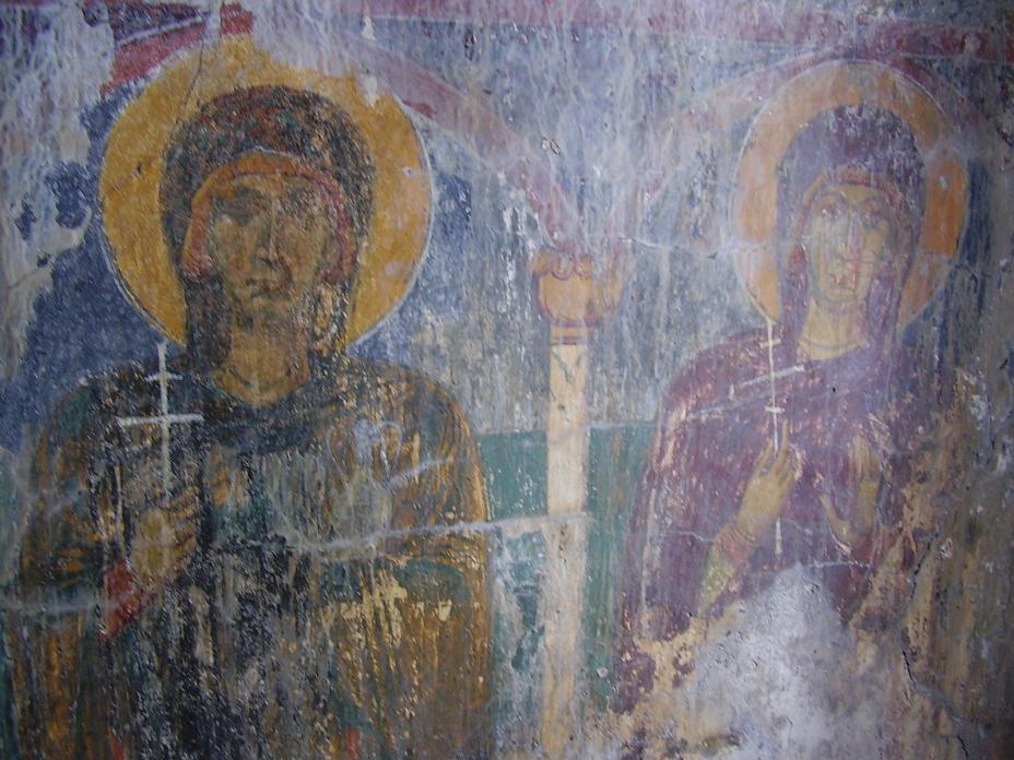
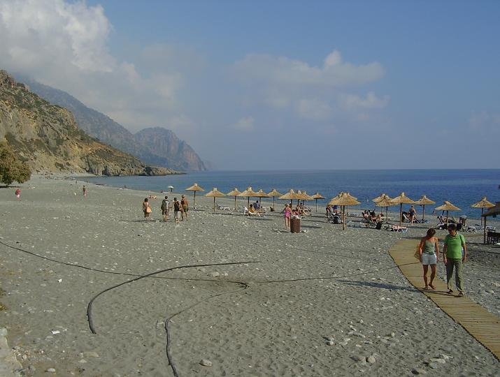
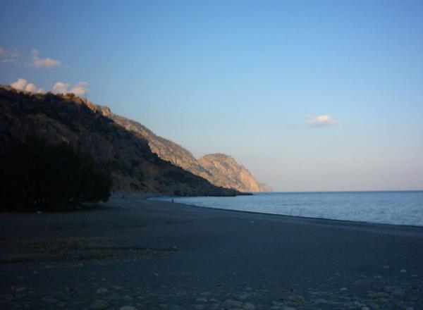
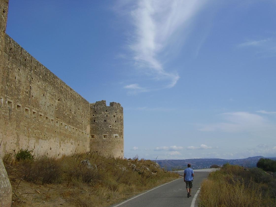
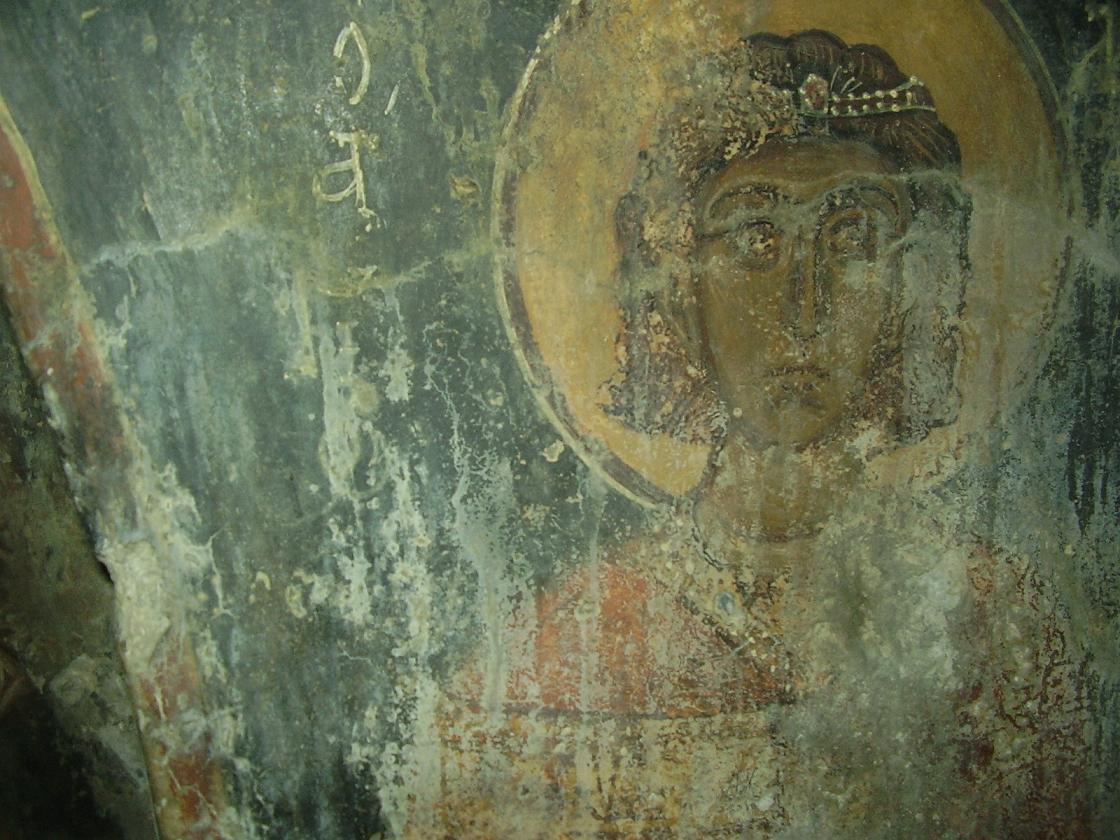
Kandanos is the capital of Selino in the southwest of Crete. Situated about 16 kilometers north inland of Sougia and Paleochora, and 60 kilometres away from Chania. Kandanos is home to a couple of nice churches and a World War II memorial monument. The village was almost completely demolished by the Gremans during the war because of their resistance to the invaders. When the Germans destroyed the town it was with the intention to do it in such a way that it could never be rebuilt again. Near Kandanos there are many interesting Byzantine churches, and some of them have interesting wallpaintings. Around Kandanos you can find many Byzantine churches with frescoes like in for instance the villages of Prodomi and Platanes. Paleochora is situated on a small peninsula in the south west of Crete, 77 kilometers from Chania. The drive to the village is through a very attractive and green mountainous landscape over lots of small and curly roads. Paleochora is 'crowned' with a Venetian castle that has for the most part fallen apart. In 1278 the Venetian general Marinos Gradengos had the castle of Selino built. The pirate Barbarosa destroyed the fort in a raid in 1539 but the outside of the fortress is still well-preserved. On both sides of the peninsula on which Paleochora is situated you can find beaches. Gialiskari Beach is a rather large pebble beach just outside the village of Paleochora, in southwest Crete. The beach is situated on the east side of the village and can be reached over a dirt track (2007) with some bumps in it. On the way to the beach - actually there are two - you will see other beaches along the way. On Gialiskari beach there are umbrellas and sunbeds for rent and there is a taverna. Parts of this beach and of the beaches on the route to it are also used as naturist beaches. The beach of Gialiskari is a pebble beach with quite large pebbles. The village of Anidri is situated about 5 kilometers east of Paleochora, on the Kandonos (or Rodovani) - Prodomi - Anidri - Paleochora route. Especially the last part of the route from Anidri to Paleochora, where you drive through a gorge, is very pretty. It is a very quiet area with winding roads, a green surrounding and lots of goats. In the village along the main road there is a water tap with drinkable water. Inside the village there is a large taverna and there are a few places where you can rent a room. One of the attractions of the village is the walk you can make through a gorge to the beach and to a nearby church on a hill. The main attraction is probably the Byzantine church, the Agios Georgios church, that you can reach by foot from a path that leads from the taverna. Inside there are some amazing old fresco's dating from around 1323. |
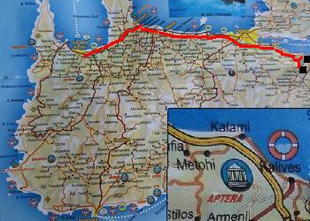
 Best is to take the wide road leading south from Tavronitis (just after Kolimbari towards Chania).
| Trip 8: Chania - Archaeological museum of Chania |
 |
 |
 |
 |
 |
|
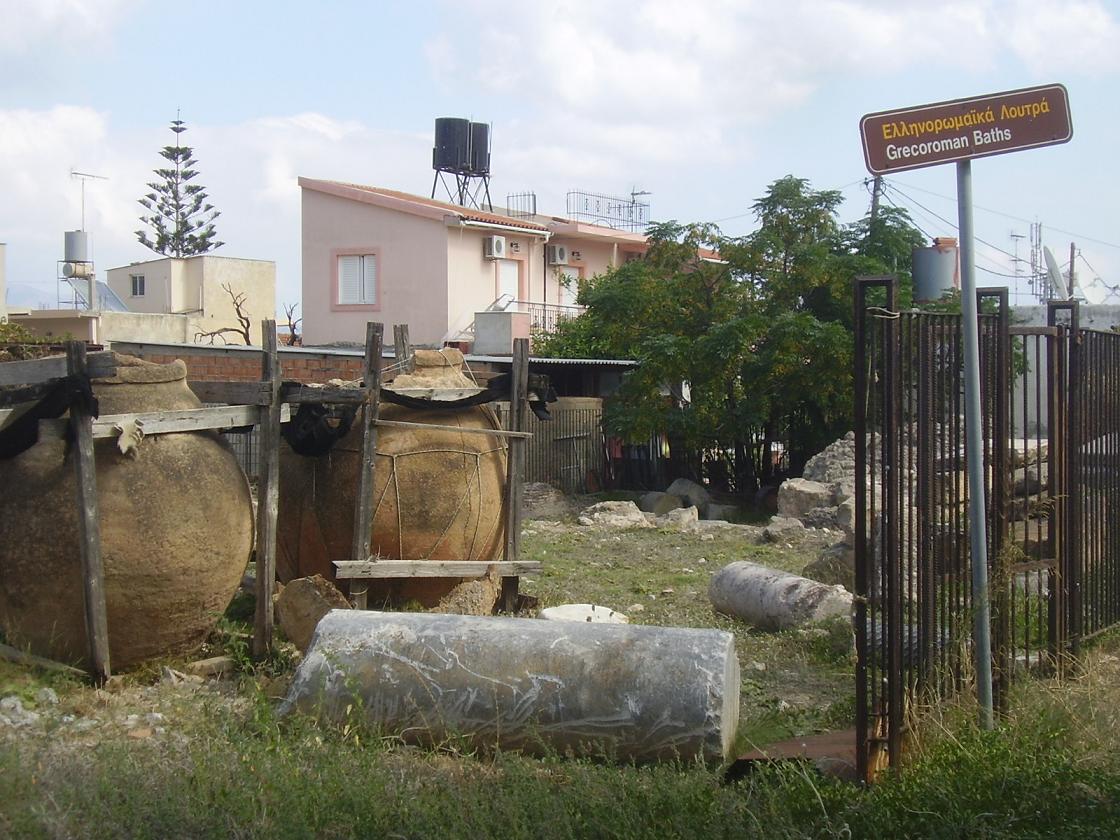
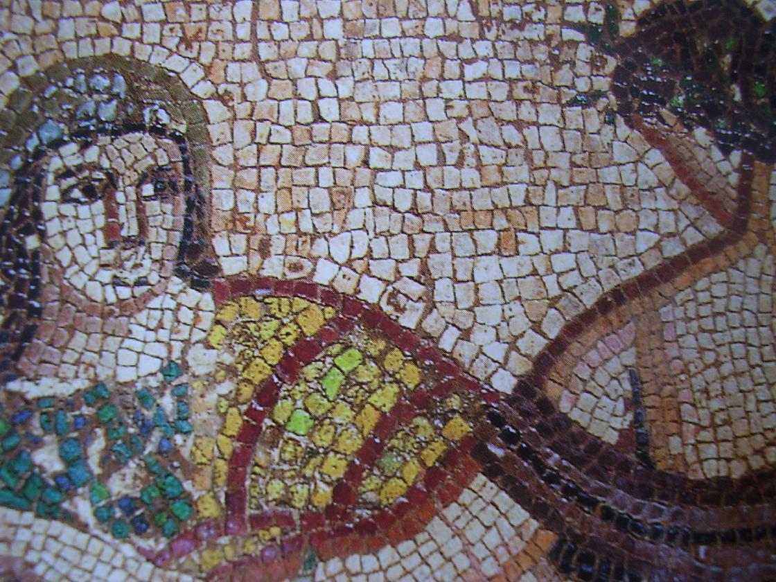
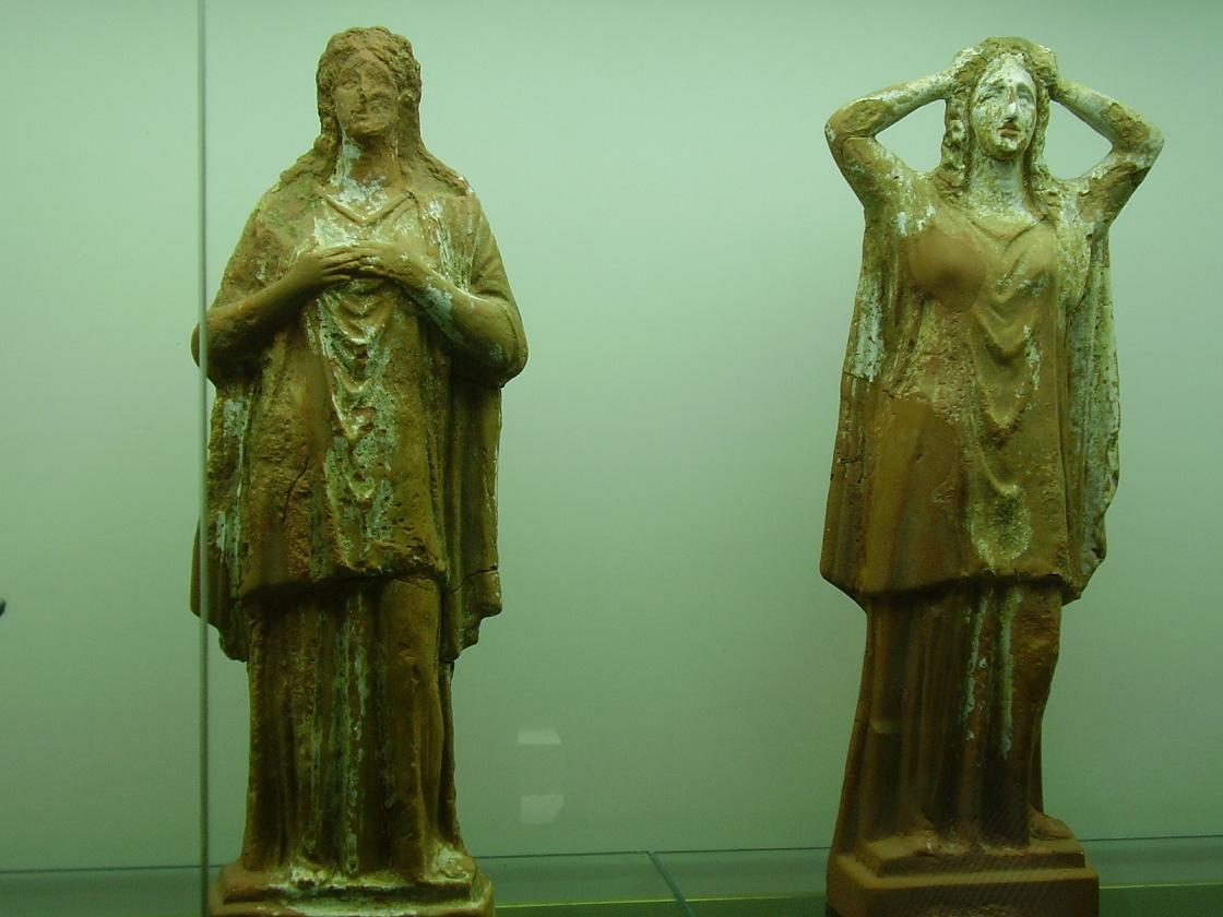
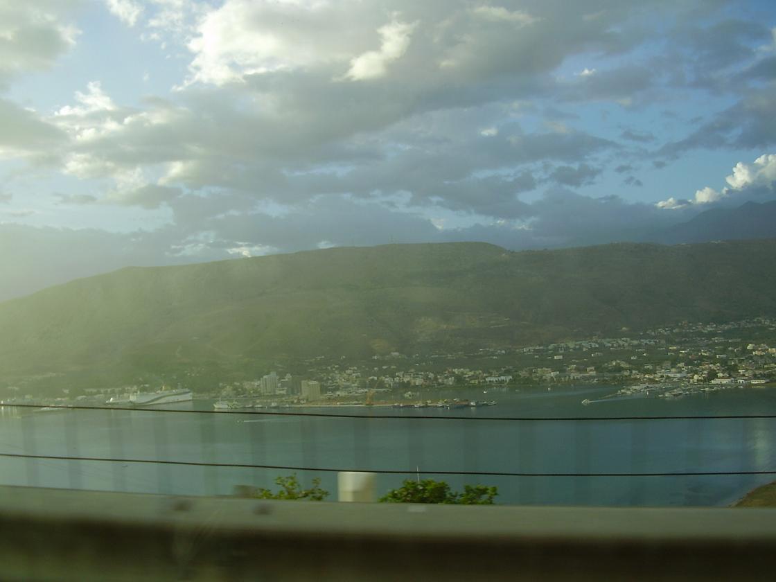
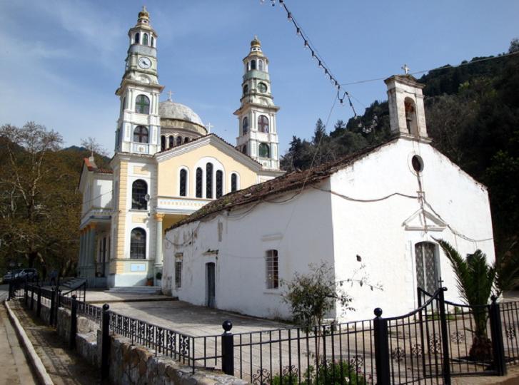
Chania is situated at 42 kilometer distance of Kissamos and it is a town where it is easy to spend a whole day. Chania is one of the largest towns on the island of Crete and is packed with historical sights, a Turkish lighthouse and a Venetian fortress, and many buildings and houses dating from the Venetian and Turkish Ottoman times. It also has many shops, a large market and a charming harbour that houses many restaurants and cafés. It is a really interesting town to spend some time in. Nowadays about 56.000 people live in Chania and it is the largest town in Crete after Heraklion. The Archaeological Museum of Chania is definitely worth a visit. You can find it in the Halidon Street, in the St. Francis Church, which dates from the Venetian period. This church is located in the busy shopping street where you can also find the Mitropolis cathedral. When we wanted to take a look the entrance was free (but I understand that normally you would have to buy a - cheap - entrance ticket). The museum houses finds from Chania and surroundings, but also from other parts of the island. Some things were found during excavations in houses and other items were found in caves. The excavations on display start with clay objects from the Neolithic period. At the entrance your attention directly goes to the large beautifully painted sarcophagi that date from the Minoan period and the large beautiful mosaic floors depicting mythological scenes that date from the Roman period (3rd century AD). Also the large marble statues in the main hall are attracting the attention. |
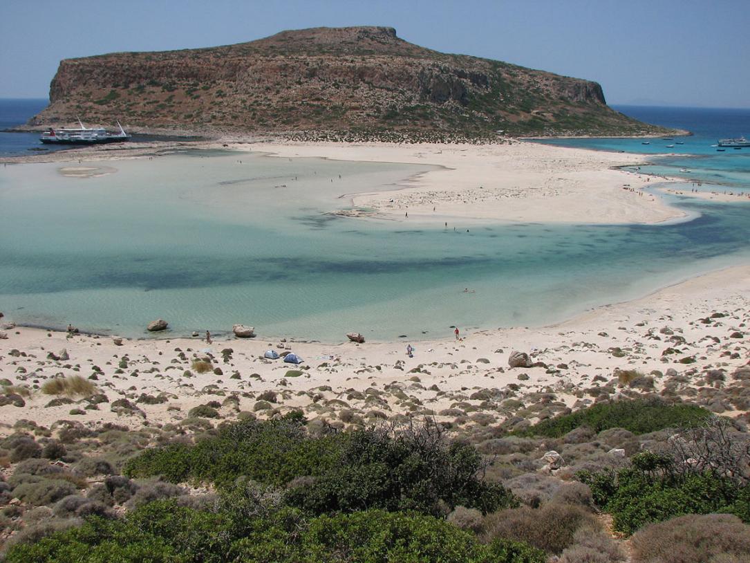
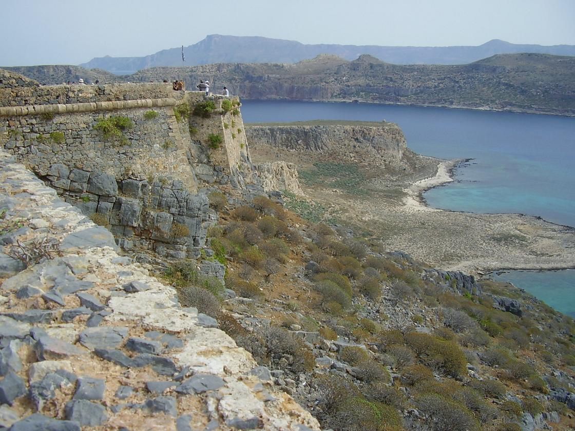
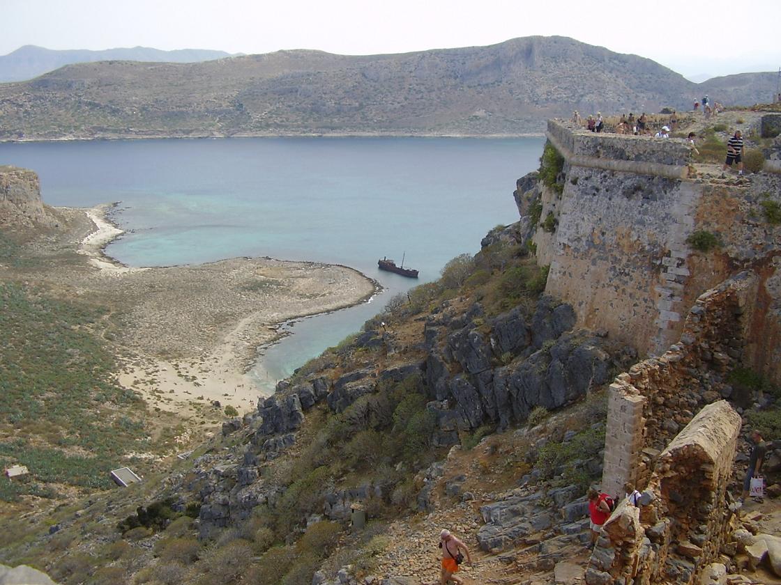
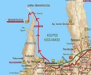
| Trip 9: Balos Beach and the island of Gramvousa |
 |
 |
 |
 |
 |
|
Balos Beach is a beach that is situated all the way in the north-west of Crete on the Gramvousa peninsula. You can reach Balos Beach in two ways. One way to get to Balos Beach is by car over a (not very good) road. You have to drive slowly, and the last part of the route is not suitable for cars. You'll still have to walk a an hour and a half before you're on the beach and back the hike lasts a little longer because you must climb up. Easier it is to go to the beach of Balos by boat from Kissamos (the harbour is just outside the town on the west side of it). The boat from Kissamos makes a day trip to the island Gramvousa and then goes to the beach of Balos. The day trip to Balos Beach is popular, so in the afternoon as the boat docks at the pier of Balos Beach it can suddenly get rather crowded, especially during high season. The beach is very pretty though, with white sand and turqoise waters. Gramvousa is one of the small satelite islands of Crete. It is situated on the north west side of the island and can be reached by boat in about an hour from the town of Kastelli Kissamos. The ferry that will take you there leaves in the morning and sails close to the coastline giving you the opportunity to take a good look at the landscape and the phenomenon of land elevation by six to nine meters above sea level (you can see the difference in the color of the rocks - the west of Crete has been rising out of the sea while the east has been sinking for the last 2000 years). On the island of Gramvousa there is a fortress where you can have a look around. The Gramvousa castle was built between 1579 and 1584 by the Venetians. It was already destroyed in 1588 when thunder struck on the powder store. The castle was rebuilt again in 1630. It is almost triangular in shape and each side is 1000 meters long. |
| Trip 10: from Maleme via Prases and Prines to Sougia Beach |
 |
 |
 |
 |
 |
|
From Maleme you drive to the south of the island and you will pass through some of the prettiest landscapes that Crete has to offer.
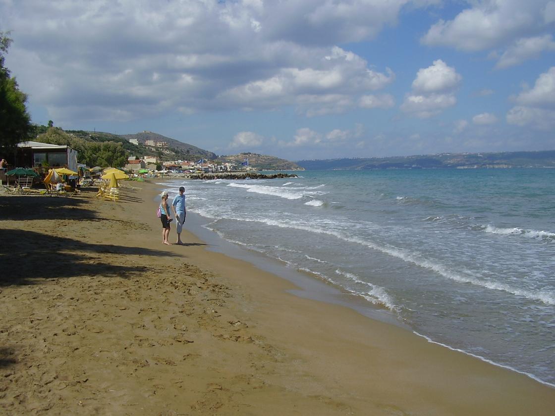
Prines is a village a little bit further on the route. On the left side of the valley you will see a church tower sticking out of the trees. Park your car here and have a look. Down in the valley there near Prines is a special small Byzantine church surrounded by walls and accompanied by a bell tower from a later date. Inside you can have a look at some beautiful old fresco's. Sougia you find all the way in the south of Crete and there is a good beach with a naturist part. There are good taverns along the coast, special visitors, and there is a sense of wild freedom in the air. The area of Sougia is also very suitable for making interesting walks, and if you feel like doing nothing at all there is that gorgeous beach in front of the village. You just take your book and your sun lotion, read a bit and make a few dips in the clean water. Sougia's ancient name was Syia, and it was a port of the Roman empire (most remains are now beneath the sea). West of Sougia are the ruins of ancient Lissos. One can admire the tiny Dorian temple of Asklipios, the ancient theatre and the vaulted tombs. |

| Trip 11: Ancient Aptera - The Turkish Izzedine fortress - The beaches of Kalives |
 |
 |
 |
 |
 |
|
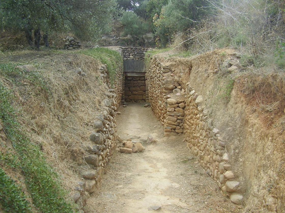
Aptera is situated about an hours drive from Kissamos, 15 kilometer east of Chania. This town has been inhabited since the bronze age. The antique town was destoyed by the Arabs in the 9th century. Archaeologists found graves, temples and the remains of houses and fortifications from Hellenic, Roman and Byzantine times. From the town there is a spectacular view over the Bay of Souda end the Turkish fortress of Izzedine. The wide city walls of Aptera are quite impressive. Aptera is the largest Roman site on the island of Crete and the city was extremely important for both the Minoans and the Romans due to its geographical location above the largest natural harbour in the Mediterranean Sea. The fortress of Izzedine dates from the Turkish period - 1816. It is situated on a hill that overlooks the Bay of Souda, the White Mountains and all of the Apokoronas. The fortress can be reached through the village of Aptera. Down the hill on the coast and on an island in the bay there are more fortresses from a later date. The Bay of Souda is considered the best harbour area / protected bay of Crete, and this explains all these fortifications. From the fortress there are magnificent views over the Bay of Souda and the green valley where Kalives is situated, and you can distinguish a part of the ancient city wall of the old town of Aptera. Kalives is sort of a big village with plenty of shops, a butcher, a bakery, a supermarket, a post office, a petrol station, kafenions and restaurants, and a very nice church. Kalives has good sand beaches. The eastern beach is the most popular because it is in the village itself. The western beach is more quiet and about one km away. |
| Trip 12: Maleme - Vlacheronitissa - Loutraki - Koufos - Alkianos - Patelari |
 |
 |
 |
 |
 |
|
This trip leads through the green area behind the coastal villages of Gerani and Platanias, which is covered with olive trees and especially with orange trees.
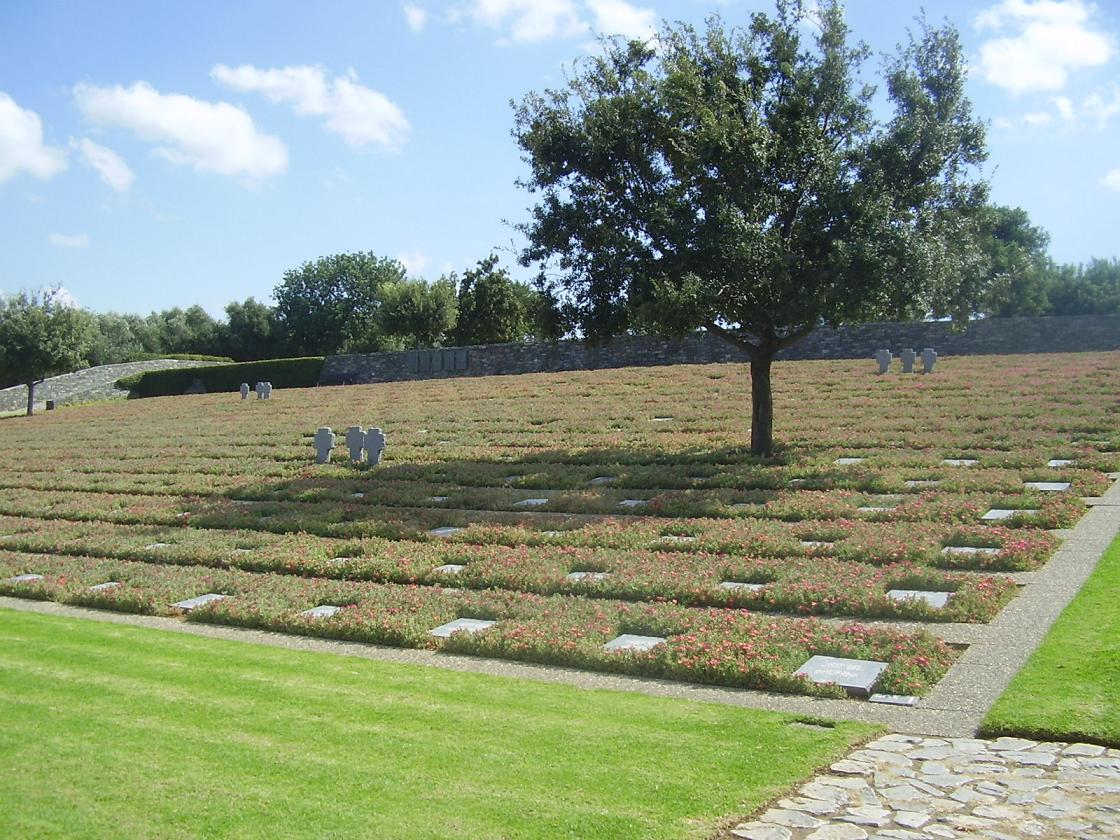
Vlacheronitissa is a village that will make a large impression on you (at least that is what it did to us). First of all there is a late Minoan tomb to see (1400 - 1100 B.C.) in Vlacheronitissa. This tomb is located at the end of a path. The tomb can be found by following the brown signs that point to most of the interesting antiquities in Crete. The tomb stones are quite large and the tomb is almost completely intact, which of course is very unusual after such a long time. In Vlacheronitissa over 4000 over these German soldiers - almost all of them very young men - lay buried at an impressive war cemetery which overlooks the Gulf of Chania and the village of Maleme. On each grave stone there are two names and these stones are surrounded by flowers. The plants that are here are green almost the whole year. It is a really impressive place to have a look at and have a good think. Next to the was cemetery is a taverna with a collection of old weapons and all sorts of memorabilia of World war II. Loutraki is just a nice old village with a couple of churches and plenty of plane trees. Koufos is also situated in this very fertile valley which is packed with orange trees. In this village there is a beautiful Byzantine church. The Byzantine church of Zoodohos Pigi just outside the village of Koufos dates from the 14th century. It is situated among the orange trees on the left side of the road as you go north from Koufos and take the exit Alkianos and Chania. The Zoohodos Pigi church is also known as the Ai Yannis Kyr-Yannis Church. It is indicated by a brown sign along the side of the road. Alkianos is also situated in orange tree country. Here you find a small factory where orange juice is made. The first thing you notice when you enter the village is the beautiful big church that stands here with its dome and two towers. At the church is an impressive war memorial of marble with a bronze bird on top to commemorate the people of the Greek resistance that were killed by the Germans in the village. In Alikianos are the ruins of the Venetian castle that once belonged to the aristocratic Molini family and in a street a little further lies the 14th century church of Agios Ioannis. The church looks nice on the outside and inside the church (which was open) are some fragments of wall paintings to be seen. Patelari is also a village you might want to have a look at. It's actually almost like a row of houses on either side of the road. In the village there are several churches, including a very small one, which is located next to a war memorial. In World War II there was this fierce resistance against the German occupation in this village and there are many casualties. Along the village flows a river (which actually looks more like a channel, because it is all straight). On the corner at the curve in the road as it runs through the village you find a tavern where you sit in the shade of the trees and have something to eat or to drink. |

| Trip 13: Deliana and Rotonda |
 |
 |
 |
 |
 |
|
Deliana is a small village in the northwest of Crete, not far from Kissamos and at 36 kilometer distance from Chania. The village lies at the beginning of the Deliana Gorge, which is the beginning of a hike surrounded by high cliffs and unspoilt Cretan nature (the walk takes about 1.5 hours). At the bottom of the gorge there is a small church where you can have a rest. The Byzantine church in the village, the Agios Ioannis church, is in good shape. It is a pretty church from the outside and on the inside there are beautiful frescoes on its walls. This church is open for the public and in my opinion this is one of the nicest Byzantine churches in this area (and maybe even in the whole of Crete). Rotonda is the place of the Byzantine church of Rotonda or the Church of the Archangel Michael. It is situated close to the village of Episkopi in the west of Crete. The church has the only 5 concentric ring stepped dome on Crete. The design is so rare in Byzantine terms that only the church of Agios Nikolaos in Thessaloniki is similar. It is believed that the church was originally built during Crete's first Byzantine period in the 6th Century and then either rebuilt or additions added in the 10th Century when it was the seat of the Bishop of Kissamos. Sections of the mosaic floor date back to the 5th Century A.D. while different layers of frescoes date from the 9th to the 11th Century. The church can be hard to find if you come from the south on the route Vasilopoulo - Episkopi - Drakona. At the end of the village of Episkopi (after driving through it) there is an exit on the left hand side and about 1 kilometer further on the left hand side there is another one. You will not see the signs because they are placed in a way that you will only see them when you come from the north from the direction of Kolimbari. |
| Trip 14: Souda - Agia Triada monastery - Gouvernetou monastery & cave - Katholikou monastery |
 |
 |
 |
 |
 |
|
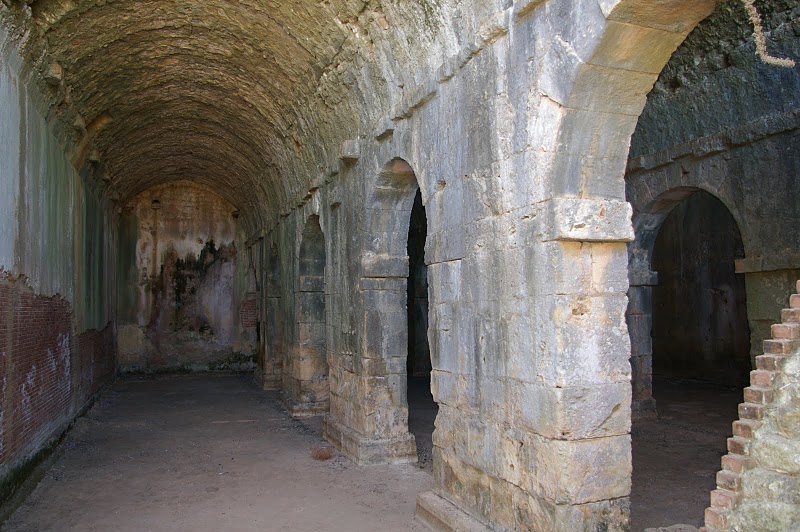
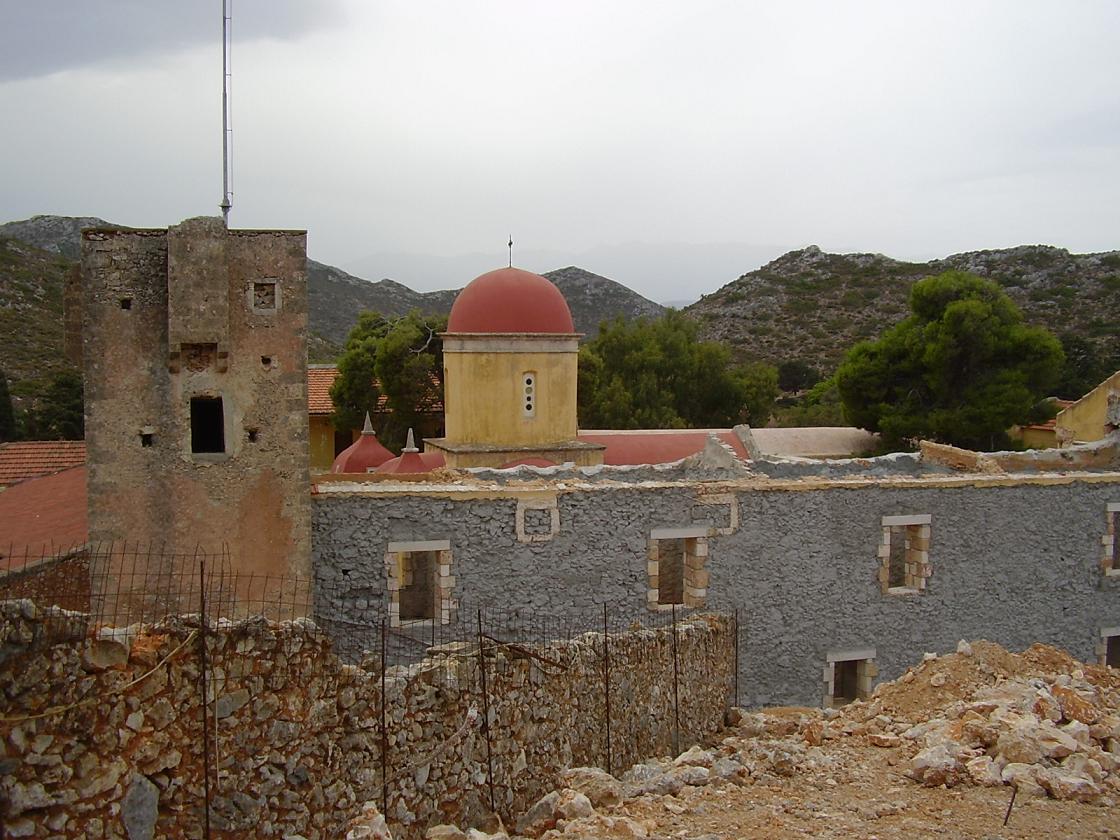
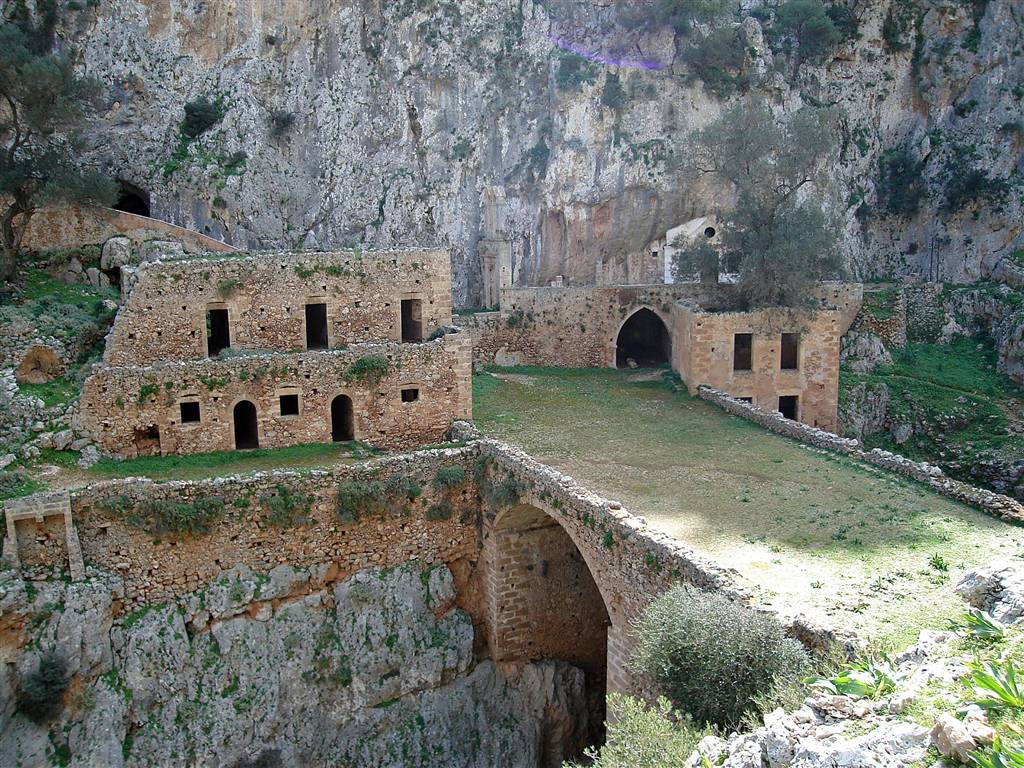
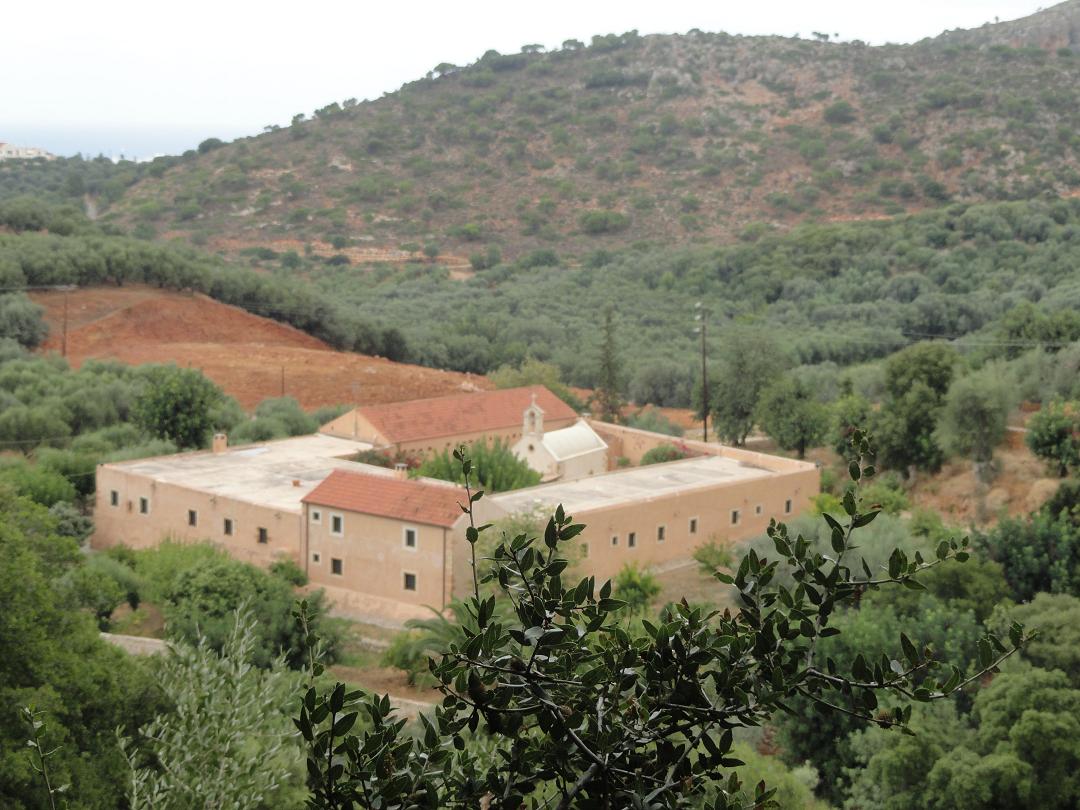
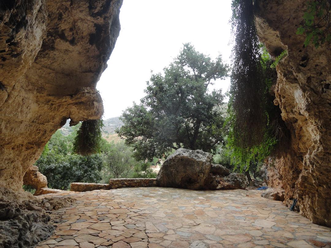
The Agia Triada monastery is situated in the north west part of the Akrotiri Peninsula, which is situated on the east side of Chania town. The town of Chania is at a 16 kilometers distance. The Agia Triada Monastery was build in the seventeenth century (1612). The monastery of Agia Triada has three domes. The bell-tower was added later in 1864. In the 19th century the monastery housed and important theological school. Inside the Agia Triada Monastery there is a library and a small museum with icons. It is a beautiful monastery and it's worth to have a look at it. The Gouvernetou monastery was built in the 16th century (1537) and on the outside it looks like a Venetian fortress because of the high, thick walls and towers around the monastery that were built to defend it against attackers. Of the original four towers only two survived. At the back of the monastery at the monument is a path to a cave in the hills (the Cave of the Bear) and the monastery of Agios Ioannis (the one of St. John the Hermit), better known as the Monastery Katholikou. The cave is dedicated to the Virgin Mary, and here artefacts were found that indicated that the cave was once dedicated to the goddess Artemis (the goddess of hunting). The Cave of the Bear owes its name to a stalagmite (the big white) in which with much imagination you could recognize a bear. In this shape of the bear the goddess Artemis would appear. In front of the cave are the remains of another old monastery and down below in the valley you can see another old building. The Minoan cave is reached after about 15 minutes walking, the Katholikou monastery is another 30 minutes walk away. This monastery dates from the sixth or seventh century and is probably the oldest monastery in Crete. It is partly built into the rocks / cave. There is a bridge in front of the monastery which is 50 meters long and 15 meters wide. It runs over a 30 meter deep gorge (the Avlaki Gorge). The monastery is partly a ruin but it is beautiful. |
 This trip to three of the finest monasteries of Crete takes about one and a half hour by car (and the same amount of time to drive back).
| Trip 15: Lake Agia - Agia Kyriaki monastery - Meskla |
 |
 |
 |
 |
 |
|
The lake is a peaceful place with special flowers and birds and a small church on its shores. In my opinion it is better than Lake Kournas because it is not as commercial as this other sweet water lake. At Lake Kournas you can rent a pedal boat or a kano, and there are parasols and sunbeds for rent. At Lake Agia the birds are more or less left undisturbed. On two sides of the lake there is a taverna where you can have a drink or something to eat and that is it: no souvenir shops, hotels and houses. If you want to have some rest and sit down to watch the birds and the nature there are wooden benches along the paths. The Agia Kyriaki monastery is located at a distance of 12 kilometers southwest of the city of Chania. The road to the monastery of Agia Kyriaki is located between the villages Mylonia and Varipetro. It is a mile driving away from Varipetro over a narrow paved road. The monastery of Agia Kyriaki was built in the 17th century and was a haven for refugees from the Turkish invaders in the 19th century. A path leads from the monastery up to several cave churches and the Kastelos fortress which is located high on the mountain. These cave churches are fairly new, but it is still interesting to take a look at them. Along the way you have beautiful views of the landscape, and the caves themselves are interesting as well. Up on the mountain around the fortress Kastelos are a lot more caves. Meskla is the site of an ancient city, and various artefacts and remains of cyclopean walls have been found here. The ruins of the houses and the remains of a city wall can be seen around the village of Meskla. It is unsure which city was situated here and what its name was. Meskla has two Byzantine churches. One of these churches is the Church of Christ Saviour or "Sotiras Christos Church" with paintings by the hand of Theodoros Daniel and his nephew Michaeli Veneris dating from 1303 A.D. A bit further on the road if you walk through the village over the bridge on the north side of the village you find the 14th century Virgin Mary Church. This church contains parts of earlier buildings including a temple of Aphrodite that was once built in this exact place and the mosaic on the floor of the present church floor was once the mosaic floor of a fifth century basilica. Behind this church a very large and imposing new church has been built. |
© Hans Huisman, https://www.angelfire.com/super2/greece/ 2018