|
Chase Prediction Center We're Here When You Storm Chase! |
|
November 24, 2001
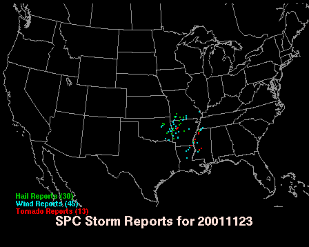
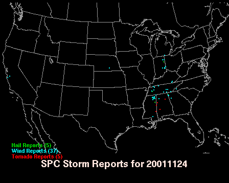
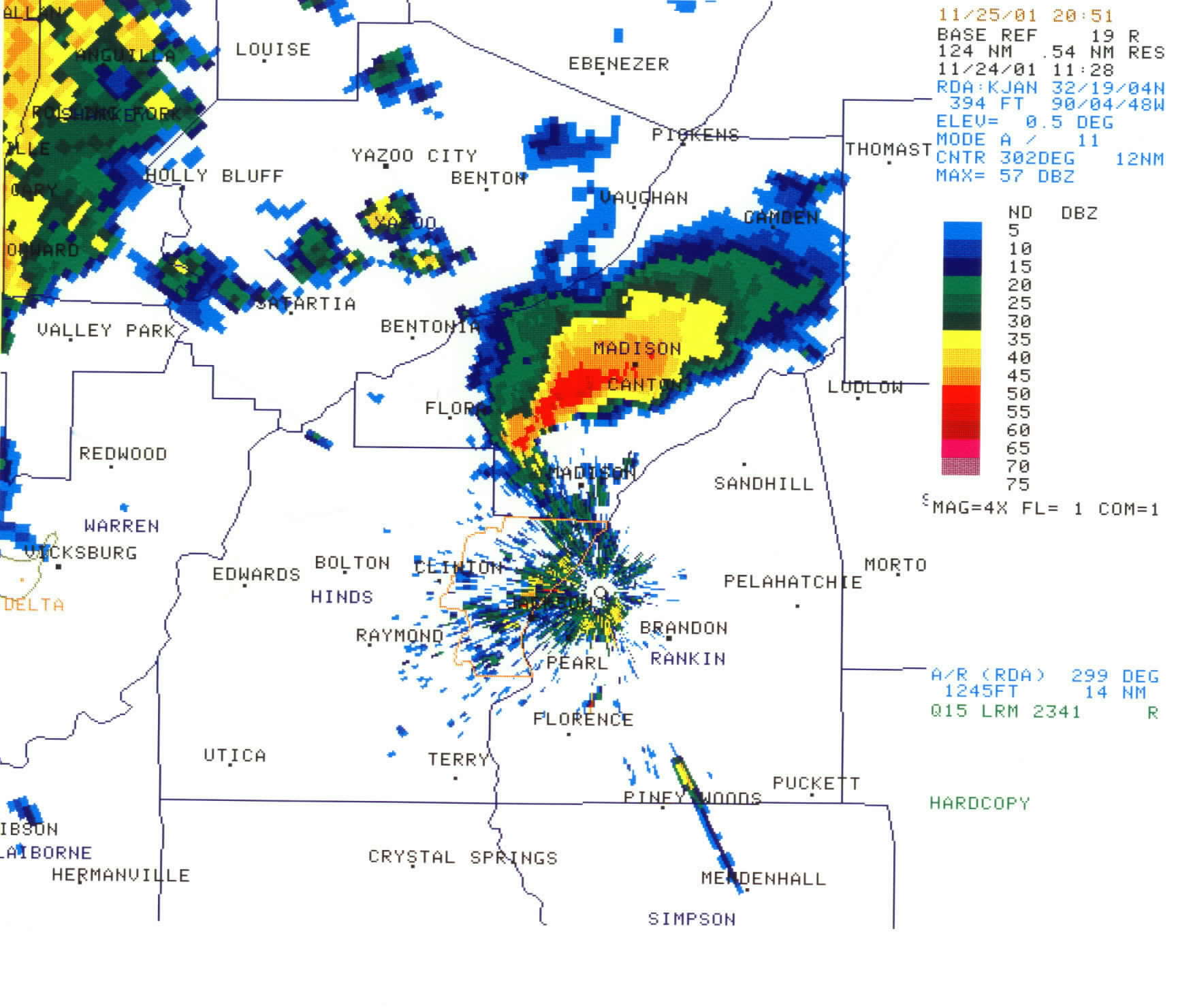
As you can see from the above storm reports, this was a fairly major tornado outbreak lasting from late evening on 23 November 2001 through the afternoon of 24 November 2001. Significant tornadoes were reported from northwest Arkansas southeast through Mississippi into Alabama. I chased on November 23 in western Arkansas, but had to work the morning shift on November 24. Storms did not develop until late in the evening of the 23rd, just to the southwest of my location in northwest Arkansas. Since I was already dark, I had to work at 4 am, and I was nearly 6 hours from home, I decided to pack up and head back to Jackson so I could at least get a couple hours of sleep before I had to be at work. Just so happens a tornado occured within 5 miles of the subway parking lot I was sitting and waiting for development at. Oh well I guess. I arrived home in Jackson about 130am and went right to sleep. I woke up about 320am and got in the shower. I went straight into work with the staff already in severe weather mode. For just about the next 15 hours we issued warnings from our CWA. We had several significant tornadoes in our area, and once severe weather was over about 3pm, I was able to go with our WCM to survey an F-4 that just went to the northwest of the Jackson metro area at 5am. It hit the town of Madison and did extensive damage. The storm also produced baseball size hail at 5am. Baseball size hail is big for Mississippi at any time of day, but especially at 5am which tells you just how strong that updraft must have been. In total we had 2 F-4's (one of them near F-5), an F-3, and one F-2 with several reports of damaging wind and hail. What a day. I worked just about 18 hours that day with severe weather and the damage survey, but it was great experience. Here is radar picture of the Madison storm below.
Also here is a link to our website at work with more extensive radar and damage pictures. National Weather Service Jackson |