|
Chase Prediction Center We're Here When You Storm Chase! |
|
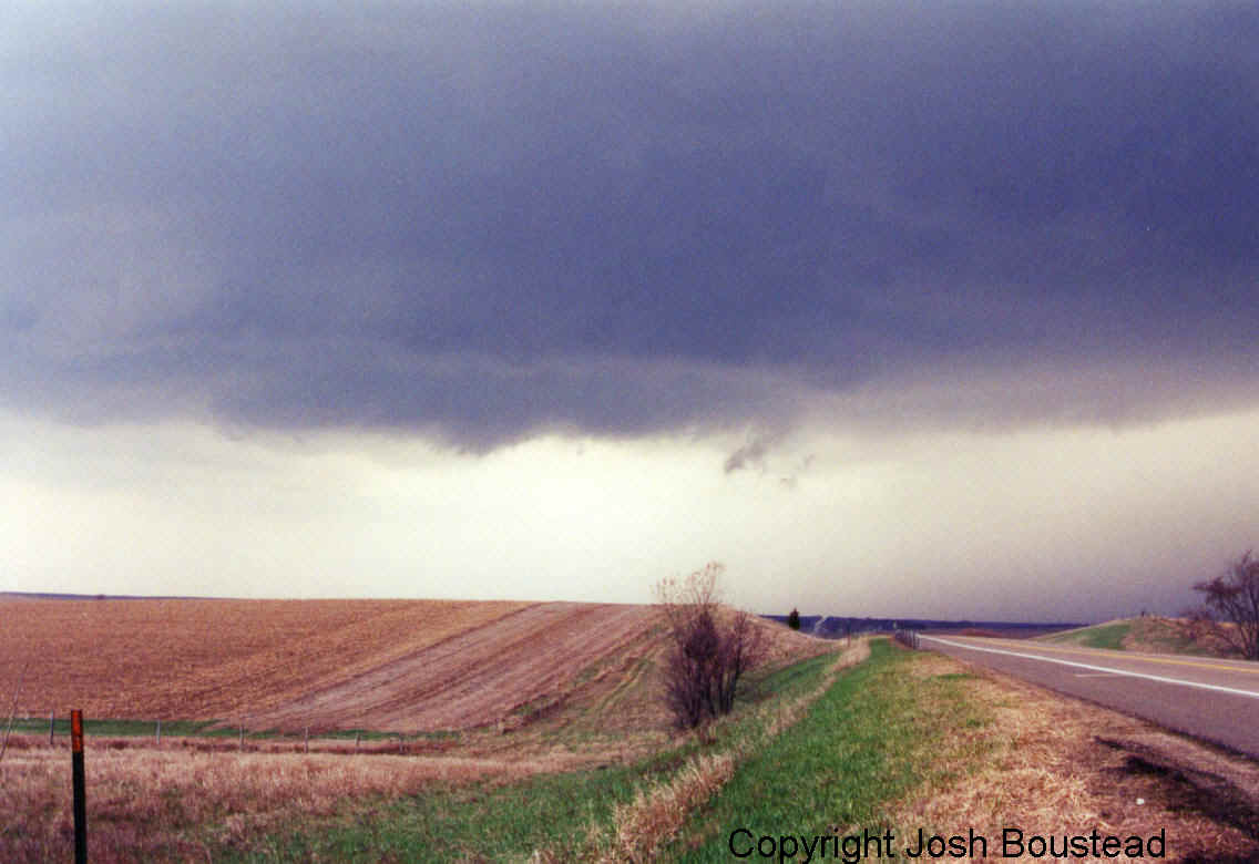
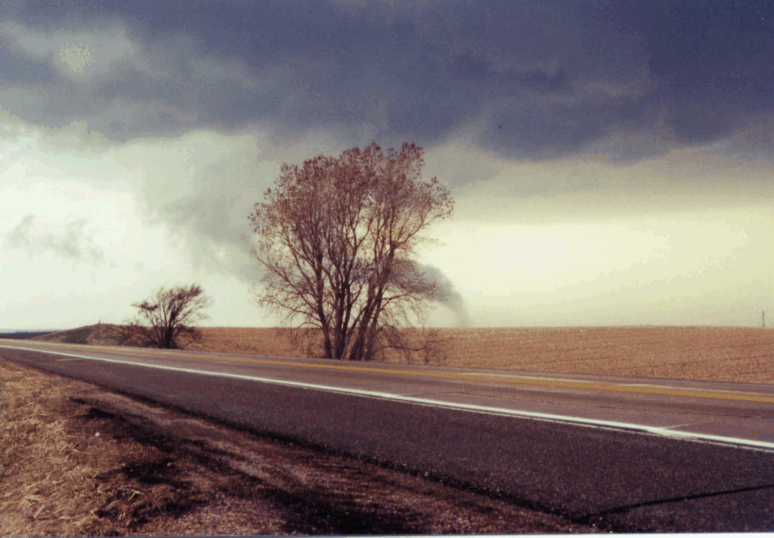
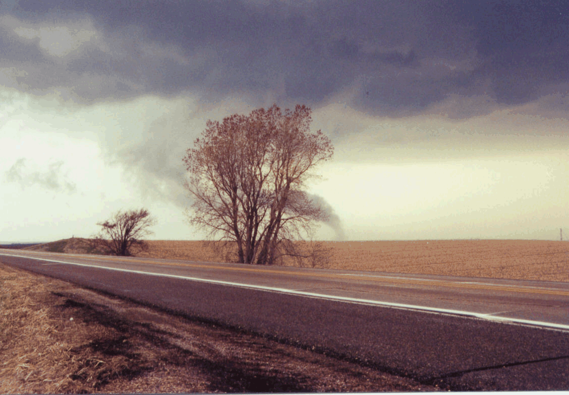
I managed to see 8 tornadoes during the year of 2001. Not all of them all shown here, due to some of the circumstances would not allow for me to get out of my car and take video or shoot stills. I worked a great deal of the last springs events at the National Weather Service, which as most meteorologists know can really hamper your chase time. I was able to get a full week of from June 3 through June 9 for a short chase vacation. I my chase partner was Mike Seaman from the National Weather Service in Kansas City. April...This first picture set is from sometime in April. I was fairly proud of this chase, as there wasn't even a slight risk out. I had some time, and did some forecasting and came to the conclusion that if storms would be able to cross the warm front in far northeast Nebraska there would be a least some small chance, and I guess it worked out. I was able to capture and video 3 tornadoes on this evening...
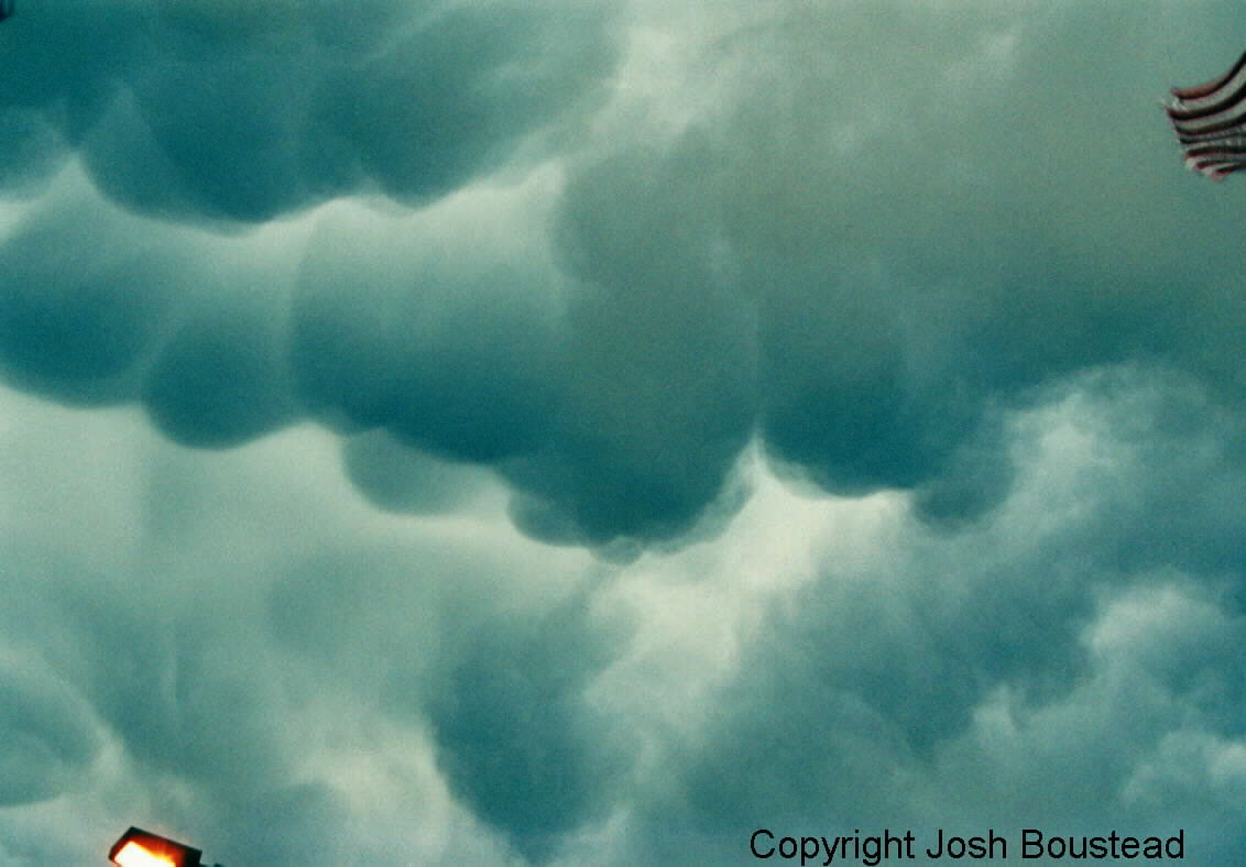
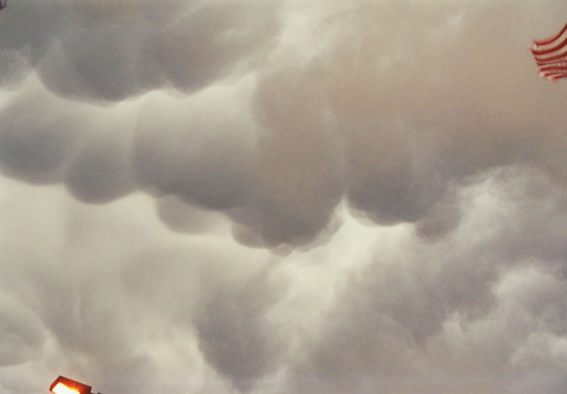
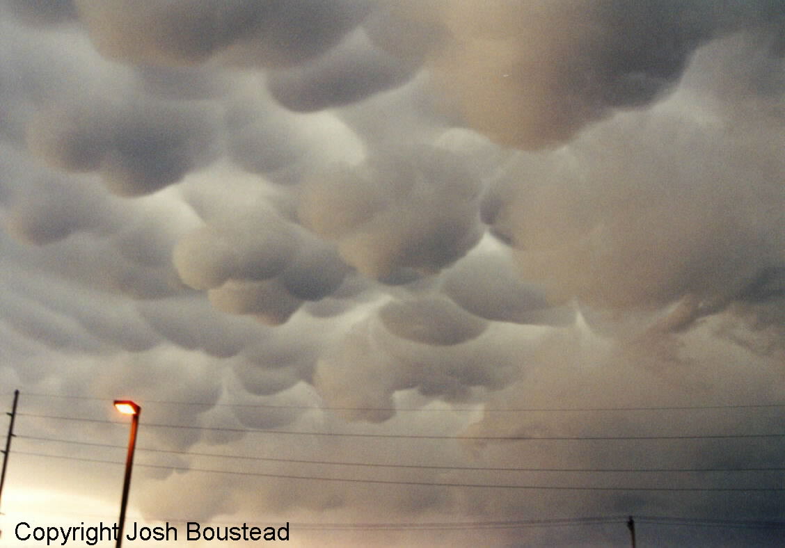
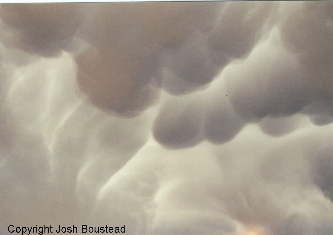
May 9...Although I had to work severe weather at the National Weather Service this night I did mange to slip outside and capture these great mamatus clouds from a elevated supercell to the northwest of the office. Some large hail reported with this storm...but no tornadoes...
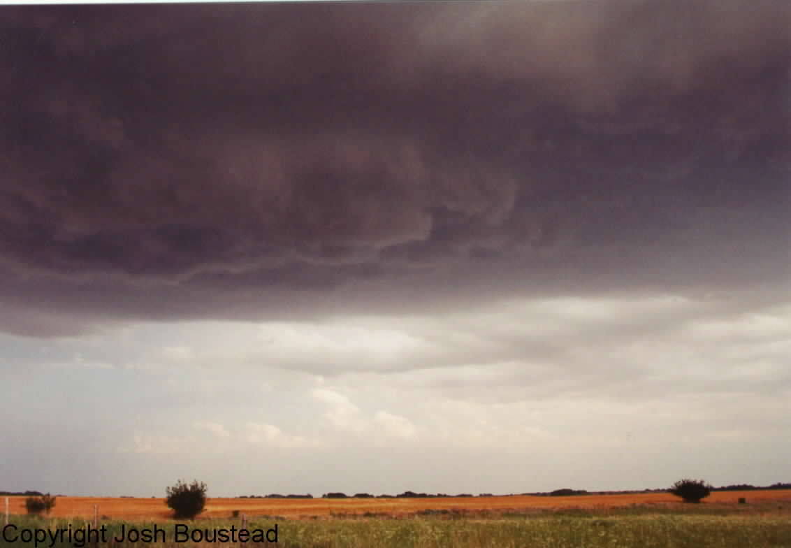
June 4...My chase vacation started on June 3, but due to a stronger than expected cap, a good chase potential went to sitting and waiting. We were in the right place for the supercell that did develop right at sunset, but due to darkness we were unable to get any kind of position. On June 4, we remained in south-central Kansas as conditions looked favorable again for thunderstorms. Thunderstorms developed between 5 and 6 pm south of ICT near the border of OK. We were north of ICT at the time and had to head south for the storm intercept. We caught the storms in southern Harper county. Below you can a nice rain free base with some hint of a rear flank downdraft on the second of those pics. As commented on the front page, the storm produce large hail, but became outflow dominate and dissipated.
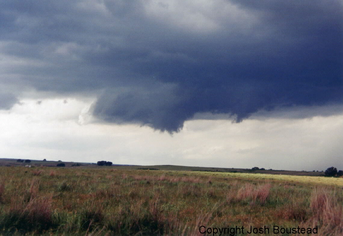
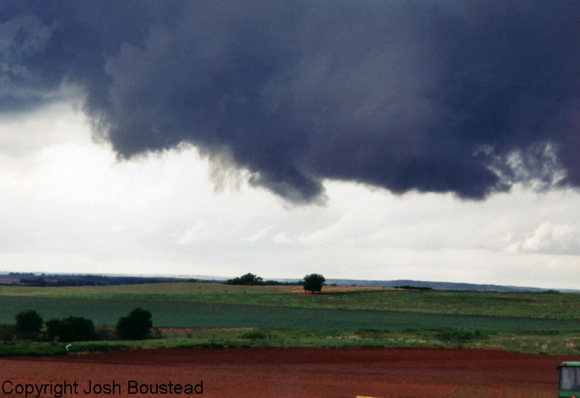
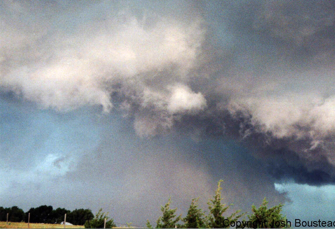
June 5...This day did not even look as promising as June 4, but turned out to be the best of the three southern Kansas chases. We started out in Wellington, KS and after a short stop at the library decided to near to far northwest OK near the Woodward area. Well we never got that far as supercells started to blow up just as we crossed into Oklahoma. This supercell developed a lowing very quickly. We ended up chasing this same storm for about 6 hours. First the first 4 hours of this storm it produced many funnels and occluded a couple of times with new mesos developing on the new southern flank. It was not until it transitioned to an HP supercell that it became tornado. Although this storm may go down in history as never producing a tornado, Mike and I were almost hit by three brief touchdowns as we were trying to punch the southern end of the storm. The occlusion wrapped up, we found ourselves in the "bears cage" with no where to go. The brief touchdowns were just off to our east, less than a mile away. Due to the quickness of what was going on, and the danger we were in, we were only able to shoot short video of two of the touchdowns. We did call in the reports to the National Weather Service in Omaha to relay to Wichita. We then punched through the core on the southern side of the occlusion to get out of the cage that we were in. That was likely one of the more scary moments in my chase career. We had rain bands wrapping all around us, and were very nervous about a rain wrapped tornado. Below are some of the pics from start to finish....
|