| The Greek Islands | Kythira HOME | Kythira Hotels | Kythira Beaches | Kythira Sights |
 |
 |
 |
 |
 |
 |
 |
 |
 |
 |
| Kythira, Kithera or Kythera in Greece - The island of Aphrodite |
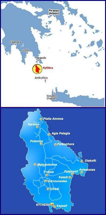

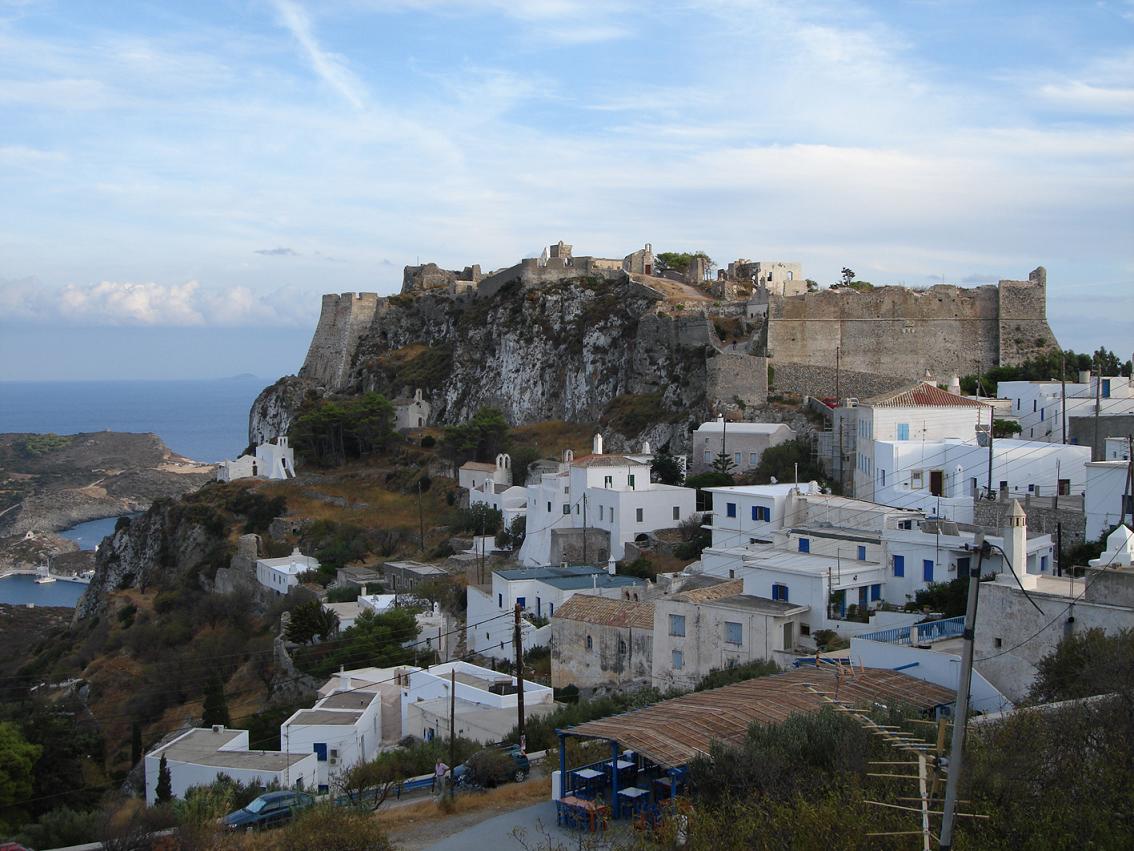
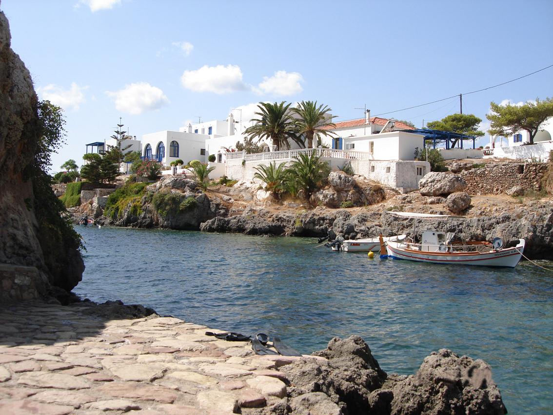
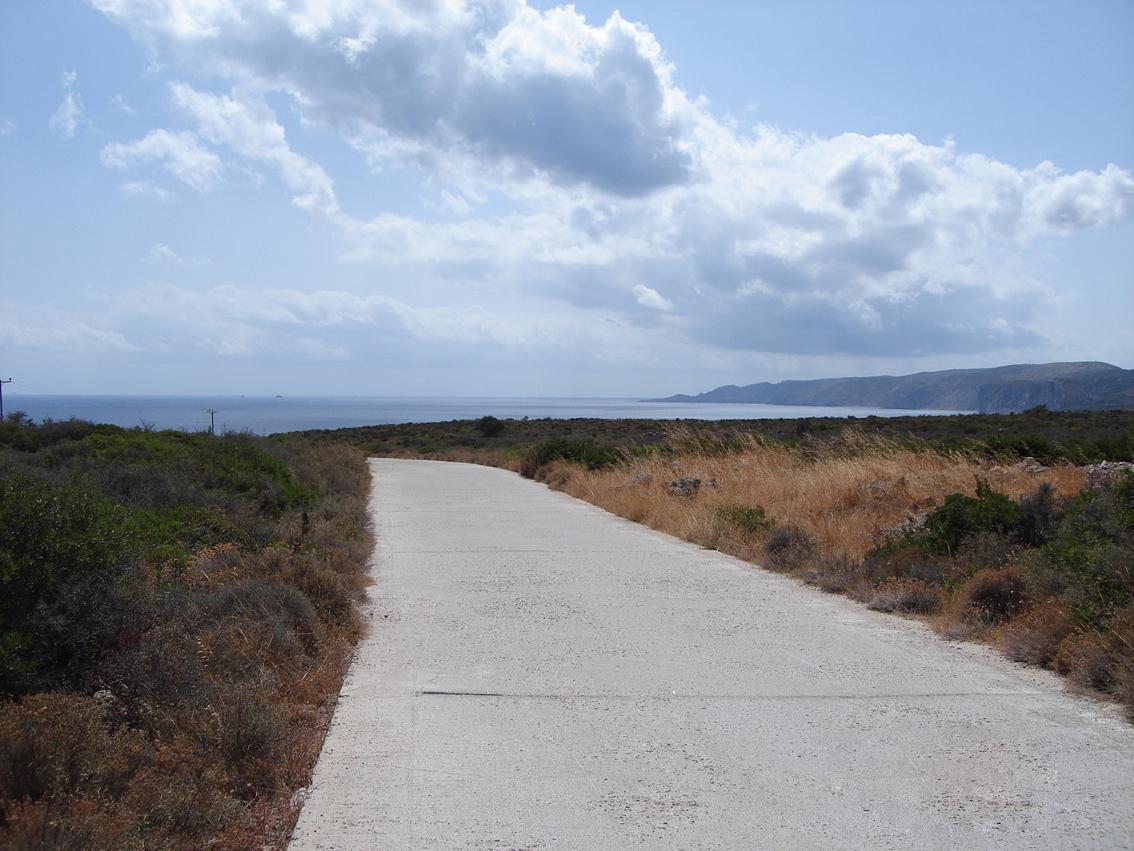
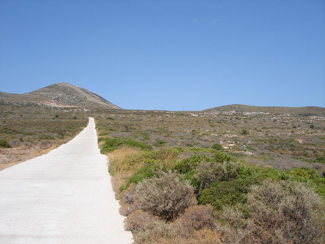
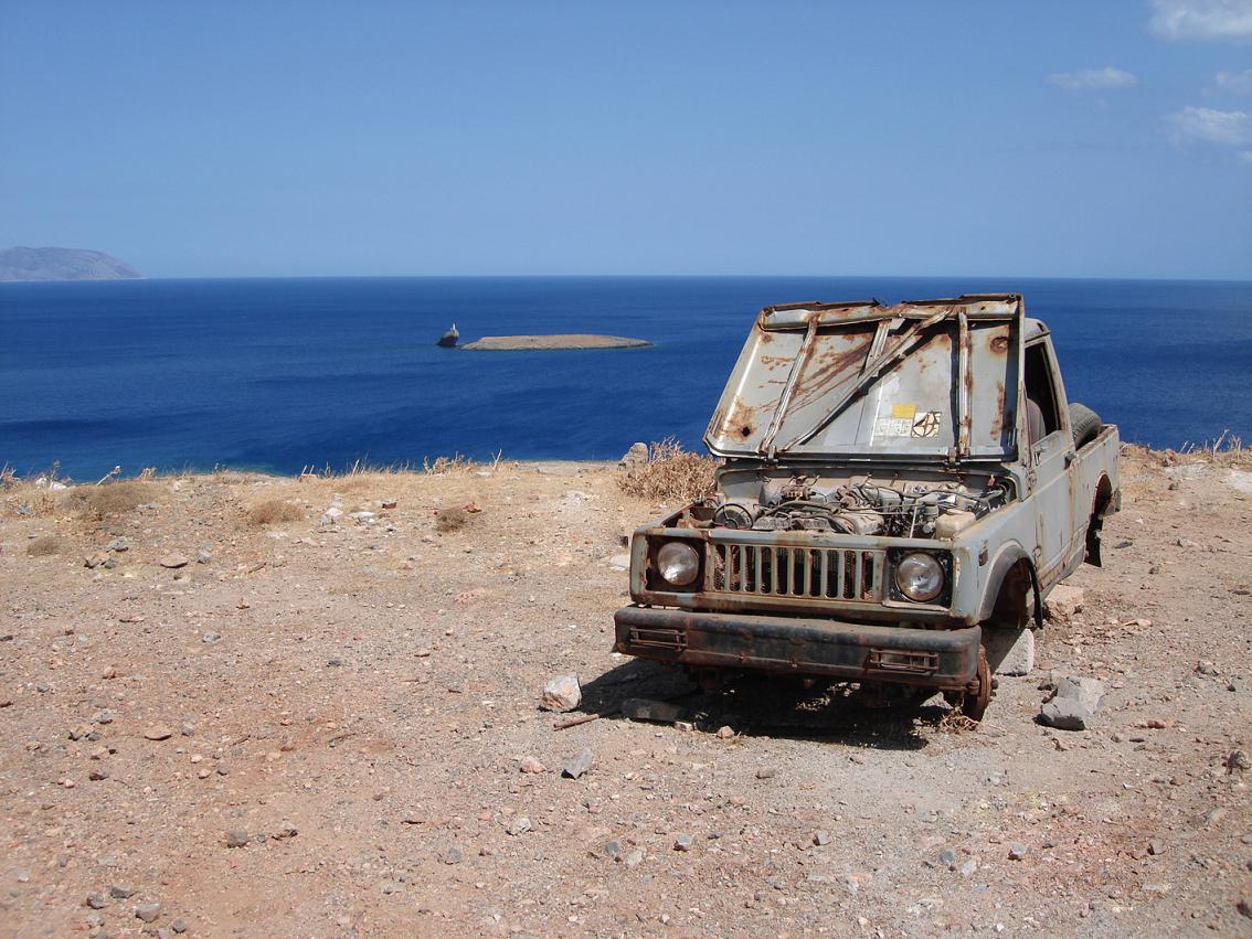
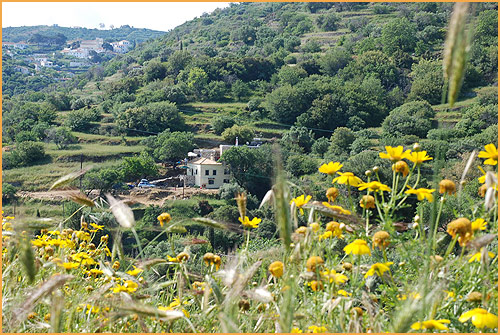
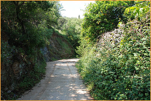
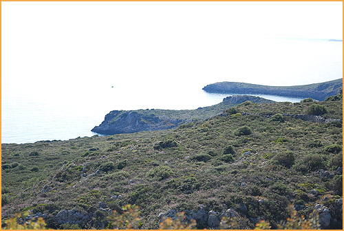
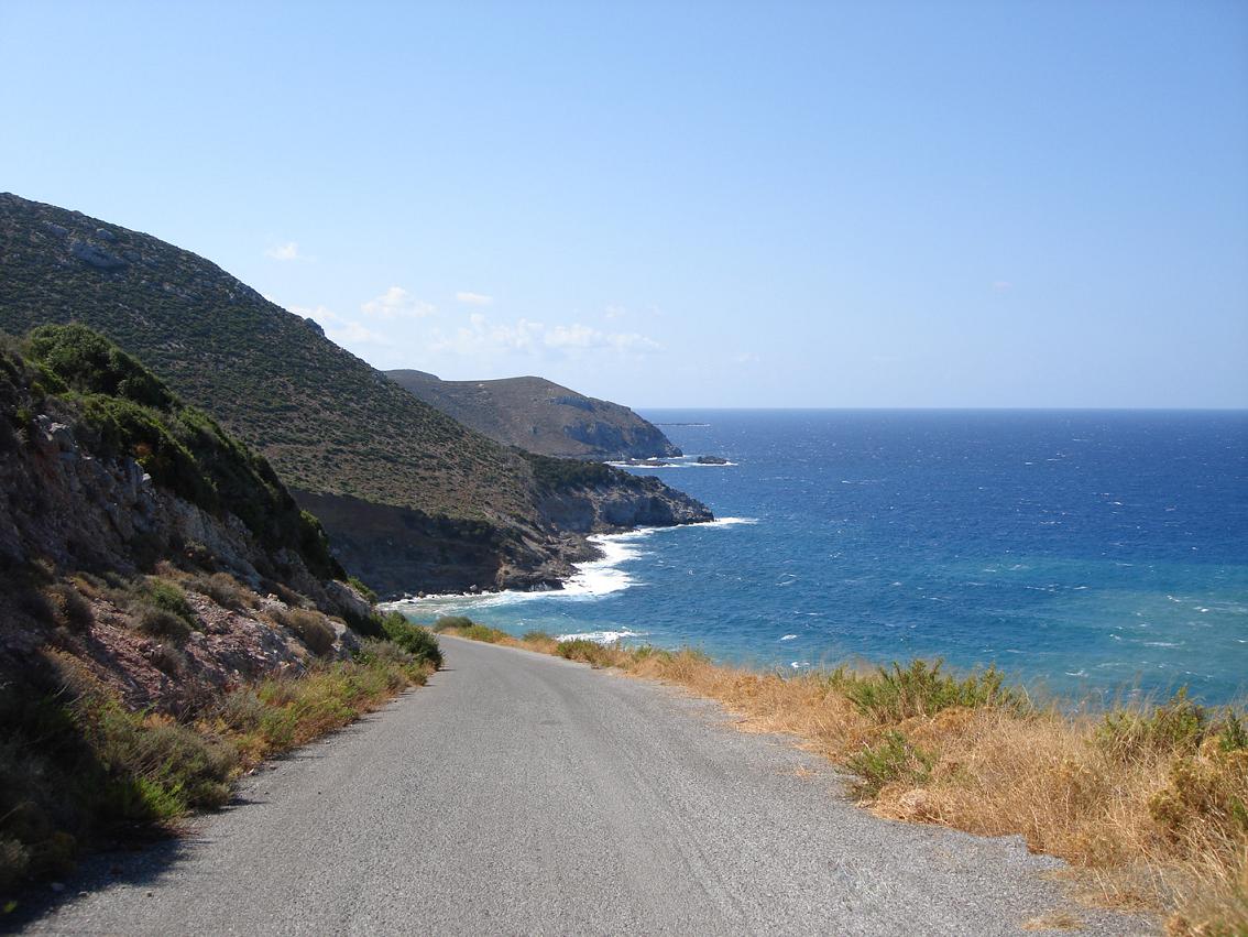
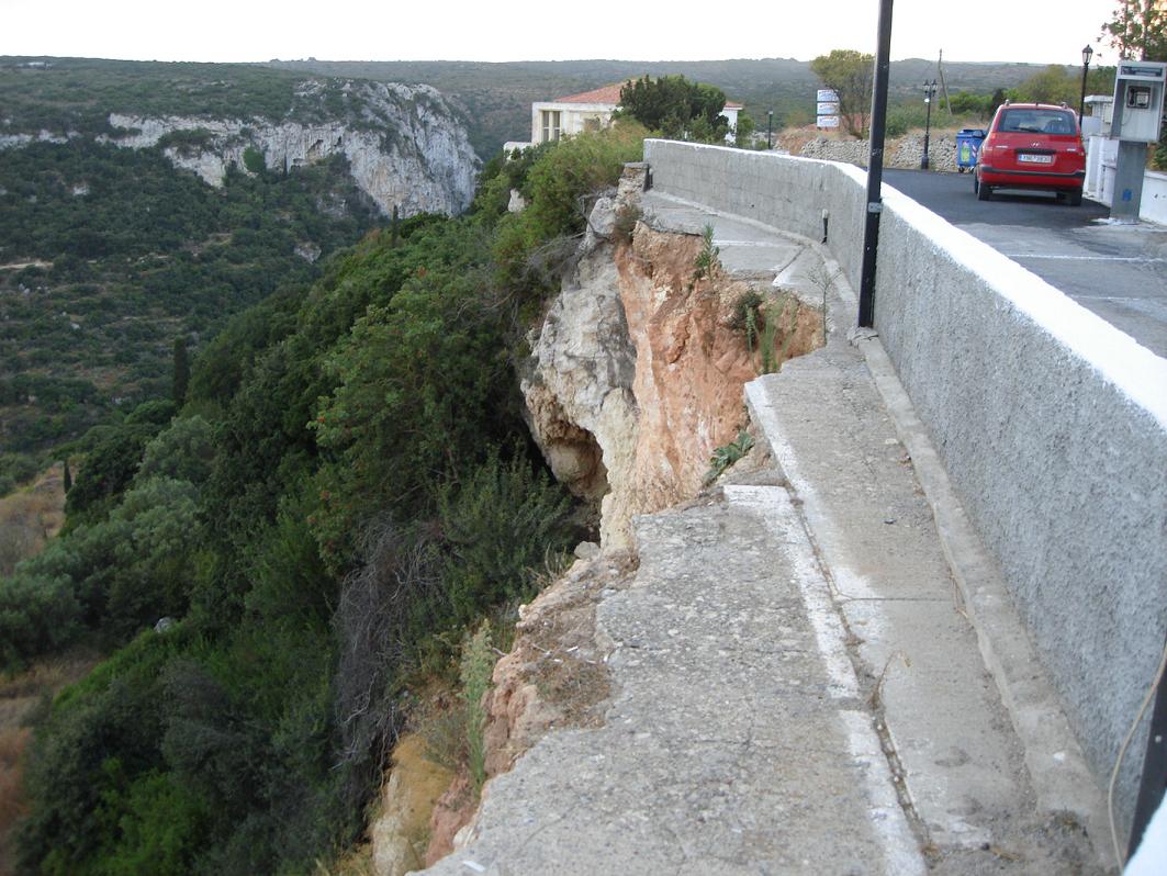
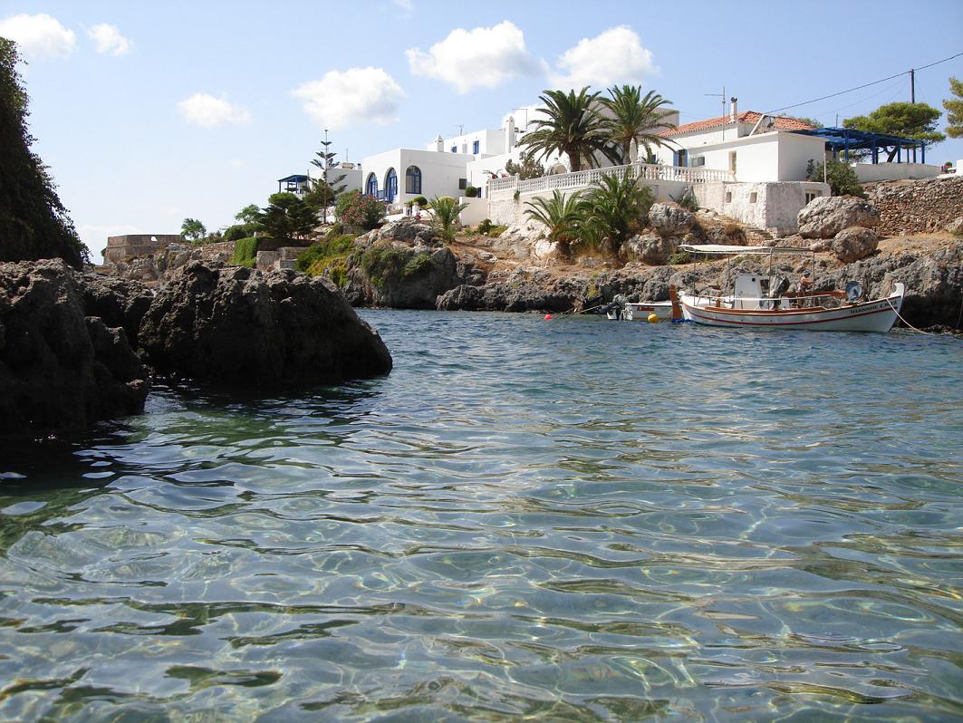
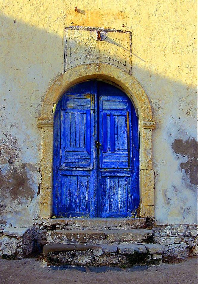
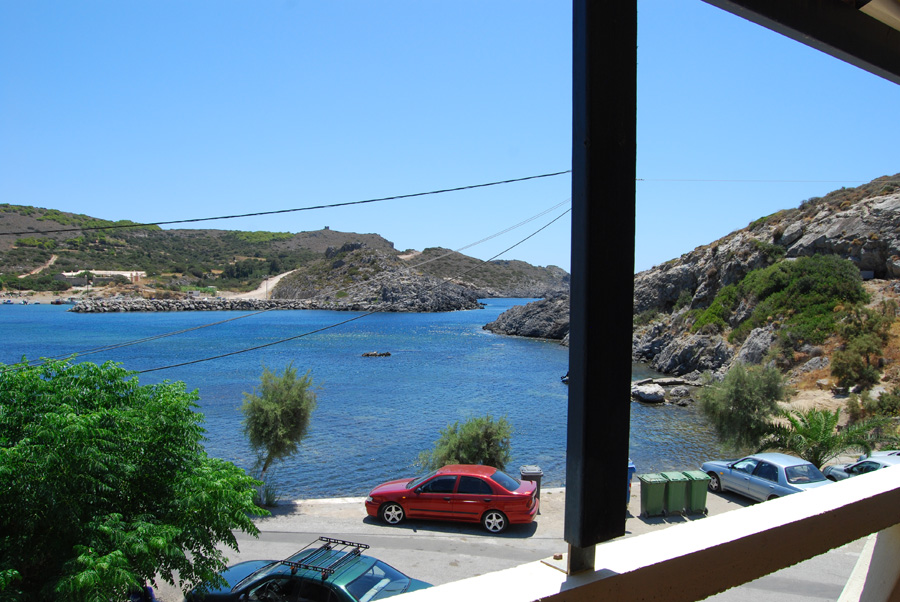
Kythira, Kithera of Kythera: It wouldn't be a real Greek island if it does not appear in many different names. The island of Kythira (this is the name which is used most) is 278 km2 in size and has about 2700 inhabitants. It lays separated from other island groups, between the mainland (Peloponnesos) and the west of Crete. The only other nearby island is smaller Antikythira. Because it is so on its own the ferry connections are limited and it is quite and unspoiled island. Most of the visitors are the Greeks themselves, the tourists who have travelled to the Peloponnesos and the occasional lost person that boarded a ferry in Kissamos in Crete. Historically seen, the island of Kythira belongs more in the Ionian islands (with a Venetian rather than a Turkish domination), but in terms of appearance (the white chalked houses and the landscape) it looks more like an island of Cyclades. It's hilly island but it does not have really high mountains and the valleys are fertile. In the spring, the island full of flowers. The east side of Kythira is fairly flat and here are most of the beaches, while the west coast is more steep and has cliffs. The beaches vary from pebble to sandy beaches (sometimes red in colour). The island is often recommended to people who like walking. Many Australian immigrants have found their house on the island, and many houses in the villages have been transformed from village cottage to holiday house. There are not that many tourists on the island and so the public transport leaves something to be desired. Kythira is een van die eilanden die je het beste met je eigen auo of met een huurauto kunt gaan verkennen. Kythira is one of those islands you best explore with your own car or with a rental car. The island has its own international airport (so not only domestic flights from for example Olympic Airways). You can check out if there are direct flights from your country to the island. If not you can also fly to Athens and then go on to Kythira with Olympic Airways. Most ferries dock in the northeast of the island, in the port of Agia Pelagia. In this village are a number of tavernas scattered over the long quay and in the village itself there are some accommodations (hotels, studios, rooms) for rent. On both sides of the harbor are several small coves with sandy beaches. Update 2014: I am told that nowadays the ferries dock at Diakofti! In the south of the island on the mountain lays the photogenic capital Chora, with its white houses, strangely shaped chimneys, and an old castle. The views from Chora are magnificent. Ten zuiden van Chora, aan de kust, ligt het haventje van Kapsali, dat soms veerboten ziet komen als slecht weer het niet toelaat dat deze in Agia Pelagia aanleggen. South of Chora, on the coast, lies the port of Kapsali, which sometimes sees ferries when it is really bad weather and the ferries cannot dock in Agia Pelagia. In Kapsali in a bay are two pebble beaches which are separated from each other by a rock with a church on top of it, of course. The best sandy beach of the island lies just southeast of Kapsali in Fryiammos, at the end of a path. You cannot get there by car, so you will have to walk or you can try to get there by motor cycle. Potamas is another village that is on the move. Het ligt op de route van Agia Pelagia naar Chora en vormt een soort tussenstation. It lies on the route of Agia Pelagia to Chora and is like a sort of "in between station". In Potamos there is a market every Sunday and there are a number of larger shops. The rest of the island is hilly and with little vegetation. Many of the villages are practically empty. |
 |
 |
 |
 |
 |
 |
 |
 |
 |
 |
| The history of the island of Kythira in a nutshell |
|
Archaeological excavations have shown that Kythira was already inhabited since 3000 BC. Because the island is strategically located it was regularly fought for and the island has had various rulers. In de buurt van het huidige Palaiopoli, in het oosten van het eiland Kythira, stond een antieke stad, en in het even beneden gelegen Avlemonas was de haven. Situated near the current Palaiopoli, in the east of the island of Kythira, there was an ancient city, and below in Avlemonas below the port was located. Here in this area on a hill Minoan tombs have been found. Athens and Sparta have often battled for the domination of the island during the so-called Peloponnesian wars, and therefore the island changed owners several times. After the end of these wars the island ended up in decay and became largely uninhabited. During the Byzantine domination Kythira prospered and many houses, churches and monasteries were built on the island. Nevertheless, even during this time there was a shadow hanging over the island because of the frequent attacks by pirates. In 1204 AD Kythira came under Venetian rule and several castles were built. The capital was strategically located at Paliochora which is surrounded by. Eventually 7000 people lived here but the town was attacked in 1537 by the pirate Barbarossa and Algerian pirates and completely destroyed. The leader of the pirates, Kemal Reis, sold the rest of the inhabitants as slaves. The domination of the Venetians lasted until 1797 after which Kythira respectively was under French (until 1809) and English reign. In 1864 Kythira became part of the Greek state. During the Second World War just like almost every other Greek island it was occupied by the Germans. After the island was liberated it went economically very bad and many of the residents left for Australia. Many of these emigrants have gradually returned to Kythira and this explains that many people also speak English well. The nickname of the island is for this reason, "Kangaroo Island". |
 |
 |
 |
 |
 |
 |
 |
 |
 |
 |
| The sights on Kythira in Greece |
|
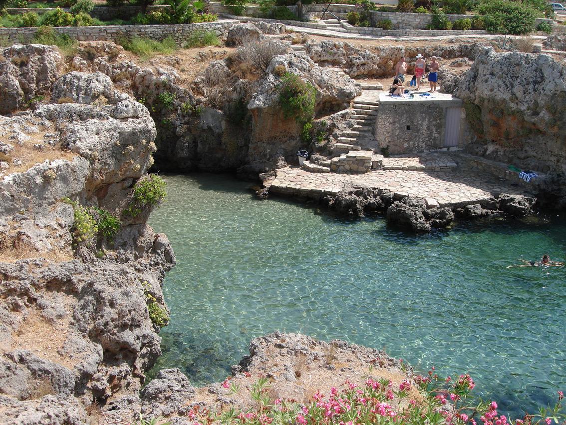
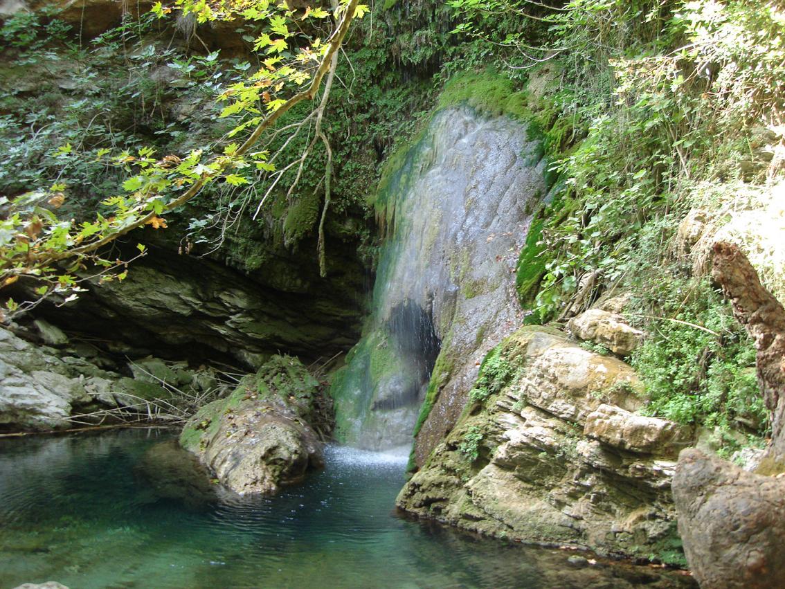
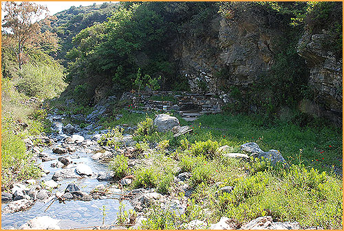
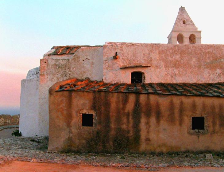
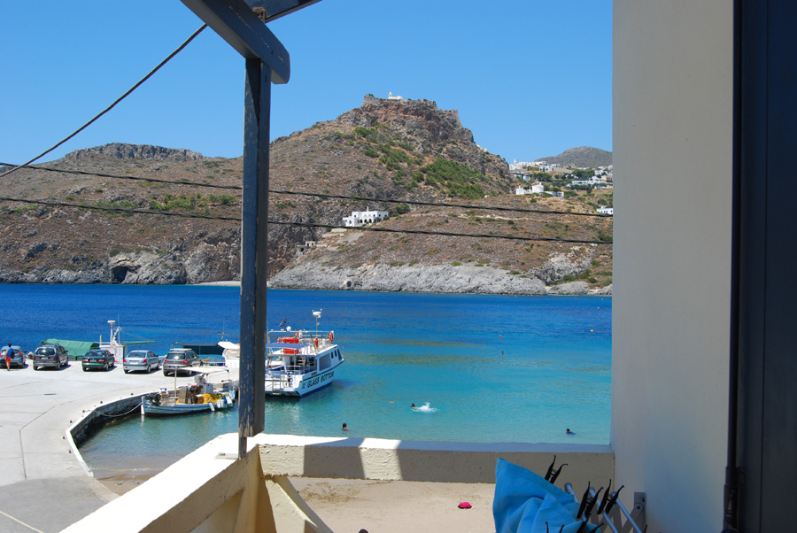
The current capital Chora with its renovated Venetian castle (which dates back to 1503), many churches and individual houses. In Chora town there is a protected medieval district. Many of the houses are made in white Cycladic cubic style with strange chimneys on the roofs. Within the area of the castle there are also three churches you can visit: the catholic Panagia cathedral, the Agios Pandeleimon church (with rare frescos) and the oldest church of the three, the Agia Triada church. Also remaning are a part of the palace of the High Commissioner, a couple of gunpowder storage buildings and two aqueducts. By the way the castle is more impressive from a distance than in close up. The magnificent view is the main reason to go and visit. In the town of Chora you can also find a small museum. The ancient deserted Byzantine capital Paliochora situated just south of Agia Pelagia and east of Potamos, in the northeast of the island. This town was surrounded by canyons. In 1537 it was completely destroyed by the Turkish Admiral Barbarossa and Algerian pirates. Many residents committed suicide by throwing themselves off the cliffs. Today the city is deserted and many of the walls and roofs collapsed, but it is still reasonably intact. In some of the old churches in the village you can still admire old freso's. Dozens of meters below in the bottom of the ravine is a small river that is called Lagadi. The village of Kapsala in the south of Kythira, just under the capital Chora, with its beautiful bay and its pebble beach which is divided into two by a rock. On the rock stands a nice church and there is a lighthouse that dates from the time of the English occupation. Kapsala lies in a bay which has usually a good protection against any wind and it is a popular beach destination. On a cliff above the town lies the monastery of the apostle John that dates back to 1592. On this spot the apostle stayed before he was exiled to Patmos where he wrote the "Revelations". The beautiful village of Mylopotamos, situated in the west of the island, with its impressive Cave of Agia Sofia and its nearby Venetian fortress and town that is called Kato Horio. Above the gate of the town there to a stone relief of the Venetian lion. In the village of Mylopotamos itself there are old water mills. The Neread waterfall just outside the village of Mylopotamos is located. Nature here is at its best. According to an old legend someone was murdered here and the waterfall is also known as the Murderes-waterfall. Between Chora and Milopotamos lies the village Livadi where there is a long bridge that dates from the English time and that looks as if it belongs in the south of England instead of on a Greek island. The remains of the Temple of Aphrodite in old Palaiopoli, once described as the finest and oldest temple in the world. At the site of the temple an old church was erected with the use of the stones of the temple. |
 |
 |
 |
 |
 |
 |
 |
 |
 |
 |
| The beaches and the naturist beaches of the island Kythira in Greece |
|
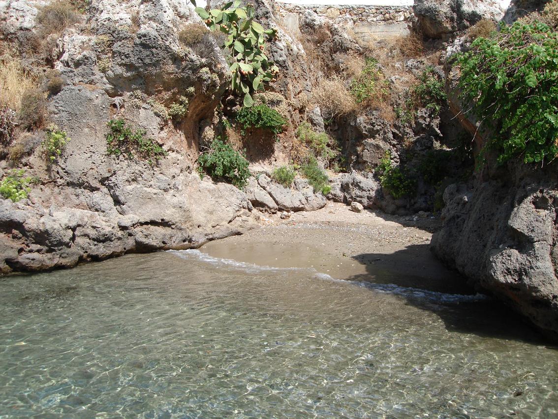
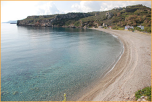
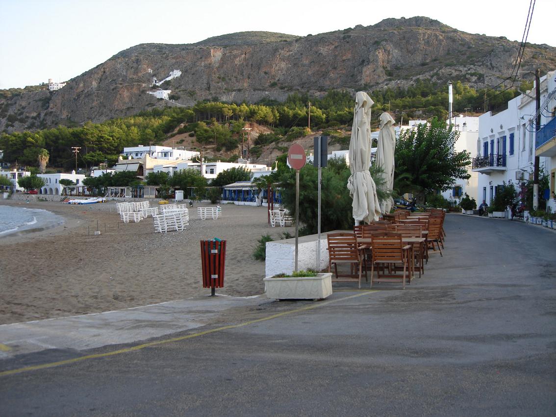
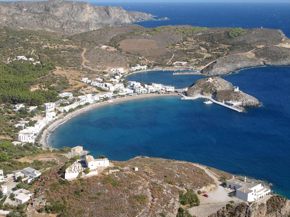
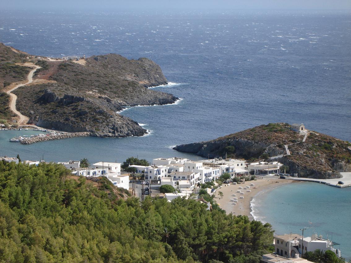
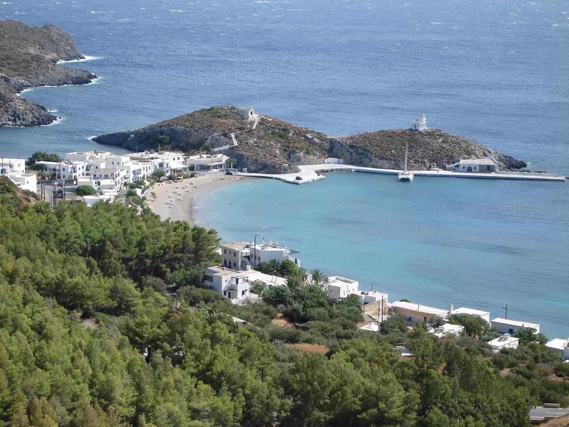
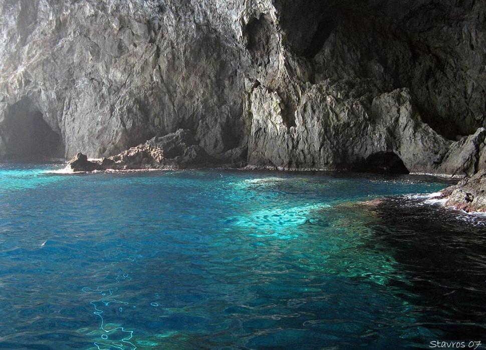
Firi Ammos (Agia Pelagia) - The beaches of Firi Ammos lie south of Agia Pelagia. It is particularly known for the unique red sand that is mainly found at the the edge of the water. The beach of Agia Pelagia is a fairly large beach. Chalkos Beach - Chalkos is a narrow pebble beach, about 200 meters long, on the southeast coast of Kythira. It is located 2.5 kilometers from the village of Kalamos. There can be some wind at the beach things because it is situated to the north. It is a good place for snorkeling. Firi Ammos (Livadi) - Long and beautiful beach with red coloured pebbles in the south east of the island. It belongs to the beaches with the most clean seawater. Paliopoli Beach - The beach of Paliopoli is very popular among the Greeks. It is a very elongated sand / pebble beach. Platia Ammos Beach - Long sandy beach on the northwest coast of Kythira not far from the village of Karavas. There is a view of the Peloponnese. On the beach is a taverna. Fourni Beach - 2 Kilometers south of the beach of Platia Ammos, in the northwest of the island, lies the small pebble beach of Fourni. This beach is usually very quiet. Agios Nikolaos Beach - Not far from Avlemonas in a beautiful bay is the beach of Agios Nikolaos. It is not too large sandy beach with some rocks on it. Kaladi Beach - The pebble beach of Kaladí is perhaps the most beautiful of all. Here you find the turquoise color of the seawater against the white pebbles on the beach. Diakofti Beach - Beach on the east side of the island, roughly at the centre of the island. The small sandy beach runs gradually into the sea. Opposite Diakofti is an island which is connected to Kythira by bridge. In Diakoft there are a number taverna. Melidoni Beach - Beautiful enclosed bay with a small and quiet sandy beach, located in the southwest of the island. The water is clear and it is good for snorkeling. Watch out: sometimes there are suddenly beach parties in the summer. Avlemonas Beach - At the Avlemonas fishing village on the east side of the island, where long they have searched for the Temple of Aphrodite, is a beach with sand and pebbles. In the village are a few small taverna. Kapsali Beach - This beach is located south of Kythira and is visible from the hills of Chora. It is a popular beach which is split into two by a rock. In front of the coast in the sea lies a strangely shaped island. The people of Kythira claim that the goddess Aphrodite was born here. |
| Accommodations, hotels, studios, apartments and rooms on the island of Kythira |
 |
 |
 |
 |
 |
 |
 |
 |
 |
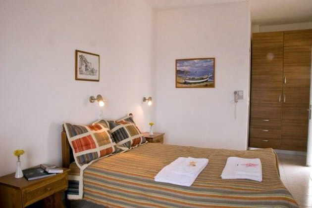 |
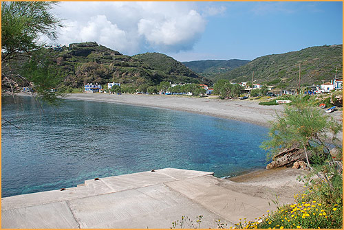
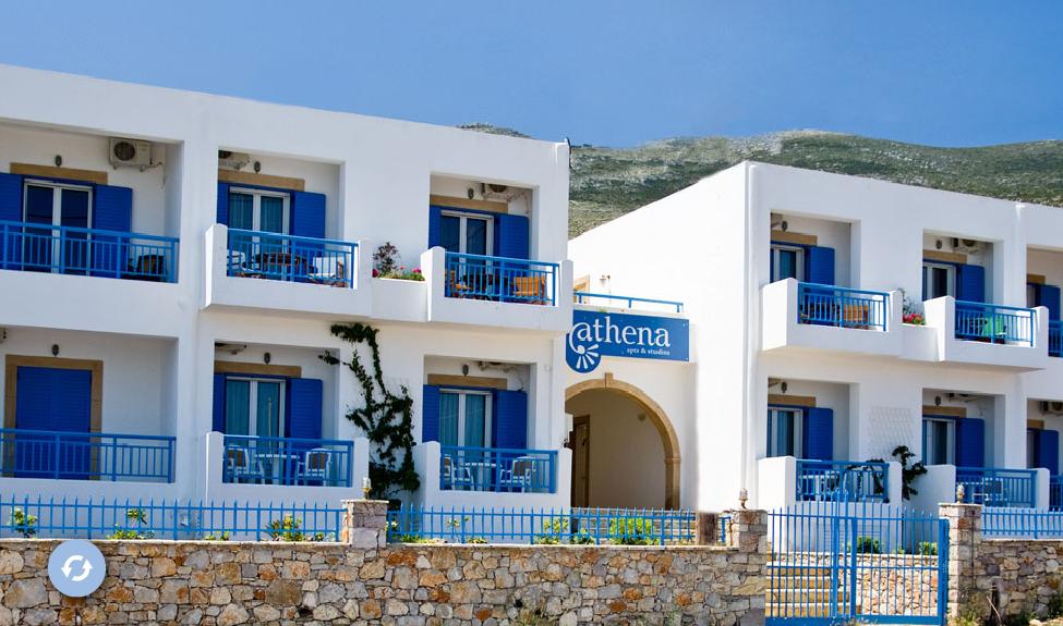
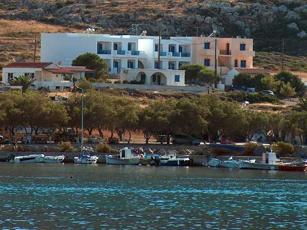
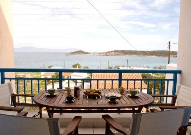
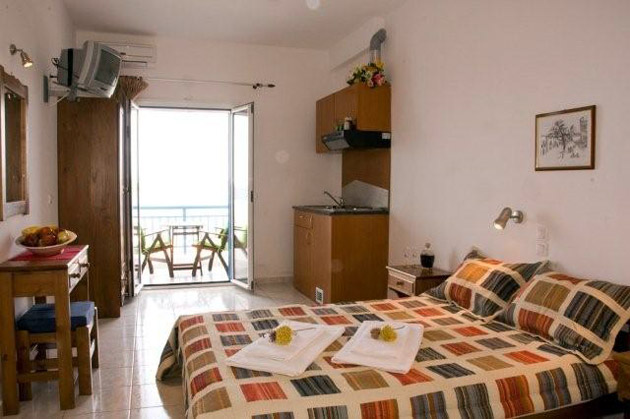
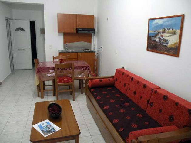
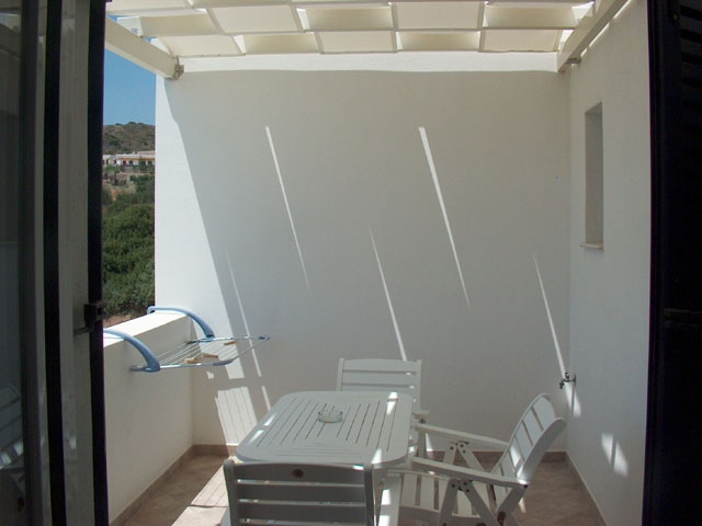
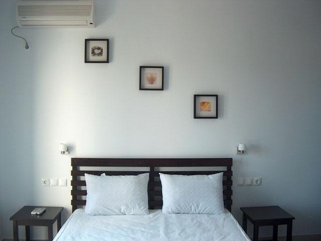
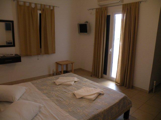
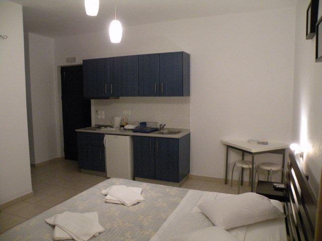
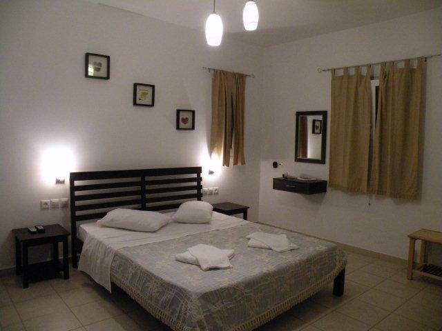
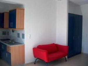
| Athena Apartments and studios in Diakofti, on the island of Kythira in Greece |
|
What better way to start your day than watching the sun rise from the sea, while enjoying breakfast on your own balcony? Athena Apartments and Studios give you the opportunity to do just that. They offer self-catering, daily serviced accommodation, 200 metres from a golden, sandy beach in Diakofti, in the beautiful island of Kythira. Athena Apartments and Studios are simply furnished and equipped with air conditioning, kitchenette and TV. Diakofti is a charming and quiet coastal village. Near Athena you will find restaurants and traditional coffee houses overlooking the bay. Located opposite the south-eastern tip of the Peloponnesos peninsula, Kythira is a mountainous island with valleys leading to secluded beaches. Centuries of coexistence between Greeks, Venetians, Ottomans and British is reflected on the island's architecture. Diakofti is directly connected by ferry to Athens, Crete and Peloponnesos. Check availability and prices & book Athene Apartments - click here. For all hotels, apartments and studios on the island of Kythira in Greece - click here. |
 |
 |
 |
 |
 |
 |
 |
 |
 |
 |
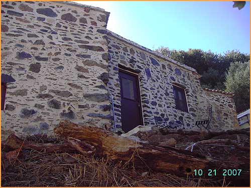
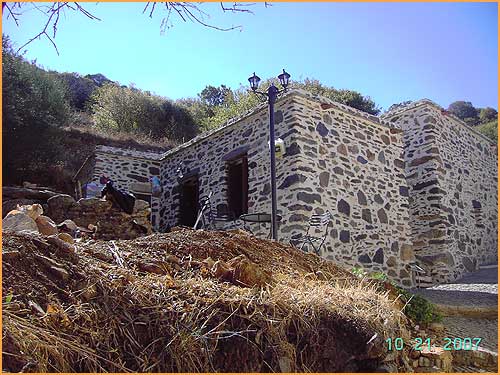
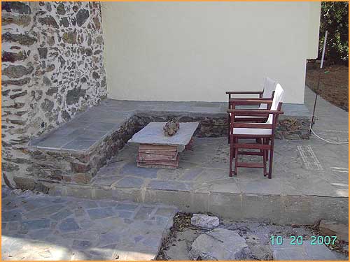
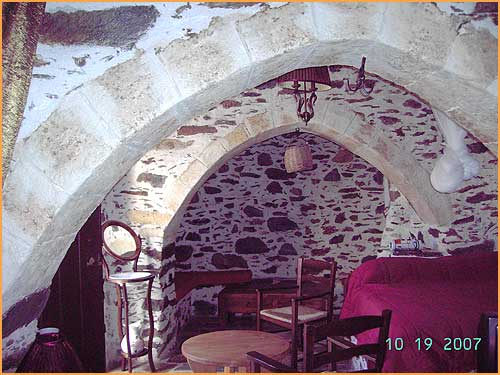
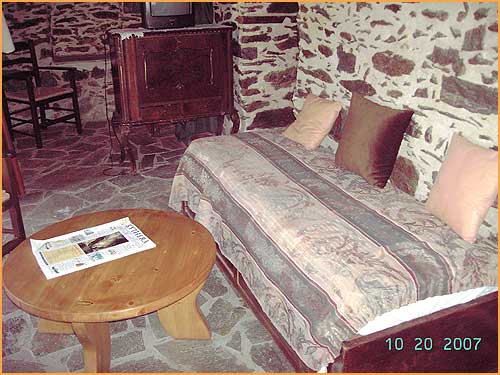
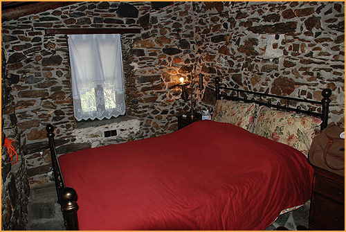
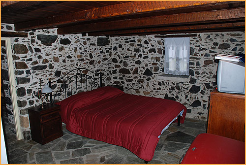
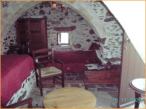
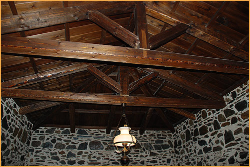
| Hotel To Lagadi Tou Karava - 3 holiday houses on the island of Kythira in Greece |
|
To Lagadi tou Karava is located in Karavas, a beautiful green village, in the northern part of Kythera island. It consists of 3 traditional, renovated, stone build houses, decorated with traditional furniture and style. The houses provide all the modern amenities but create an atmosphere that takes you back to the past. The location is surrounded by green landscapes and forests. There guests can find the famous springs of Amir Ali. The beach is only 10 minutes drive from the houses. The location is ideal for quite, relaxing holidays combining sea and green landscapes
Check availability and prices & book the holiday houses of To Lagadi Tou Karava - click here. |
 |
 |
 |
 |
 |
 |
 |
 |
 |
 |
| Elea Apartments in Kalamos, on the island of Kythira in Greece |
|
Elea Apartments are situated at Kythira between the Cape Maleas and Crete, in Kalamos village, not far away from the Venetian Castle, the beaches and the cosmopolitan area of Kapsali. Elea Apartments is a small complex with cheap prices. Elea Apartments is the ideal location for those seeking a relaxing and calm holiday. For a more active time, explore the Cave of Saint Sofia. For longer excursions, use the car rental service. Check availability and prices & book Elea Apartments - click here. |
 |
 |
 |
 |
 |
|
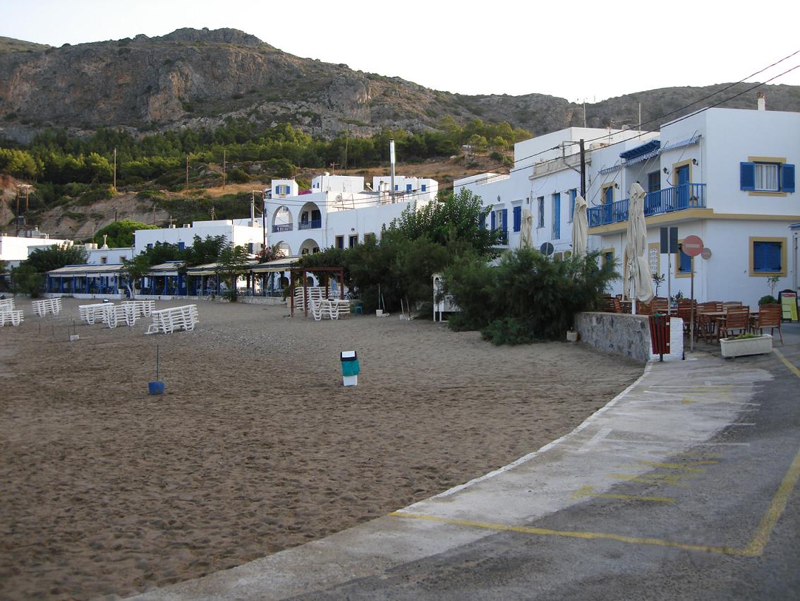
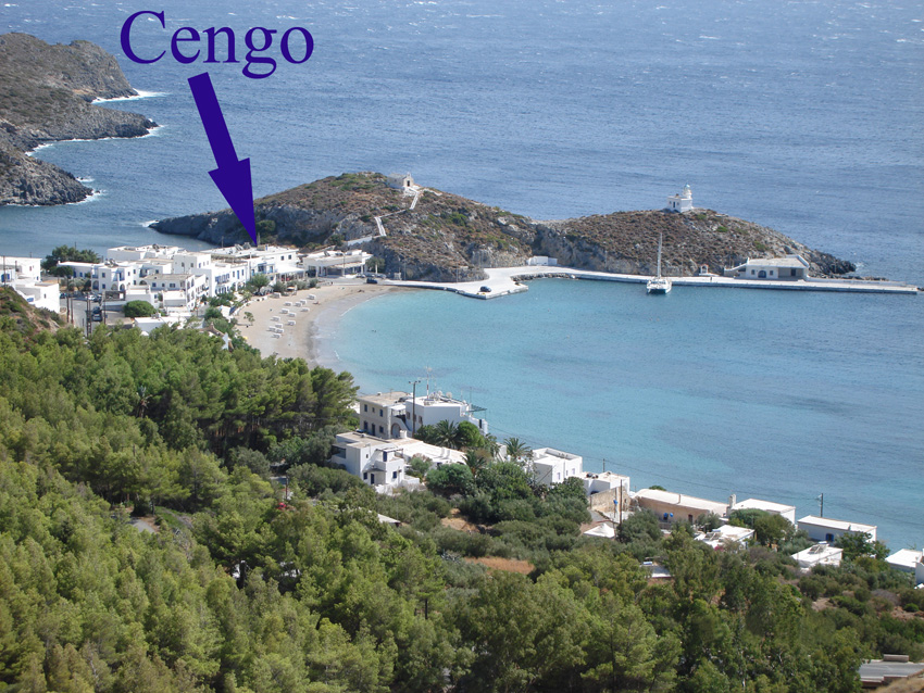
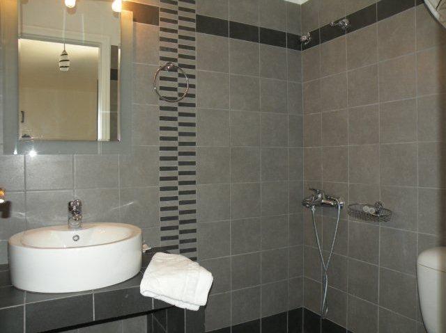
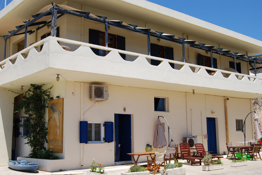
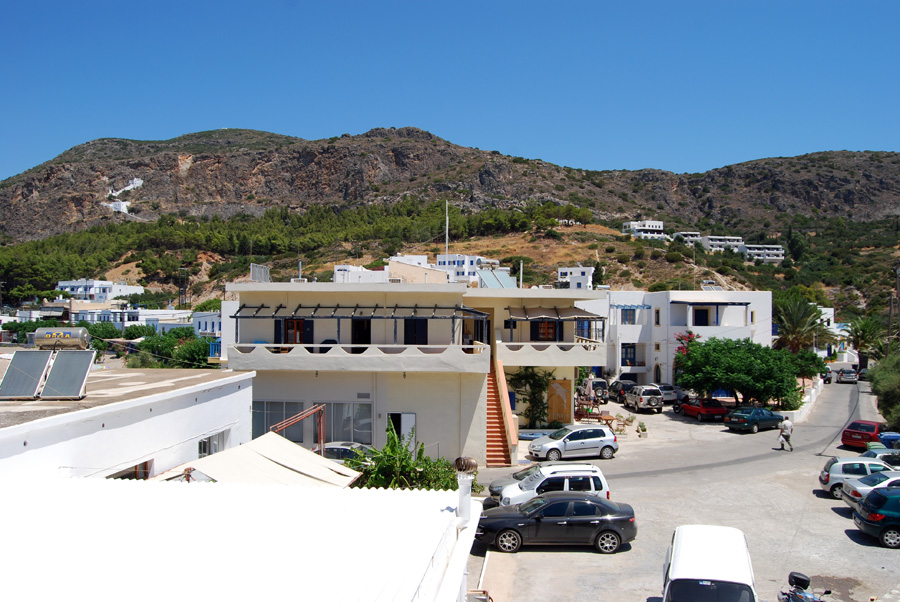
A number of the pictures on this page were made by very much appreciated correspondent Dirk Slegers who stayed at Kythira in September 2008. He liked very much the authenticity of the island (not so many people). His favorite village was Kapsali in the south of the island where he stayed at the hotel Cengo in a large room with a view of the sea and the Chora (40 euro a day in 2008 - single room). Send an e-mail to the Cengo Hotel - Tel: +306977616293 For car hire he recommends Panayotis car rental who have offices at the airport, in Diakofti and on three other places. In 2008 he rented a Hyundai Matrix at 30 euro a day.
Send an e-mail to Panayotis Car Rental
- Kapsali: (+30) 27360 31600 - Chora: (+30) 27360 31004
Tsikalaria: (+30) 27360 31551 - Agia Pelagia: (+30) 27360 33194
Fax: (+30) 27360 31789, Mobile: (+30) 6944263757 |

© Hans Huisman, Hotel To Lagadi Tou Karava, Stavros Souyannis & Dirk Slegers, https://www.angelfire.com/super2/greece/ 2014