Maps of Ethiopia Across Time
Quick Links: |
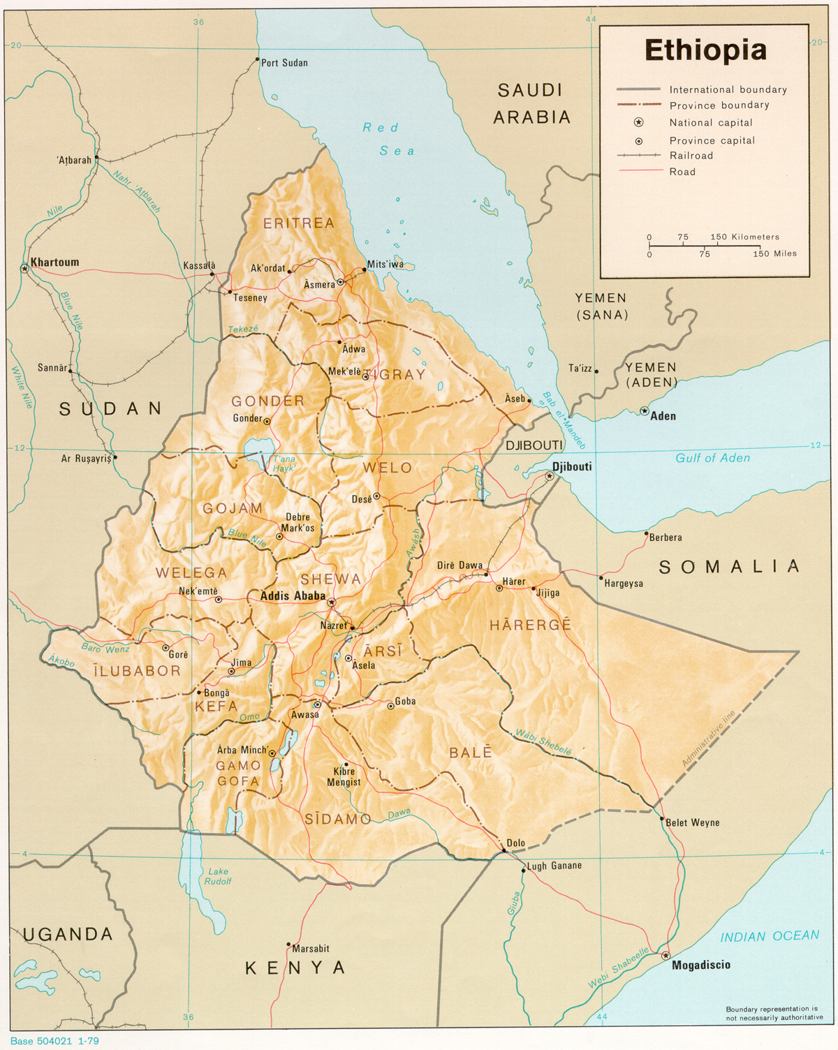
Ethiopia from 1960 - 1974 (Above)
Following the desolution of the Federation of 1951 by vote of the Eritrean parliament in 1960, Eritrea entered into complete union with the rest of the Empire and became a province of Ethiopia. The Province of Welo is also sometimes spelled Wollo. Arsi sometimes was spelled Arusi, Gojam was also spelled Gojjam, Harerge as Hararge or Harrarge (the Duchy of Harrar serving as it's capital was also spelled Harar or Harer). The province of Gonder was also spelled Gondar, and infact, the prefered name for the Province was Beghemidir and Semien, with the capital city at Gonder (Gondar). Tigray is also spelled Tigrai, Asmera as Asmera etc.
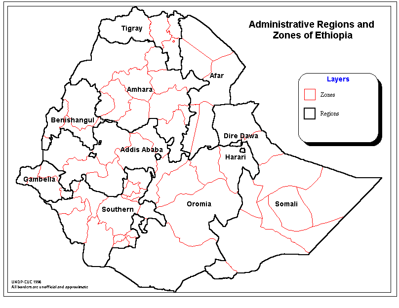
Ethiopia from 1991 - Present (Above) With the fall of the communist Derg regime in May of 1991, and the assumption of power by the Ethiopian Peoples Revolutionary Democratic Forces (EPRDF), the old Imperial era provinces were all abolished with the exception of Tigrai. The borders of Tigrai itself were drastically redrawn to include northern area's of Gondar, and cedeing much of it's east to the new Affar territory. The new "Regions" were roughly based on ethnic group and language rather than the long standing historic kingdoms and provinces of the Ethiopian Empire. The new "Zones" are based roughly on the subdivisions of the old Imperial provinces and kingdoms as re-organized by the Derg regime. Eritrea had broken away under the Eritrean Peoples Liberation Front (EPLF) and was declared the independent state of Eritrea in 1993, making Ethiopia landlocked.
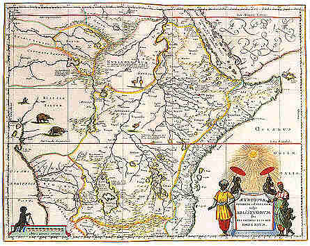
Early European Map of the Ethiopian EmpireThis map is a renaissance era impression of the Empire of Ethiopia, based on the accounts of the Portuguese allies of the Ethiopian Empire. The Europeans believed that much of the African interior was part of the Empire, or had been at one time. |