Rivington, Lancashire, England
Rivington sits below 'The
Pike' and east is
Winter Hill, Lancashire both are within the West Pennines in
Northern England. The area is within the 10,000 acre catchment area
of the Rivington Pike Scheme supplying water to Liverpool, managed
by United utilities, known for it's reservoirs, Lever Park, Rivington
Pike and moorland.
This site commenced and has been maintained since 1996 with the aim of providing FREE access to information about Rivington past and present. Contributions very welcome by E Mail
Rivington Today
Rivington is a rural area and a popular tourist attraction, tourism commenced in the later Victorian period and was built upon by Lord Leverhulme from turn of the 20th century. There are 20 listed buildings and structures located in the parish, a list is located at a link here.
The name Rivington settled in in 1827, after a lot of other variations. Lever Park sits in a valley with a height above sea level of 146.14 Meters, the most visible local landmark is Rivington Pike at 1,191 feet (363 metres).
Rivington Camp Sites & Hotels
There are various places to stay nearby and two Caravan and Camp sites open to the public, one is located at Home Farm, Adlington, details at Camping and Caravan club and the other Wilcocks Farm, it's web page is at this link.
Rivington is served by good overnight accommodation and hotels Travelodge Bolton West M61 Southbound 0871 984 6334, De Vere Whites, Middlebrook 01204 667788, Ramada Jarvis Hotel, Bolton 0844 815 9095, Premier Inn Bolton West 0871 527 8118.
Attractions
The Lever Park area has two barns serving refreshments, a replica of Liverpool castle and toward the Pike Leverhulmes Bungalow grounds features its Pigeon tower, Pike Tower and bridge. The Lever Park Barns are accessible on foot, cycle and car. The Pike Tower and Bungalow grounds can be accessed via Georges Lane by car but on arriving the paths include many steps and slopes. Rivington has many tourist attractions, for the Bungalow Ground location of Terraced Gardens and Pike has car parking. There are many prehistoric sites on the moorland.

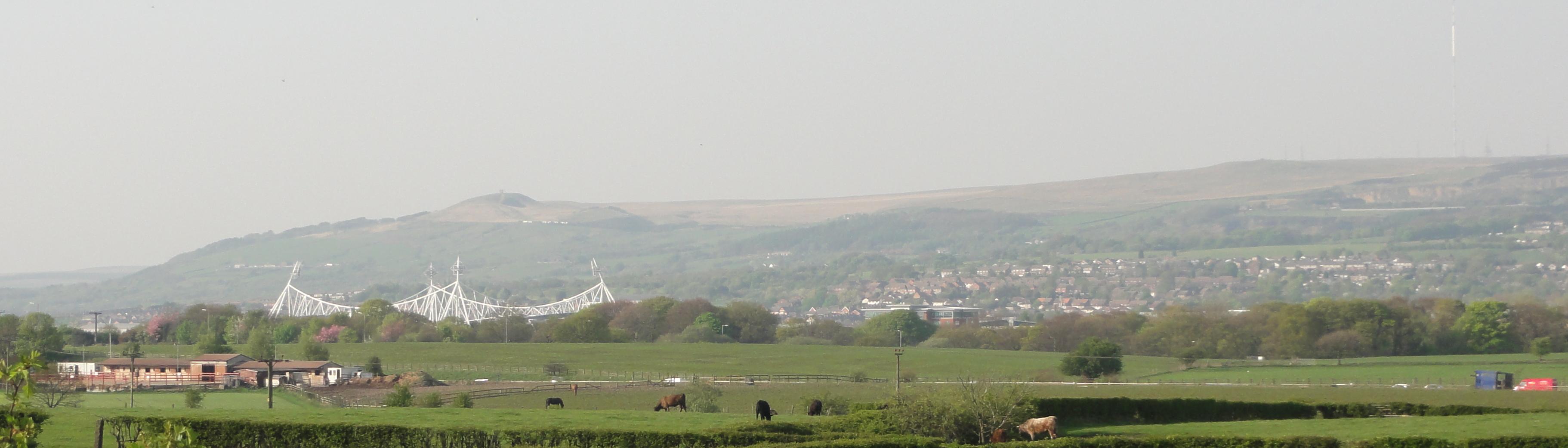
The area is a popular place for walkers, cyclists and families on days out and most people go and venture along the banks of the Rivington Lower and higher reservoirs and the large adjacent Anglezarke reservoir.
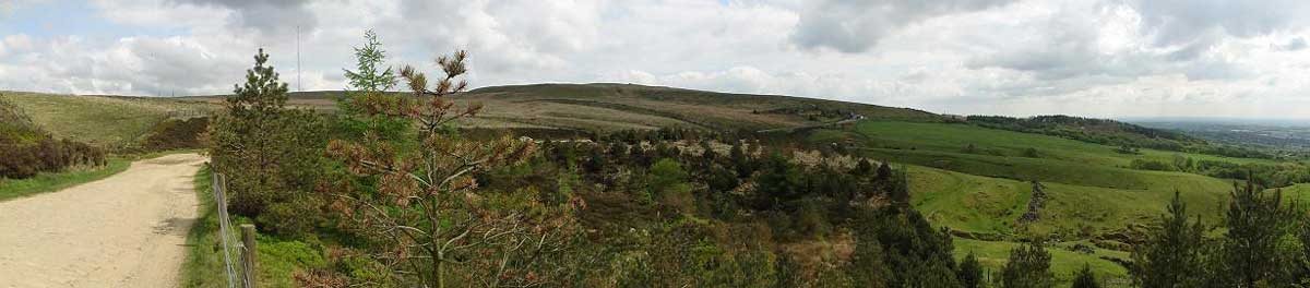
In the Victorian period the area was known as the little lake district. The Rivington Pike Complex is 8 reservoirs known as Higher Roddlesworth, Lower Roddlesworth, Rake Brook, Anglezarke, High Bullough, Yarrow, Upper Rivington and Lower Rivington which are interconnected flowing via 'The Goit' at Anglezarke to the system of reservoirs at Rivington supplying water to the city of Liverpool.. The old quarries at Anglezarke nearby are today popular with climbers.
The Lower Rivington reservoir has facilities located at the Anderton side for boating and outdoor activities at the Anderton Centre.
Helicopter fly overs also available from locations within driving distance. For Hikers in addition to Rivington Pike, there are another 12 hill summits in the area of Rivington.
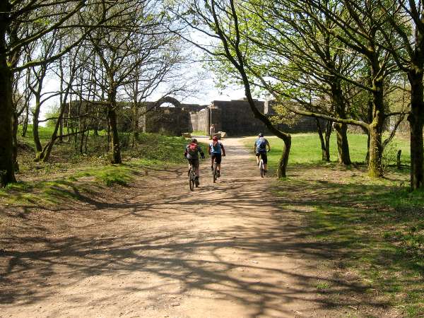
Cyclists
For Cyclists a local business provides mountain bike tutorials on how to ride safely and exclusively on bridleways. The groups site is at http://www.mountainbikeskills.co.uk The group also campaigns for better provision for cyclists at the Terraced Gardens.
Go Ape
One of the features of Lever Park close to Great House Barn is today the Go-Ape venue, which has proved very popular with visitors, located on the banks of the Lower Rivington Reservoir, combined with other attractions in the park can make for a great day out with the family.
Anderton Centre
On the opposite bank of the same reservoir is the Anderton Centre, open for bookings,
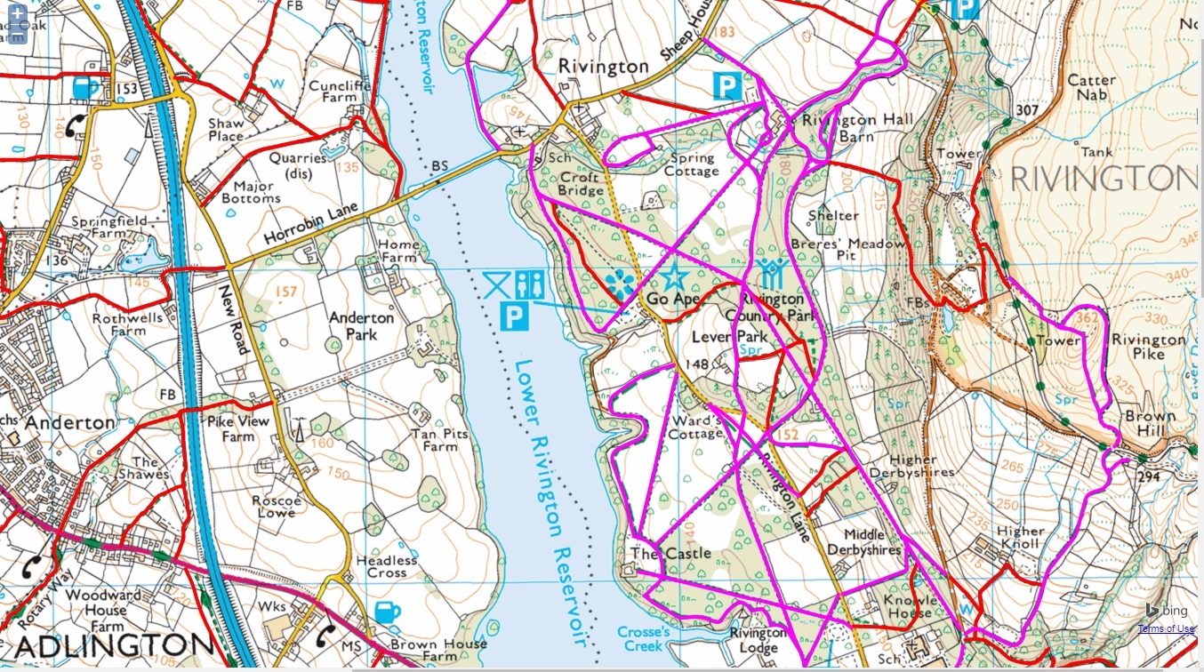
Rivington and
Lever
Park Map
Getting around the
area can involve a lot of walking, there are many public rights of way,
bridleways and tracks, details can be found at
Rowmaps, a image of the map of
rights of ways and bridleways can be
downloaded here
An high resolution historic map of the original Lever Park proposed area (1904) showing the locations of many buildings since demolished on a map fordownloading from this link. The map gives indication of the boundary of the park created by the Liverpool Corporation Act 1902 after negotiations. The park mostly comprises of land forming part of the Crosses and Great House farm holdings.
Refreshments & Private Function Hire
Rivington Village Green Tea Room's, Sheephouse Lane, rear of Rivington Chapel
https://www.rivingtonvillagegreentearoom.com/
Rivington Great House, Rivington Lane, Rivington, Bolton BL6 7RZ,
http://www.greathousebarn.co.uk/
Rivington Hall Barn, Rivington, Bolton, BL6 7SB
http://www.rivingtonhallbarn.co.uk/
Spring Cottage, Rivington Lane, Horwich, Bolton BL6 7SB
https://www.springcottage.org/cafe
Bowling Green Tea Room, Rivington
Countryside Code
Natural England produce the Countryside code Be safe, plan ahead and follow any signs, Leave gates and property as you find them, Protect plants and animals and take your litter home, Keep dogs under close control, Consider other people.8) In summer moorland fires can spread quickly causing significant damage to the landscape. People should avoid lighting fires and should not discard cigarettes, matches or glass bottles when visiting Rivington or adjacent moorland.9)
Local Police are Lancashire Constabulary 0845 1253545, in emergency 999. Bolton Mountain Rescue operate in the area, a recent rescue being a man who had collapsed at Rivington Pike.10)
Moorland fires can start with as little as a discarded Cigarette, if you do start a fire you could end up with a prosecution and a large bill for fire engines. Camp fires, camping and barbecues are not permitted by United Utilities on it's land at any time of year
Rights Of Way
For obstructions to roads and issues regards rights of way a report should be made to Lancashire County Council
Lower Rivington being Lever Park is protected by the Liverpool Corporation Act 1902 and Lever Park Act 1969, link here and those acts ensure "free and uninterrupted enjoyment by the public" but those rights are constantly under threat.
The Pike summit, moorland and Japanese
Gardens are
open access land and you have a legal right to roam without having
to use paths, your rights remain even if the land is privately owned,
there are limits on some activities on such land. There is a public
footpath that crosses Rivington Terraced Gardens connecting to the
Pigeon Tower and Pike Tower. Some locations on the hillside may have stiles or gates to
climb. There are a network of footpaths, bridleways and former roads at
the hillside that are recorded as having any public rights of way. The
routes can be found on
the definitive map, details at
Mario Maps. Routes not recorded by 2026 are effected by a change in
law.
The Ramblers Association have a national
campaign to preserve rights of way, some across England and Wales will
be lost in 2026, more details at the Ramblers
web site.
If you wish to check the location of
registered rights of way you may find these at
Mario Maps to check the definitive map, you may also find footpaths
and bridleways using
Rowmaps
Separate page at this link,
Rivington Your Right To Roam.
Organisations:
Rivington, Latest News
The local newspapers covering Rivington are:
Disabled people using all terrain mobility scooters may wish to check http://disabledramblers.co.uk/
Pike Belmont Road, Accessibility: Rivington Pike is managed by United utilities and can be accessed to an extent. Note ground conditions can be muddy in the very early and later months of the year. Access should be open via Belmont Rd (USRN 7400767) a public road from Georges Lane proves vehicle access. Belmont Road is of historic interest being the old coach route and is one of the ancient roads. An advisory speed restriction is 5mph once past Pike Cottage. The road itself has excellent views of the surrounding countryside. Drivers will need to use their own judgment on the suitability of their vehicle for this route. The road is rough but Pigeon Tower can be accessed via this route.
There are no benches or resting points provided and no toilets.
Rivington Hall and Great House Accessibility: Both barns have car parks and are accessible, although very busy and parking can be a problem. The land surrounding both is rough, but passable with an all terrain scooter. There are gates that do restrict access for mobility vehicles, note these also may pose an obstacle for all terrain scooters. Lever Park is managed by United Utilities.
Terraced Gardens
Former Bungalow site: The former bungalow site, managed by Rivington Heritage Trust is possible to access for those who have all terrain mobility scooters to a limited extent from Belmont Road, keeping to the old driveways made of crushed stone. There is a public footpath, no 82 that may provide access for ambulant disabled or elderly to a limited degree, the area further downhill in the gardens has many steps and no adaptions are in place.
Note: Roynton Rd passes under seven arch bridge, it is a public adopted road that runs through the gardens, its road number is USRN 7400820.
Click map below to enlarge

Books on CD in acrobat format may be bought via an order from the site.
My first site was created in 1996 for dial up. The site is being updated and some sections are still in draft. Contributions & suggestions for site are welcome please feel free to contact me please use Rivington in the subject line: Suggestions
Details of local organisations and charities may be found at at the link here
A BIG thanks to the contributors who have helped.
Copyright
The text and images used on the site are copyright unless otherwise stated, copyright may be held by the sites author or be in use with consent where copyright is retained by a contributor.
Copyright Paul Lacey, Bolton, England, 2010.
Note
This site is the oldest and first web site published by anyone about Rivington in Lancashire, the original page was first created in 1996 for dial up modems of 33KB speed, times have changed and the page format is changing also, it is with big thank's to Angelfire now angelfire.lycos.com for reliably hosting since then. At present (2017) the pages are being reworked and many links will for the time being take you to the byethost14.com site as files are moved across. It is also with big thanks to the late David Owen for his kind assistance in research and also a big thanks to Martin Brownlow over many years for his support and tips on content. http://rivington.byethost14.com/
References
This research is cross referenced to a great many sources and includes examination of original documents.

This site is recorded on the Internet archive, at the link here.
Copyright Paul Lacey 2010
c