
small change enterprises Presents
The Piney Woods
of
East Texas

Scenic Routes in the East Texas Woodlands
Key to Ratings: 1-5 stars with 5 being must see. The + indicates a personal favorite.
The Wilderness Areas: Of the six wilderness areas, one has very restricted access (Beech Bottom), so we'll skip that one. There is a book that is very helpful, if you can get a copy, entitled Realms of Beauty: The Wilderness Areas of Texas by Edward C. Fritz. (available at Barnes & Noble)
There are several towns and cities that can serve as your hub of activity, but the areas are spread out over a lot of miles. Consider Lufkin, Woodville, Zavalla, Nacogdoches, Crockett, Hemphill, Alto, Ratcliff and San Augustine as possibilities.
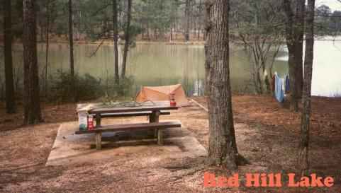
Three of the wilderness areas are close to one another and located near Jasper, a good place to get provisions. Also in the areas are Toledo Bend Reservoir to the east, Martin Dies State Park (***), Cassels Boykin Park, and several Sabine and Angelina National Forest Parks including Red Hills Lake (***+) near Hemphill and Milam which has a nice lake for canoeing and fishing. Primitive camping is also available.
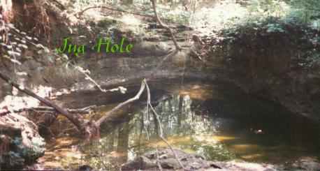
To get to Indian Mounds Wilderness from Jasper go north to Hemphill located on Hwy. 87 (there are several routes; take your pick). From Hemphill, Indian Mounds Wilderness is 10-12 miles east on FM83. Both FR115 and FM3382 are to the right and into the wilderness. One interesting site within the wilderness is the Jug Hole. You will need a map. We had a map, and it still took us all day to find it. Be sure to take a compass.
To get to the next wilderness, Turkey Hilll, from Hemphill, take Hwys. 87 north and 103 west. Go south on Hwy 147. FR300 on the left and southeast takes you into the wilderness. Another wilderness area is near Zavalla (located Hwys 147 & 69). To get to the Upland Island and Longleaf Pine Wilderness, take Hwy 69 8.8 miles south from Zavalla. FR314 on the left goes into the wilderness.
A fourth wilderness in the Sabine Basin, the Big Slough, can be found from Ratcliff. Ratcliff also has a nifty National Forest Park by the same name with a small lake nestled in the trees. The park also has a trailhead for the 19 mile 4Cs Trail. The 8 mile Big Slough Canoe Trail is also nearby on FR517. In addition,
Mission Tejas State Park (+****), Caddoan Mounds Historic Park (+****but no camping) and Rusk/Palestine Railroad. All of Houston County is interesting with great cemeteries. A county or Davy Crockett National Forest Park map will be helpful. To get to the Big Slough Wilderness from Ratcliff, take FM227 north for 1 mile to gravel FR547 northward for .3 mile to sandy FR533 northeast 7/10 mile then sandy Houston County Road 10 north 1 1/5 mile to FR519 at the southwest corner of the wilderness. You may go left on H10 or FR519 to parking. Both parking areas are located just past the trail crossings.The fifth wilderness, Little Lake Creek, is located near Montgomery in Sam Houston National Forest and about 30 miles south of the Big Slough Wilderness. From Montgomery go 4.5 miles north on FM149. Parking is available on the left about 2 more miles down the road.
Other interesting places:
- Alabama-Coushatta Indian Reservation
- Lake Livingston State Park (***)
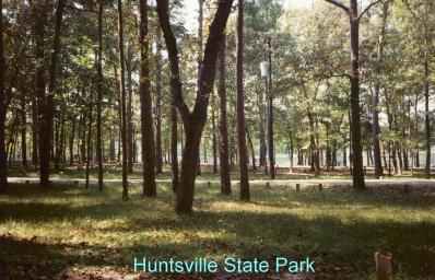
- Huntsville State Park (+****)
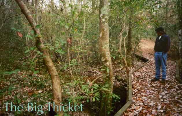
- Big Thicket National Preserve (****) - See our article below.
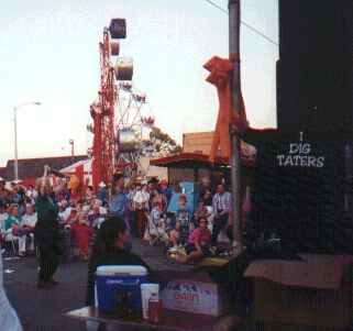
- Cities of Jefferson, Gladewater, the antique capital of the world, and Gilmer, home of the October Yamboree. See our Gilmer Photo Album.
- Tyler State Park (***1/2)
- Martin Creek State Park(***)
- Lake Bob Sandlin & State Park (***)
- Purtis Creek State Park (***)
- Daingerfield State Park (****)
- Atlanta State Park(****) near Texarkana
- Bonham State Park (***)
- Caddo Lake State Park (+*****/canoeists' heaven)
- Many lakes including Lake O' the Pines(****) and Lake Sam Rayburn
- Lake Cooper State Park
- Lake Tawakoni State Park
Like the Wilderness Areas, the Big Thicket is not easy to locate. Units are located throughout Southeast Texas. Trailheads are located on small roads. There are no signs to lead the way. There are a couple of information offices. No doubt, though, you will need a map. The best one we found was available for free at Martin Dies State Park and other state parks. Units are located near the towns of Segno, Romayor, Spurger, Warren, Saratoga, and Beaumont. In addition, the Big Thicket encompasses the entire length of the Neches River from Steinhagen Lake to Beaumont, Menard Creek, and Little Pine Island Bayou.But, what is the Big Thicket and why would anyone go there? Well, the Big Thicket is an amazing botanical wonderland. Located in an area where different ecological systems converge, the visitor can view everything from swamps and moss draped trees to Pine Forests. We visited the Big Thicket in January of '99 and were amazed at the varieties of evergreens that made us forget it was the middle of winter. As for why visit the Big Thicket, it is an excellent place for hiking or just a short walk. Fishing and birdwatching are other activities. If you want solitude, this is the place to be. One trail pamphlet (available at trailheads), the Beechwoods Trail, boasts that the trail averages only 25 visitors a year! In January when we were there, we saw no other visitors at any of the hiking trails. By the way, the weather was perfect...Although the days were chilly, in the woods, the wind was blocked and walking kept us comfortable. Some days reach the 60s and 70s even in the midst of winter.
Trails vary in length and scenery. The Pitcher Plant Trail is a very short branch of the much longer Turkey Creek Trail. The Pitcher Plant Trail is wheelchair accessible, too. It is very interesting with carnivorous pitcher plants everywhere. Another advantage of the Big Thicket is you are close to the most remote part of the Texas coastal region from Sabine Pass to the West. See our Gulf Coast Page for more information.
© 1999 small change enterprises
All rights reserved
Visitors
Page created by: wandagoslow@yahoo.com