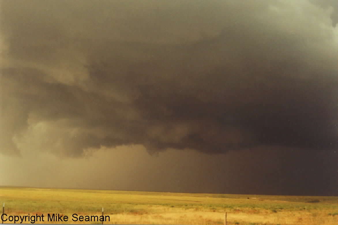
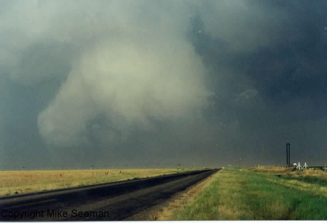
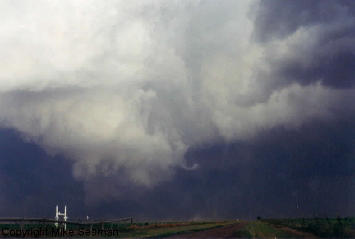
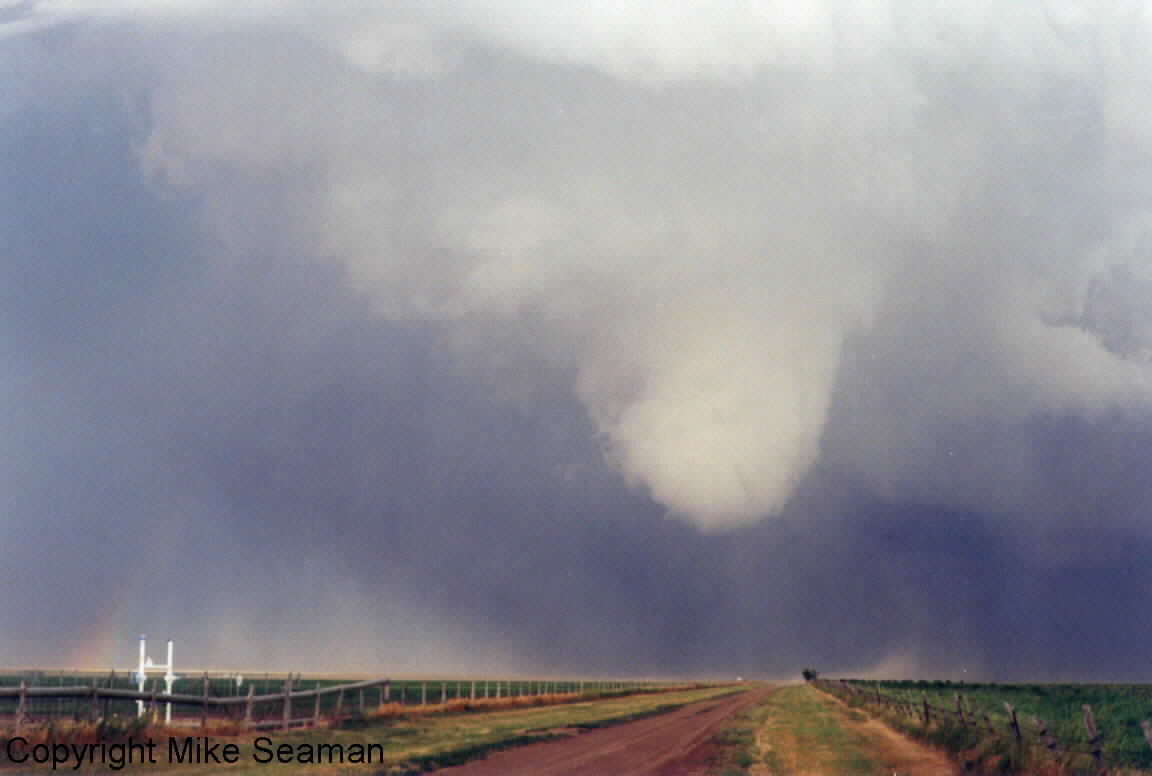
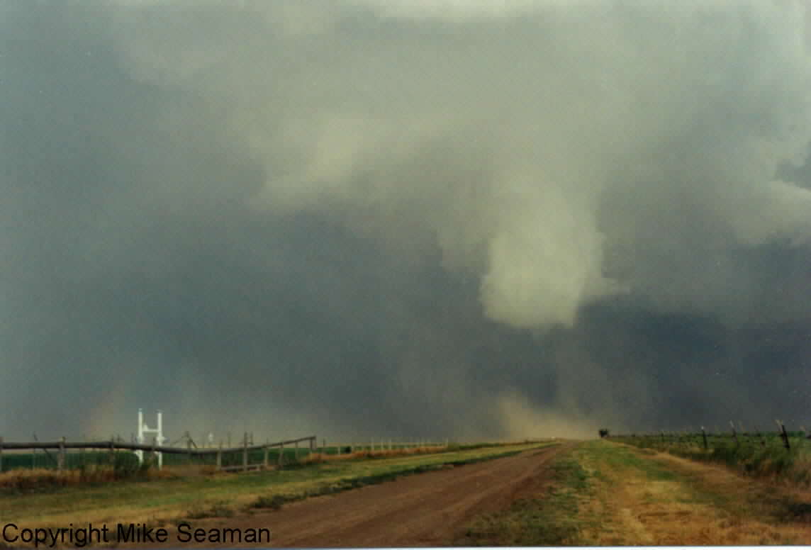
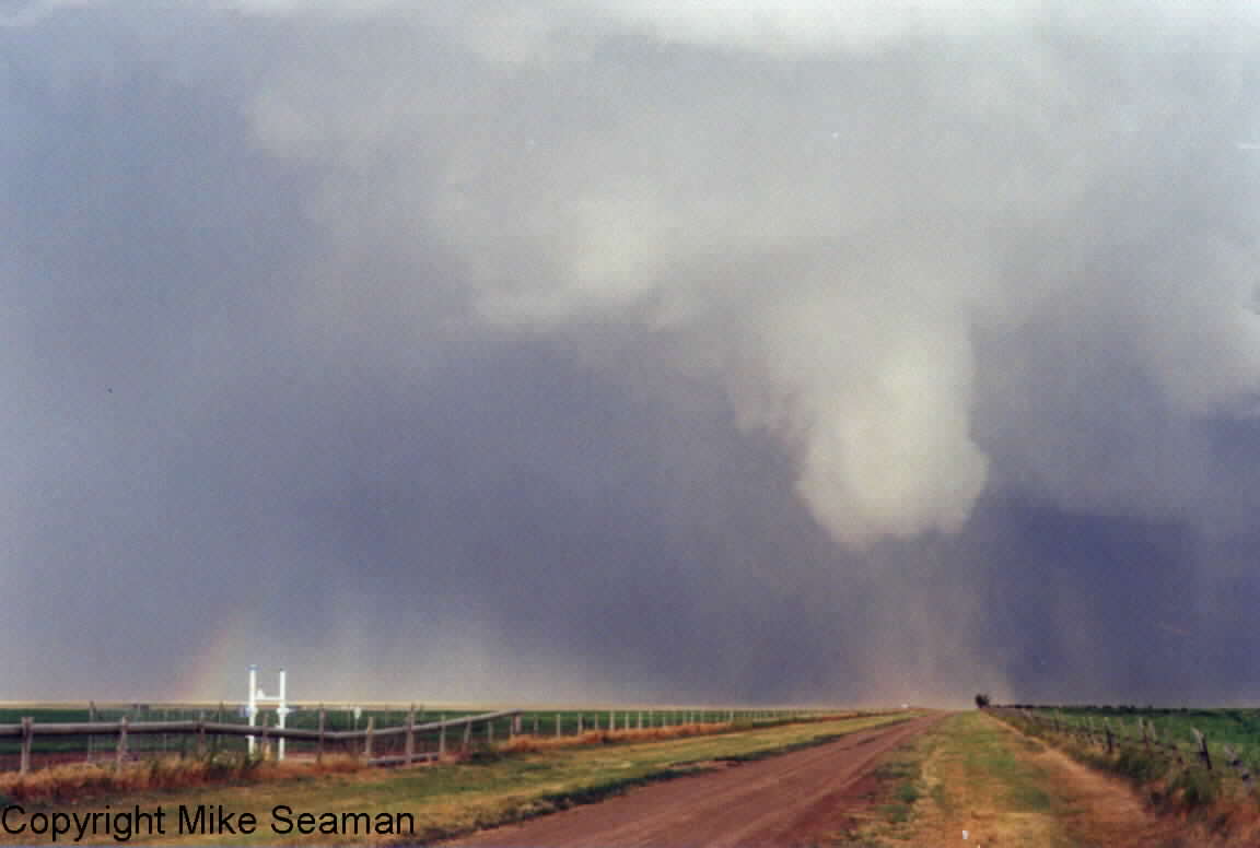
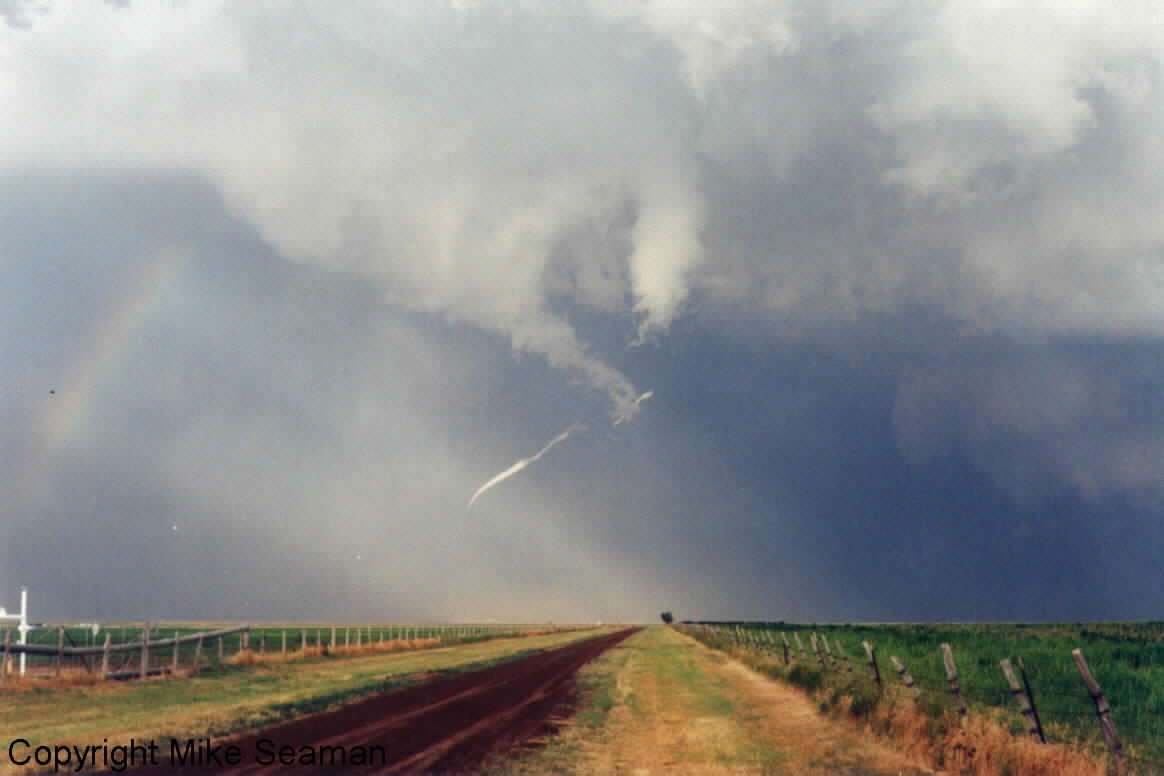
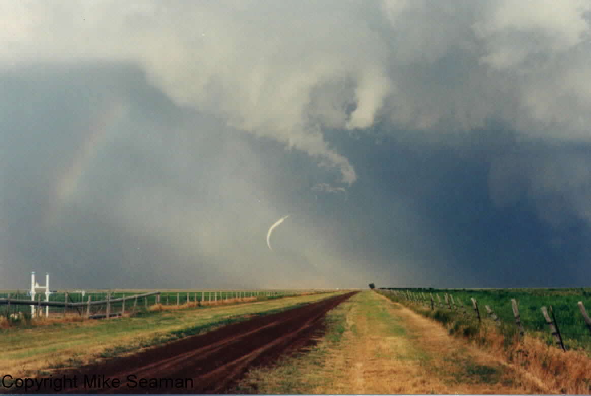
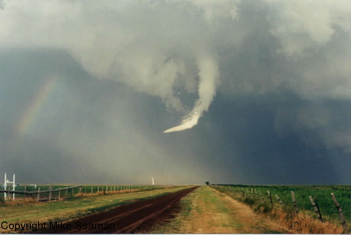
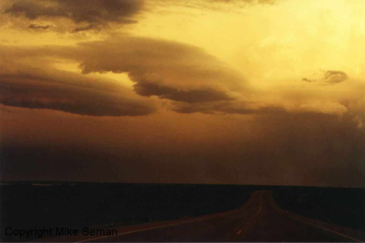
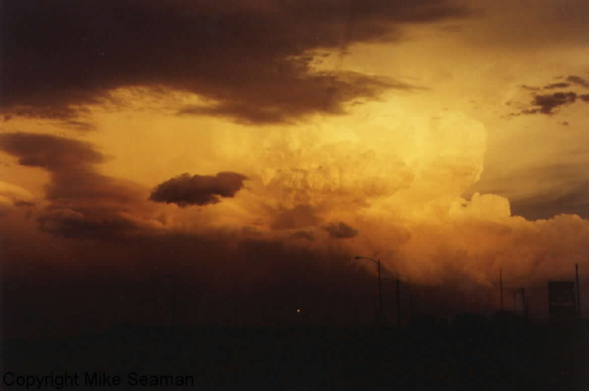
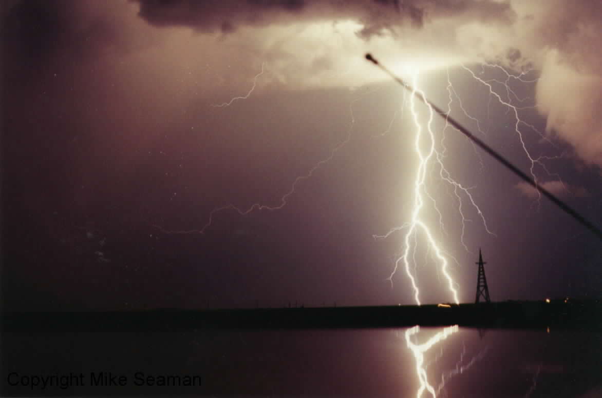
June 29, 1999
After some disappointing chasing all over the central and southern plains, we decided that we would give the Texas Panhandle a try. There was moderate risk out with the outlook mentioning a "few tornadoes possible." We actually had to go to a lecture that morning where Josh Wurman showed us some of the latest findings from the Doppler on Wheels chasing. We looked extensively at the May 3 Moore storm and saw some really neat detailed Doppler images of the tornado. So that got us all in the mood to chase. Same chase partners as all spring. And once the talk was over headed for northwest Oklahoma. We intercepted a southeast moving supercell that had developed in far southeast CO as it was moving through the OK panhandle into the TX panhandle. We had to punch through the north side of the storm since we initially overshot it. We were pounded by golfball size hail, but once we got through the hail, it turned out to be the best storm of the spring for us. It was kicking up some dust, but not too much and the structure was just, wow! We were on the storm for nearly an hour before it finally produced. Then we tracked a tornado which was on the ground for likely around 7 or 8 miles and 20 to 30 minutes. At times it is hard to tell if it was on the ground b/c of the dust, but closer look at pictures and video revile that it likely had a continuous path. Then on the way home it rewarded us with just a great lightning show. Well worth the wait. The pics you are about to view were taken by chase partner Mike Seaman while I drove and took video. Here are the pics...