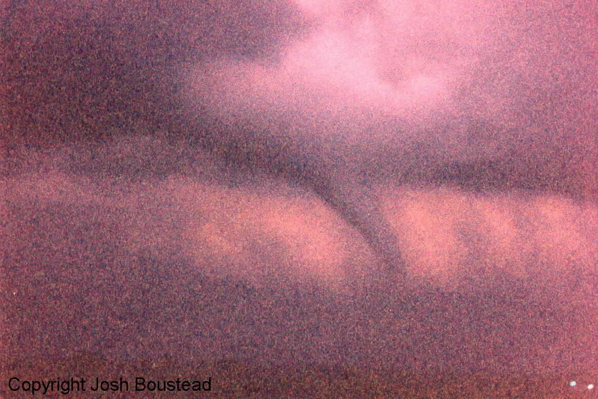
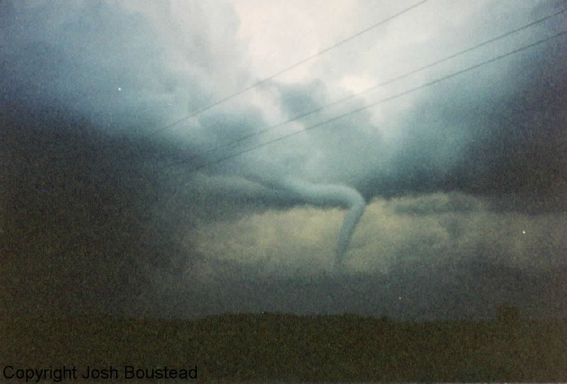
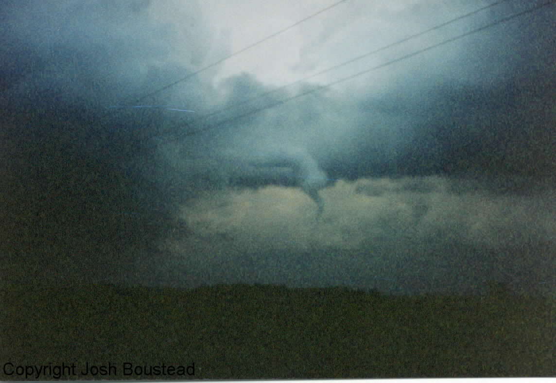
August 9, 1999
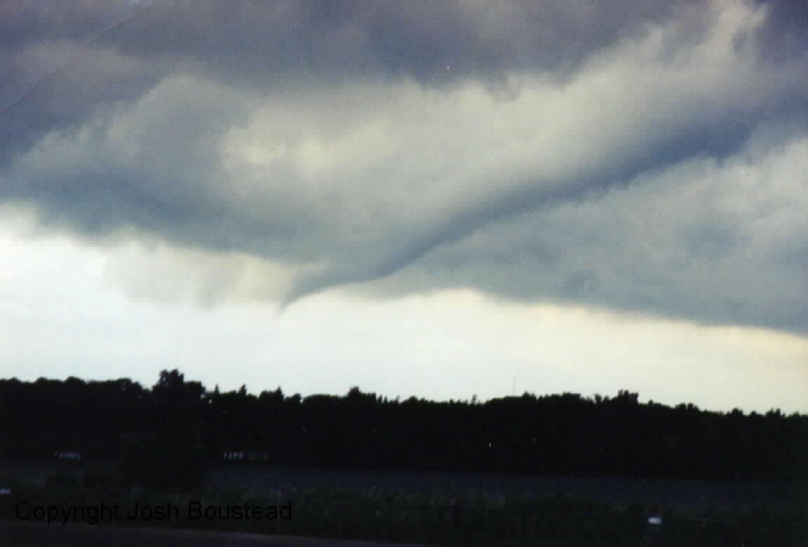
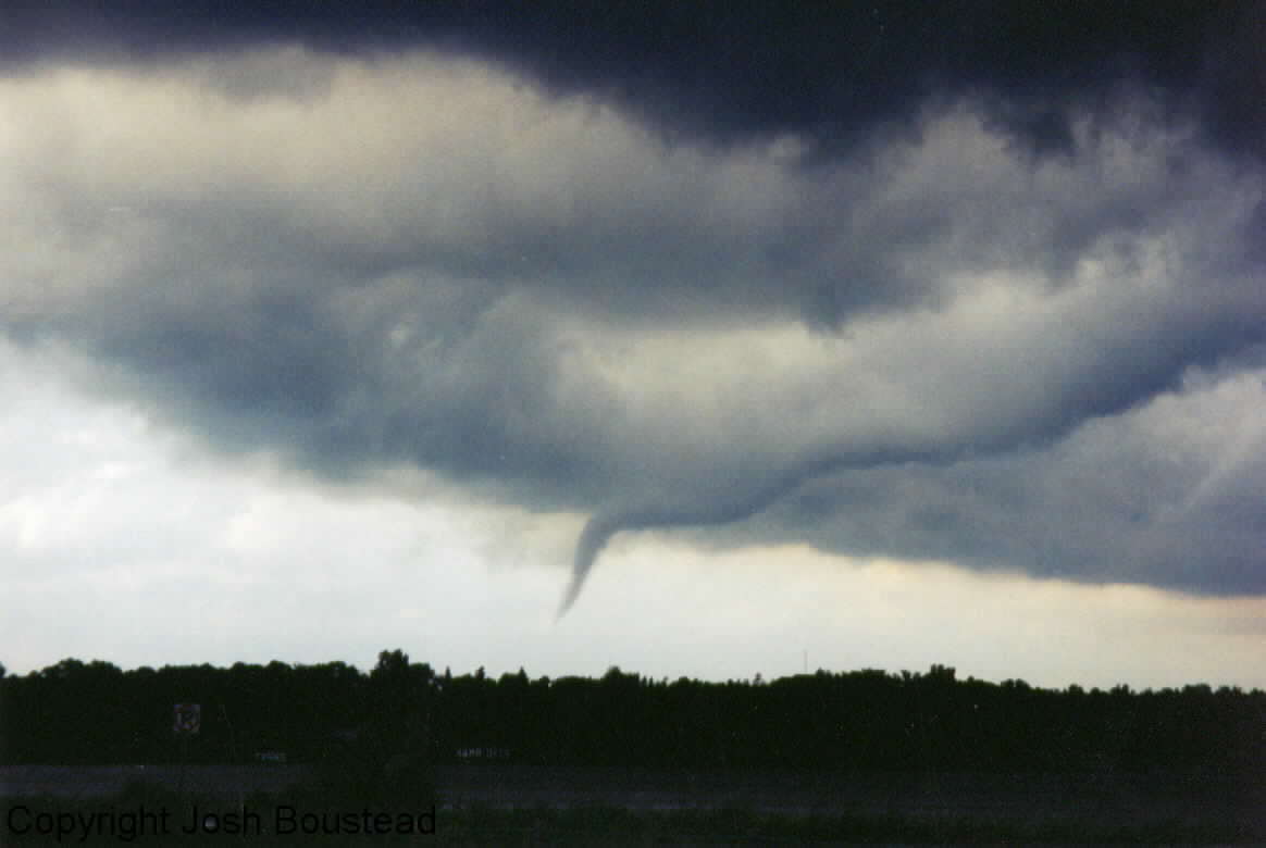
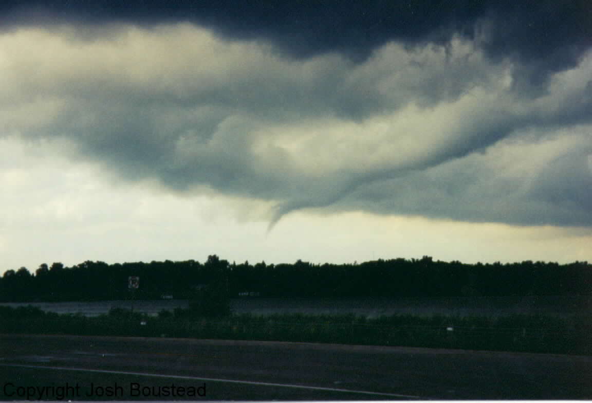
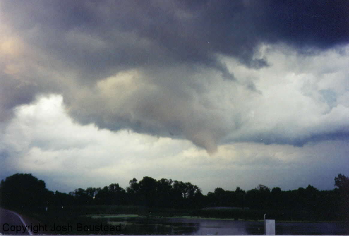
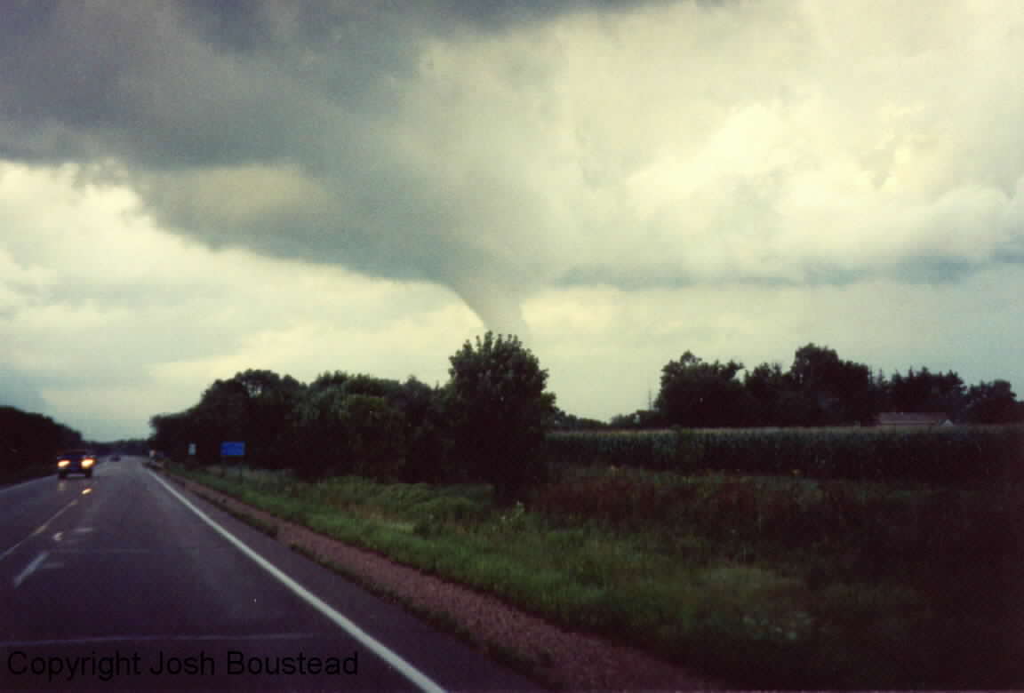
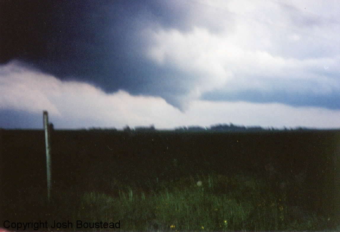
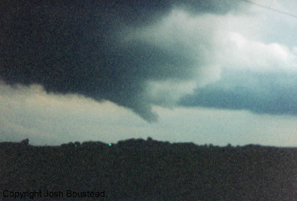
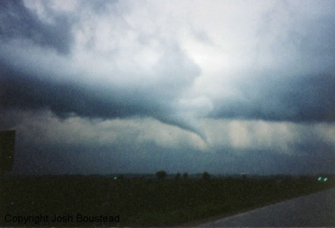
Just a couple of days after the flood in Omaha, the northern plains were in a northwest flow situation. SPC issued a moderate risk for southern Minnesota and northern Iowa. My chase partner on this day was Chris Lenz. We left Omaha around 10am and headed for southern Minnesota. We received updates on the weather situation from the laptop/cell phone connection to the internet. The 1630Z outlook included the possibility of a strong tornado due to the significant low level shear. Once we made it into southern Minnesota we encountered low clouds and very cool temperatures (lower 50s). After stopping at a library we decided to head west into more sunshine. A MD was shortly issued for this area...and according to a subjective surface plot we analyzed this seemed like the best move. It turned out the warm front quickly moved to the north and we had headed to far west. Thanks to Chris's driving we were able to get back east and catch a good part of the action. Instability seemed to be lacking as we encountered the storms due to the very low tops. Tornado warnings continued to be issued from the MSP office and we continued to try and catch the storms. We finally did and were treated to 4 tornadoes that evening from 3 different supercells. All the tornadoes were small and most did not last more than a couple of minutes, but according to storm reports did do some minor damage. Here are the picks from three of the four tornadoes...