| The drive to Duluth gave us views of rolling hills and some river valleys. Near the junction of highways 53 and 33 (near the city of Independence) where highway 53 crosses the Cloquet River are a series of drumlins. Drumlins are glacial deposits that look similar to the tops of whales as they swim high in the water. They follow the direction of the glacier movements, gently sloping up parallel with the advancement of the glacier and then dropping off more steeply. From the ground they are difficult to distinguish from other glacial features but they are easily identifiable from topographic maps, satellite images or aerial photographs. At the end of the drumlin field is the Highland Moraine Complex that extends into the outskirts of Duluth. The tills north of this area are from the St. Louis Sublobe of the Des Moines Lobe of the Wisconsinan glacial period. The tills southeast of Independence are from the Rainy and Superior lobes. | 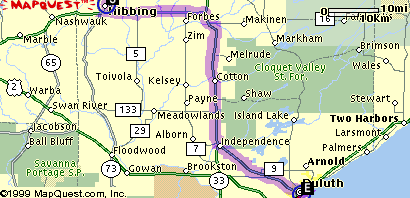 |
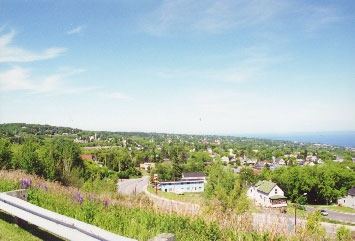 |
The photo at the left shows the
skyline of
Duluth from the "Copper Top Church". The high ground rock
formations
are gabbro, part of the Duluth
complex. According to Dr. Annexstad the gabbro is more
resistant
to erosion than the country rock of basalt so it remains in place where
the basalt has been eroded away. About 10,000 years ago the lake
level of Glacial Lake Duluth dropped but the size of the lake expanded,
in part because of the melt water of glaciers. For about 3,000 to
4,000 years the lake stabilized with a level of at least 200 feet lower
than it is today. The reason is that the weight of the ice had
depressed
the land so far that now the land is coming up from isostatic rebound
and
is still continuing now as some towns on the North Shore are losing the
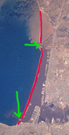
harbors as the land continues to be elevated. In the photo below the blue arrow is pointing to the Aerial Lift Bridge, the red arrow to Minnesota Point and the white arrow to the canal through Minnesota point into Duluth harbor. This photo is also taken from the parking lot of the same church. The canal was dredged to create the harbor and must still be dredged as sand is washed in. |
 |
 |
|
 |
||
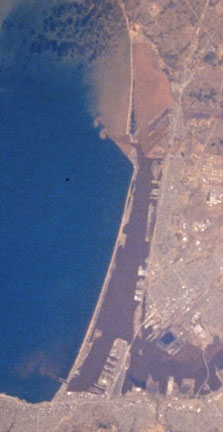
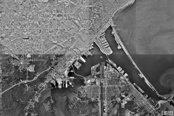
| The two photos below are from
the United States Geological Survey. They are satallite composite
photos of the harbor. The one at the right again outlines the baymouth
bar called Minnesota Point in red. The Duluth lift bridge entry is at
the top and the Superior entry is at the bottom right. |
|||
 |
 |
||
 |
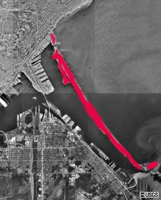
The action of the waves is easy
to see in these closer photos of the Duluth entry to the harbor. The
"line" in the photo at the left is caused by the composite of two
images. Notice the pattern of the waves caused by the reflection from shore. The waves are aproaching the shore from an angle slightly from the lower left (almost straight east). After they hit the shore they go back out parallel to the shore (northeast). A minature ripple pattern like this is visible in the sands near the shore. Because the ripple pattern caused by waves like this are mostly symetrical geologists can see similar patterns in rocks (like those at Pipestone) and know that they were made in a lake or ocean environment. Ripples that are not symetrical indicate water movement of only one direction, indicating that the rock was formed in a river environment. |
||
 |