Site hosted by Angelfire.com: Build your free website today!

Water Action of Ancient Seas

 
strata
strata
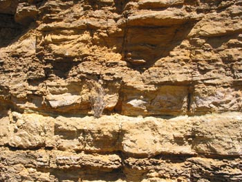
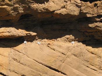
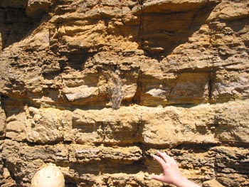
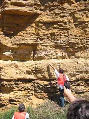
The photos below are a series (I hope you can see all three side by side) that highlight a feature where a sediment band is thick in the middle but gets squeezed out at either end. The photos at left are of the same rock formation with people pointing to this feature.

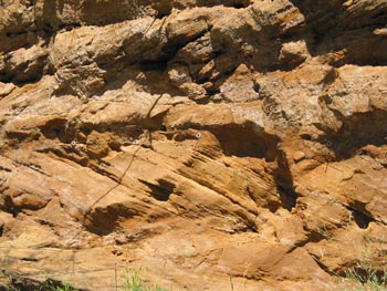
The major feature of these layers is called cross stratification. The strata (layers) or rock cross each other. The feature in this has been interpreted as tidal bars. This is a situation where there is a near shore environment where material is shifted back and forth from tidal action (tidal bars). In a wider view there is a series of these features where the strata doesn't continue very far left to right before it is pinched out by another strata.
strata
strata
strata
strata strata

In the next set of photos (just above and below) the strata (layers) meet at angles. Strata meeting like this is called herringbone cross stratification. It happens in situations where tide is coming in one way and going out another way. When the tides cause water movement, the water carries sediment along with it and then deposits sediment in a pattern that is determined by the direction of water movement. The grain size of this sand is much larger than that on the previous page indicating that this was deposited in an area of shallower water. Since we are higher up in the layers of rock this must have been deposited in a shallower sea at a later time. The evidence of tidal bars and the herringbone cross stratification along with the size differentiation are indicators of tidal channels and near shore tidal action. All of this is happening in the Jordan Sandstone, part of the Upper Cambrian Age rocks. Just above the Jordan Sandstone is the Oneota Dolomite that was being mined in the quarry in earlier pages. Oneota Dolomite is part of the Prairie Du Chien Group (the other parts are Shakopee Formation) of Lower (older) Ordovician Age rocks. Above (younger) the Shakopee Formation is the St. Peter Sandstone.

strata
strata
 
Since these layers represent tidal action, each layer is an indication of the length of a day and multiple layers reflect the lengths of months and seasons. In the photos below geologists have put in markers (nails with large washers) to help mark and record these events to study things like the changing length of days and seasons.
 
strata
strata
strata
strata


Backprevious pagehomenext pageNext

Home