
 |
 |
 |
 |
 |
 |
 |
|
 |
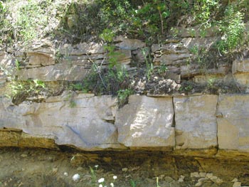
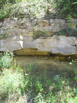
Above
the St. Lawerence Formation is the Jordan Sandstone (still part of the
Upper Cambrian age). The sandstone contains quartz and feldspar, the
result of weathering of granite. The small sand particles are well
rounded indicating a long transport causing the smooth particles. The
bedding of the sandstone is highly variable from troughs cause by wave
action as in the above right photo to to planar (basically level
sheets) in the above left photos and those below. In these photos (left and below) Dr. Summa is showing us the cross stratification of the rock that is characteristic of currents in one direction that would be the result of a river delta or possibly tides. In the photos below notice that the bedding forms a kind of sideways V shape where the bottom is sloping upward to the left but the top is nearly level. This is an unconformity and is evidence of erosion. Layers at an angle were shaved (bulldozed some would say) off before the next layer was deposited. |
|
 |
As sediments are first deposited
on the beach the bottom of the rock
formation is put into place. As more sediments are placed on top over
millions of years the sediments are packed and water carrying minerals
slowly trickles down through the sand. Minerals, in this case
carbonates, are deposited and help to hold the sand particles together.
In order for the minerals to become sedimentary rock it needs to be
buried very deep, at least a kilometer (about 3300 feet). Then, in order for us to see it at or near the surface something has to change to lift it up and take off the sediment at the top. Plate tectonics causing an uplifting generally causes things to tilt as well because not everything gets lifted the same amount. Imagine picking up a heavy board, how likely is it that the board that was level stays level as you lift it? As it lifts the rock will bend and fracture. These fractures may form joints that allow water to flow through. As we saw before these joints can be the start of caves or sinkholes. |
 |
 |
 |


