

Kentucky Road Photos
From six-lane rural Interstates to four-digit state routes that are a lane and a half wide, Kentucky Road Photos will showcase the variety of highways that dot the landscape of the Bluegrass State. If you have a photo you would like to contribute to the Kentucky Road Photos project, please contact me at michohioroads#yahoo.com (change "#" to "@" to e-mail).
Guide Signs | Shields and Other Signs | Road Scenes
|
Description
|
Photographer
|
Date
Taken
|
|
|
10/04/2003
|
|
|
|
10/04/2003
|
|
|
|
J.P.
Nasiatka
|
9/12/2003
|
|
|
J.P.
Nasiatka
|
9/12/2003
|
|
|
J.P.
Nasiatka
|
9/12/2003
|
|
|
J.P.
Nasiatka
|
9/12/2003
|
|
|
J.P.
Nasiatka
|
9/12/2003
|
|
|
J.P.
Nasiatka
|
9/12/2003
|
|
|
J.P.
Nasiatka
|
9/12/2003
|
|
|
J.P.
Nasiatka
|
9/12/2003
|
|
|
J.P.
Nasiatka
|
9/12/2003
|
|
|
J.P.
Nasiatka
|
9/12/2003
|
|
|
J.P.
Nasiatka
|
9/12/2003
|
|
|
J.P.
Nasiatka
|
9/12/2003
|
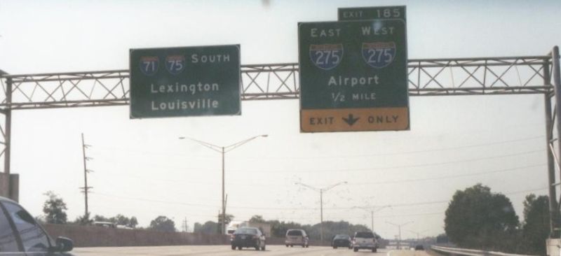
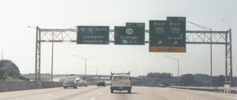
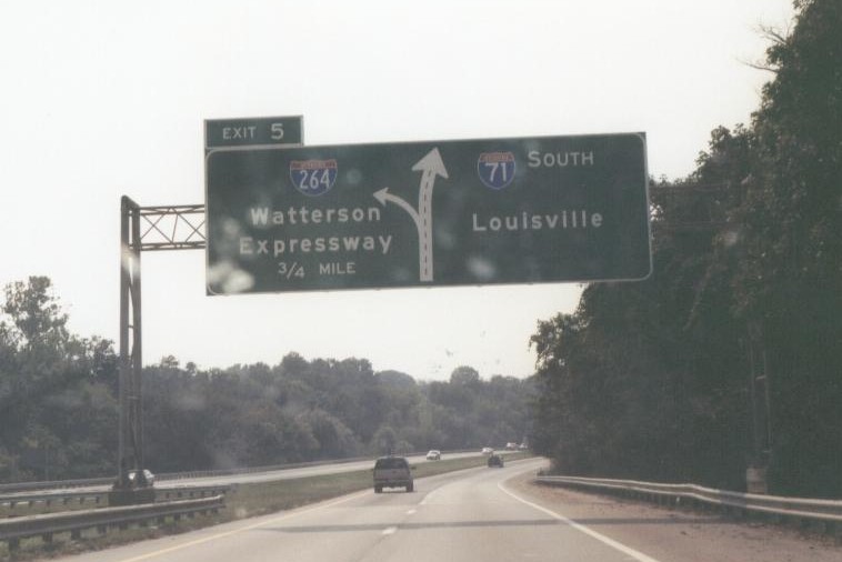
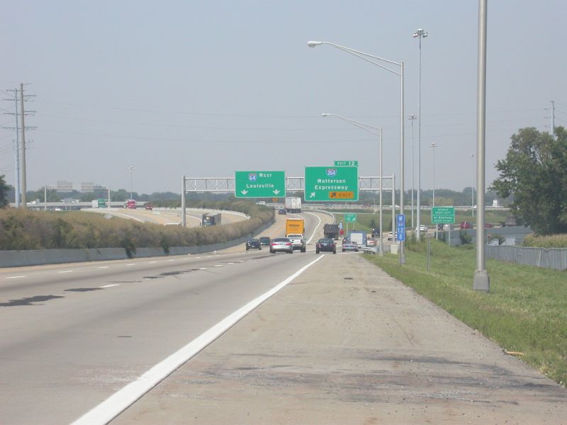
| I-264 gantry signage on I-64 West at the eastern interchange between the two routes, Jefferson County. |
8/25/2003
|
|
|
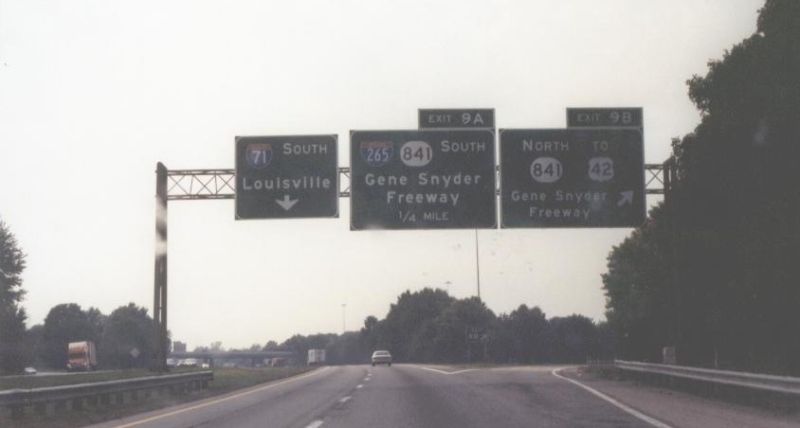
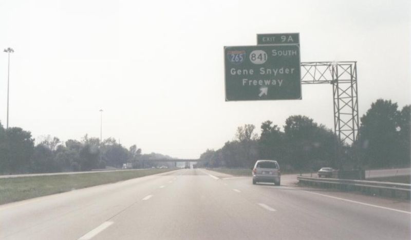
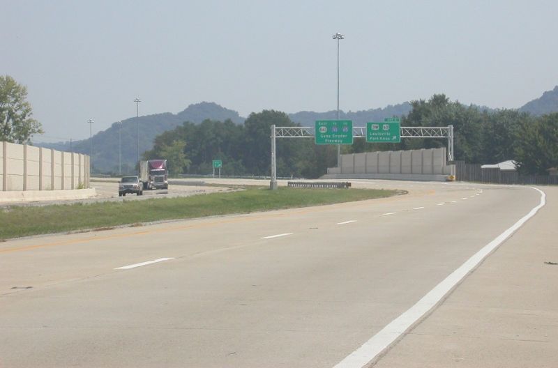
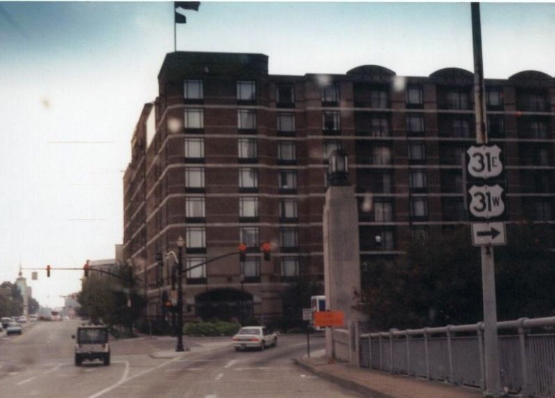
Gantry signage at the start of KY 841 East at the US 31W/US 60 interchange, Jefferson County. This interchange southwest of Louisville marks the transition from KY 1934 (Greenbelt Hwy.) into KY 841 (Gene Snyder Fwy.). 10 miles ahead, KY 841 intersects I-65, where I-265 begins and multiplexes with KY 841 around the eastern edge of the Louisville vicinity up to I-71. |
8/25/2003
|
|
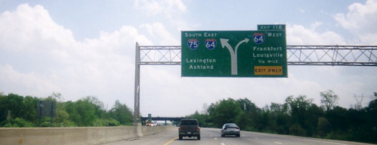
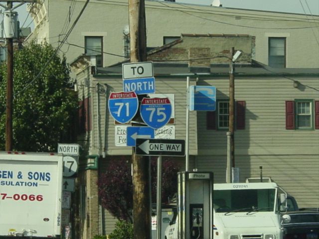
| Overhead diagram sign for upcoming I-64 West interchange (0.75 mile) on I-75 South , Fayette County. The right lane of I-75 South becomes exit only for I-64 West when it gets to the interchange. I-75 South then multiplexes with I-64 East for 7 miles around Lexington. |
4/28/2002
|
|
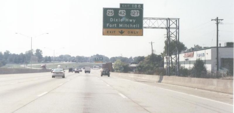
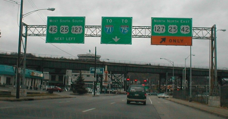
| US 25/US 42/US 127 gantry signage on KY 8 West, Covington, Kenton County. A right turn here puts traffic on the Clay Wade Bailey Bridge, which carries US 25, US 42, and US 127 across the Ohio River. The US 25 designation terminates at the northern end of the bridge, while US 42 and US 127 continue on into downtown Cincinnati and points beyond in Ohio. |
11/24/2001
|
|
Description
|
Photographer
|
Date
Taken
|
|
|
10/04/2003
|
|
|
|
J.P.
Nasiatka
|
9/12/2003
|
|
|
J.P.
Nasiatka
|
9/12/2003
|
|
|
J.P.
Nasiatka
|
9/12/2003
|
|
|
J.P.
Nasiatka
|
9/12/2003
|
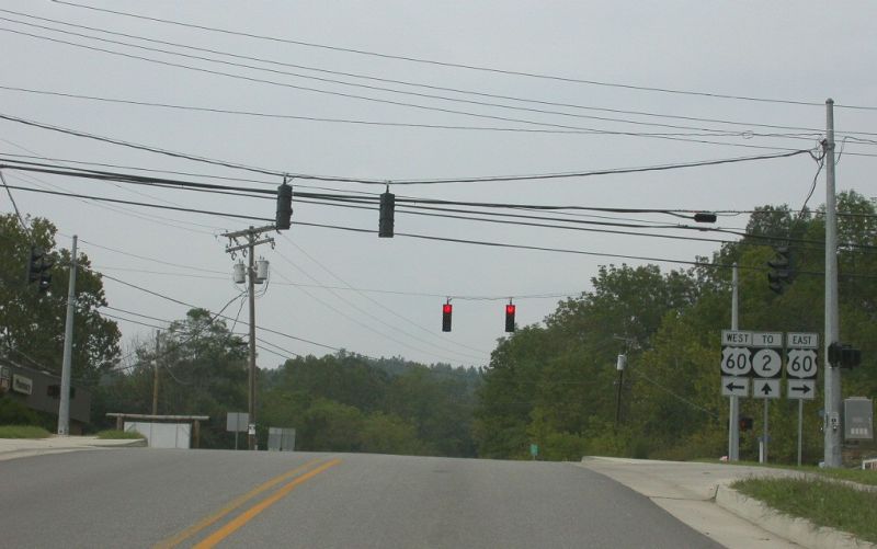
| US 60 and KY 2 shields at the starting point of KY 2 North, Olive Hill, Carter County. The TO tab above the KY 2 marker is a bit misleading, as this is in fact where KY 2 begins. |
9/07/2003
|
|
|
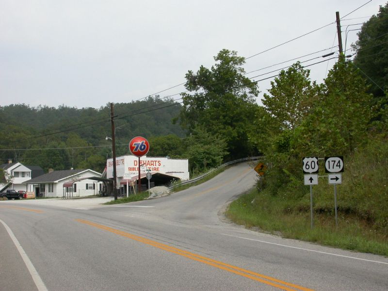
US 60 and KY 174 shields on US 60 East at KY 174's western terminus, Rowan County. |
9/07/2003
|
|
| BL I-24 and Business US 60 East shields, Paducah, McCracken County. |
Jason
Ilyes
|
6/16/2003
|
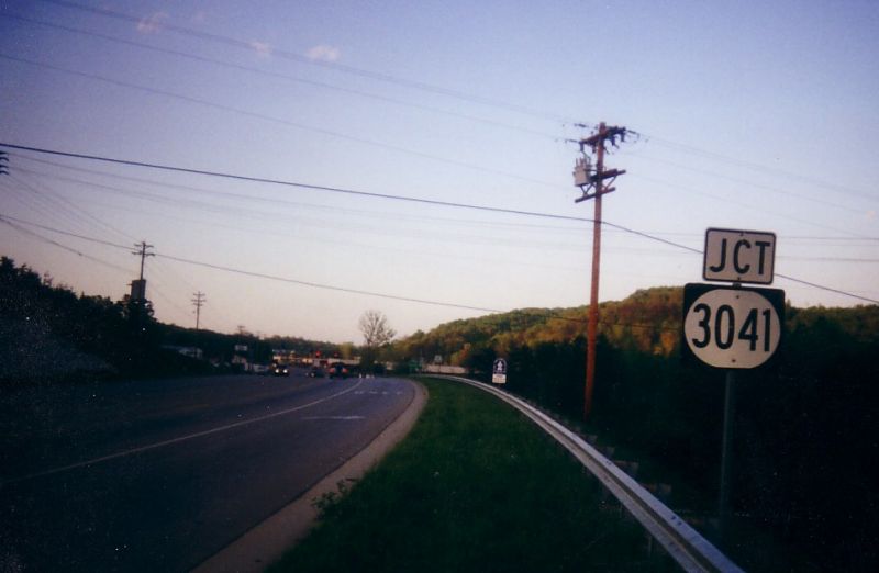
| JCT KY 3041 marker on US 25W North, Corbin, Whitley County. KY 3041 is a two-lane southern by-pass of Corbin, connecting US 25W with US 25E. The by-pass is relatively new, opened in 1997. |
4/28/2002
|
|
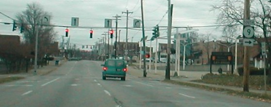
| KY 9 South shield on KY 8 East, Newport, Campbell County. KY 9's intersection with KY 8 in downtown Newport serves as its northern terminus. |
11/25/2001
|
|
| First KY 770 trailblazer, just west of the US 25E interchange off of I-75, Corbin, Laurel County. KY 770 serves as a western extension for US 25E beyond I-75. KY 770 is less than two miles long, coming to an end at KY 312. |
5/01/2000
|
|
Description
|
Photographer
|
Date
Taken
|
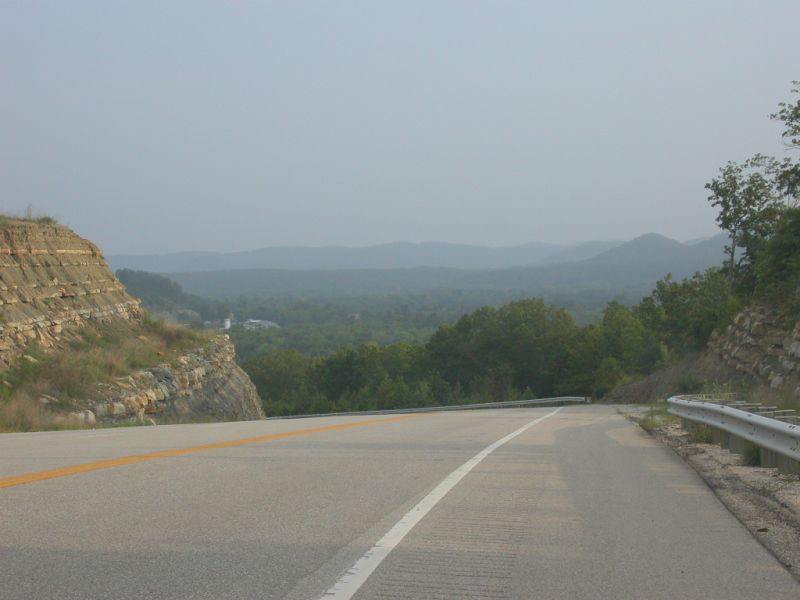
| Scenic view from KY 801 South as it descends into the valley near Cave Run Lake, Rowan County. |
8/29/2003
|
|
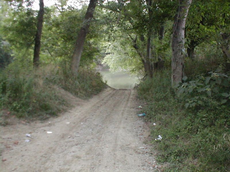
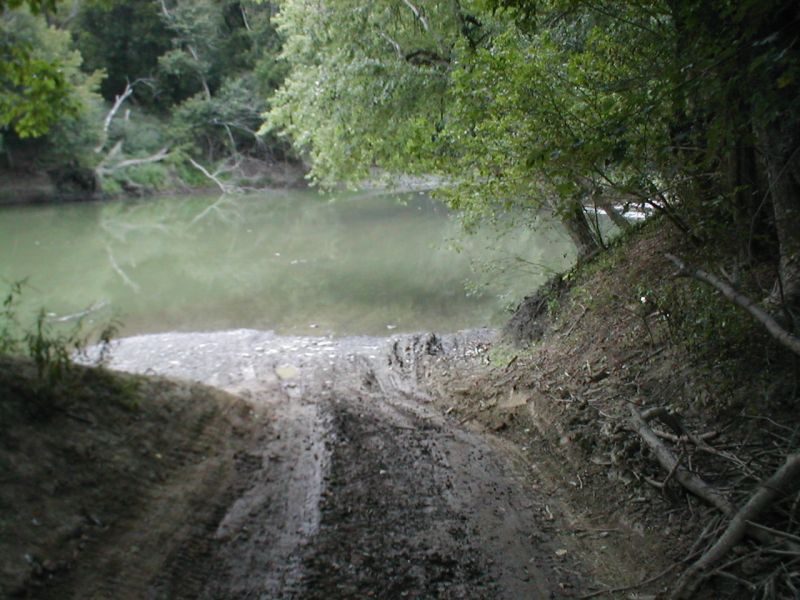
| Gap in KY 57 South at the Licking River, Fleming County. There is no access for KY 57 across the Licking River. Rather than a bridge or a ferry to connect the two segments of highway, on either side KY 57 narrows into a muddy path and then disappears into the river! (For a close-up of the disappearance of KY 57 into the river, please click here.) |
9/01/2002
|
|
|
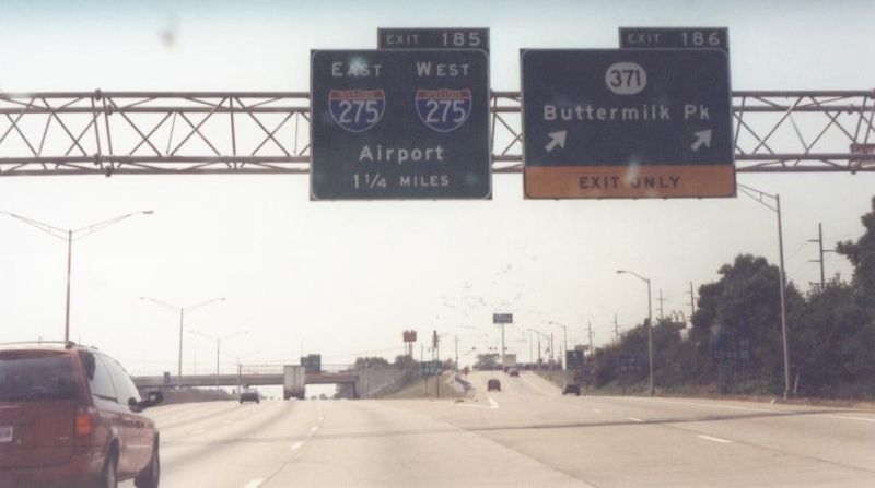
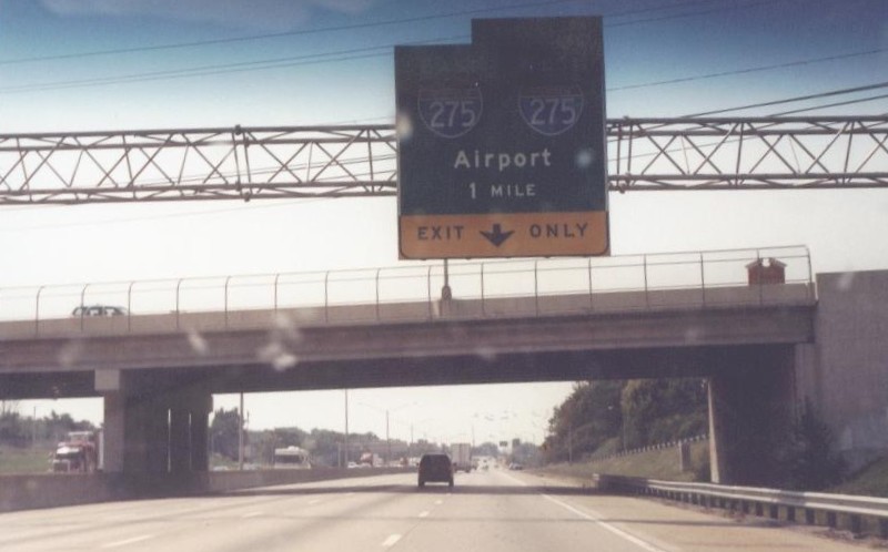
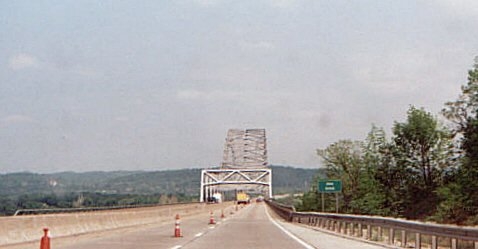
View of I-275 as it departs Kentucky and crosses the Ohio River into Indiana, Boone County. I-275 is a full circumferential by-pass of Cincinnati, Ohio. It passes through Ohio, Kentucky, and a small sliver of Indiana. This photo shows I-275 as it prepares to begin its three mile jaunt through the Hoosier State, after departing the Bluegrass State. |
5/08/2000
|
Acknowledgements
Many thanks go to Jody Aho, Sherman Cahal, Jason Ilyes, Dan Moraseski, and J.P. Nasiatka for their contributions to the Kentucky Road Photos Project.
Links
© 2003, Dan Garnell.
All rights reserved. All pictures used on this site are the property of the
respective photographers, and are used by permission. No picture may be used
without the consent of the respective photographer.
Page Created: April 4, 2003.
Last Updated: November 12, 2003.
![]()
