MAP 7A
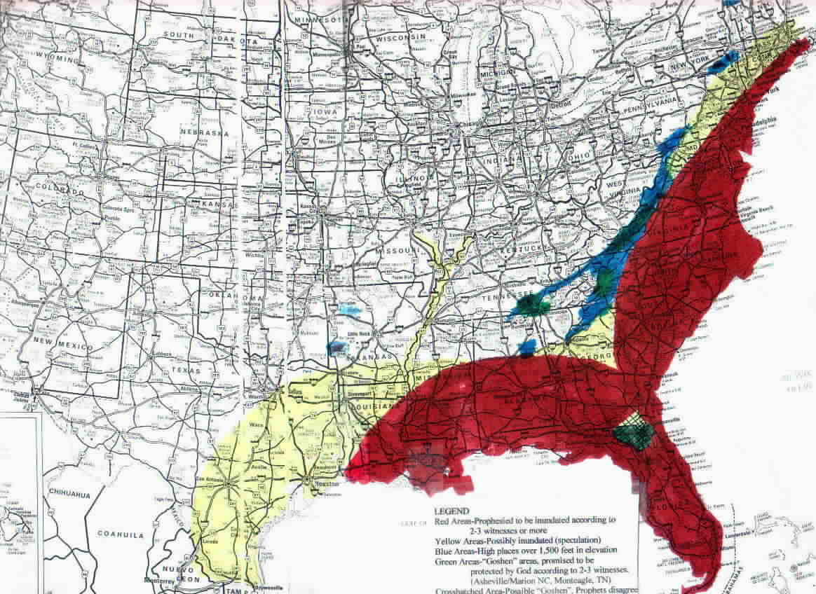
ASTEROID EVACUATION ZONE MAP-Zoom To Georgia
Below, you can see the recommended evacuation zone map. All inundation areas are colored in darker blue, as they are lower than 1,050 feet in altitude. I expect these areas to be under water. It is really sobering to see this up close! No data is known for the Gulf of Mexico tsunami, but it is thought to be not as large as the Atlantic tsunami, which is thought to be 2.4 miles in diameter and estimated to strike about 2,000 miles East. The altitude of downtown Atlanta is 1,050 feet, but that altitude is not uniform. Some parts of it may go under the water. A careful examination will reveal that much of the Greater Atlanta area is below 1,050 feet altitude. Please also realize that altitudes for areas up to 1,160 feet may "possibly" be in danger around the Atlanta area, as the encroachment altitude has been estimated from that which is known prophetically about the wave as it encroaches 200 miles inland into coastal North Carolina to an altitude of 1,160 feet. Downtown Atlanta is 225 miles from the Ocean. There are many cities and towns between Marietta GA (North side of Atlanta) and Chattanooga TN (Elevation 630 ft) that are well below 1,050 feet. I do not believe these towns will be inundated by the wave itself, but low lying areas may be filled in by rivers that connect to the inundation zone. All people in the Atlanta Metropolitan Area and in the area to the North and Northwest of Atlanta up to the Tennessee line should pray and develop their own evacuation plan as led by the Holy Spirit. Many of you are very close to future beachfront property.
MAP 8
Nuclear Plant Map With Earthquake Zones

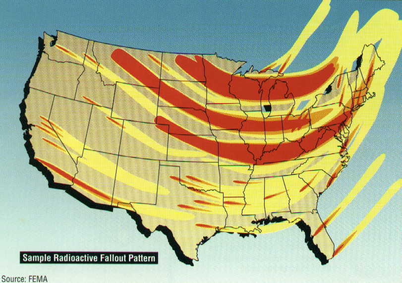
MAP 9
Nuclear Fallout Map-Prevailing Winds
MAP 10
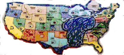
Matthew Stephen's Disaster/Refuge Map-Circa 1993
The important feature revealed here is the locations of refuge areas near Jacksonville, North Carolina, Tennessee and Western Montana. These must all be contended for with prayer and fasting. The Eastern refuge areas will be more temporary. Encroachment by tsunami is shown as far inland as Atlanta. You can obtain more information at Matthew's website at:
Prophetic Watchman Vine-Matthew Stephen
MAP 11
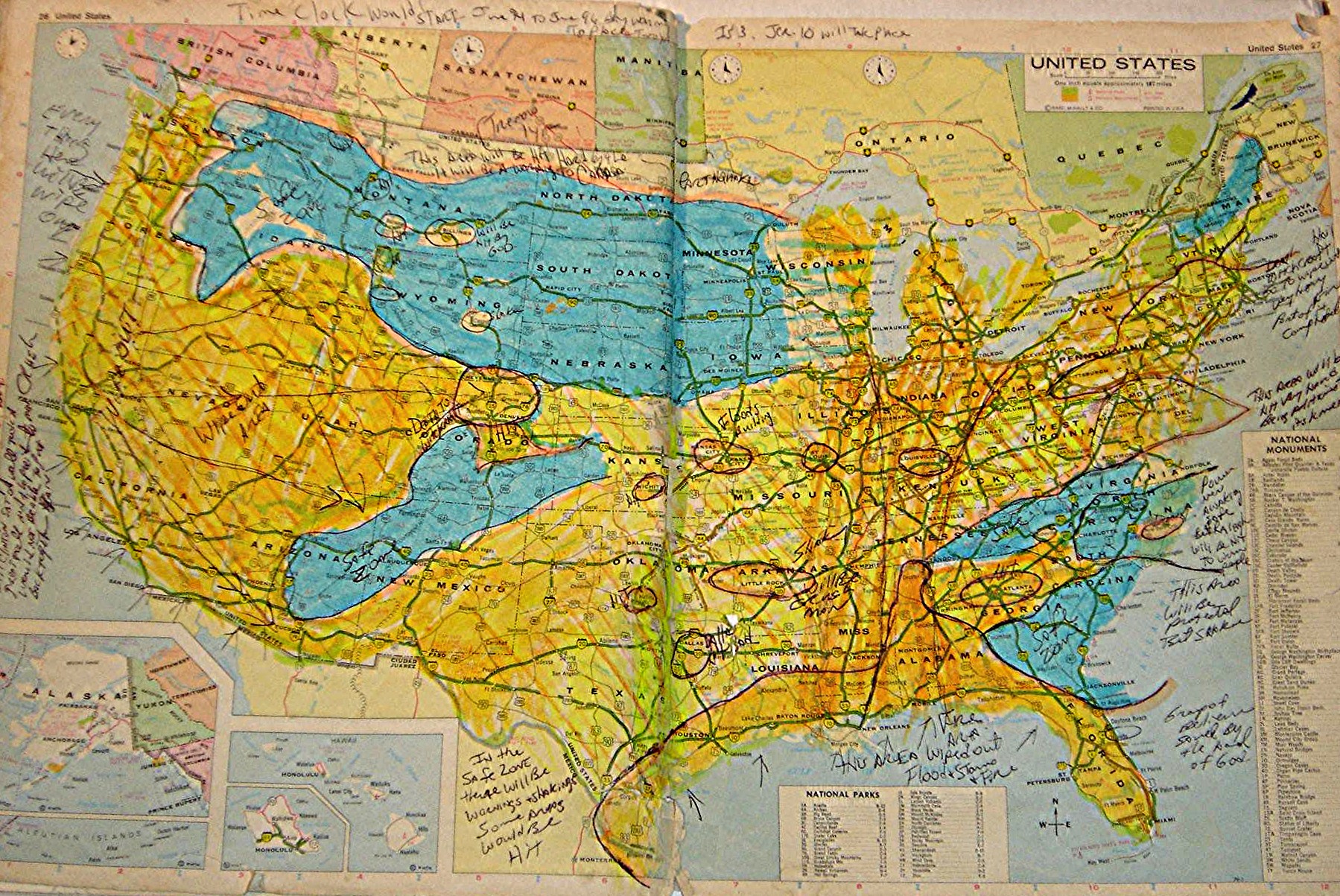
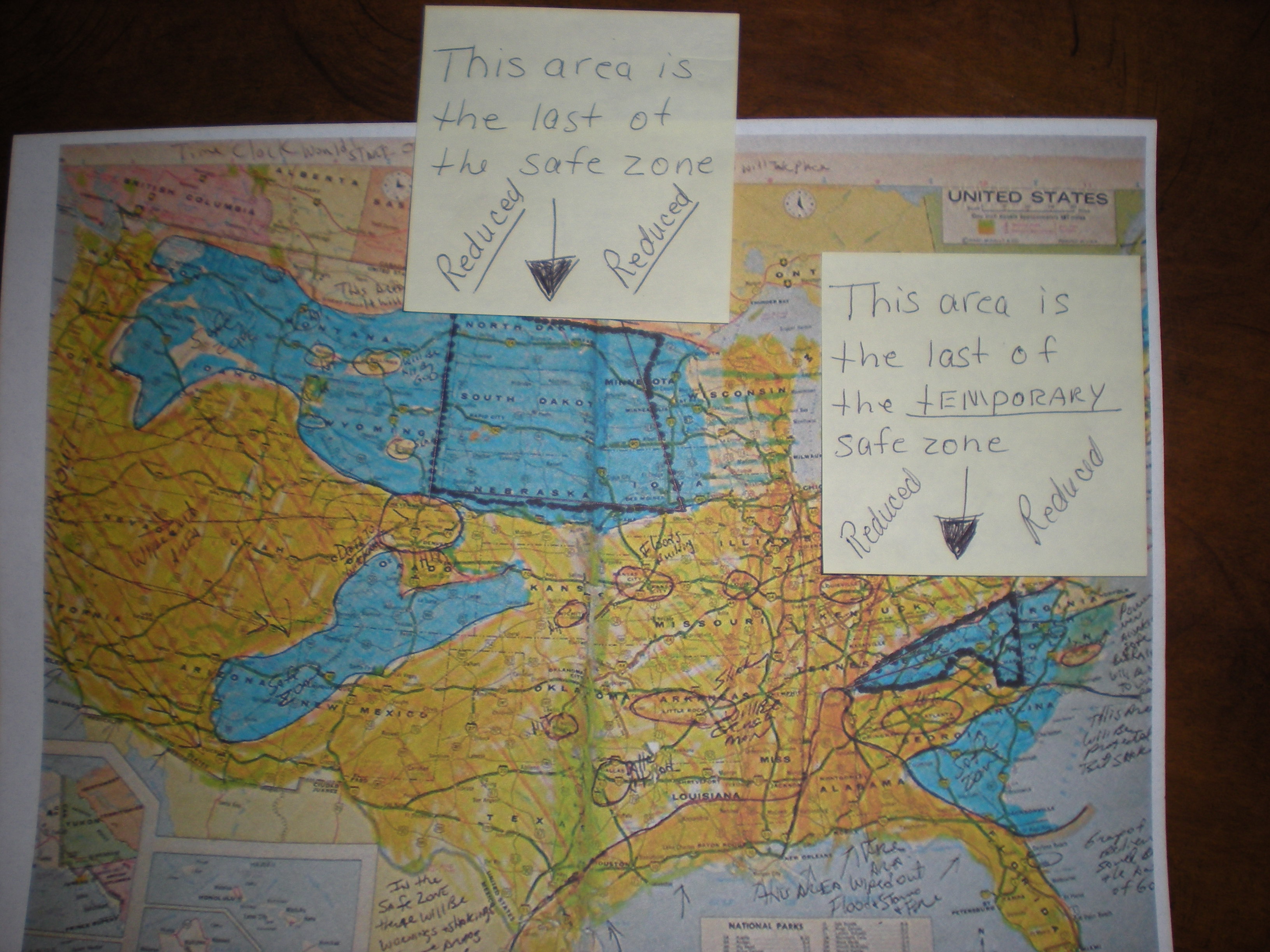
Matthew Stephen's Disaster/Refuge Map
The important features revealed here are that by 2009, the prophesied refuge areas have shrunken greatly, compromised by disobedience of the remnant. This map has error that came about through Matthew's fleshly weakness. You can obtain more information at Matthew's website at:
Prophetic Watchman Vine-Matthew Stephen-Revised 2009 Map-Shrinking Refuges
Presented By:
Stephen L. Bening
A servant and prophet of our Lord Jesus Christ
Making disciples through international and home missions
Dedicated to edifying the body of our Lord Jesus Christ
Click Below In the Yellow Fields To Go To Links
Updated Daily
Unless The Lord Is Silent
Click Below to Send Email to Stephen L. Bening at:
Gammadim@Bellsouth.net
What is a Gammadim?
A watchman!
(Ezekiel 27:11)