
New Mexico still contains quite a few sections of original (1926) and newer sections of Route 66. Unfortunately, much of the road (especially in the east) has been buried by the SuperSlab.
Suggestion:
Order the New Mexico Vacation Guide. The map insert lists Route 66 as one of New Mexico's trails and provides insights on finding the road.Glenrio, Texas to Tuccumcari, New Mexico
| Original Alignment (1926) After you leave Texas, Route 66 followed
two alignents. As you head east from Glenrio, you will come across in a
split in the road. A new alignment (the one closed) curved back toward
I-40. Follow the road that goes to the left. It is not paved, but it's
narrow and the bridges are rather old. This road
is also slippery when wet. Use caution as many people lost their lives
traveling this section of Route 66. You follow this road crossing
cattle guards and stirring up dust. You pass through the old (and nearly
nonexistant) town of Endee. A hint of pavement is shown between a double
set of bridges (notice the wood posts used for guards). I-40 eventually
rejoins you on the right as you enter the town of San Jon. Look for the
closed gas stations and a Route 66/Western mural while driving throught
town.
New Alignment Look to your left from I-40 after passing Glenrio and you will see a bridge that brought Route 66 to it's later alignment. You will see the road approach I-40, be interupted by I-40 and become the north frontage road. Follow this frontage road to the east side of San Jon. Cross to the south side of I-40 and drive into San Jon. |
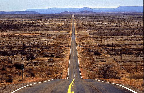
I happened upon Route 104 ("click for pic") in 1991. I absolutely love this road. Although it was quite passable (1991 on a motorcycle), it is not for the faint of heart. Its approximately 100 miles of NOTHING . . . but wide-open spaces. . no towns, gas stations. . NOTHING.

|
Liberty Mesa and Mesa Rica
Chical Mesa, La Cinta Mesa and Tenaja Mesa
Why is a river in the plains of New Mexico called "The Canadian"? An excellent but controversial question. Some say it comes from a Native American word that means "Red River." Others say it comes from the Spanish word "canada," for the valley it flows through. Some say it was named by early homesick French-Canadian trappers. To most New Mexicans, this river has always been and still is, "The Colorado," but mapmakers finally had to give it another name to distinguish it from all the other Red Rivers. Between Hwy 104 and the Canadian River is Chical Mesa, so named for its brush-type plants. Further to the north, beyond the river is La Cinta Mesa -- meaning "ribbon or sash" in Spanish. At the tip of Conchas Lake is Tenaja Mesa, appropriately named as a "large earthen jar for holding water or other liquids" or the rock that holds water. Sandstone is weathered by wind and rain, causing many large boulders to balance on top of pinnacles, sometimes appearing as giants among the land. Conchas Lake State Park
|
- Or -
Tuccumcari to Santa Rosa
As you leave Tuccumcari, U.S. 54 turns south back to the Interstate. There is an access/frontage road. This was once Route 66 but it ends near the country club. You can follow this and see glimps of old bridge abutements and the ATSF/BN railroad. Turn around and rejoin I-40/U.S. 54 and head west.Take I-40 to Exit 321. Follow the south frontage road which will cross to the north frontage road. Continue west to Montoya. At Montoya, cross I-40 again and follow the south frontage road. The frontage road crosses I-40 and Route 66 is the north frontage road through Newkirk and Cuervo.
From Cuervo to Santa Rosa, you can follow an old, rough road south from Cuervo. Follow the south frontage road from Cuervo. It curves left away from I-40. Follow to NM 156. Follow 156 to US 84. Follow US 84 past I-40 and turn left and go into Santa Rosa.
Those who want the easier trip, use Exit 276 from I-40 and follow US 54 into town. Follow Will Rogers Blvd through Santa Rosa. Will Rogers Blvd turns into Parker Ave.
Santa Rosa
Joseph's (closed last summer when I checked in 6/95)
Blue HoleLeave Santa Rosa after crossing the Pecos River on Coronado St (BUS I-40/US 84). Reenter the interstate and head west.
Old 1926-1937 Alignment from Santa Rosa to Correo (via Santa Fe)
Travel from Santa Rosa on I-40 to Exit 256, US 84 north to Dilia and Las Vegas. Route 66 use to head NW from the Colonias exit of I-40 to Dilia. The road is not paved and is a deadend on a local ranch.If you exit at Colonias, you will find the south frontage road, an old remenants of Route 66. At Dilia, Route 66 is US 84 north to Romeroville. Just south of Romeroville (before the cut in the rock, a road splits down into the valley. This is Route 66. Due to I-25 construction and various realignments, much of this original alignment of Route 66 has been altered or destroyed.
From Romeroville, follow the north frontage road of I-25 passing by Tecolote and San Jose. At Exit 320, cross to the south of I-25 and continue west to Rowe. Follow SR 67 to Pecos. A place to stay near Pecos Pecos River Campground.
In Pecos, follow SR 50 back to I-25. Head southbound on I-25 to Exit 294, Canoncito. Follow the north frontage road, looking for Old Pecos Trail. Old Pecos Trail turns into Sante Fe Trail.
|
jandersj@home.net |
Photo's and Stories of Route 66 New Mexico Hotels
