
PSH 2 (Trunk)
PSH 2 began in Seattle at Jct PSH 1. From Seattle, PSH 2 originally headed SE via Rainier Ave S to Renton and Jct PSH 5. In the mid-late 1930s, Empire Way (now Martin Luther King Jr Way) was built. PSH 2 was shifted to Empire Way and PSH 5 was extended north on Rainier Ave to Seattle. From Renton, PSH 2 headed NE to Issaquah. Upon completion of the Lake Washington Floating Bridge in 1940, PSH 2 was rerouted via the floating bridge from Seattle to Issaquah. The highway via Renton became PSH 2 RE (Renton Branch). From Issaquah, PSH 2 originally headed east to Preston, north to Fall City, and SE via Snoqualmie to North Bend. A year or two after the floating bridge was completed, a shortcut from Preston to North Bend was opened. PSH 2 was rerouted via this shortcut. The highway from Preston to Fall City became a county road. The highway from fall City to North Bend became an extension of PSH 2 BO (Bothell Branch). From North Bend, PSH 2 headed east via Snoqualmie Pass to Cle Elum. A few miles east of Cle Elum at Teanaway, PSH 2 intersected with PSH 3. PSH 2 turned left and headed north over (Old) Blewett Pass to jct PSH 15 near Peshastin. At Peshastin, PSH 2 turned right and headed down the Wenatchee Valley to Jct PSH 10 at Olds Station. PSH 10 joined PSH 2 and headed south to Wenatchee and east to East Wenatchee. At East Wenatchee, PSH 10 left PSH 2 and headed downstream along the Columbia. PSH 2 turned left and headed upstream to Orondo. At Orondo, PSH 2 turned right and headed east via Waterville, Coulee City, Wibur, and Davenport to the western outskirts of Spokane. PSH 11 intersected with PSH 2 and ended west of town. Closer in, PSH 3 joined PSH 2 and headed to the east side of downtown. East of downtown, PSH 3 left PSH 2 and heded north. PSH 2 continued east to the Idaho State Line.
PSH 2 RE (Renton Branch)
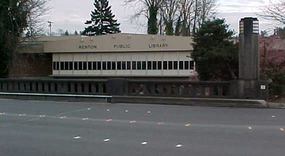
Upon completion of the Lake Washington Floating Bridge in 1940, the PSH 2 trunk was shifted from the Seattle-Renton-Issaquah route to the more direct Seattle-Mercer Island-Issaquah route. The former PSH 2 trunk via Renton was redesignated PSH 2 RE. This highway was signed as Alt US 10 into the 1950s, then State Highway 2, until being renumbered as SR 900 in 1964. The portion of former PSH 2 RE/SR 900 from Central Seattle to the Boeing Access Rd junction was dropped from the state highway system on April 1,1992.
PSH 2 BO (Bothell Branch)
Before the completion of the first Lake Washington Floating Bridge in 1940, traffic heading from the north end of Seattle to Snoqualmie Pass and points east usually used PSH 2 BO. This route started in downtown Seattle, taking Fairview Ave and Eastlake Ave to the University Bridge and University District. North of the bridge, PSH 2 BO took 10th Ave NE, later renamed Roosevelt Way, to Bothell Way. PSH 2 BO followed Bothell Way the rest of the way to Bothell. Bothell Way inside the Seattle city limits was renamed Lake City Way in the 1960s. From Bothell, PSH 2 BO went east to Woodinville, then south to Redmond. From Redmond, PSH 2 BO went ESE to Fall City and Jct PSH 2. After PSH 2 was straightened between Preston and North Bend in the early 1940s, PSH 2 BO was extended along former PSH 2 from Fall City via Snoqualmie to Jct PSH 2 in North Bend. On the Seattle end, PSH 2 was shortened in the later 1960s after I-5 opened thru the city. Bothell Way (now Lake City Way) was extended west from Roosevelt Way to I-5 Exit 171. PSH 2 BO from downtown Seattle to Bothell Way was dropped from the state highway system. When the current numbering system was first posted, PSH 2 BO was resigned SR 522. In the 1970s, SR 522 from Woodinville to North Bend was redesignated SR 202. The 202 designation between Woodinville and Monroe was changed to SR 522. In some ways, SR 202 from Redmond to North Bend should be changed to SR 520. Just as the original PSH 2 trunk around the south end of Lake Washington was replaced by the first floating bridge, the SR 520 bridge replaces PSH 2 BO as the main link between the north end of Seattle and Snoqualmie Pass.
PSH 2 AN (Auburn-North Bend Branch aka Echo Lake Cutoff)
Originally planned in the 1940s, PSH 2 AN provides a shortcut for traffic headed between Tacoma and Snoqualmie Pass. PSH 2 AN began at Jct PSH 1 in Federal Way and headed east to Auburn, then NE via Covington, Maple Valley, and Tiger Summit to Jct PSH 2 near Echo Lake, a few miles west of North Bend. The Federal Way to Auburn portion opened first, around 1960. By late 1962, the highway had been extended past Maple Valley to the Issaquah-Hobart Rd junction. In January 1965, after being resigned as SR 18, the final link over Tiger Summit to PSH 2 (US 10, now I-90) was opened. Today, PSH 2 AN is SR 18. Some WSDOT records indicate that SR 18 is to be extended SW from Federal Way to tie into SR 509 in the Port of Tacoma area.PSH 2 (branch)
When construction on Grand Coulee Dam began in the mid-1930s, a branch of PSH 2 was extended north from PSH 2 at Almira to the dam site. SSH 2F and 4C (now SRs 155 and 174) were added to the state highway system in the late 1930s. After these two routes were improved in the 1950s, the PSH 2 branch from Almira to the Grand Coulee Dam area was dropped from the state highway system.
Interstate Routes
US Routes
State Routes
Primary State Hwys
Secondary State Hwys
Home Page
