
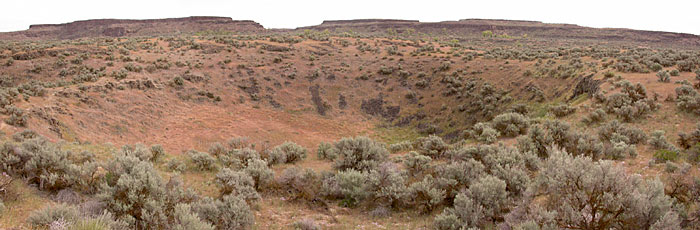
 Ellensburg School District employees told us the potholes in the Columbia Basin were carved out by glaciers. What else did they lie to us about? Whirlpool type currents in the flood waters drilled these giant depressions in the basalt.
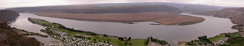 An awesome piece of flood evidence is right here in Kittitas county. The west bar across the Columbia from Crescent Bar is really something if you know what you're looking at. I need to get better photos of this area. I haven't been out there in very good lighting. Geologist Bruce Bjornstad explains that the giant current ripples on the west bar average 24 feet in height and are 360 feet apart. And composed of boulders up to 4.5 feet in diameter. The ripples currently lie a full 150 to 250 feet above river level. Based on ripple size and spacing, geologists have estimated the floodwaters were about 650 feet deep when the ripples formed.
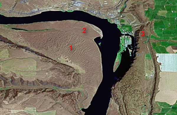 It's easier to see some of the flood evidence from a satellite than a car (this one from the Google satellite image map page). Check out the ripples in the area marked #1. The ripples have been removed in the smooth area marked #2 by smaller floods that came later! When you stand on the overlook previous image was taken from (#3) and try to imagine water 650' deep rolling by ... You kinda get dizzy!
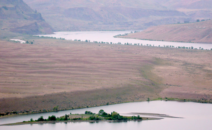 This shot shows the transition between area #1 and #2
Click below for more photos
Page 4

