Well ...I don't know where to start on this one? Tom spent a little too much time reading about the Lake Missoula floods in April. He then drug Teresa around the Columbia Basin looking at things we'd seen many times before only this time to wouldn't shut up about the floods that carved the landscape. Why does Tom now think he's qualified to explain the catastrophic floods? ... He's read a couple books, visited a few websites and don't forget he took Geology 101 in 1979 (and brought home a "C"!).
I think I will try to construct an Ice Age Floods website this fall so that I can start to share some of the amazing places we visit and as a way to meet others interested in these events.
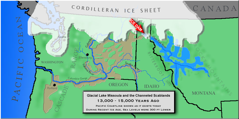
If you have no idea what I'm talking about, a quick review of this map might get you interested. As recently as 12,000 to 15,000 years ago the ice sheet that covered the northern portions of Washington, Idaho and Montana had crept far enough south to block the Clark Fork River. Over several years a HUGE amount of water accumulated behind the ice dam (When I say "HUGE", I mean a reservoir of water equal to Lake Michigan! A quick summary of what happened next is: The water level rose to the point that it floated the ice dam (probably in late summer) and all that water rushed out in less than 48hrs!
(I should be mentioning the basalt flows that preceeded the floods my more than 12 million years ... but ... I'll save that for later).
Back to the big flush! All the water roars over Eastern Washington and eats into the basalt layers (I should have explained them first!) that covered the area. Geologists estimate the flood waters reached speeds of 50-60 miles per hour. Anyone in the path of the flood would have heard the roar 30 minutes before they got wet. The water carries huge iceberg type pieces of the ice dam that contain massive boulders of a composition unique to northern Idaho and Western Montana (You've seen them sitting all over the Columbia Basin, as well as around Richland, Pasco and Kennewick. Many are stranded on the hillsides above the Willamette River south of Portland Oregon! (That's right ... we now have four western states involved).
I've got to stop ramblin' or I'll be here all night!
If you can take one more look at the map above before scrolling through the picures below ... Check out "Wallula Gap", this is a KEY choke-point in the event. This bottleneck caused the flood waters to back up the Yakima River drainage all the way to Yakima (I'm inclined to think that it might not hurt to flush out the Yakima Valley every 3 or 4 million years). The massive lake behind Wallula Gap is now known as Lewis Lake and may have only exist for a few days before the water was able to move through Walluala Gap.
Geologist know that the flowing ice sheet repeatidly blocked the Clark Fork River and the same event was repeated as many as 40 times! On to some of the pictures from the last few weeks.
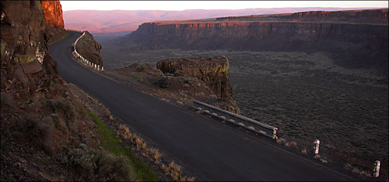 Part of Frenchman Coulee about a half hour east of our house. One of many coulees carved by the floods.
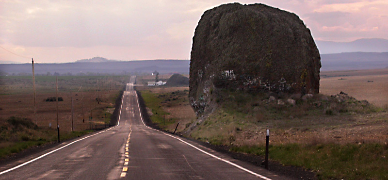 These pictures really jump around ... I'll build my official more organized Ice Age Flood Site later ... West of Grand Coulee dam the the plateau is dotted with many boulders deposited by the ice sheet. It's amazing to me that during the last ice age, this boulder was pushed south almost to ... but not onto the highway between Sims Corner and Mansfield.
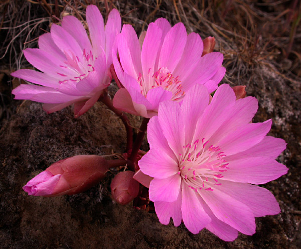 Teresa and I have been seeing some amazing wildflower displays in the basin this spring. This is a small bitterroot plant blooming for all it's worth above the Columbia River near Crescent Bar. Thousands of them were blooming the day we were out there.
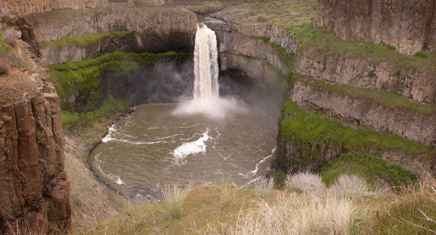 Palouse Falls ... This creek didn't carve the huge canyon and create the big plunge pool ... The floods did.
Click below for more photos
Page 2

