Photos from my June, 2022 traverse of Big Bald on the AT with Jack, Scott, and Dillon. (Photos)
Photos from our March, 2022 hike from Indian Grave Gap to Beauty Spot. (Photos)
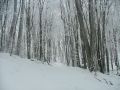
Photos from a solo exploration of Rube Rock Branch and Tom Hall Branch in the Pigeon River gorge. (Photos)
Photos from our February, 2017 hike with Team Waterfall (Christy, Brenda, David, Kyle, Angelina, Jonathan, Leigh, and Jonathan) along Big Laurel Creek from the trailhead in Hurricane to the ghost town of Runion on the French Broad River. Photos.
In April, 2016 Christy and I finished a week-long trip on the Cumberland Plateau with a dayhike with friends from Michigan on the Appalachian Trail from Lemon Gap to Max Patch. Photos
Photos from my May, 2015 dayhike with Brenda, Dillon, and the dogs to the Harmon Den area
Our August, 2014 dayhike with Brenda, Bob, Megan, Nathan, and Jonas to Lost Cove, a ghost town in the Nolichucky River Gorge that was abandoned in the 1950's. Photos
My June, 2013 4-day backpacking trip with Boone and Kona on the Appalachian Trail from the Nolichucky River, outside Erwin, TN, to Hampton Cove, beyond Roan Mountain. Photos
My May, 2013 dayhike on the A.T. from Browns Gap to Snowbird Mountain. Photos
My January, 2010 backpacking trip from Hot Springs to Rich Mountain. Photos
My January, 2010 dayhike in the Big Laurel Creek Gorge. Photos
My April, 2008 solo backpack loop in the Shelton Laurel area, including the Green Ridge, Appalachian, and Jerry Miller Trails. Photos
My December, 2007 backpack with Joel over Unaka Mountain and the Beauty Spot. Photos
My November, 2006 solo dayhike from Harmon Den to Max Patch Photos
My January, 2006 dayhike with Bob from from Hughes Gap to beyond Little Rock Knob.
My March, 2003 car camping trip with Dave, featuring:
A dayhike from Big Creek through Whiteoak Flats to Blackstack Cliffs
A dayhike on the AT to Camp Creek Bald.
Our September, 2000 car camping trip with Bob and Laura, featuring:
a loop hike from Big Creek to Big Butt on the Green Ridge, Appalachian, and Fork Ridge Trails.
A dayhike along the Big Laurel Fork to the French Broad River.
A September, 1998 car camping trip featuring a dayhike on the AT to Max Patch and a dayhike from Hurricane to Hot Springs, following the Big Laurel Fork Trail and the railroad tracks through the French Broad River Gorge.