UTAH: The Aztec Homeland

This is 1807 map was used by Zebulon Pike in his quest to explore the area west of the Rockies.
Lac de Tampanagos is supposed to be Utah lake.
What is interesting is that the Great Salt Lake is located at around 41 Lat. and Utah Lake just south, is at around 40 Lat. and 111 Long. The Lake of Timpanagos is said to be the same as the Lake of Thequao. Notice the protruding river that says "Rio Salado" or the Salty River.
The lakes pictured in this map are also located at 40th Lat., however, they appear to be at 114 Long.
I believe that this Char'd Alzate de Thequao is a map of an Aztlan homeland.

Remains of Moqui Villages are not known to exist this far north in Utah, but here it is on this map from 1882, just below Castle Dale, Utah where the Old Spanish Trail turns south. Adding credence to the notion that the Great Salt Lake was, at the very least, part of the Aztec homeland.
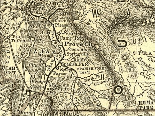
Possibly, more evidence of Aztlan being near the Great Salt Lake. A ruin site just southeast of Provo, Utah and just north of the Spanish Trail's Northern Apex, where six different springs feed Utah Lake.
This map is from 1876. The ruins are 36 miles west of Combs Ridge, stay on 95, left at 276, left at 260RD or Gultch Creek Rd, they're on the left about 10 miles in.
A News Article About Aztlan

Spanish Drawing of Utah and New Mexico.
For more evidence click here