
|
Switzerland 2003
Cycling Through Three Cultures in One Small Country Part 4: Interlaken to Bellinzona via St Gotthard Pass |
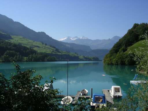
Lungernersee |
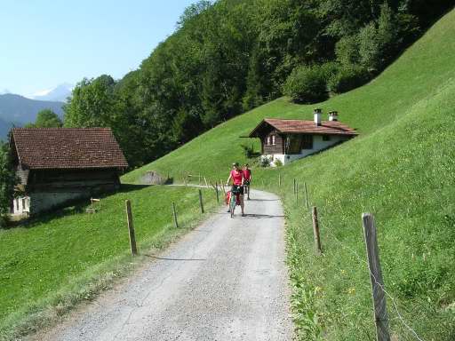
We had an ambitious day ahead of us as we left Interlaken. The goal was to reach Hospental, at the base of St. Gotthard Pass by evening. To accomplish this we needed to weave together an itinerary involving train, bike, and boat travel. The train took us from Interlaken, along the Brienzersee, to Meiringen. Then over the Brünig Pass and down to the village of Lungern. The bikes were dusted off, having not been ridden much the last few days. The Lungernersee shimmered in the late morning sun. The bike route was pleasant and scenic along the neighboring Sarnersee, Alpnachersee, and finally to the boat terminal at Beckenried on the Vierwaldstättersee (Lake Lucerne). |

Vierwaldstättersee |
We made the departure by ten minutes having dealt with a flat tire on the way. Our ship was a vintage steam powered paddle wheeler. It was the life of Riley, cruising on a beautiful boat surrounded by dramatic mountain scenery. The ship made several stops at shore-side communities as the lake made a dogleg turn and became the Urnersee (Lake Uri). Last stop was Flüelen at the southern point of the lake. |
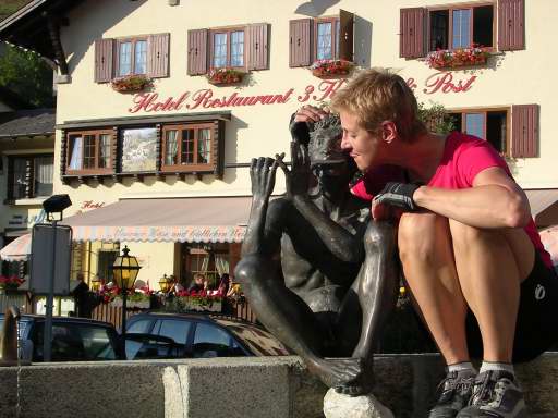
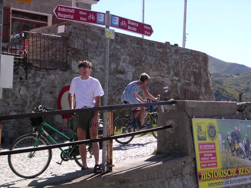
Andermatt, CH |
The final leg of the day's journey found us on the train from Flüelen up to Andermatt, arriving in time for dinner. The efficiency of the Swiss transportation system took us and our bikes where we needed to go without missing a beat. After dinner there was time to get acquainted with a local before biking the last couple miles to Hospental and its quirky youth hostel. |
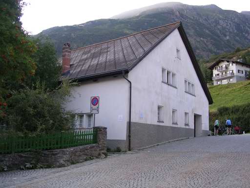
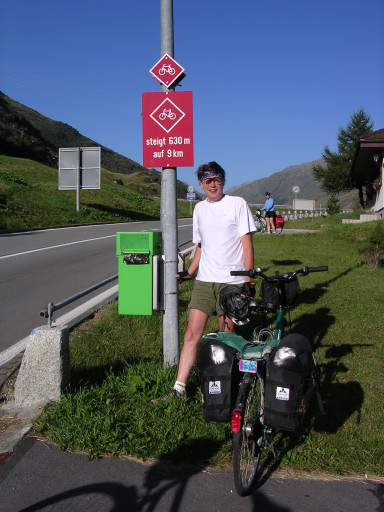
Youth Hostel Hospental, CH |
Evening was drawing some long shadows as we entered the Hospental youth hostel. It appears as an unpretentious rural residence at the edge of the tiny mountain village. We found the reception office unattended and noticed a few college-aged travelers floating in and out of the kitchen while a few more were engrossed in preparing their dinner. We looked around at the rustic interior and noticed a note in German taped on the office window that advised guests to use the wall phone to call the manager if unattended. We called and she told us take our clean bedding from the laundry bin in the corner and proceed to room #10. We asked about the room key. She said there wasn't any. How about a key to the youth hostel? No key for that either! Ok, well it appears the crime rate is rather low in this neck of the woods. The manager showed up later in the evening to collect $15 per person. She turned out to be a very pleasant lady who spoke English quite well. We liked the Hospental hostel. |
|
About 100 yards from the hostel the stats on the St. Gotthard Pass are presented for cyclists. The pass involves a climb of 630 meters in 9 kilometers. St. Gotthard Pass has been one of the most important passages between northern and southern Europe for centuries. We are now on Swiss Cycle Route #3. |
Towards St. Gotthard Pass |
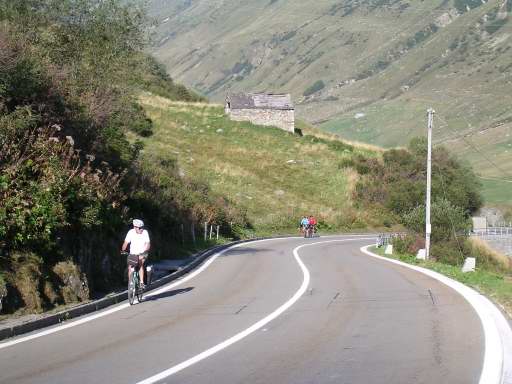
The climb begins in earnest immediately upon leaving Hospental. Although not particularly steep the climbing is relentless all the way to the summit. Traveling from north to south this section of the road has been engineered for modern traffic and has a well maintained surface. The distance from Hospental to the summit can be completed in less than two hours by taking a slow but sure turtle's pace, and not stopping for rest breaks. |
|
Traffic is light as we pedal our way higher and higher. The St Gotthard road was improved in the early 1800's to accommodate commercial stagecoach traffic. The train line was put through in the 1880's. It wasn't until 1980 that a tunnel was completed for vehicles thereby diverting traffic from the old road. In the center of the photo is a forerunner of the truckstop. This little oasis served to assist travelers in what must have been an arduous journey long ago. |

|
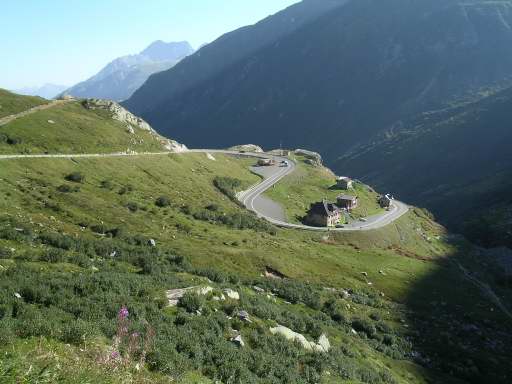
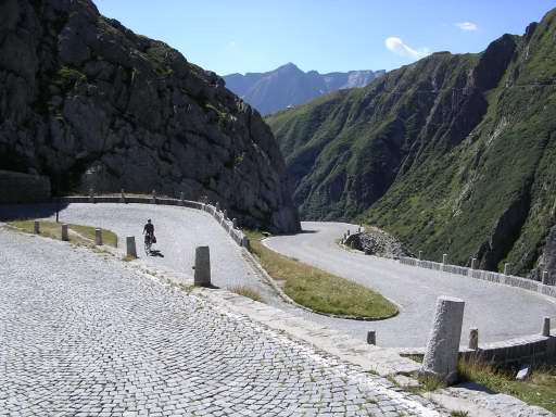
About 2/3 of the way up cyclists have a choice. Continue on the modern road or take the old cobblestone road the rest of the way to the summit. Both have pros and cons. The old road has no vehicular traffic save for the occasional nostalgic horse drawn carriage. This route also may be a bit less steep than the new road. But one must deal with the cobblestone surface. The new road has a smooth surface and may be somewhat more direct in reaching the summit. However, there is some traffic and it may be a tiny bit steeper. The new road can be seen to the left in the photo. |
St. Gotthard Pass |
Making to the summit is a relief but also somewhat anti-climatic. Your arrival is greeted by pole signs showing hiking and biking directions as well as the elevation of 2,108 meters. A quarter mile around a bend and down about a hundred feet in elevation you'll arrive at the St Gotthard tourist center. This consists of a museum, a restaurant, a gift shop, and outdoor stalls selling bratwurst and souvenirs. Now the task at hand involves a 2800 ft. drop in elevation to Airolo, 12 km away. Of course one could avoid the whole up/down affair by taking the train from Flüelen to Airolo. |
Val Tremola 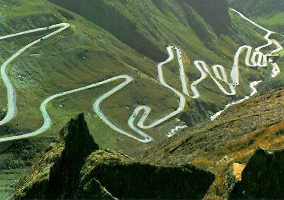
Val Tremola |
The modern road leading from the tourist center down to Airolo is not recommended to cyclists due to the long dark tunnel as soon as you leave the tourist center. It is advisable to take the curvy, cobble-stoned, old road down the Val Tremola despite the 37 hairpin turns. Eventually the road becomes smooth asphalt at some point on the way down. The brakes and rims take a beating on this part. We were concerned about these components on our inexpensive rental bikes. Occasionally we'd stop to check the rims and found them very warm. At one point we splashed water on them from a cliff-side spring to provide some relief. |
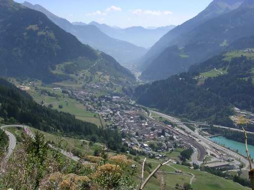
Airolo, CH |
Finally, the village of Airolo is in view. It's time for a well-deserved lunch stop. There's more downhill ahead with another 2800 ft drop down the Leventina Valley from Airolo to Bellinzona but it's spread over an enjoyable 65 km. The road surface is very good with a traffic level that is not irritating or hazardous. |

Giornico, CH |
If one is not in a hurry there are many picturesque mountain villages in the Levintina Valley waiting to be captured in a timeless moment. |
|
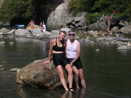
But we didn't dawdle too much in the 90 degree heat except for a cool-off in Biasca with a splash in a mountain stream. |
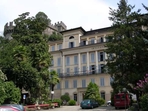
Youth Hostel Bellinzona, CH |
We were exhausted upon arriving in Bellinzona. The youth hostel is very comfortable as it had been a girls' school in a previous life. We all had either single or double rooms. Wide hallways and elegant stairways aren't exactly commonplace in the proletariat atmosphere of most youth hostels. This place is nice and it's located right in front of the marvelous Castello di Montebello. We stayed two nights to allow for a day to explore Bellinzona and its castles. |
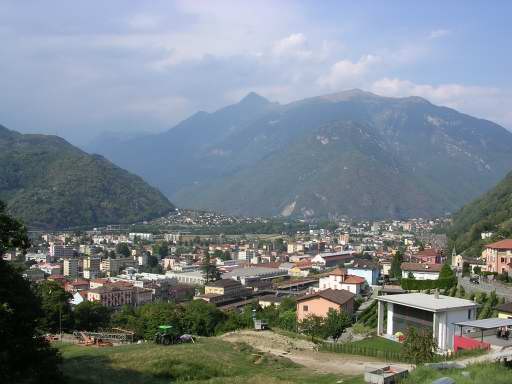
Bellinzona, CH |
Bellinzona, the capital of Ticino canton, commands a strategic location at the confluence of the Leventina Valley (left) and Mesolcina Valley (right). This site controls traffic to the alpine passes of St Gotthard and San Bernardino. Not surprisingly the town has one best preserved examples of medieval fortifications in Europe and has been designated a UNESCO World Heritage Site. There are three superb castles with sections of city walls drawing a curtain across the valley floor. |

Castel Grande |
The most important is Castel Grande sitting on a massive rock outcropping. It's located closer to the center of the valley floor than the other two castles. Fortifications were built on this site by the Romans as they expanded to conquer the Alpine region. The castle was the center of Bellinzona's power struggles between Italian kings, local rulers, and the Germanic empire during the earlier parts of the Middle Ages. By the early 1500's Bellinzona fell under the control of the Swiss Confederation. The recently restored complex provides castle lovers with a nutshell history lesson and nice views of the town. You can either follow a steep walk up or take the elevator. |
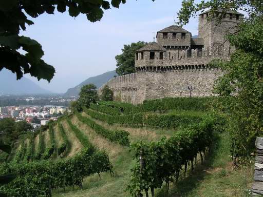
Castello di Montebello |
Just to the east, on a higher elevation right behind the youth hostel, is Castello di Montebello. The crenellated parapets bristle with medieval bravado as vineyards spread out below the walls. Smaller and more intimate than its imposing sibling this castle is fun and easy to explore with great views of the town in all directions due to the higher elevation. Both castles have small museums. |
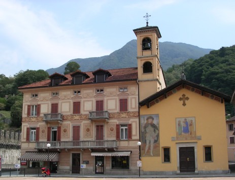
Piazza Independenza, Bellinzona |
We did not visit the third castle in the triad, Castello di Sasso Corbaro. It is situated at a still higher elevation requiring a walk that was a bit too ambitious for those of us "castled out" by the previous two fortifications. Instead, we enjoyed the small town charm of Piazza Independenza just a couple minutes walk from the youth hostel. |
| Part 5: Locarno, Centovalli & Rhône Valley to Montreux |
