| FIND A VILLA | Bayview Bungalows | Bayview Movies | The surroundings | Makrigialos | Excursions |

| DAY TRIPS AND EXCURSIONS THAT YOU CAN MAKE FROM THE BAYVIEW BUNGALOWS IN LAGADA |
|
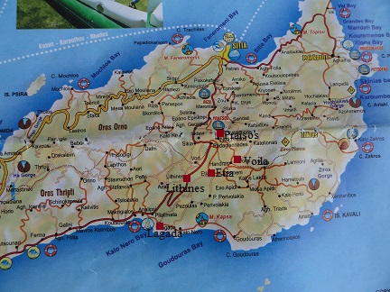
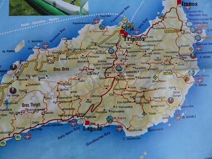
Below I have described a couple of day trips you can make from the Bayview Bungalows. If you want to know more about a certain village, beach or church, then click on the link to read more about it and see all the pictures. These are just some examples of tours and walks you can do in this area, because there are a lot more. For some trips it is useful to leave early and keep track of how much time you need to drive back. |
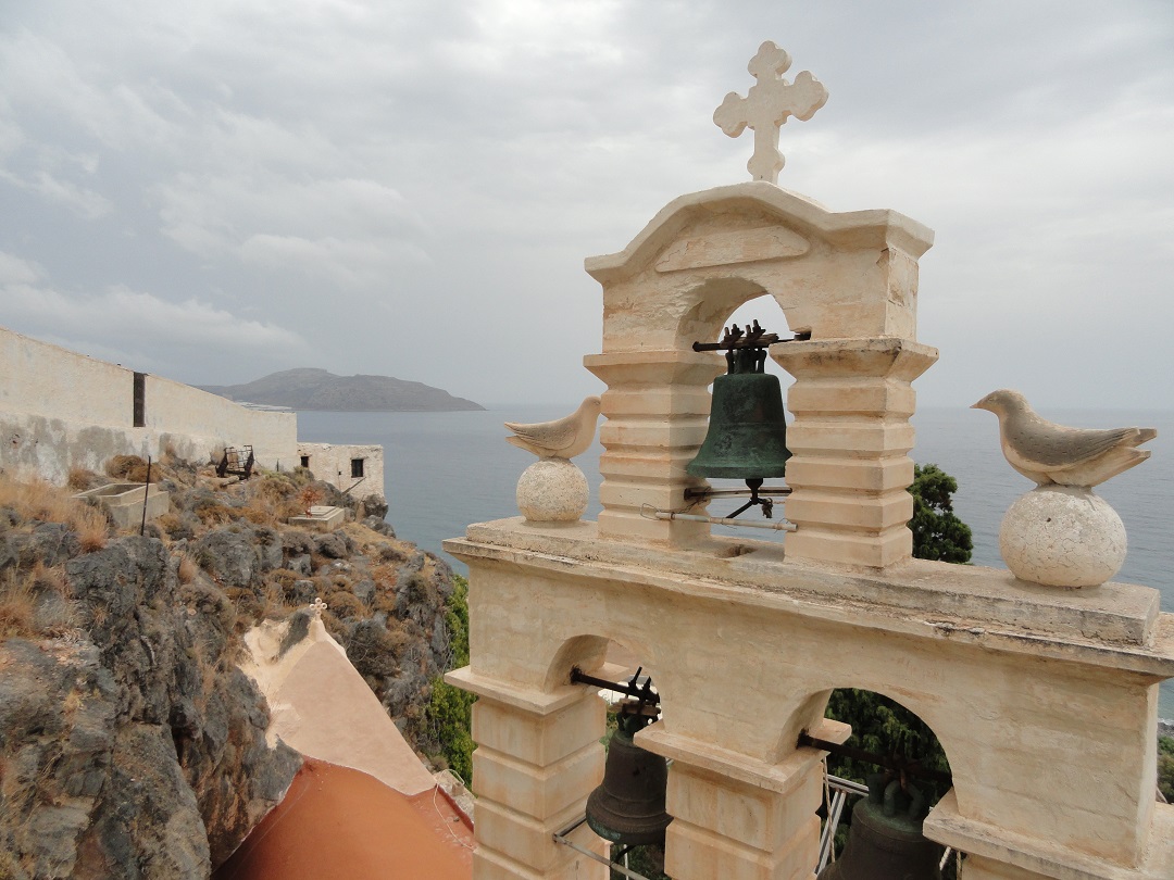
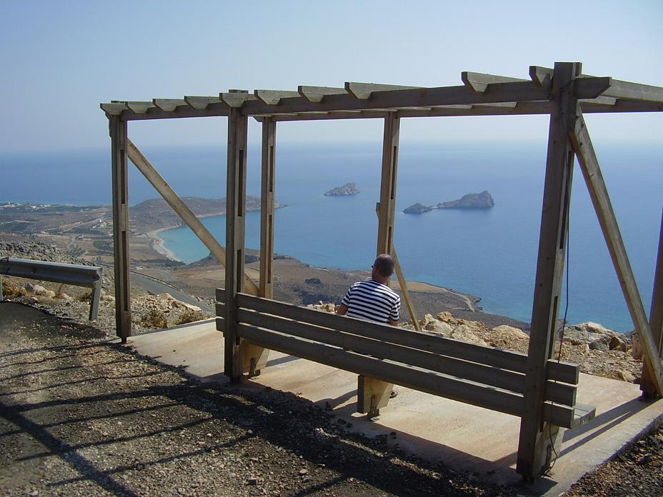
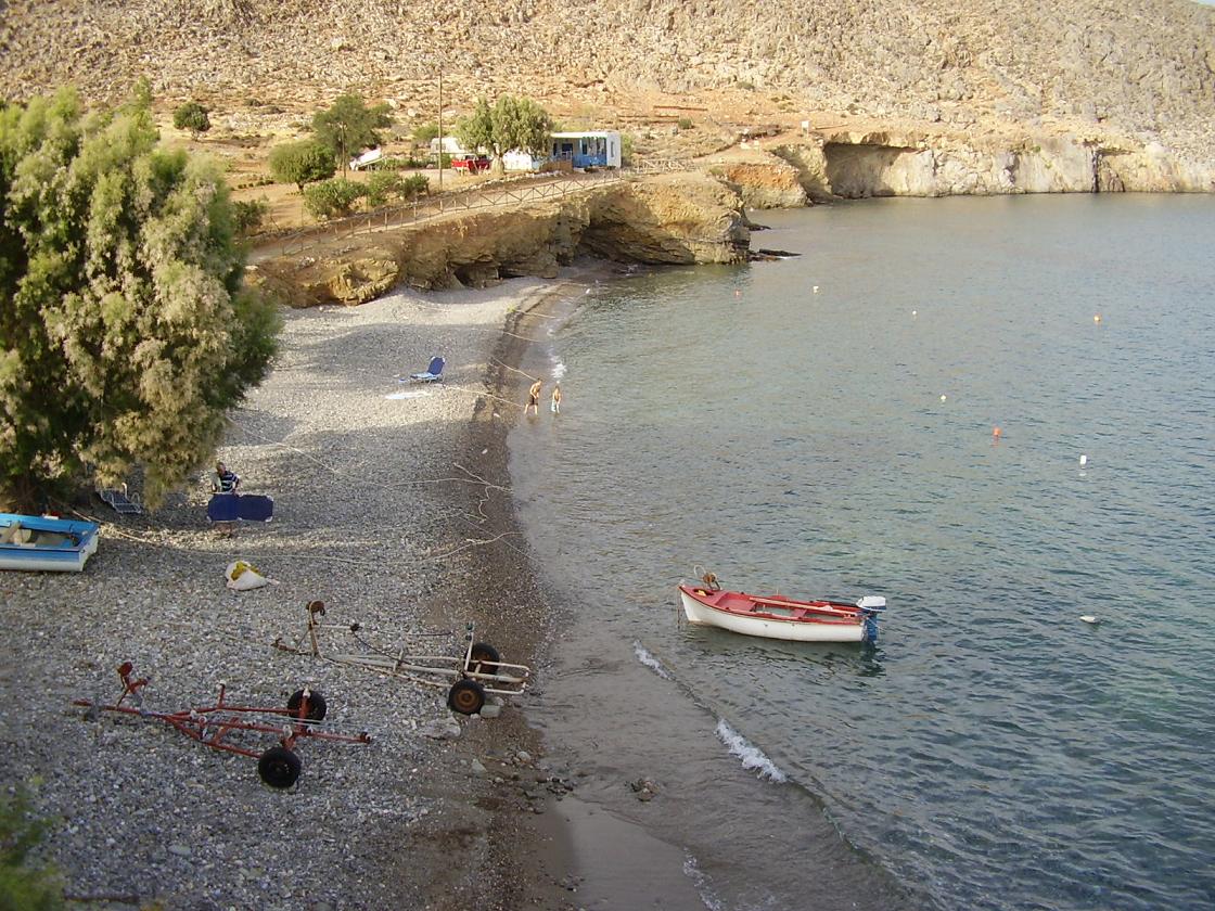
| Trip 1: Moni Kapsa, Xerokampos and Kato Zakros |
 |
 |
 |
 |
 |
|
Drive into Goudouras and than up into the mountains, head towards Ziros en just before the village you take the exit to Xerokampos. Xerokampos is actually not really like a village or a beach, but it is more like a collection of different beaches, and groups of houses, a hotel, a pension, a few tavernas. The houses, the accommodations and the tavernas lie a bit scattered over the valley. There are crudely said three "main beaches" and than there are several other smaller beaches in the area. On some parts of the larger beaches you can rent an umbrella, but most of the beaches are unspoilt. This was really a fun part of Crete in our point of view and it's also a pretty part, with cute islands in the front, and it is quiet. In Xerokampos there are also the remains of a Hellenistic settlement to be seen. Nice as a bonus but nothing too spectacular. If you keep on driving the road straight ahead you will end up on the road to Kato Zakros. This road is not yet indicated on a lot of the maps. In Kato Zakros you find three beaches, the remains of a Minoan palace, a cave, the Dead Gorge with Minoan tombs and cosy taverns. En route between Zakros and Kato Zakros you will also pass the remains of a Minoan Villa. I like Kato Zakros very much because of its simplicity, the friendly inhabitants and the kind of tourists that visit the place and stay overnight. |
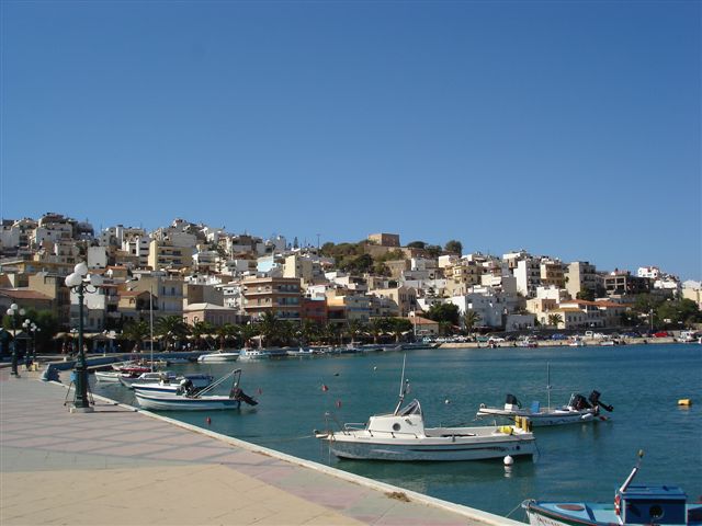
 Leave Lagada and drive towards the east (Goudouras). After a short while you will see the
 | Trip 2: Lithines, Etia, Voila and Praisos |
 |
 |
 |
 |
 |
|
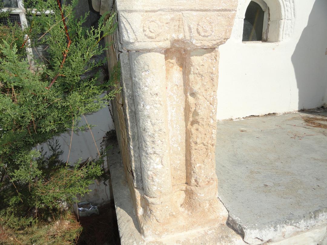
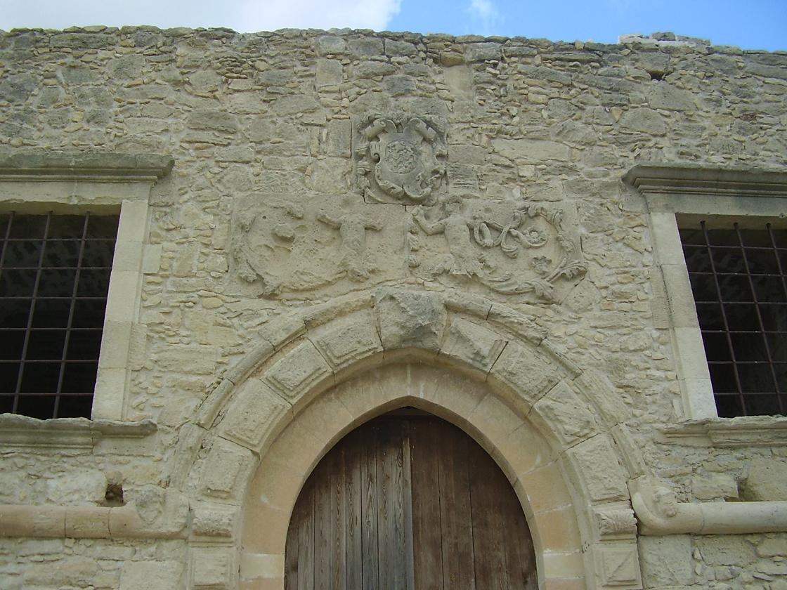
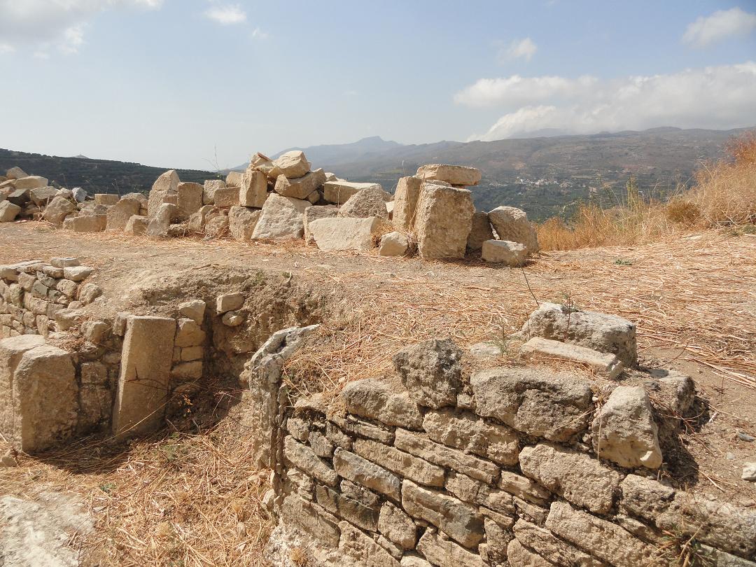
In the village of Lithines there are a few churches. The most important is the church of the Virgin Mary of Lithines which dates from the 15th century. Inside the church are several icons, including an icon of the Virgin Mary of which it is said that it can heal people. The strange plates that are stuck on the church wall were put in by the workers who built the church. These are the actual plates that these people have eaten from. In the southeast of Crete near the village of Armeni and at 2 kilometer distance from the village of Papagianades (where you can take the exit to Armeni) are the remnants of the old Venetian village Etia. Once the village was inhabited by almost 600 people. Now the houses in the village are in ruins, the streets and alleys are empty, and the large Venetian private villa on the outskirts of the village is being restored (2008) to its former glory (after it was distroyed by the Greeks during the revolution of 1867 because the Turkish invaders were housed in the villa). This is perhaps the most beautiful private Venetian villa on the island and it belonged to the De Mezzo family. The Mezzo family originated from the town of Sitia. The Venetian villa at Etia dates from the 15th century. It is a witness to the wealth of the former conquerors. Etia already existed in the Byzantine period, but prospored most during the Venetian occupation. In the village of Etia there are also a couple of beautiful old churches (including two Byzantine, the St. John and St. Aikaterini) that are worth having a look at. The medieval Venetian village of Voila is situated in the east of the island of Crete, about one kilometer from the village of Chandras. It is indicated with a brown sign and the last 200 meter or so to the site are over a dirt track. The remains of buildings are spread out over the hills here. The most striking on the site is the tower of Tzen Ali. The tower stands on a hill and was part of a fortress. According to a Turkish inscription it was built in 1740-1741 (the inscription says 1153 but this is in the Islamic calendar). Tzen Ali was probably a Venetian nobleman of the Zeni or Zenos family, that was converted to Islam. The tower now is partly ruined, but the bottom is still almost completely intact so you can take a look inside. Next to the tower are the remains of the church of Tzinalis. Around this fort are the remains of the old Venetian houses, some of which still have rooms intact. There is also a Turkish fountain on the site. The 15th century church of Agios Georgios is situated a little further on another hill. It consists of two parts that are stuck together. The church bears the cota of arms of the Solomon family and inside the church where the fresco of the Virgin Mary is, you can find the tomb of this family. The remains of the ancient town of Praisos are located on a hill in the east of the island of Crete. The last few miles to the site are over a narrow and sometimes bumpy road (but not a dirt track). Eventually you'll end up on a parking lot at the bottom of a hill and you do the last bit on foot (look out for the arrows that indicate the easiest route). In the parking lot there are signs with information about the site. There are remains of a temple, of houses and a city wall, but a lot of it is no longer intact. In the 2nd century BC Praisos was inhabited by the descendants of the Minoans. They had fled to this area in order to escape attacks by the Dorians, but eventually after a battle the town fell. Both Ieraptyna (nowadays Ierapetra) in the south and Itanos in the north were Doric towns and there were frequent conflicts about who had control of the temple of Zeus at Paleokastro. In 155 BC Praesos was destroyed by Ierapetra. |
 The village of
 | Trip 3: Sitia, Tripitos and Itanos |
 |
 |
 |
 |
 |
|
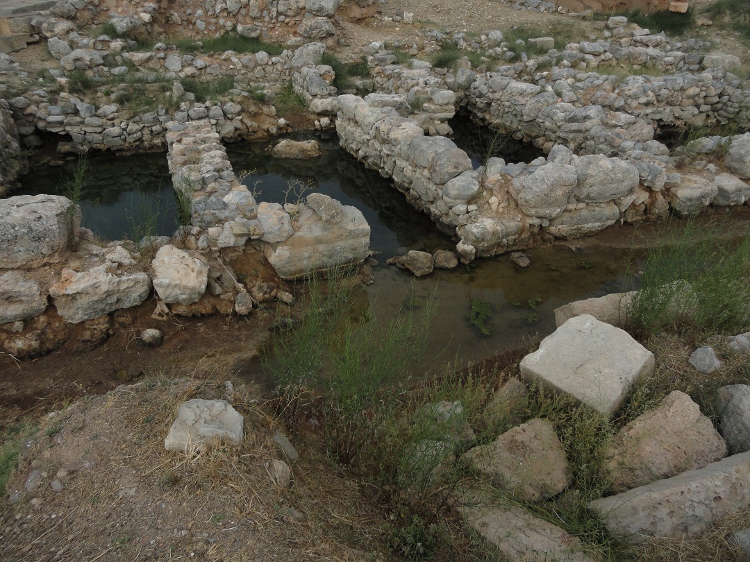
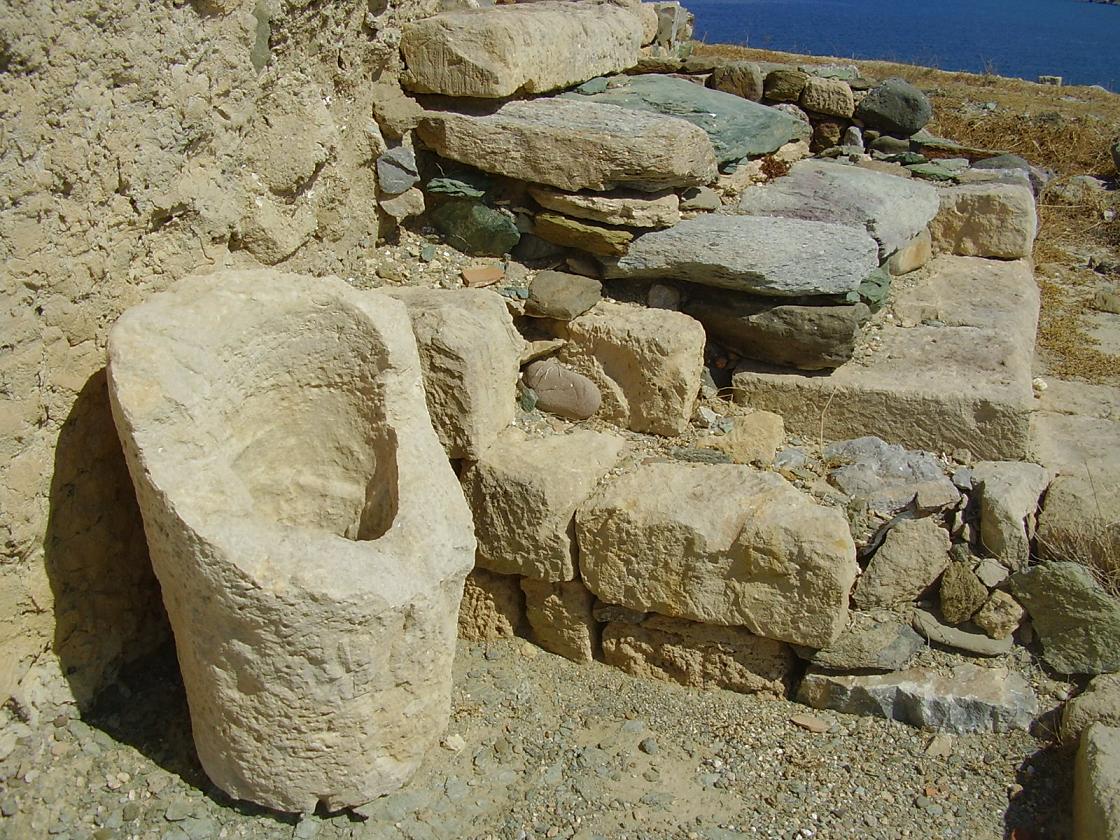
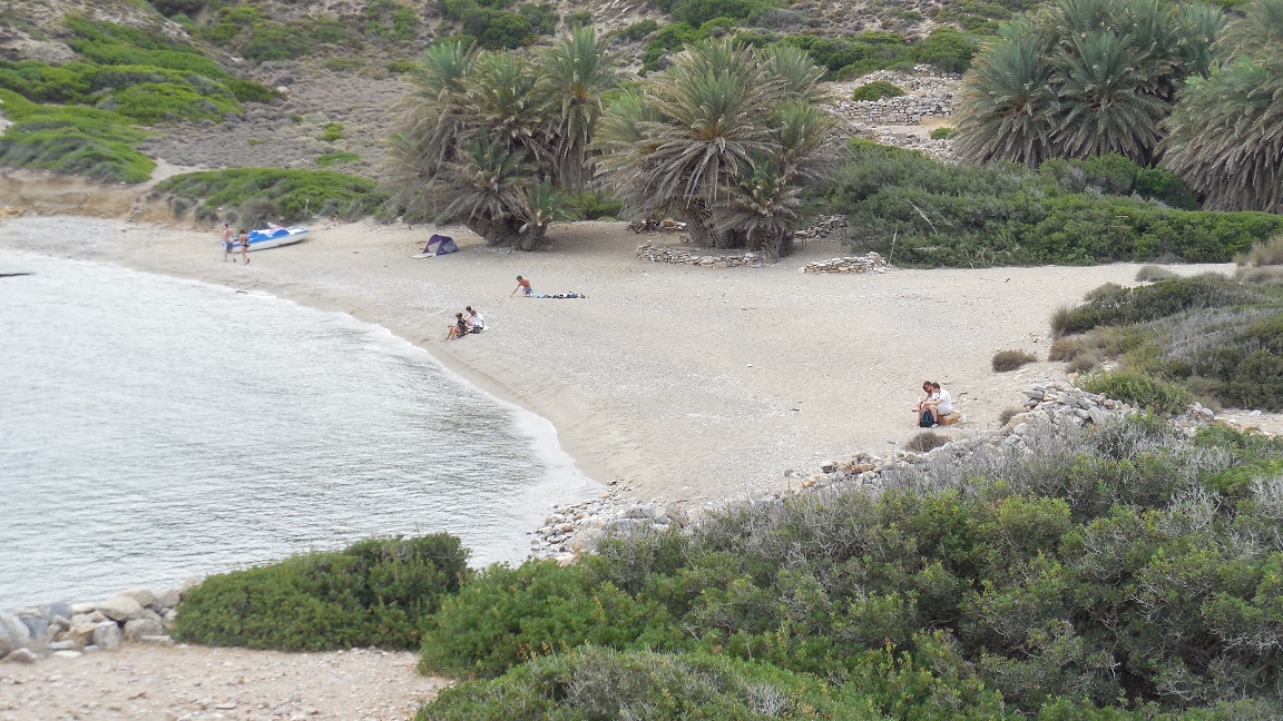
There's a long boulevard with lots of taverna's and coffeeshops, and some palmtrees and roses. Behind that are the shopping streets. The town is topped by the Venetian Kasarma castle that in its nowadays shape dates from 1631. It is built on the remains of an older Byzantine castle. Within the walls is a three storey tower. This is the old armory of the Venetians, the socalled "casa di arma". Maybe the remains of the Venetian fort are less impressive than some of the other castles you can find in Crete, but the views from Kasarma are wonderful. The townbeach is not the most inviting of Crete though, only 1 kilometer long, not very wide and close to the main road. It also did not make a very clean impression if you got further out of the town where there are no sunbeds and parasols. The water is clear though and the beach is shallow and suitable for small children. My judgement: for such a big place not bad at al ;), nice for a visit, because there is a really good atmosphere. If you want to spend only all your time on the beach than maybe it's better to look somewhere else Drive out of Sitia towards the palmbeach of Vai. At three kilometers east of the city of Sitia you can find the archaeological site of Tripitos of Trypitos (350-50 BC). This former small Hellenistic city with its protected harbour and shipyard is located on the hillside of a small peninsula. The exit is clearly marked from the road. A narrow path leads you to the excavation. Only a part of this settlement has been excavated. There were coins, pottery and jewelry found. Even now you when you walk on the paths of this settlement you can see the pieces of orange pottery on the ground. There are remnants of a city wall, stone houses and large stone utensils. From the peninsula you have a spectacular view over the beaches and the town of Sitia in the distance. A short drive north of the famous palm beach of Vai (in the north east of Crete) you find the relatively isolated bays and beaches of Itanos (also including a rather nice and relatively quiet sandy nudist beach). As an extra bonus there is a Minoan city at the entrance of the main beach. Itanos was one of the most influential places in the east of Crete. It florished from early Minoan to early Byzantian times. There are traces of a basilic and of Greek walls, and a lot of fallen apart traces on the hill. |
 Drive towards Makrigialos and take the exit to Sitia.
The town of
Drive towards Makrigialos and take the exit to Sitia.
The town of © Hans Huisman, https://www.angelfire.com/super2/greece/ 2014