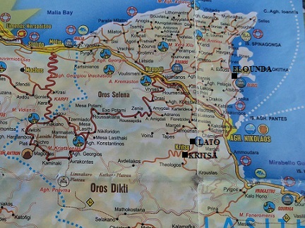
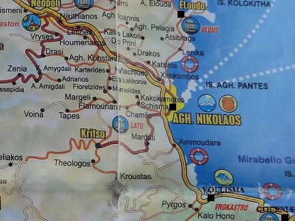
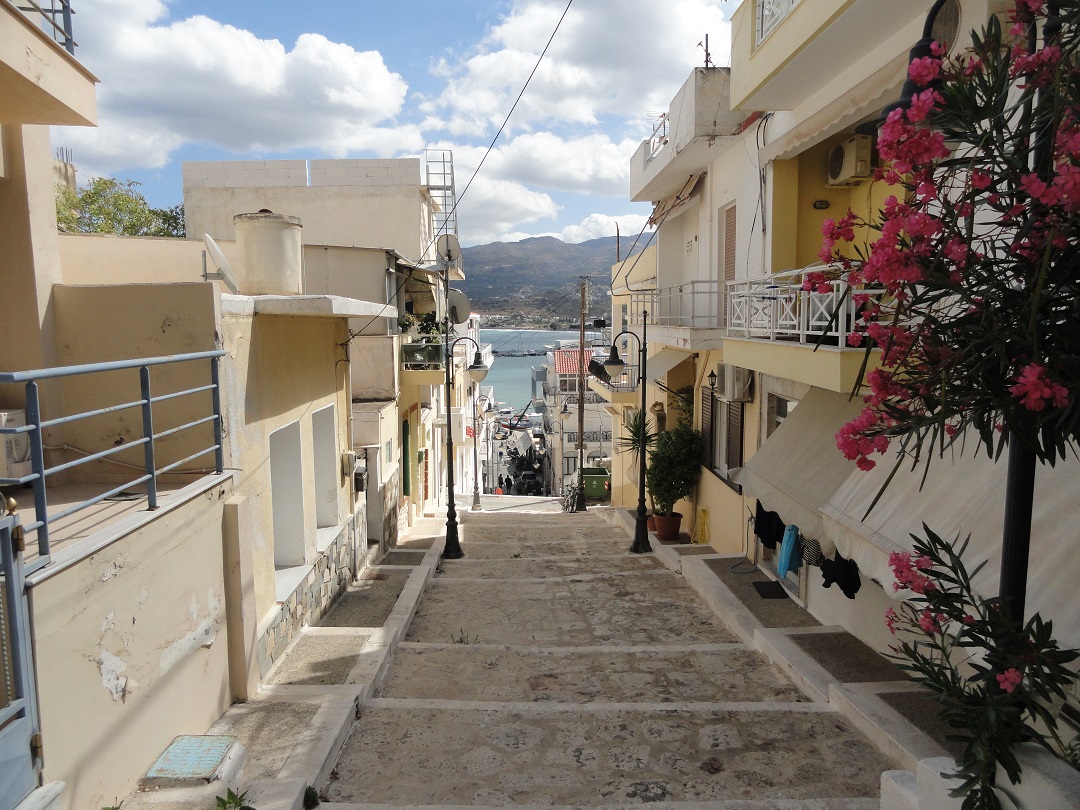
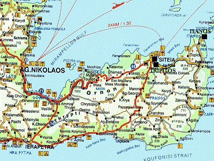
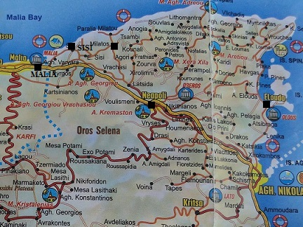
| FIND A VILLA | Elounda Solfez Villas | Videos of the villa | Elounda | The surroundings | Excursions |
Google Chrome thinks enlarging my pictures, some links and sometimes scrolling through the pages is a popup. If you want to navigate my website than please allow "popups". |

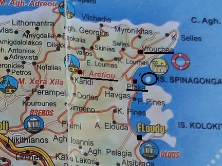
| DAY TRIPS AND EXCURSIONS THAT YOU CAN MAKE FROM ELOUNDA SOLFEZ VILLAS IN ELOUNDA |
|
Below I have described a couple of day trips you can make from Elounda Solfez Villas. If you want to know more about a certain village, beach or church, then click on the link to read more about it and see all the pictures. These are just some examples of tours and walks you can do in this area, because there are a lot more. For some trips it is useful to leave early and keep track of how much time you need to drive back. |
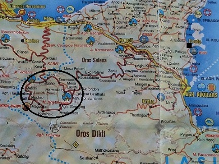
| Trip 1: Panagia Kera church - Kritsa - Lato |
 |
 |
 |
 |
 |
|
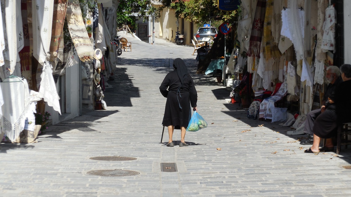
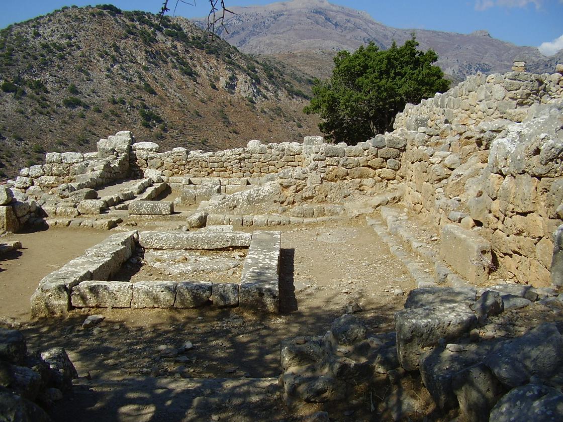
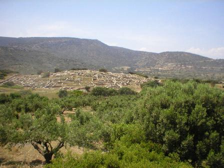
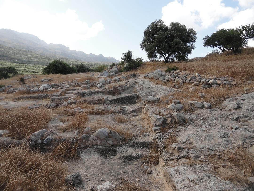
The village of Kritsa is 8 kilometer south west of Agios Nikolaos, to which it has a regular connection by bus. It is a traditional mountain village with lots of narrow streets and several Byzantine churches. There are mini-markets, souvenir shops and taverns, and there is a bakery, a post office and an ATM machine in Kritsa. The village is quite large and has approximately 2700 inhabitants. If you are going to look further than just the main street with all the shops you will see cute narrow streets with photogenic old dilapidated cottages. The ancient Doric city of Lato is situated in a beautiful natural place, about 4 km north of the village Kritsa. You can reach the village over a narrow but good asphalt road that leads through the olive groves, than take the exit and go to the parking lot. Now you take the stairs up to the site. Lato was founded in the 8th century BC by the Dorians and it was built between two hills. The city is named after Leto, the mother of Apollo and Artemis, but the main goddess that was worshiped here was Eileithyia (the goddess of fertility and birth). This goddess is also depicted on the coins that were minted in the city. Lato is also the birthplace of Nearchos, the famous admiral of Alexander the Great. |
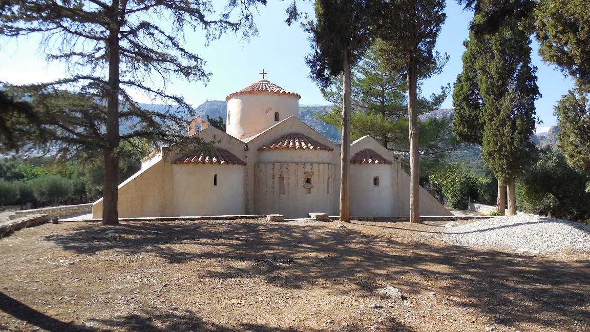
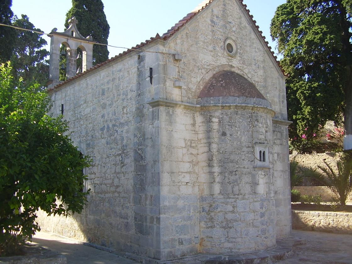
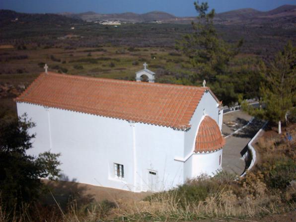
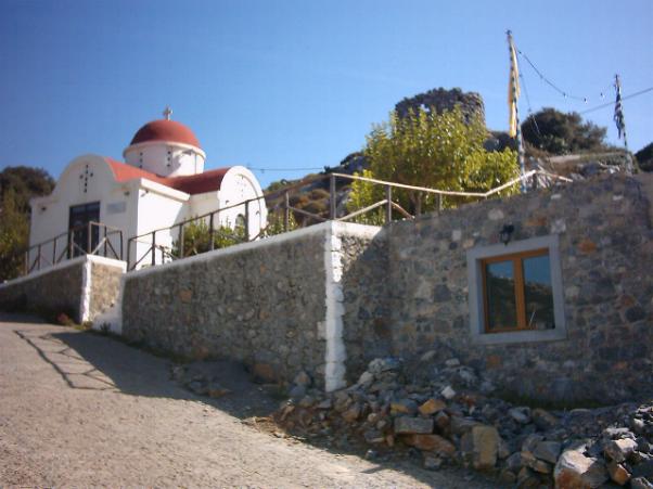
 One kilometer before the village of Kritsa, in the site named "Logari" is the old Byzantine church of
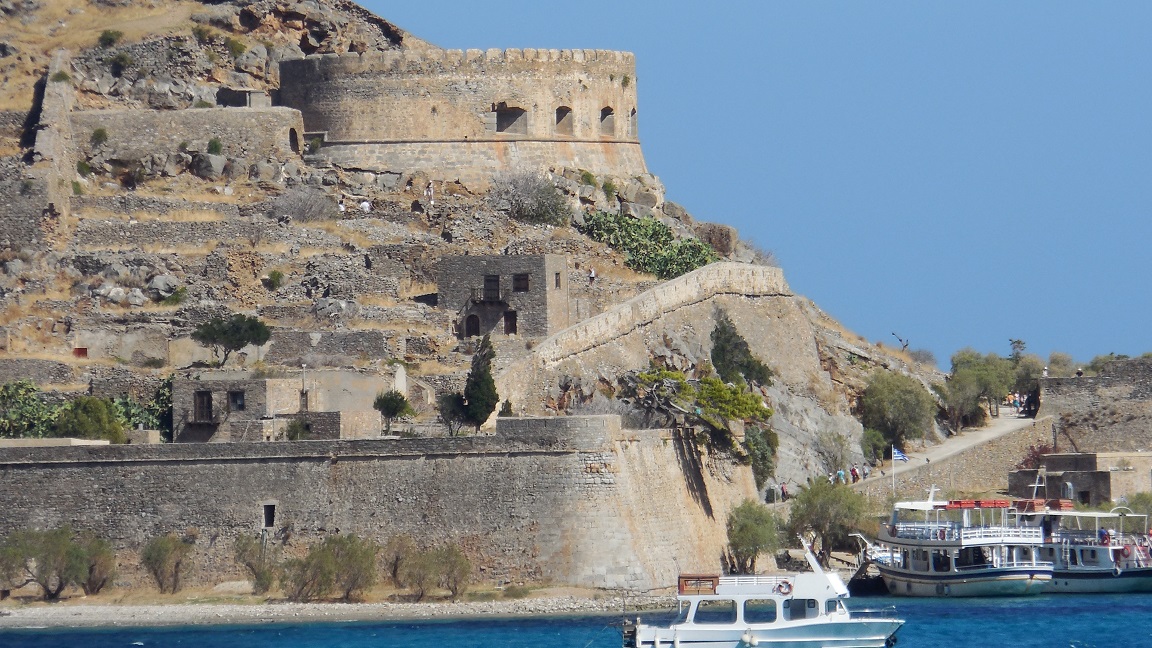
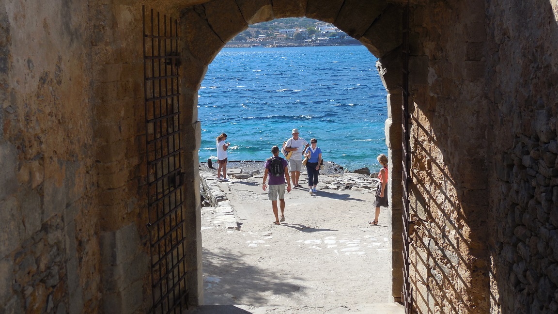
 | Trip 2: Plaka - Spinalonga island - Vrouhas - Moni Aretiou |
 |
 |
 |
 |
 |
|
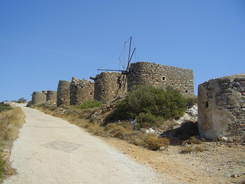
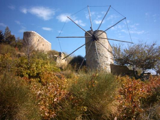
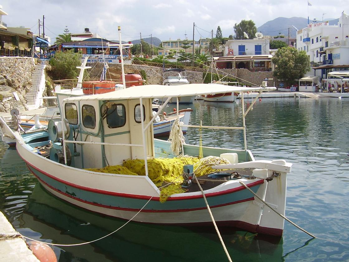
The Venetians built a big fortress on the tiny island of Spinalonga close to the town of Agios Nikolaos (in Crete). Here and in the villages of Elounda and Plaka you can find boats that visit the island of Spinalonga for a day trip. It takes about an hour to walk around the entire island. Spinalonga is quite impressive, especially when you walk past the large buildings that used to be the hospital and you realise what has happened here only last century. The fortress and the rest of the buildings are all in pretty good shape (there's also a renovation going on). The village of Vrouhas or Vrouchas is a small village situated a little north of Elounda and Agios Nikolaos on the Agios Nikolaos - Elounda - Plaka - Vrouhas route. It is a quiet village in a rural and agricultural setting with olive groves, forest and vegetable fields. Just outside the village of Vrouhas on a hill there is am interesting row of old windmills that were built around the year 1800 and that were used for grinding corn. Most of them are still in pretty good shape. A little bit east of the village on a cape there is a lighthouse. The 16th century monastery of Moni Aretiou is built against a mountain in a fairly dry and inhospitable place northeast of Neapoli. The monastery has recently been restored. Within the high walls of the monastery are two beautiful churches, which are very dark inside. The biggest church of the two is dedicated to the Holy Trinity, the other to St. Lazarus. The monastery Aretiou was the most prosperous monastery in the region of the Mirabello Gulf. In the courtyard of the monastery grow cypresses, palms, flowers and fruit trees, especially lemon trees, but also other fruits (that were unknown to me). Funny are the bell towers which are not in a tower but that are just hanging on a rope between two trees. |
 The road from Elounda continues following the coastline to the north to the small village at the end of the peninsula, called
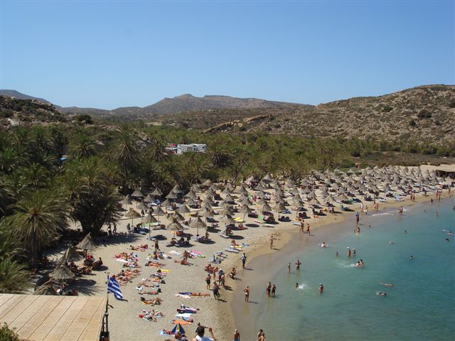
| Trip 3: Kavousi - Tholos beach - Mochlos |
 |
 |
 |
 |
 |
|
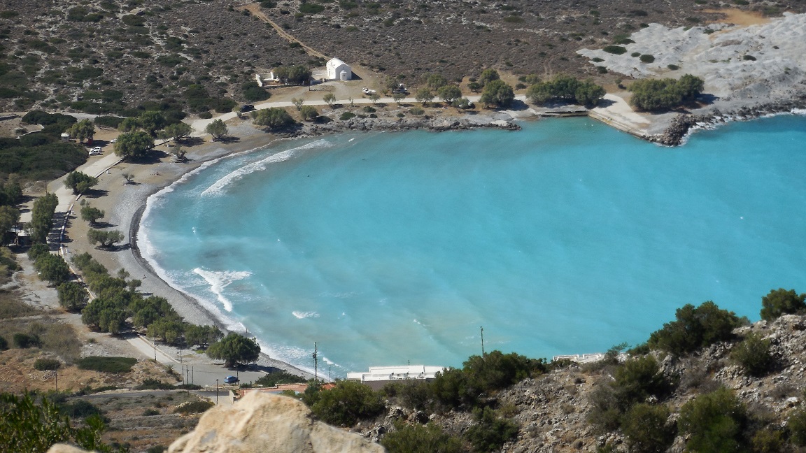
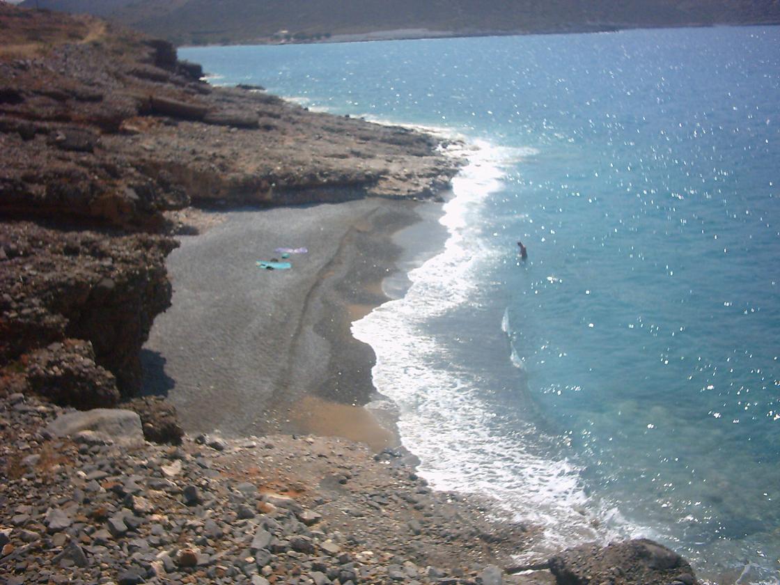
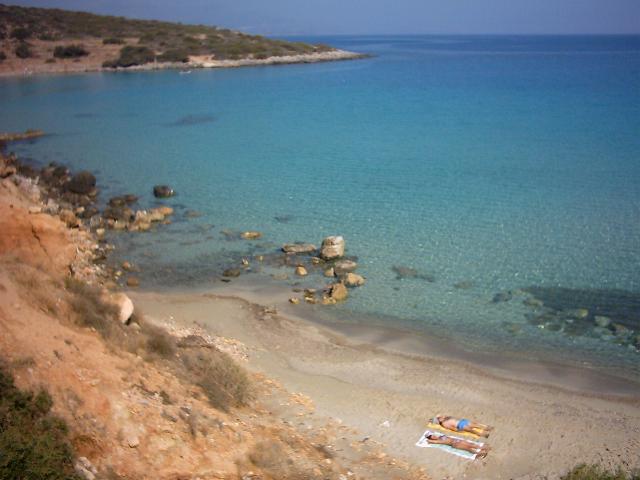
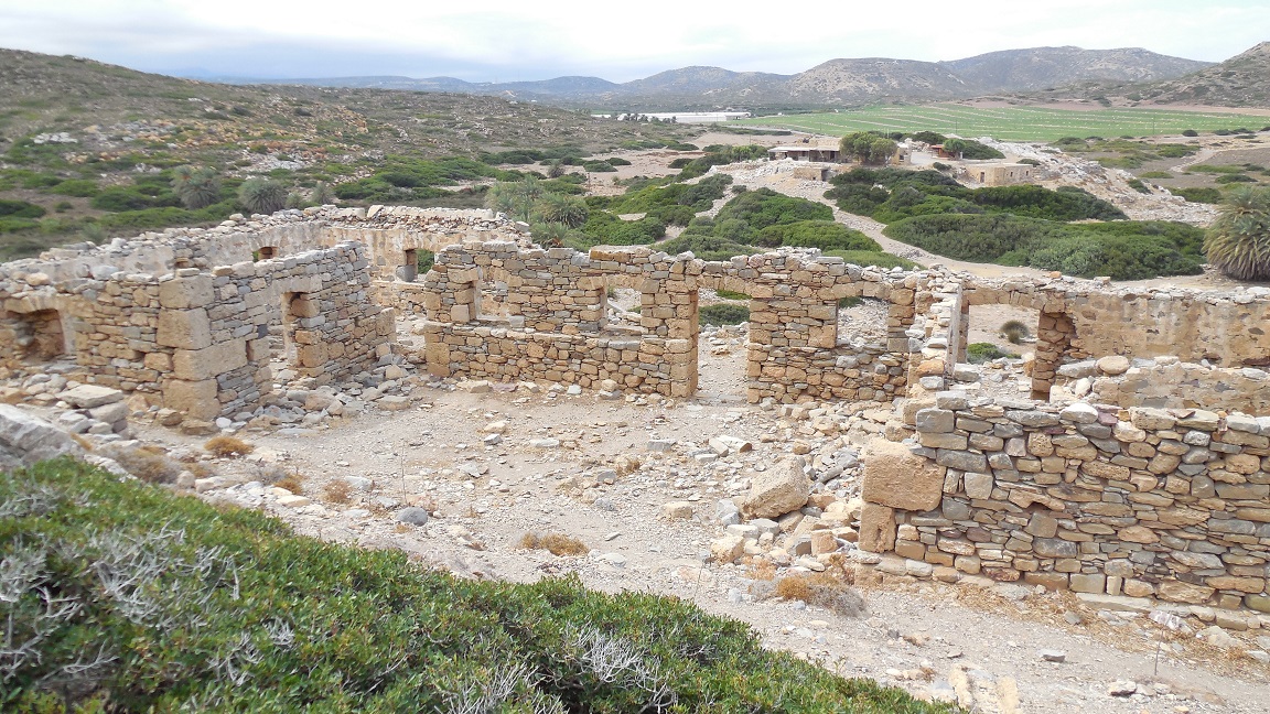
Halfway between Agios Nikolaos and Sitia lies the village of Kavousi, and a road leading from this village will take you to this hidden gem: the beach of Tholos. It's quiet, the water is the most turquoise I've ever seen, there's an island right in front of it: it's just absolutely stunning!! On the beach there is a 2 square meter taverne, and one house where you can rent rooms. Together with a small church and one more house this is about all the buildings that you can find here. Kouremenos and Ithanos also very, very nice, but this would be my number one tip for a beach in the north of Crete. A little bit past the main beach is another smaller hidden beach that is used by naturists (in this case: us, because it is usually empty). Naturism and beautiful nature go hand in hand here. Mochlos has extensive Minoan remains, most of which are on the island with the same name (Mochlos) opposite the village, next to the little chapel. A Minoan settlement was found in the south of the island and also a cemetery and several tombs were uncovered in the west. Sometimes there's a boat that will take you there, but I have seen people swim to the island). The boat can take you to the island of Mochlos or to the island of Psira. Mochlos island is not far out of the coast, only about 150 meters. In Minoan times the island was probably an important harbour and still connected to the mainland of Crete. Also on the mainland of Crete, behind the current village of Mochlos, two work places have been discovered. |
 The village of
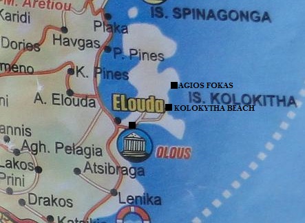
| Trip 4: Elounda - Ancient Oulos - Kolokytha beach - Agios Fokas church |
 |
 |
 |
 |
 |
|
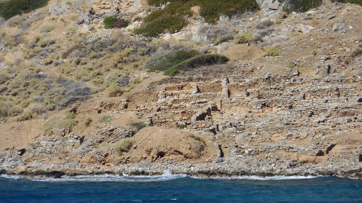
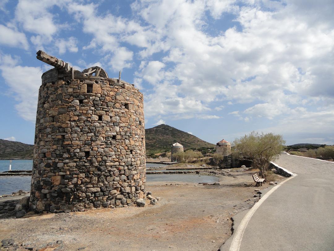
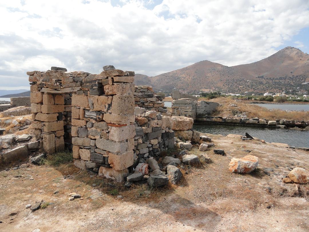
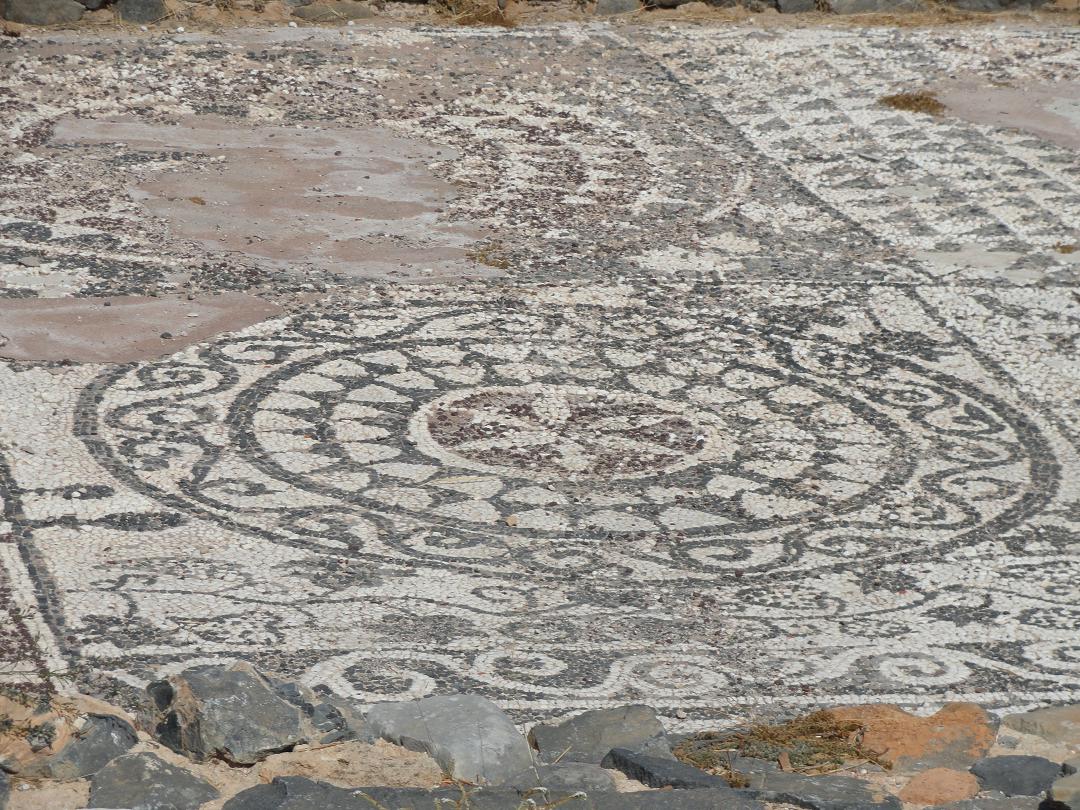
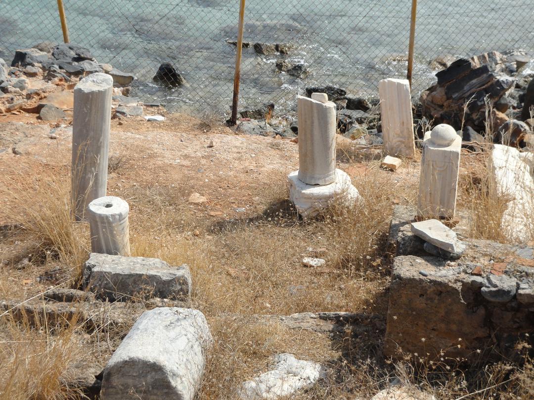
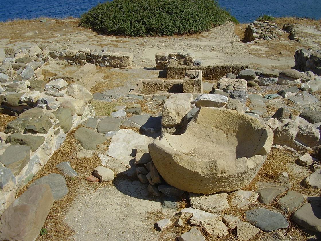
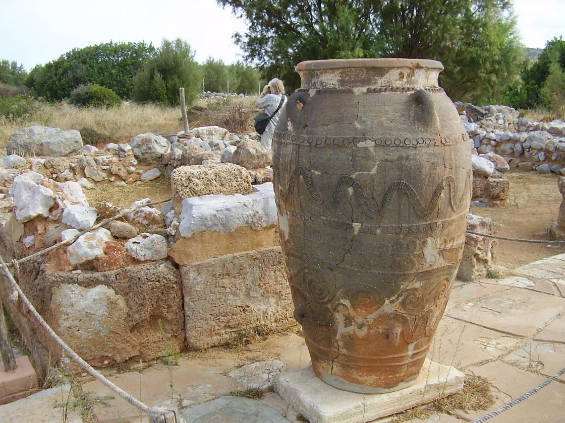
Olous was a Minoan city which had about 40,000 inhabitants. The eruption of the volcano on Santorini and the gradual lowering of the soil in the eastern part of Crete have caused that the city is now largely submerged under the sea. Olous was often in conflict with its neighbours of the city of Lato (near Kritsa). On the site statues, vases and coins with the name of Olous on it were found. The first remains of this ancient city you will see along the small canal at the windmills when you go to the Spinalonga peninsula. Here there are some remnants of walls and a large stone with a function unknown to me. You can also see sunken walls still next to the small white church on your right hand side. If you take a look behind this church you will see more remains, including a large feeding bin, and many pieces of pottery that testify that people have lived here long ago. If you still want to see more of the city then you can go snorkeling. Directly behind the windmills, reachable over a path that leads from the taverne you will see here, you can find the remains of the early Christian basilica with its mosaic floors. When you walk across the island you will encounter even more antiquities. After about half hour, after you have climbed over the hill and climbed back down to the shore again, you have reached the small beaches of Kolokytha Kolokytha on the other side of the peninsula. Here are remains of antique house and a lot of columns. The beaches are also a stop for the excursion boats that leave from Agios Nikolaos and Elounda to go to Spinalonga Island (the former leper colony with the Venetian fortress), so it can get crowded. You will have a beautiful view of another small island (Kolokytha) just off the coast. We walked further to another church (the Agios Fokas church) that you can see on your left hand side. The walk from the beach to this church also takes about half an hour (1.5 km). Supposedly it is a Byzantine church but probably so well restored it looks almost new (but you could for instance see that the stones around the windows were really old). |
| Trip 5: Agios Nikolaos - Gournia - Voulisma beach |
 |
 |
 |
 |
 |
|
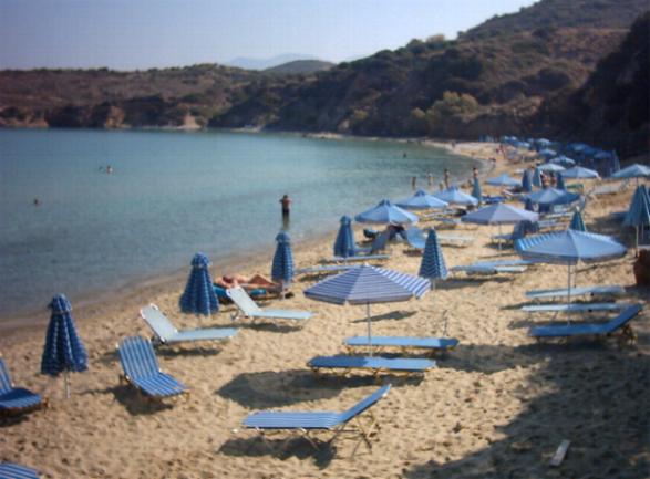
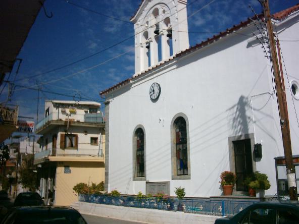
Agios Nikolaos has become a very populair tourist desination, so it can become crowded. On a hill at San Nicolo Bay, where the Venetian ships made their stops, you can find the well preserved Agios Nicolaos Church that dates from the 10th century (next to Hotel Minos Palace - supposedly with special, bright and beautiful fresco's of saints, but it was closed when we were there, the key is in the hotel). This Minoan "Pompeii" is situated on a hill close to the sea, where once a 14km long Minoan road lead south to Ierepetra. There are no palaces in the center of attention. Gournia was a city for ordinairy people, with homes, workshops an shops. There was even a sewage system. The center is a square on the top of the hill, with next to it a sanctuary. The streets are paved. the houses were two to three stories high. Downstairs was the place for the cattle and the supplies, upstairs were the living quarters. Here and there there are in the floor places to drink for the cattle (in Greek these are called "gournes", and this is where the name derives from). The beach of Voulisma is one of the beaches at Istro village, a little east of Agios Nikolaos. It's a nice sand beach with clear turqoise waters. The beach is organized and there are sunbeds and umbrellas for rent. Near the beach there are tavernas. There is also some choice for accommodations in this area. |
 Some people like it and some people don't, like with most places. And although
| Trip 6: Lassithi plain - Exo Potami |
 |
 |
 |
 |
 |
|
Exo Potami is a small traditional village east of the Lasithi Plain on the way to Neapoli and Agios Nikolaos. It's a sleepy village where some people sell honey. Between the old stone houses along the main road that leads through the village you find the cute yellow village church with its red roof. Just outside Exo potami on the side of the road you will see a couple of nice old stone windmills. |
 The
The | Trip 7: Sitia - Tripitos - Vai or Itanos |
 |
 |
 |
 |
 |
|
There's a long boulevard with lots of taverna's and coffeeshops, and some palmtrees and roses. Behind that are the shopping streets. The town is topped by the Venetian Kasarma castle that in its nowadays shape dates from 1631. It is built on the remains of an older Byzantine castle. Within the walls is a three storey tower. This is the old armory of the Venetians, the socalled "casa di arma". Maybe the remains of the Venetian fort are less impressive than some of the other castles you can find in Crete, but the views from Kasarma are wonderful. At three kilometers east of the city of Sitia you can find the archaeological site of Tripitos or Trypitos (350-50 BC). This former small Hellenistic city with its protected harbour and shipyard is located on the hillside of a small peninsula. The eit is clearly marked from the road. A narrow path leads you to the ecavation. Only a part of this settlement has been excavated. There were coins, pottery and jewelry found. Even now you when you walk on the paths of this settlement you can see the pieces of orange pottery on the ground. There are remnants of a city wall, stone houses and large stone utensils. From the peninsula you have a spectacular view over the beaches and the town of Sitia in the distance. A short drive north of the famous palm beach of Vai (in the north east of Crete) you find the relatively isolated bays and beaches of Itanos (also including a rather nice and relatively quiet sandy nudist beach). As an extra bonus there is a Minoan city at the entrance of the main beach. Itanos was one of the most influential places in the east of Crete. It florished from early Minoan to early Byzantian times. There are traces of a basilic and of Greek walls, and a lot of fallen apart traces on the hill. The palmbeach of Vai, in the north west of Crete, is without a doubt the most photographed of all Cretan beaches. Every day from all the corners of the island hundreds of people come to visit it. It is called the Caribean beach of the Mediterenean sea. Vai is famous for its palmtrees, the "phoeni theophrasti". It's typical for Crete and it doesn't grow in the wild anywhere else. You can see them on the beach and in the valley behind it. |
 Situated on the water around a bay in the east of Crete,
 | Trip 8: Pachia Ammos - Vassiliki - Ierapetra |
 |
 |
 |
 |
 |
|
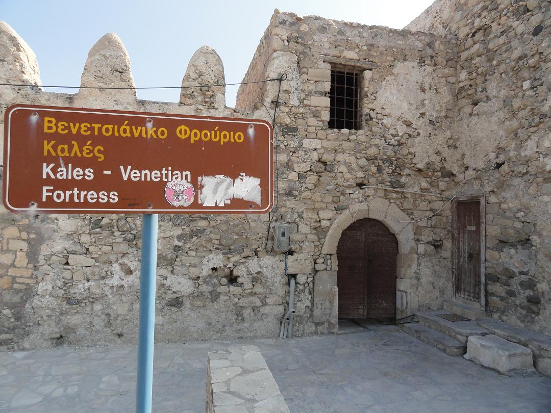
Vasiliki is a nice and quiet village in the Lasithi province, just south of Pachia Amos. You can reach the village through a turn in Pachia Amos, or if you come from the south comes Ierapetra, you can take an eit on the left hand side of the road. There, a little further on the left of the road between the olive groves, are the remains of a Minoan archaeological site. The village of Vasiliki itself however is also nice to take a look at. There is a large basin on the village square and an old church. This water basin has a large number of fish in it (koi carp, I think, I don't know much about fish). There is also a small tavern and there are water springs. The road goes up past old stone houses, bougainvillas and a few ruined houses to the big church that you have already seen from the distance. Ierapetra is the most southern town in Crete and one of the sunniest places in Europe. After Heraklion, Chania and Rethimnon it is the fourth largest town on Crete. Still this town is less touristic than the large towns that you find on the north part of the island of Crete. Even during the summer months you can still find a bit of Greek atmosphere and the local people aren't completely lost in between the crowds of tourists. Ierapetra is a modern city with mostly large concrete buildings. Only the center in the old city with its buildings from the Turkish time and the fishing port is still really authentic. Here are the narrow streets with nice small cosy traditional houses where you can walk around. At the harbour front there are many restaurants and kafenions where you can have a snack or a drink, look at the sea and the people that pass by, and enjoy the sunshine (or the shade!). Here the youth gathers in a couple of the trendy bars. In front of the town hall several artefacts from the antiquity have been put on display, including a sarcophagus and some antique columns. More objects can be seen at the Archaeological Museum of Ierapetra, which is opened every day except on Mondays. At the end of the boulevard is the Venetian fortress of Kales and you come to a square with a clock tower and two churches on it. There is a harbour with colorful fishing boats and you can book an excursion here to the island of Chrissie, which lies off the coast of Ierapetra. Here on this island you have a beautiful sandy beach. On the east side of Ierapetra you find the long beach of the city which runs for kilometers. Here are the most hotels. In spite of the hotels the beach is not really busy and large parts of it are without sunbeds and umbrellas. On some places there are rocks in the sea. |
 20 Kilometer east of Agios Nikolaos on the main road lies the little coastal village of
 | Trip 9: Neapolis - Palace of Malia - Sisi - Milatos cave |
 |
 |
 |
 |
 |
|
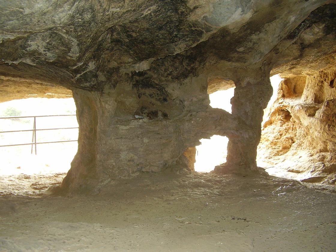
A little bit outside the village of Malia and close to the beach is the Minoan Palace of Malia which dates back as far as 1900 BC. It was destroyed by an earthquacke two centuries later and than rebuilt again. Unlike the Palace of Knossos nothing has been reconstructed here and it is all in the original state in which it was found. The palace covers and area of 7400 square meters and it is the third palace in size after Knossos and Festos. The remains that you can see today date from around 1650 BC. Because they don't know the original name of the palace the simply named it after the nearby village of Malia. In 1450 BC the palace was destroyed again, together with the other Minoan palaces on Crete. Sisi is a small and very attractive village on the north coast of Crete between Heraklion (40 km) and Agios Nikolaos (25 km), just a little of the main road. To reach it you have to drive over a curvy road through the olive groves and the nature. The port of Sisi is charming and long stretched, and it looks like there is a river running through it. From here several boat ecursions are organized (with small boats) to beaches and villages in the surrounding of Sisi. Around this small "river" there are several tavernas where you can have a great meal and have a wonderful view at the same time. There's a path along the coast from Sisi to the nearby village of Milatos that will lead you to three other beaches that are better than the beaches you can find in Sisi itself. Milatos was already a place of importance in the ancient times, when there was a city here. Milatos city was one of the seven cities that took part in the Trojan war. The cave of Milatos is situated a couple of kilometers outside the village of Milatos. You have to drive through the old village (just follow the signs, it is clearly marked). A large stone with the name "Milatos Cave" on it makes it clear that you are there. You have to park your car and than walk about two hundred meters over a path before you are at the cave. You would be wise to bring a torch / flashlight!! When we were there there were no lights and it was pretty dark. Inside the cave there is a small church and there is a memorial with bones, for the thousands of people that were slaughtered here in 1823 during the Turkish occupation. The cave itself is about 2100 m2 large and 73 meters deep with several entrances. Traces have been found that prove that the cave was already inhabited a long time before that. |
© Hans Huisman, https://www.angelfire.com/super2/greece/ 2018