|
The Ochil Hills -
in Central Scotland
|
| |
|
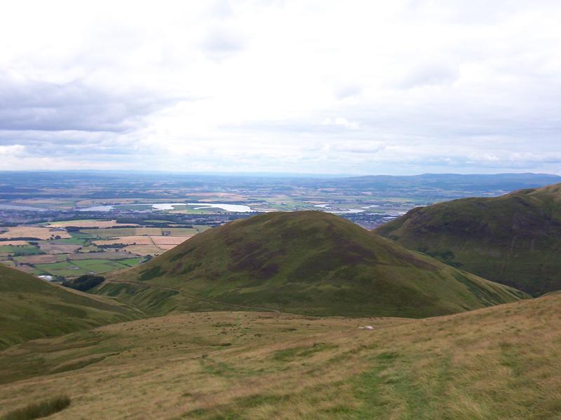
| The
Ochils stretch from Dunblane to Milnathort for more than 35 kilometers between
the Rivers Forth and Tay. The Ochil's highest hill, Ben Cleuch, is 721 metres
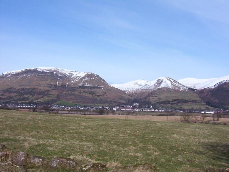
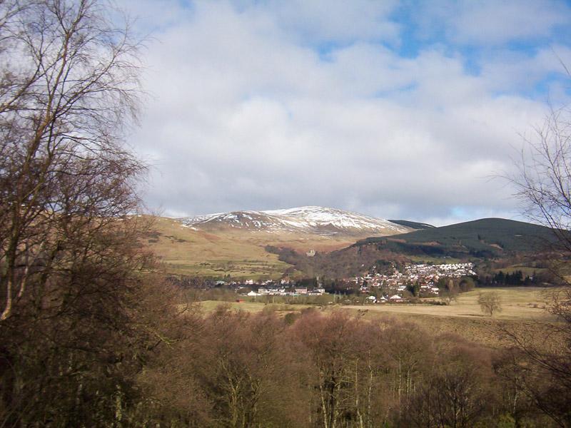
high. The settlements of Blairlogie,
Menstrie, Alva, Tillicoultry, Dollar and Muckhart lie along what is locally
called the 'Hillfoots' on the south side of the Ochils, and there these
hills form the northern boundary of Clackmannanshire, which is Scotland's
smallest county. |
| Click
on the small picture to see the larger version |
|
|
|
|
|
|
|
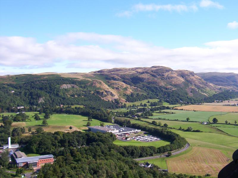
The Ochils (Dumyat) from the top
of the Wallace Monument
|
Alva - in the Hillfoots
|
Dollar - in the Hillfoots
|
|
|
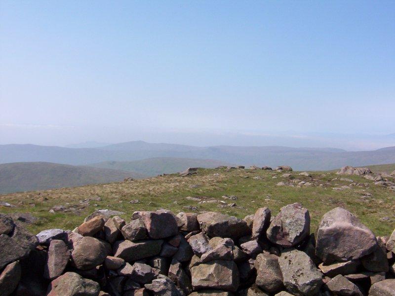
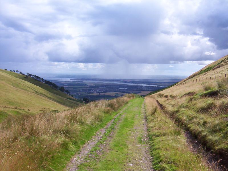
The Ochils
are pleasant enough to walk over on a sunny day, if you are sensible,
but they can be dangerous for the unwary in mist or bad weather
and should never be taken lightly. Alva, Tillicoultry and Dollar
all have Glens with paths laid out for the casual visitor. The
Ochils are sheep country, so it's best to leave the dog at home.
Serious walkers should take a compass and map. Ordnance Survey Landranger
58, Perth to Alloa, - ISBN 0-319-22058-3 is the map I've got. There
are at least two ancient routes across the Ochils (1) Tillicoultry
to Blackford via the Frandy and Glen Bee (an old packhorse route)
and also (2) Dollar to Glendevon via Glenquey and on to Auchterarder
via the Borland Glen (an old drove road). Climbing Ben Cleuch to
see the sunrise on the longest day of the year is a sort of local
thing for young and old.
Ochil
- 'Uchel
or Uxellos' (Brittonic or Celtic) meaning High - Oychellis 1461,
Ocelli montes 1580. 'High ones'.
|
| |
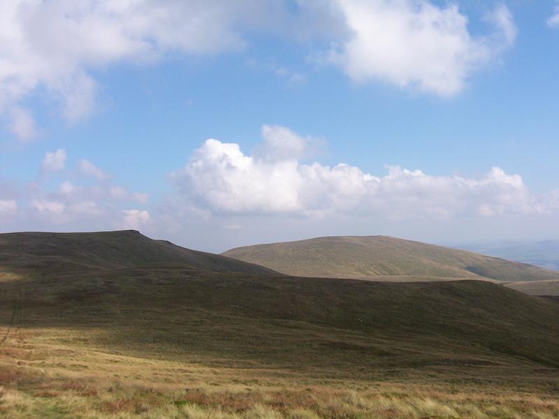
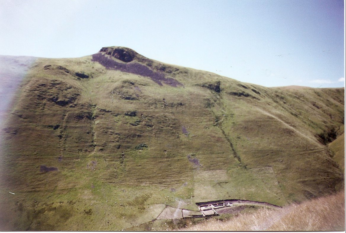
| Ben Cleuch - 721
metres - The Ochils highest hill. |
| The name is perhaps from 'Clach' or 'Clioche'-
Stony peak - it has rocks at the top - or cleuch (scots) after the
ravine below it - the Daiglen - or from 'cliatach' - a slope
|
|
 |
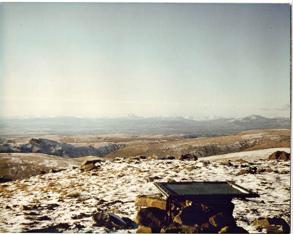
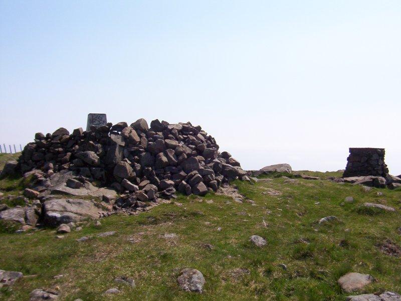
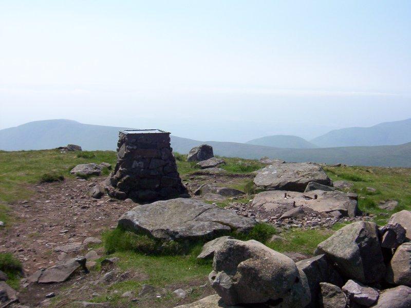
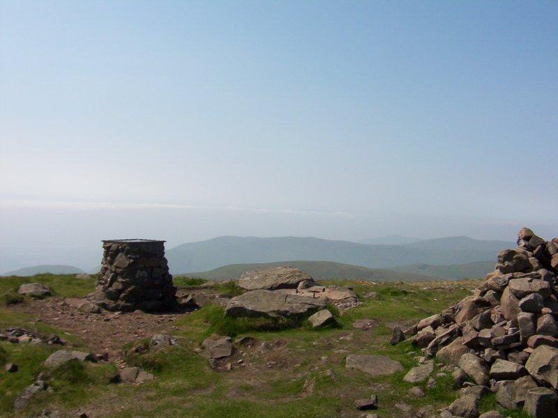
Left - This winter picture of the top of Ben Cleuch
was taken a few years ago, before the map pedestal in the picture
was removed by the Scouts and renovated by Abercrombies Engineering
of Alloa. The renovated map pedestal is shown in the pictures below
taken more recently. The picture - on the extreme right in the first
row below shows the renovated map pedestal and the rock (to the right
of the present map pedestal) with the remnants of the iron rods embedded
in it, which were the base of the marker in the picture on the left.
The old map pedestal fell over a few times before it was finally splendidly
renovated to make it as is now - it carries the original map from
the 1930s. The old map points out the amazing number of mountains
that can be see from the top of Ben Cleuch (in clear weather naturally). |
|
|
|
 |
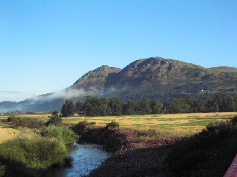
Dumyat (418m) (pronounced - duh-my-at)
-This most Westerly of the Ochil Hills is popular with walkers and
runners from nearby Stirling University. Dumyat has two tops. The
Western top has a cairn and the remains of a Pictish fort. The Eastern
top has a triangulation marker, a memorial to the Argyll and Sutherland
Highlanders and a beacon basket. (see You Tube video below) This hill
is easily climbed from the Sheriffmuir road and there is also a rather
steep path up from Menstrie. The Warlock Glen, the gully between the
two tops, provides a way up for the adventurous from the carpark on
the A91 at Blairlogie. The river in this picture is the Devon. |
|
| The name Dumyat is
perhaps from the gaelic 'Dùn Maeatea' meaning
'Fort of the Maeatae' . The Maeatae were a confederation of Pictish tribes
who fought the Romans. The Maeatae are mentioned by the Roman writer Dio
Cassius in the early third century. There were two confederations of Pictish
tribes who fought the Romans - the Maeatae and the Caledonians.The fort
on Dumyat would have been a southern outpost of the Maeatae. The Caledonians
were further north. The Maeatae and the Caledonians were always Rome's enemies.
Archaeologists from Stirling University have investigated the fort on the
western top of Dumyat. /OR - the name Dumyat is from 'Dùn-ma-chit'
meaning 'fort of good prospect'. Either or both names are
feasible. The hill name used to be written as 'Demyat', which is perhaps
nearer to the way it is pronounced. It is pronounced locally as Duh-my-at
|
|
|
|
|
The statue of Robert the Bruce, King of Scots, at the
Borestone, at Bannockburn, with Dumyat and the Ochils in the background.
The Borestone was where Good King Robert raised his Royal Banner before
the Battle of Bannockburn on midsummer's day 1314. |
|
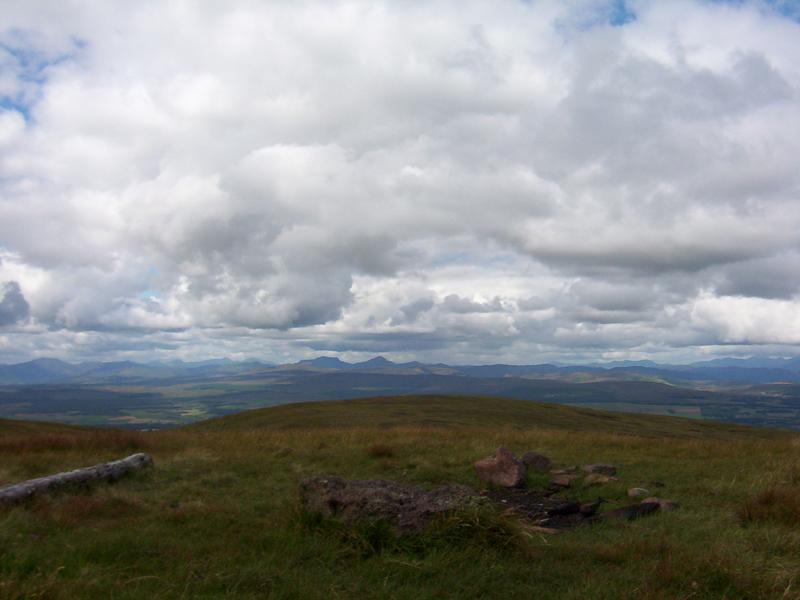
| The 'Round of the Ten'
is climbing the ten highest Ochils hills in the same day. Starting in
Glendevon (Tarmaukin Hotel) the route is by the tops of INNERDOWNIE - WHITEWISP
- TARMANGIE - KINGS SEAT - BEN CLEUCH - THE LAW - BEN CLEUCH (again!) -
BEN EVER - BEN BUCK - BLAIRDENON - GREENFORET - finish at Sheriffmuir (Sheriffmuir
Inn). There is an argument about Ben Buck - some people say that Ben Buck
is not a hill in its own right - it's a shoulder of Ben Cleuch, the name
is supposed to come from 'buac' meaning the brow of a hill ---- for people
who say this - it's the 'round of the nine' - but going by the top of Ben
Buck is a convenient part of the route to follow! It needs a long summers
day to do this walk - winter days are too short!
|
| The 'Reservoirs Trail' is
a path linking woodland with some of the reservoirs in Glendevon. The well
signposted path runs from Muckhart to The Frandy. The reservoirs are Glenquey,
Glensherup and the Frandy (Upper and Lower Glendevon Reservoirs). There
are parking places beside the Castlehill Reservoir (laybye on the A823)
and at Glensherup (a picnic area accessed from the A823 - near the GlenDevon
Lodges). There is access to the hills at several points on the Reservoirs
Trail. The Reservoirs Trail is organised by the Woodland Trust. |
| |
| Here's a few
names of Ochil Hills and heights in metres:- The Law (638m), , Ben Ever
(622m), Whitewisp (643m), Innerdownie (611m), Mickle Corum (596m), Colsnaur
(558m), Sauchenwood (534m), Ben Shee (515m), Graig Leith (513m), Craigentaggart
(491m), Steele's Knowe (485m), Green Law (468m), Ben Thrush (456m), Muckle
Law (398m), Myretoun (378m), and Rossie Law (324m).
|
|
|
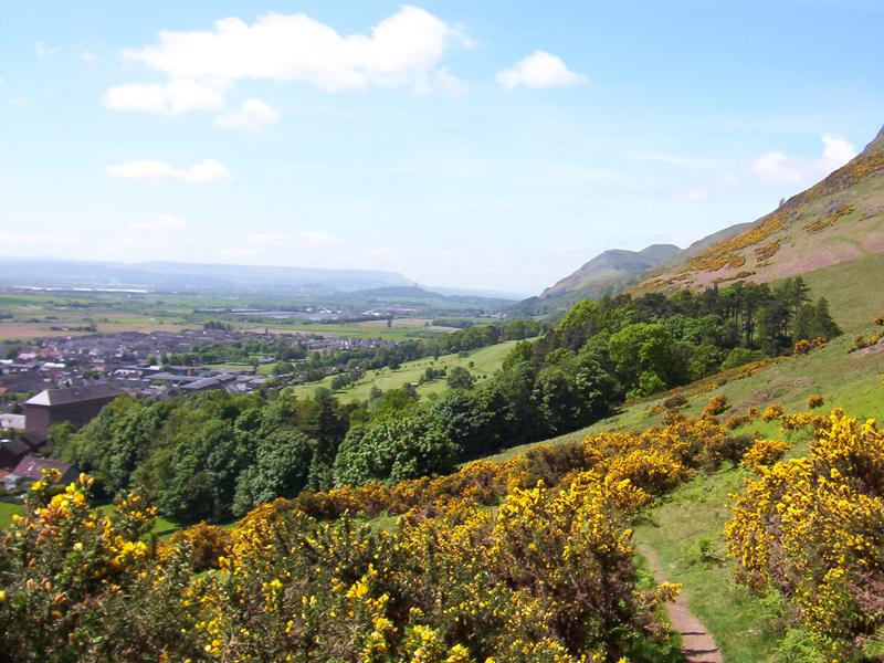
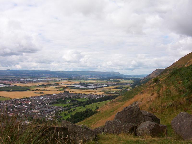
| The left hand picture above shows the path up to the Silver Glen
from Alva - it shows Alva, Alva's 9-hole Golf Course, and the bulk
of Dumyat sticking out from the end of the Ochils. In the centre distance
is the Wallace Monument. The City of Stirling is in the haze on the
left horizon with the Campsie Fells behind that. The Middle picture
shows the same view from higher up on the track at the entrance to
the Silver Glen.The right hand picture shows the view looking back
down the track that goes up the Silver Glen with the slope of the
Nebbit on the right and the Woodhill on the left on the other side
of the burn. The Silver Glen is named for the silver mines that used
to be there. Silver from those silver mines was used to found the
colony of Nova Scotia in Canada. The track shown goes up the Silver
Glen and on to the top of Glen Winnel. This picture also shows rain
approaching on the other side of the River Forth.- these 3 pictures
were all taken on different days |
|
|
|
|
|
|
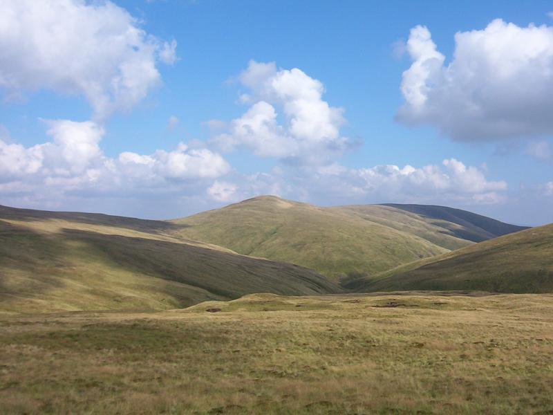
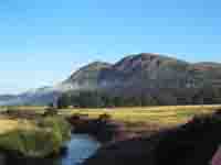
Andragannel in shadow with King's Seat
in the sunlight
|
Blairdennon, with Ben Vorlich and Stuc
a' Croin in the distance. Ben Ledi is on the extreme left horizon.
|
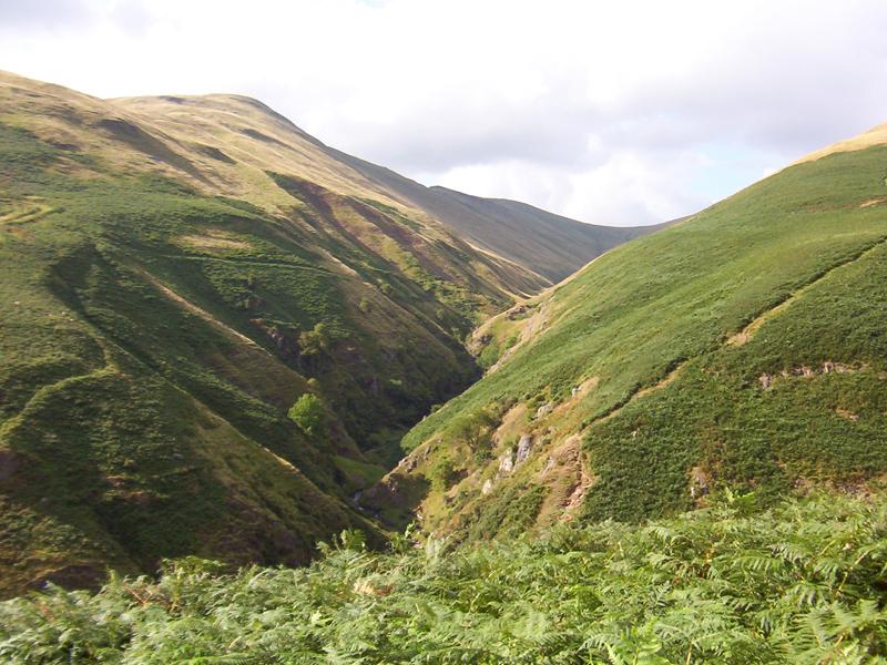
The Daiglen and the start of the steep
path that goes from Tillicoultry Glen up the Law then on to the
top of Ben Cleuch
|
|
| |
Andragannel is a hill which overlooks the
Gannel Burn - from the Gaelic 'An Sruth Gainmheil'
- the sandy bottomed burn -(Tillicoultry Glen) /OR
the Gannel Burn and Andragannel might be named after a man who lost
his life thereabouts about 1860, but many people dispute this.. I
remember when this hill was not marked on the OS map. We called it
Andragannel then. Nowadays it is marked on the OS map as Andrew Gannel
Hill.
Blairdenon - The first part of this hill name comes
from the gaelic word 'Blàr', which can mean a flat place, a
field, or a battle site. It has a fairly flat top, which is very easily
missed when it's misty. I don't know what 'denon' means.
Daiglen - 'Daimh Ghlean' -
glen of the stag /or buck
King's Seat's comes perhaps
from 'cean' meaning head and 'suidhe' meaning seat. I was always told
that it was from this hill (above Dollar) that King Malcolm Canmore
(Canmore means 'big head') watched the hunt going on
|
| |
|
| Rob Roy MacGregor and his men are said to have stood
on an Ochils Hill and watched the 13th November 1715 Battle of Sheriffmuir.
It was probably from Greenforet near Blairdennon. Rob Roy didn't take part
in the battle because he couldn't decide who was going to win! |
|
Rob Roy he stood to watch
On a hill, for to catch
The booty, for aught that I saw man;
For he ne'er advance
From the place he was stanced,
Till nae mair was there to do at a' man.
|
|
|
Ben Gengie - 'Beinn-an-Teanga'
- 'Hill of the tongue' - it looks a bit like a vertical
tongue in this picture taken from the Alva Glen side |
|
|
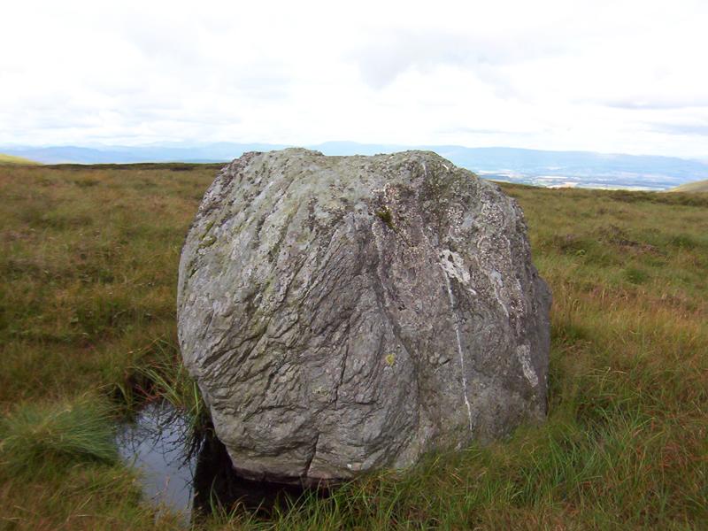
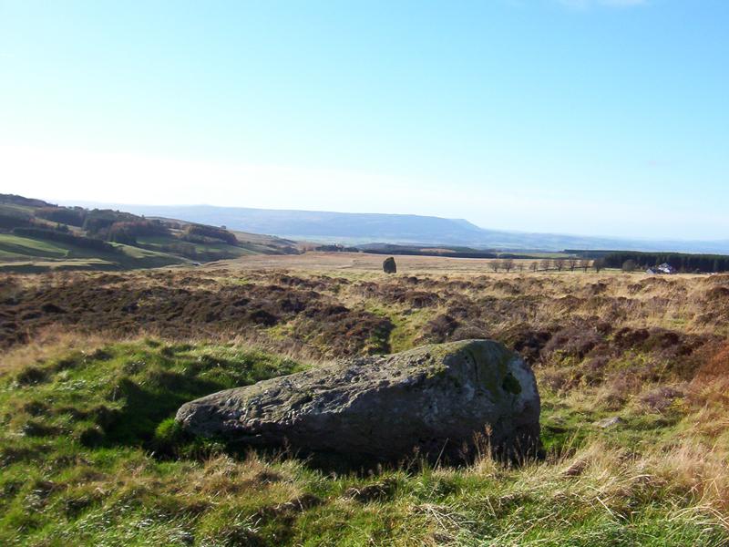
This is the Wolf Stane. It's about four feet
high. I was once told that it was where the last wolf in the Ochils
was killed. It's on the other side of the Alva Moss on the way up
Blairdennon from the top of Glen Winnel. I have always thought that
it was a stone put there to show the way across the Alva Moss. It's
not marked on any maps. I was recently told that it's an erratic -
dropped there by a glacier. If it is, it's the only one there. |
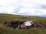 |
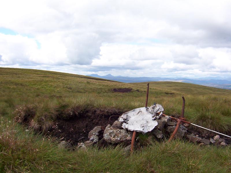
This is the 'The Aeroplane'. It's marked on some
OS maps. Its all that's left (2005) of an aeroplane that crashed there,
on the far side of Blairdennon, in the 1950s. The student pilot -
I think his name was Fullerton, died in the crash. There used to be
a wooden cross and a brass plate but they have long gone. I saw, a
few years ago, that someone had left flowers there. It's a lonely
place. Ben Vorlich and Stuc a' Croin can be seen in the background. |
|
|
|
|
|
|
Tarmangie - hill of the goat
|
The Nebbit - A bonnie wee Alp
|
The Wood Hill
|
|
| |
Tarmangie - from
torr - mang - - hill of the fawn or goat
The Nebit - Scots - 'Nebit'
- nosed, beaked - this hill is called 'Middle Hill' by some people
I was told, years ago, that the trees on the upper parts of the Wood
Hill (Scots Pine) were planted sometime in the 1700s
by Sir John Erskine of Alva, but there may have been trees there before
that. |
| |
|
|
|
| Above are pictures of the Wallace Stone on Sheriffmuir. This
stone is said to have been a meeting place for William Wallace and
his followers. It is the only stone left standing of a line of five
or six standing stones which form an alignment with the escarpment
of the Campsie Fells (two right hand pictures). These stones had already
been there for hundreds of years when William Wallace was around.
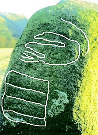
One of the fallen stones has cup and ring marks on it. The two right
hand pictures also show the Sheriffmuir Inn - on the right. You can
see this stone when you're having a beer in the inn, if you know where
to look. On Sheriffmuir there is also the Boat Stone and a stone circle
of very small stones which I couldn't find the last time I looked.
I saw it once. |
 |
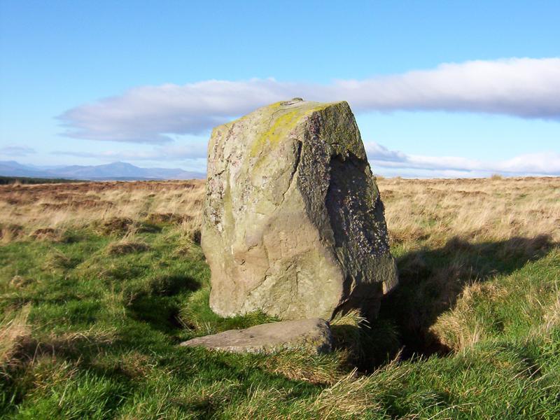
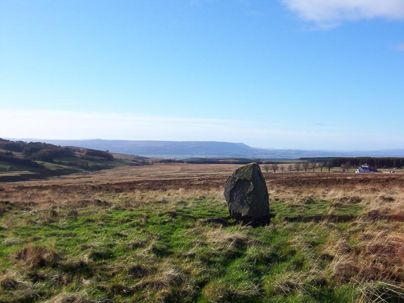
In a field by the A823; Crief - Dunfermline road just after
it crosses the A9 heading for Dunfermline - on the right -
entering the Ochils Glen called Gleneagles, is a standing
stone with an indistinct Pictish symbol on it. - pictures
- http://www.ancient-scotland.co.uk/site/118
- the carving is of a goose with a rectangle below it. There
is another stone nearby in another field in the direction
of Stirling, but it has no carvings.
The picture on the left is taken from the
site and I've 'improved' it a bit.
|
|
| |
|
|
|
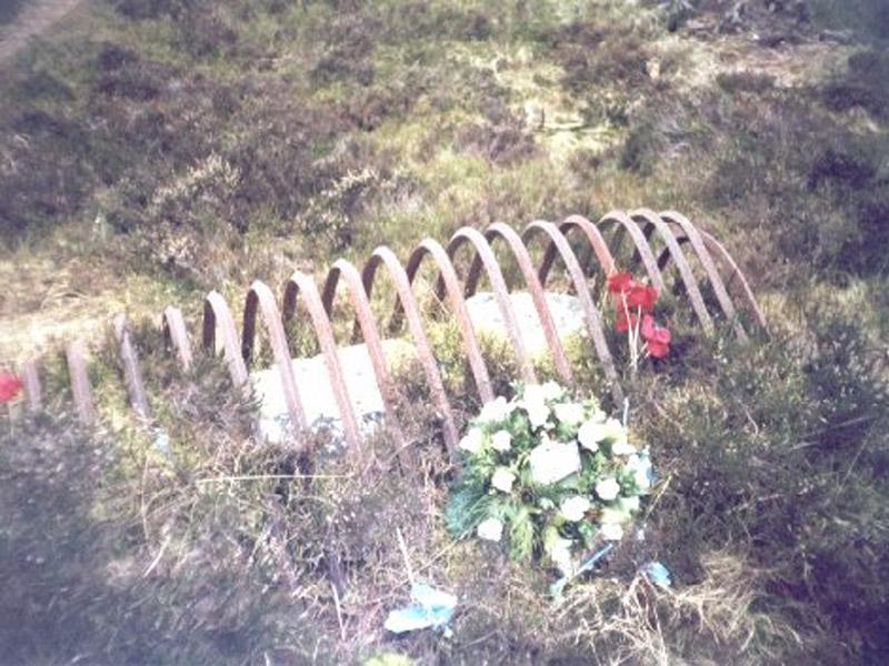
Hidden away on Sheriffmuir is the Gathering Stone.
Its covered in the carved initials of the Highlanders who gathered
there before the Battle of Sheriffmuir in 1715. It's protected by
iron bars. Its probably the remnant of a much larger stone which has
fallen over and became broken in the boggy ground. There are what
look like mass graves near this stone. The wreaths and flowers have
been left there by members of the White Cockade Society. The White
Cockade was the badge of the Jacobite soldiers who supported Prince
Charles Edward Stuart (Bonnie Prince Charlie) in the 1745 Jacobite
Rebellion. It's said to have become their badge when Bonnie Prince
Charlie picked a wild white rose and stuck it in his hat. |
|
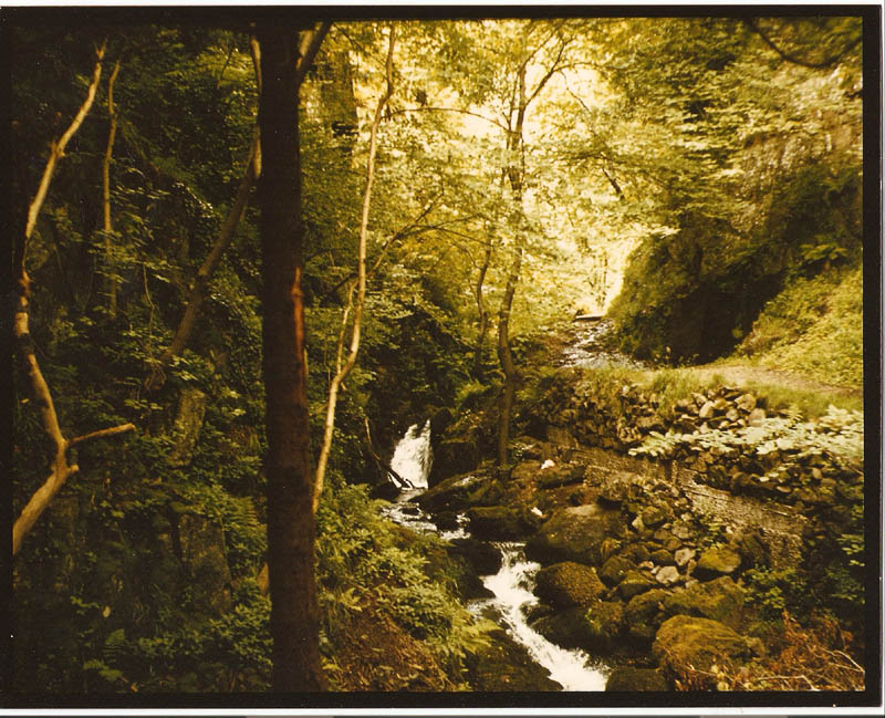
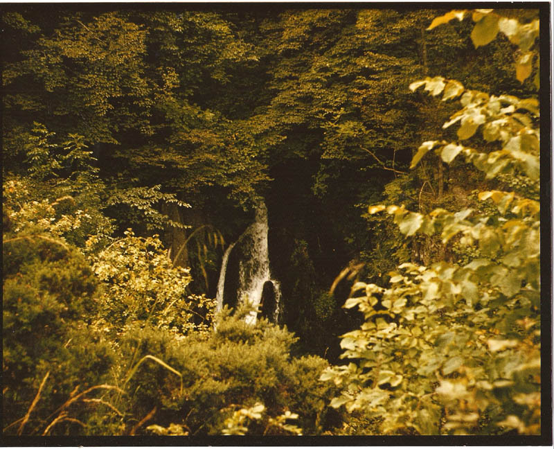
| Pictures below show Tillicoultry
Glen - showing some of the paths in Tilly Glen |
|
|
|
|
.
|
|
|
2008 - These are windmills on the Green Knowes in Glendevon
. They only started turning in 2008. There are twenty of them -
1024x768 pixels. There are more of these behind Ben Cleuch
|
|
| Wildlife that I've seen in the Ochils
includes Herons, Foxes, Roe Deer, Rabbits, Hares (White in winter),
Grey Squirrels, Voles, Weasels, Peewits, Blackbirds, Swallows, Crows,
Magpies, Kestrels, Owls and Green Lizards. I don't know the names
of all the small birds. There are Cuckoos in the Ochils, on the Wood
Hill and in Glen Quey definitely, but I've never seen one, only heard
them. I saw Mink in Glendevon near the Tarmaukin Hotel beside the
Castlehill Reserviour and a farmer in Dunning Glen told me that it
was Mink that had cleared out his duck pond. There are Sheep and Cattle
as well, but they aren't wildlife. I've even met the man who is paid
to shoot the Roe Deer by the Woodland Trust people in Glenquey. He
told me that he sells the meat. Years ago there used to be a man whose
job it was to poison (or gas?) the foxes around the Ben Cleuch area,
but I don't know if anybody does that nowadays. There are trout in
the Ochils reserviours and burns. Some of the reserviours are stocked
with trout. Insects aren't usually a problem in the Ochils, except
around Menstrie Glen and Dumyat, where Clegs (Horse Flies) are a nuisance
in summer. At other places in Scotland, I've seen Red Squirrels, Eagles,
Buzzards and Ospreys. I've seen the feral goats on Ben Lomond. Once
I saw a Pine Martin in Faskally Wood near Pitlochry and in Ardamurchan
I saw, what I was told, was a wildcat.. I've also seen the bigger
deer, Fallow Deer, I think there called, herds of them, in other places
- not in the Ochils.. |
On Tuesday, May 26, 2009 in Glen Quey, on
the track beside the reserviour there, I saw a green lizard. It was
lying on a stone not moving. Only its eyes moved. It was about five
inches long. It was a lizard. It had four legs, a tail, and a head.
It was a lizard. It was green. I stood watching it for five minutes
or so. Only its eyes moved. It wasn't a very warm day, but it wasn't
a cold day. I carefully walked around the lizard and left it there.
I didn't see it move. It's only the second time I've seen a lizard
in the Ochils. The previous time was years ago, on Blairdennon, on
a really hot summers day. One of my companions saw it first, but it
was moving fast and I only got a glimpse, but the one I saw on May
26, 2009 wasn't moving. Only its eyes moved. Maybe it was trying to
warm up in the sun.
For more information, see this site - http://www.greenlizard.org.je/lizards.htm |
| |
From the Daily Mail - Tuesday, September 15, 2009
Hillside memorial to Canadian pilots after 66 years
Two Canadian pilots killed when their Spitfires crashed in Scotland
66 years ago have finally been commerated.
Flying Officer Hugh 'Bud' Reynolds and Sergeant Gordon Dude, of the
Royal Canadian Air Force, died instantly when their planes hit King'g
Seat Hill in the Ochils in Clackmannanshire, on January 16, 1943.
The men, both 21, were on a flying exercise when they and a third
Spitfire were diverted due to bad weather. Lost in thick mist, all
three aircraft struck the hillside. The third pilot - Sergeant Vincent
Daly from Australia - survived.
Now a cairn has been built as a lasting tribute on the site, unveiled
during a ceremony of dedication, marked by a fly past of Spitfire
and Hurricane fighters and a Lancaster bomber. Major Brian Imrie,
of the Army Air Corps, was the driving force behind the memorial.
He said yesterday: 'We owe these men a debt of remembrance. |
|
|
|
LINKS
|
|
|
|
|
|
|
|