
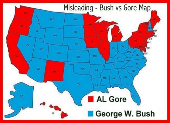
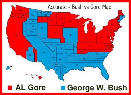
Looking at a territorial map of the United States, it appears that George W. Bush won a sweeping majority. That is a misrepresentation, however, because he carried most of the large, but lightly populated states throughout the country. This political map on the right (bush_vs_gore2) shows just how close the race really was, with Gore's political territory matching Bush's in proportionate size. This projection is based on the 2000 Census.
|
|
