
GIS Resources
About Me
My name is Cameron Bouchard and I created this site to help GIS students and professionals locate reliable and useful data and resources.
I have worked at Industry Canada and have helped develop the GIS section of the
Emergency Telecommunications branch. I currently work for the federal Department of Public Safety, supporting their Geomatics section in Emergency Management and National Security.
My mapping software of choice is the ArcGIS suite of products. In the past, I trained and worked with ArcView 3.2. I have since upgraded my software and training and am quite satisfied with the change. There are many simple functions that were not carried over to the new version but for the most part, they can all be performed in different ways. I also use PCI Geomatica for my image processing needs. In my section of Public Safety Canada, remote sensing is not essential (useful but not essential), but processing of satellite imagery to be used in mapping software is always needed.
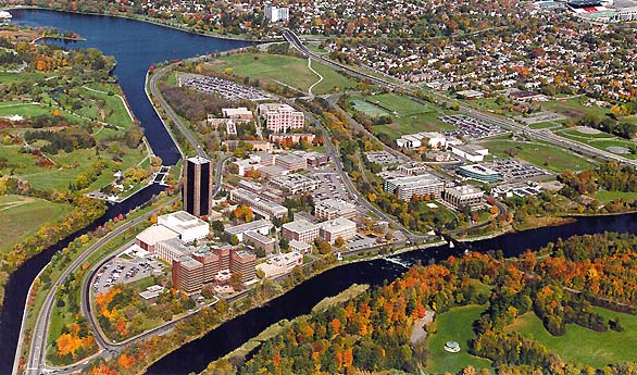
I graduated with a
B.A. Hon in Geographic Information Processing (GIS,RS,Stats,Carto) from Carleton
University.
The campus stretches from the residential areas on the right side of the image
to the water boundaries on the bottom and left sides.
Click on the photo of Carleton Campus to go to the Geography Department webpage.
 |
Carleton University - Geography Department
 |
 |
