

Landscape Description of Chernobyl Exclusion Zone
Climate is mild-continental with mild winter and warm summer. The presence of forests, ponds, reservoirs, bogs and settlements affect the local climatic conditions. In winter the air temperature ranges from -25 to +5 Celsius, average - 6C. Depth of frozen soil reaches 80 cm and the height of snow cover is 16cm. Temperature ranges from 17 to 19 Celsius during summer. Average length of unfreezing period is approximately 160 days. Annual average precipitation is near 500 cm.
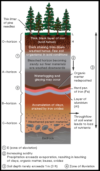
Nature of relief, maternal rocks, climatic conditions and herbage provide territory soil variety. Analysis of prevailing water-glacial sediments are of sandy composition that are near river valleys, sandy grounds are changed by clay and a small reduction of relief is formed by sandy loam soils. There are podzol soils (see H in diagram below) on the higher grounds between rivers.
Relief of modern surface Chernobyl exclusion zone
Erosion of river valleys, denudation-erosion of slopes, beds of large rivers, former river-beds, extended bog plains, former river-beds, lake-bogs and bogs on lowlands and crests form the elements of relief.
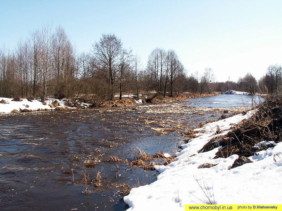
Erosion and denudation-erosion slopes of river valleys are developed on the Pripyat River's right bank on the section between the villages Priborsk and Oranoe and on the left bank of the Teterev River. Slopes of the Teterev River valley has caused a change in the characteristic land form. River bank height reaches 12 m near village of Oranoe and decreases a little further up the river. In the Pripyat Valley the bank slopes are marked near Chernobyl and the village Lelev. Bank height is 20 m, and then in the north-west and south-east the valley slope is more gentle.
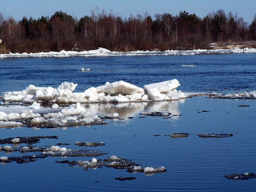
The largest river within the territory is the Pripyat River. It crosses the area from north-west to south-east, it meanders within the broad flood plain. Width of the riverbed is highly inconstant—from 60–100 m on north-west to 700–800 m near Otashev Valley at the mouth. Down in south-east the Pripyat River and its multiple dry channels merge with the bay of the Kiev reservoir. River banks are gently sloping, however there are multiple small areas with bluff coasts and height of up to 2–4 m. Altitude of water line is near 103 m/ASL.
Rivers Teterev and Uzh feed the Pripyat River and increase it in size. Their width usually does not exceed 80 m. Altitude of water line varies from 106 m to 103 m/ASL. Gently sloping coasts change to bluff ones. Meander-line of the riverbeds are less pronounced than in the Pripyat River.
The path of the Pripyat flood plain has a highly sinuous nature, reflecting development of multiple meanders. In relief the flood plain residual crests have different heights, basically in 1–13 m. Extended bog plains are typical for small rivers—tributaries of the Pripyat, Uzh, Braginka, Teterev. Among them it is possible to select river Nesvich, Veresnia, Hocheva, Il'ia and others. Those bog plains reach a width of 200–500 m and in the Braginka-Pripyat tributaries reach 1–2 km and more. Nearly all the beds of these rivers are channelled and bogs are partly constrained. After the ChNPP accident multiple dams were built along small rivers to control radionuclide migration. As a result underflooding of the territory has occurred and peatbog irrigation.
References:
Davydchuk V.S., Zarudnaya R.F., Miheli S.V. et al. Landscapes of Chernobyl zone and their evaluation by condition of radionuclide migration. Kiev: Naukova dumka, 1994. 112 p.
Tixomirov F. A., Scheglov A. I., Cvetnova A. B., Klyashtorin A. L. Geochemical migration of radionuclides in forest ecosystems of ChNPP radioactive zone // Pochvovedenie. 1990, No 10. 41–50 pp.