
Who can benefit from Google Earth?
| Real Estate/Construction Industry: Using Google Earth, Real Estate developers and Construction companies can inspect potential property investments from their own home. Google Earth can help investors understand the environment surrounding potential investments (road access, school districts, distance from highways/shopping centers, etc). | Developers can overlay site plans on Google Earth Imagery  (View Larger Image) |
| Insurance Industry: Google
Earth can help insurance issuers and underwriters analyze the risks of
properties in a geographic area. Google Earth can also integrate with
risk software and policy databases to give insurers a comprehensive
picture of their working environment.
|
Insurance Policy Database layered into Google Earth 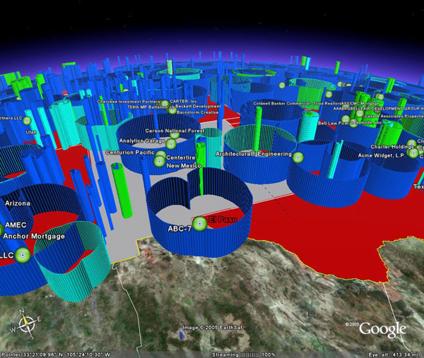 (View Larger Image) |
| DOD/Home Land Security: Google Earth can be used by the military as an intelligence system for area familiarization and situational awareness. Commanders can use Google Earth for mission planning, training, and simulations. Google Earth can also be used with a GPS tracking system to monitor troop movement and get a bird's eye view of the battle field. |
GPS vehicle tracking in an Urban Environment 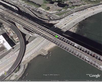 (View Larger Image) |
![]()
![]()
