
|
|
|
|
|
General Information: Area: 892,677 sq km (344,662 sq miles) Population:
3,907,738
(2001).
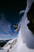
GEOGRAPHY:
British Columbia
is Canada’s most westerly province, bordered to the south by the USA
(Washington, Idaho and Montana states), to the east by Alberta, to the
north by the Northwest Territories and the Yukon, and to the west by the
Pacific Ocean and the ‘Alaskan Panhandle’. It is mainly covered by
virgin forests, and encompasses the towering Rocky Mountains (rising to
3954m/12,972ft), vast expanses of semi-arid sagebrush, lush pastures on
Vancouver Island’s east coast, farmland in the Fraser River delta, and
fruit land in the Okanagan Valley. The highest mountain is Fair-weather
at 4663m (15,298ft). Between the eastern and coastal mountains is a
lower central range. The coastal range sinks into the Pacific, with
larger peaks emerging at Vancouver and Queen Charlotte islands. The
Columbia River flows from the Rockies into Washington State and out into
the Pacific Ocean. |


 Pricing
for this trip stars at $900.00 (us dollars), for a 3 day 4 night stay.
Pricing
for this trip stars at $900.00 (us dollars), for a 3 day 4 night stay.