
http://www.afs.nemas.net/
http://www.afs.nemas.com/
http://www.fss.nemas.net/
http://www.fss.nemas.com/
http://www.staff.nemas.net/
http://www.staff.nemas.com/
Click on 3 letter identifiers for 24 hour obs readings.

Hourly Text Obs
Regional Surface Map
Real-time Java Metars

A Listing of Tools
IWIN Watch/Warn Display
Current Watches from SPC
NEMAS SWO
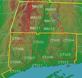
CT Weather Warnings
MA Weather Warnings
NJ/PA/NY Weather Pages
CT/MA/RI Weather Pages
Model Updates from NCEP
Model Status from NCEP
Model Diagnostic Discussion from NCEP
QPF Discussion from NCEP
Coastal Marine Forecast
Ocean Temperatures
Precip Totals
River Conditions
Ozone Levels
UCAR Satellite Data
NASA Satellite Data
Full Nexrad Radar
Rain/Snow/Ice Radar
Lightning Data
Skew-t Soundings
PSU Northeast Weather Page
850mb Temp Conversion Charts (Excel File)
500 Height/Temp Conversions (Excel File)
Sun and Moon Data
Entire NE Climate Data
Hartford Climo Report
Bridgeport Climo Report
BOX Snow Totals
OKX/ALY Snow Totals
Winter Forecasting Tips
Wind Chill Chart
Heat Index Chart
Snowfall Total Chart
General Pressure Heights
Boundary Layer: about 1000mb (300 ft / 100m) up to about 925mb (2,300 ft / 700m)
850 mb = 5000ft or 1.5km
700 mb = 10,000ft or 3km
500 mb = 18,000ft or 5.5km
400mb = 23,300ft or 7km
300 mb = 30,000ft or 9km
200 mb = 39,000ft or 12km
150 mb = 45,000ft or 13.5km
100 mb = 53,000ft or 16km
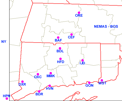
Metar Station Listings
BAF - Westfield, MA
CEF - Chicopee Falls, MA
ORE - Orange, MA
BDL - Windsor Locks, CT
HFD - Hartford, CT
IJD - Willimantic, CT
DXR - Danbury, CT
OXC - Oxford, CT
MMK - Meriden, CT
BDR - Bridgeport, CT
HVN - New Haven, CT
GON - Groton / New London, CT
Use the following links for your forecasts and it will be the best you can do. Write up a discussion, look at a few maps, and go from there. For a little help, check out these links from NCEP for a quick weather update and outlook for the upcoming days, then check out the NWS forecast and see if you agree!
Current Surface Analysis
Short Range (Days 1-2) Outlook
Medium Range (Days 3-7) Outlook
*** If any of the links below don/t work, then use the following links of Zones from the NWS.
