
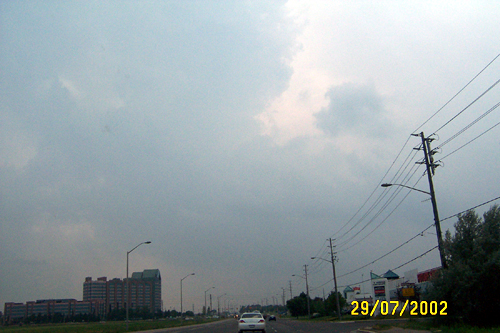
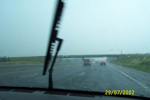
- I headed out today and had a really good chase! Things didnt start off well; the Rogers guys down the street were fixing the cable boxes, therefore I had no real idea of what was going on out there (I have cable internet). However when I heard on TWN that a tornado warning had gone up I decided to head out. Thanks to Tom for giving me a good indication on what was going on out there:) After speaking to Tom, I decided to target the King City area. As I reached King road (Hwy 11) Things were really heating up... I drove west and once I passed the 400 I got my first real good look at this monster... not being able to get in contact with anyone (I'm guessing the regional topography/storm had knocked out my signal in the area) I stayed on hwy 11. By King City the whole sky was boiling and scud was swirling everywhere (I also noticed a very green tint to this sky). I knew this was gonna be good. The rain began just passed King City and so did the lightning. Lots of CG's everywhere, one, which I caught on my video of this chase, was no more then 200 feet away!!! As I passed the small town of Laskay I had punched the core of the storm. I wasnt planning on doing this, since core punching is one of the most dangerous things a chaser can do. However the hilly terrain had obstructed my view of how close this cell really was. Anyway, take a carwash jet and multiply it by 10 and add some flying debris and that's what I got. Rain came down really really hard until Nobleton, where the power had been knocked out (Later analysis in the area had indicated F0 microburst damage). I pulled into the Petro Can to get gas but...of course nothing was working because of the power outage. So I headed down south looking for a gas station in service! It was at that time that I witnessed the strong rotation of this storm. I saw a half-decent looking funnel, however my need for gas unable me to continue the chase. I later figured out that this was indeed the tornadic York/Durham cell that caused tornado warnings. Yikes! After getting gas I figured I would never catch this storm since it was well ahead of me and heading at 55km/h now. So I headed home. On the way I caught some pretty nice pics of this mammoth backlight storm. This was my first real chase of the season and I must admit it was quite rewarding :) Check out my many pics and also a map of my driving track on this chase.
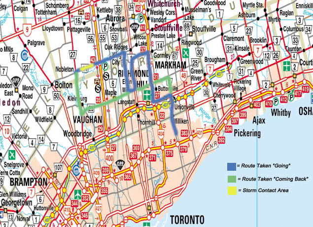
A map of where my chase took me.
When I left home the sky was bright blue. However things quickly changed as I drove west on highway 7. I gave Tom another call and he advised me to head north. Therefore I headed up the 404, where we got brief rain.
I turned off the 404 and headed west of stouffille rd.
I had made the mistake to look at the map too quickly... Stouffville road ended at yonge street! So I had to head back down to a road which would go through. The closest was major mackenzie. While heading down we came accross a small cell, and encountered brief heavy rain and also the nice storms going up to our east.
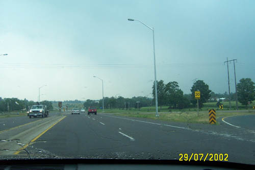
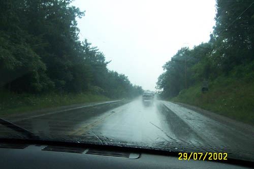
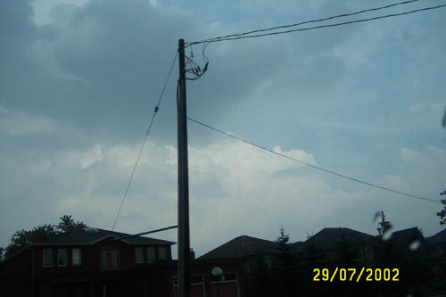
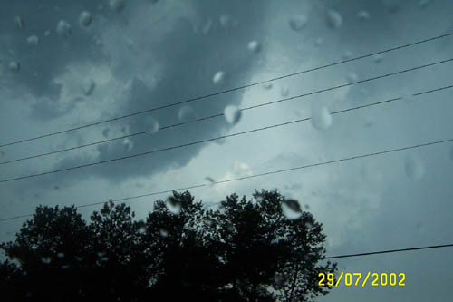
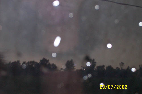
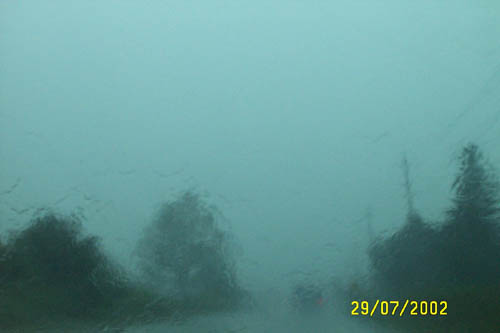
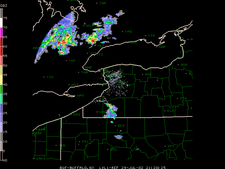
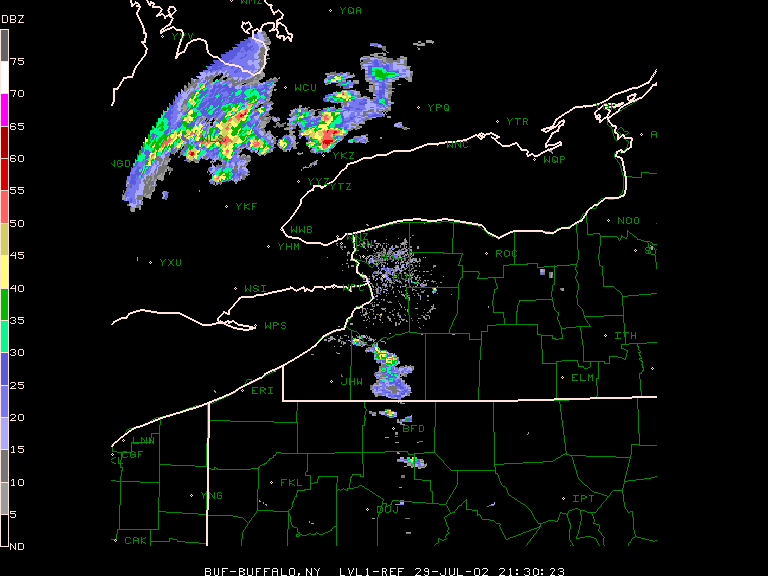
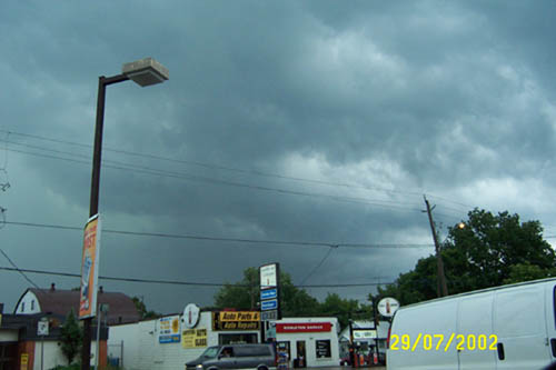
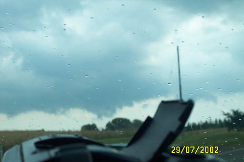
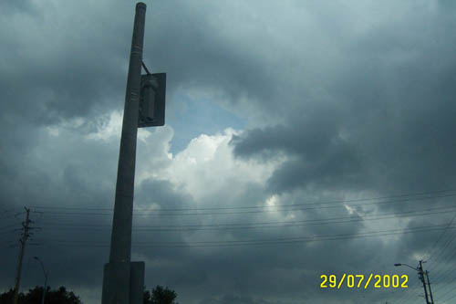
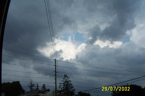
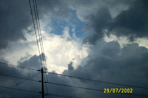
We then drove up Bathurst towards King Road. At King road I headed west towards the darker sky. When i reached King City scud was visible as you could see in the pictures. I punched the core of this storm between the 404 and Nobleton. I encountered lots of lightning, heavy rain, brief strong winds. It also got so dark that it felt like night and most cars had high beams on. I've added radar pics of the storm at this time.
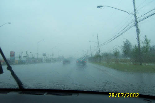
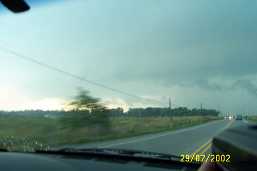
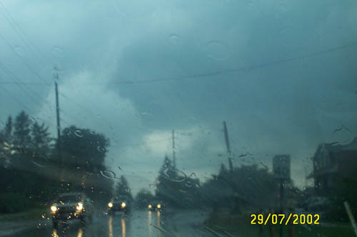
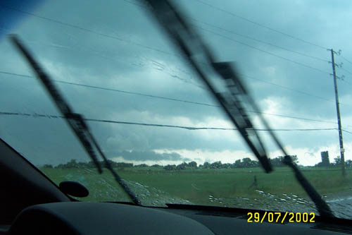
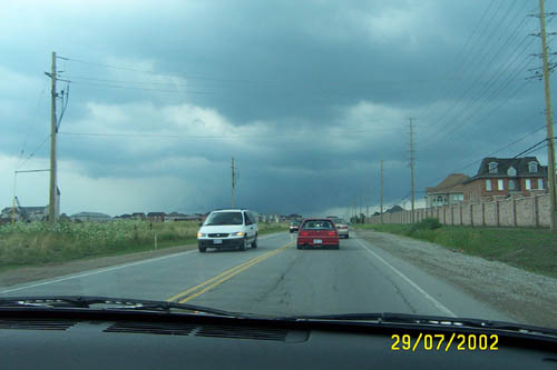
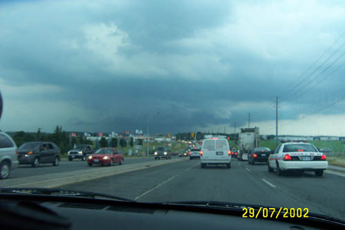
We got out of the thick of things right before Nobleton, where power had been knocked out and the street lights weren't working. Branches and small debris littered the road. We stoped for gas but since the power was out the pumps werent working. While stopped at the station I took a nice pic of the back of the storm from behind. So we headed south.
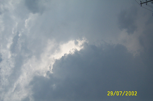
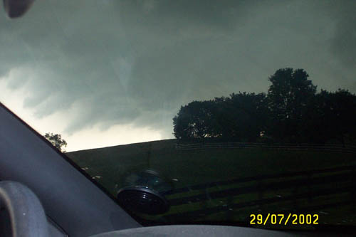
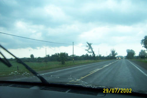
As we drove south we got a much better view of the storm since it was backlit. You could see in the pics the tail cloud and some wind damage to a large tree. I also witnessed the rotation at this time (as is visible in the third pic). I'm pretty sure I saw a funnel come out of this wall cloud but it was barely visible.
When we got back down to Rutherford road we got gas and decided to head back home. Although we now couldnt catch the storm, I still got some nice shots of it :)
Warnings
COUNTY'S UNDER SEVERE TORNADO WARNINGS
All pictures are the property of Adam Bennett 2002. Please Email me at addy_ben@hotmail.com if you would like to use them.
GREY
BRUCE
HURON
DUFFERIN
WELLINGTON
REGIONAL MUNICIPALITY OF YORK
REGIONAL MUNICIPALITY OF DURHAM
Reports
WOCN10 CWTO 300342
GENERAL WEATHER STATEMENT
ISSUED BY ENVIRONMENT CANADA. REGIONAL CENTRE TORONTO ONTARIO.
11.42 PM EDT MONDAY 29 JULY 2002.

STRONG TO SEVERE THUNDERSTORMS CROSSED SOUTHERN ONTARIO MONDAY..

 A COOL FRONT MOVING THROUGH THE HOT AND SULTRY AIRMASS OVER THE
REGIONS TRIGGERED A LINE OF HEAVY THUNDERSTORMS WHICH CROSSED MOST OF
SOUTHERN ONTARIO FROM WEST TO EAST MONDAY AFTERNOON AND EVENING.
 THERE WERE SEVERAL REPORTS OF SEVERE WEATHER INCUDING FUNNEL CLOUDS
AND POSSIBLE TORNADOES..AND MANY REPORTS OF MARGINALLY SEVERE
WEATHER.

HERE IS A LIST OF THE MORE IMPORTANT REPORTS RECEIVED BY THE REGIONAL
WEATHER CENTRE ONTARIO:

3.45 PM      POSSIBLE TORNADO              SHELBORNE
                                         ( WATERLOO-WELLINGTON-DUFFERIN )

4.30 PM      REPORT OF TORNADO SIGHTING    KOSH LAKE
                                       ( PETERBOROUGH AND THE KAWARTHAS )

5.15 PM      FUNNEL CLOUD SPOTTED          S OF KENILWORTH ON HWY 6
                                       ( WATERLOO-WELLINGTON-DUFFERIN )

5.55 PM      POSSIBLE TORNADO              WYOMING
             ( TREE LANDED ON HOUSE )     ( SARNIA-LAMBTON )

6.23 PM      FUNNEL CLOUD REPORTED         OSHAWA

7.00 PM      TREES DOWN                    THORNDALE
                                          ( E OF LONDON )

7.33 PM      POWER OUTAGES REPORTED        PARRY SOUND-MUSKOKA
             FROM HUNTSVILLE TO BURKS FALLS

7.40 PM      72 MM OF RAINFALL             SHELBURNE
             UP TO 7.40 PM             ( WATERLOO-WELLINGTON-DUFFERIN )


END/TWN..
