
- After what felt like forever without any active weather the models were finally setting up for a classic day of severe weather. Things began heating up early in the day around 11am. By the time 12 came along cells were going up everywhere to the north west of Toronto. A severe thunderstorm watch was put out by Environment Canada shortly afterwards. On my way to picking up batteries for my digital cam I caught some pics of the TCU's going up to my N and NE. I knew today was going to be a long day! I was contemplating going out on a chase but opted not to, since the line was headed for my area anyways. Around 1:15 the sky started getting darker as the line approached Scarborough. The sky was boiling and scud tags were turning everywhere above me. This was probably the most impressive sight of the day. The Line past around 1.45 accompanied by brief heavy rain and lots of CC lightning, a few CG's. Most of the action was kept to my north and I now longer had the car :(. This was my first time using my new digital cam for weather and I am quite pleased :)... Have a look at some of my pics.
TCU's Going up around 12:30 to 12:45.


Pics of the boiling dark sky before the storms. None of the pics have been altered. It was this dark! =O


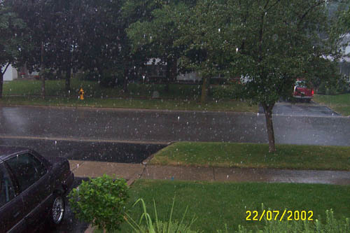
Then came the rain! Very small hail is also visible.
Nice ending to a fun day

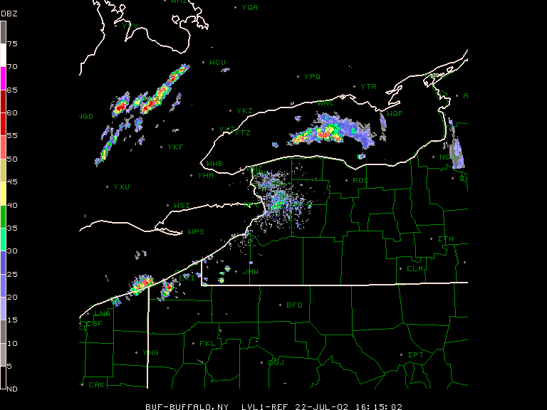
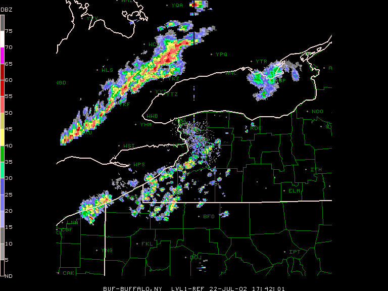
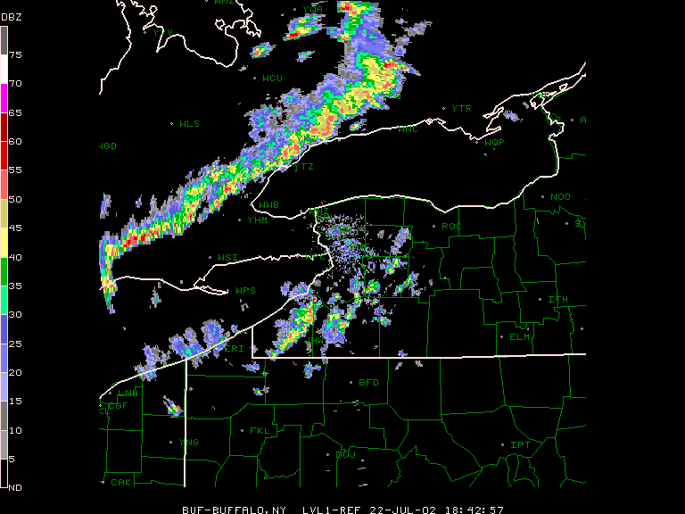
Radar shots. 1) 11:15am First sign of storms 2) 12:45pm Storms to my north (as seen in my pics) 3) Line coming through my area around 1:45pm.
Warnings
SEVERE THUNDERSTORM WARNINGS
- 11:45 AM - Reports
None as of yet.
ESSEX COUNTY
- 1:03 PM -
CHATHAM-KENT
LAMBTON COUNTY
- 1:48 PM -
TORONTO
HAMILTON
REGIONAL MUNICIPALITY OF HALTON
REGIONAL MUNICIPALITY OF PEEL
REGIONAL MUNICIPALITY OF YORK
REGIONAL MUNICIPALITY OF DURHAM
WELLINGTON COUNTY
- 1:50 PM -
SOUTHERN KAWARTHA LAKES
PETERBOROUGH COUNTY.
- 2:20 PM -
OXFORD COUNTY
REGIONAL MUNICIPALITY OF WATERLOO
BRANT COUNTY
- 2:28 PM -
ELGIN COUNTY
MIDDLESEX COUNTY
HALDIMAND AND NORFOLK COUNTIES
- 7:54 PM -
SIMCOE COUNTY
