NORTHWEST OHIO HIGHWAYS
Toledo's Changing...And So Are We
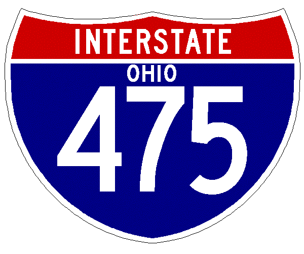
I-475 ROAD GUIDE
Toledo's bypass, it keeps growing and
growing.
|
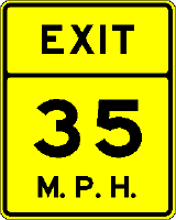
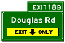
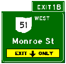
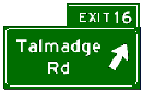
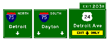
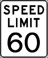
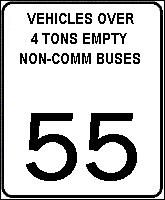
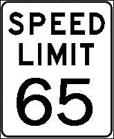
State Highway, Street name or Exit Destination SPEED LIMITS and County Lines |
Other |
|
 WEST - Scroll Down
 |
EAST - Scroll Up |
|
|
ORANGE
BARREL ALERT
|
 |
|
|
|
|
|
|
OTTAWA RIVER |
||
|
Auburn Avenue BRIDGE |
||
|
|
|
|
|
BRIDGE OVER Upton Avenue |
||
|
Westland Avenue PEDESTRIAN BRIDGE |
||
|
|
|
|
|
Sherbrooke Road BRIDGE |
||
|
Toledo Terminal Railroad BRIDGE |
||
|
|
|
|
|
Rushland Avenue BRIDGE |
||
|
Bowen Road BRIDGE |
||
|
|
|
|
|
RAMP FROM MONROE STREET TO EB I-475 BRIDGE |
||
|
|
||
|
|
||
|
Woodley Road BRIDGE |
||
|
|
||
|
|
||
|
ORANGE
BARREL ALERT
|
||
 |
 |
|
|
|
 |
|
 |
||
| Holland-Sylvania Road BRIDGE | ||
| Toledo Terminal Railroad BRIDGE | ||
NORTH

BECOMES
|
||
 |
 |
|
|
WEST
BECOMES SOUTH
|
||
| BRIDGE OVER Blossman Road | ||
 |
 |
|
| Toledo Botanical Gardens | ||
| SPRINGFIELD Township Limits | SYLVANIA Township Limits | |
| Bancroft Street BRIDGE | ||
| BRIDGE OVER Dorr Street | ||
| BRIDGE OVER Hill Avenue | ||
| BRIDGE OVER Angola Road | ||
 |
|
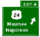
Spring Meadows |
 |
||


 |
||
| Perrysburg-Holland Road BRIDGE | ||
| Garden Road BRIDGE | ||
|
BRIDGE OVER
|
||
| BRIDGE OVER Manley Road | ||
 |
Dussel Drive |
|
|
Arrowhead Industrial Park |
||
|
|
||
| SPRINGFIELD Township Limits | MONCLOVA Township Limits | |
|
|
||
 |
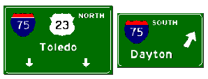
Anthony Wayne Trail |
|
|
Waterville |
||
| BRIDGE OVER River Road | ||
|
LUCAS County
Line MONCLOVA Township Limits |
||
| Maumee State Scenic River | ||
|
WOOD County
Line PERRYSBURG Township Limits |
||
|
|
||
| Hull Prairie Road BRIDGE | ||
| Fort Meigs Road BRIDGE | ||
| PERRYSBURG Township Limits | PERRYSBURG City Limits | |
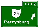 |
Bowling Green |
|
|
|
||
 |
|
|
|
SOUTH - Scroll Down |
NORTH - Scroll Up |
|
|
State Highway, Street name or Exit Destination SPEED LIMITS and County Lines |
Other |
|
Counter:
© 2002-2003 By Sean Lyons. All rights
reserved.
E-MAIL:
toluwohwys#buckeye-express.com
(Spam Filter in effect - change # to @ to e-mail)