
Before we Descend...a Look at the Topo Map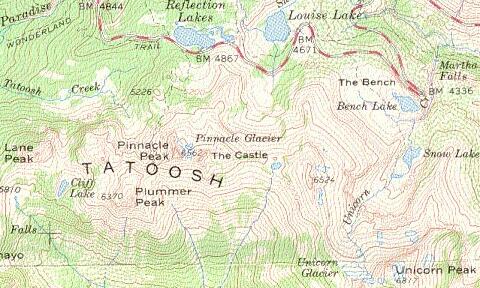
The U.S.G.S. topographic map of Mount Rainier National Park came in handy for locating hiking trails, physical features, and learning names of the individual mountain peaks.
|
 Calling Friends
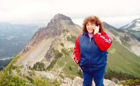
Vicki shares her trail experiences from the top of Plummer Peak with fellow hiker friends Bobby and Donna in Virginia. Pinnacle Peak rises in the background. Reflection Lakes (location of the Pinnacle Peak trail head) can be seen at the far left. |
 Volcano Stories - Live!
Steve rubs in a live volcano report to volcano-fearing Donna: "All is well, no fresh lava!" |
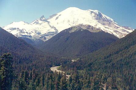 Mount Rainier
A view of Mount Rainier from high above the White River valley. This photo was taken looking southwest from an overlook near the White River Entrance.
Ranger's Mount Rainier National Park Pages |
