Map to the Blue Hole
Trail Map to the Blue Hole
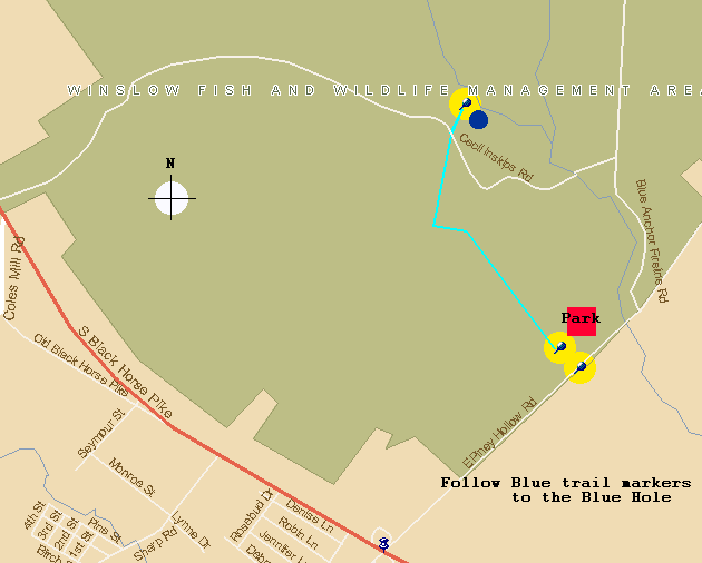
Trail Map
GPS (global positioning
system) coordinates of the Blue Hole are:
N 39deg 37.589'
W074deg 53.734'
Special Thanks to K.L. for the coordinates.
Here are some maps from the USGS which accurately places the Blue Hole at the junction of the Cecil
Fire road and the Great Egg Harbor River at Inskips. Thanks to Dr. TGS who kindly pointed out my error in my sloppy attempt to map out the location.
 A very large map
A medium map
A small map
Go to expanded map
Go Back to Trek