Site hosted by Angelfire.com: Build your free website today!

  Black Canyon of the Gunnison

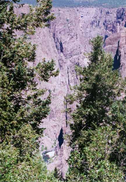
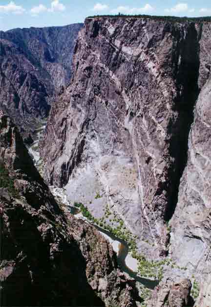
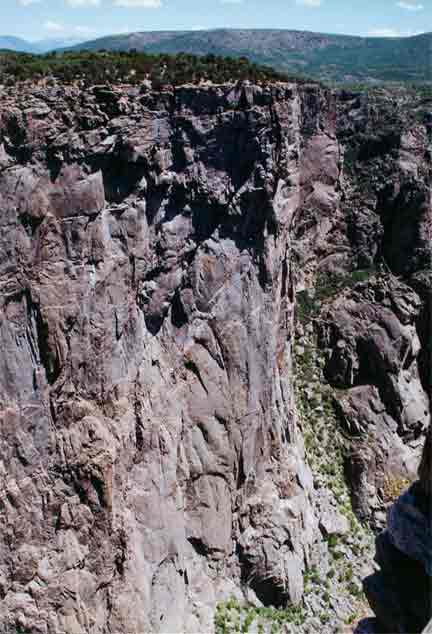
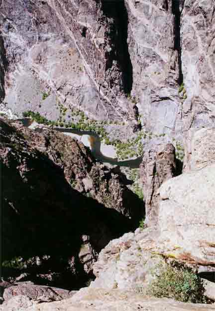
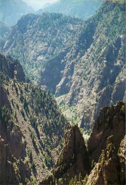
The Black Canyon of the Gunnison is a National Monument formed by the Gunnison River is south central Colorado. It is called the Black Canyon because it is said that even at mid day it is so dark at the bottom that one can see the stars above. At it's narrowest point the Black Canyon is only 40 feet wide but 1,100 feet deep. 40 feet is less than a baseball throw from shortstop to first base, but if you drop this ball you'll have to go down a 1,100 foot hole to get it. The canyon is 48 miles long and 2,722 feet deep at the deepest point. In contrast, the Sears Tower, the tallest building in the world, is 1,454 feet tall. Yes, that is a river down there and although you probably can't see them without the aid of binoculars, there are people camping on the sand bars in the photo below right.

black canyon black canyon
black canyon

Most of the rocks of the Black Canyon are PreCambrian age metamorphic rocks of schist and gneiss. In addition to the metamorphic rocks there are intrusions of igneous rocks, mostly forms of granite. This means that after the original (called country rock by geologists) rock had formed volcanic activity caused magma to intrude or squeeze between parts of the metamorphic rocks. The most common of the igneous rocks is pegmatite, a large crystalled rock that indicates very slow cooling of the intruded magma. A major mineral component of pegmatite is microcline feldspar, a pink to yellow color is the most common and is easily visible in these photos as large bands that cut across the metamorphic rock formations. The photo below right is of "Painted Wall" where many stripes of the pegmatite are easily visible. Because the igneous rock is harder than the metamorphic rock it weathers more slowly, often causing sharp ridges that were once dikes buried in the metamorphic rock.

black canyon
black canyon
black canyon
black canyon The formation of this canyon near Gunnison, CO is unexpected because just a few miles to either the north or south lie much softer rocks for the Gunnison River to erode. The explanation for the river at this location is that it started to flow in this location, making a small river valley. Later as the mountains were formed as part of the Laramide Orogeny, the mountain building process that formed the Rocky Mountains, the land was uplifted and the river valley along with it. Because the change in gradient (slope) increased the river did most of it's erosion by downcutting. As more of the hard rock was downcut and the rocks continued to be uplifted the river didn't have any other place to go. See this page from the National Park Service for more information on the formation of nearby mountains and the uplifting that caused the canyon. The canyon continues to erode downward at the rate of about one inch per century. At the rate of one inch per century how long does it take to dig a 2,000 foot canyon?
black canyon
black canyon
black canyon black canyon
 
 
black canyon
black canyon


Backprevious pagehomenext pageNext

Home