
| The Minnesota River Valley presents many opportunities to
study geology.
The next stop on the field trip is at Fort
Snelling State Park. There isn't much bedrock geology to see
at the park but the visitors center has some nice displays and
informative
books on geology.
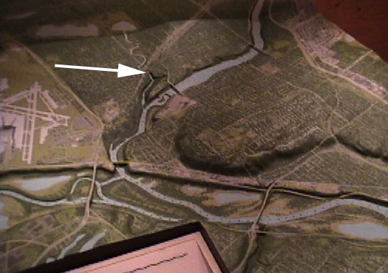
One of the displays at the park is a 3D map of the junction between the Minnesota and Mississippi Rivers. Three images of the map are shown below. |
 |
 |
 |
| The map above left has an arrow pointing to Minnehaha Falls,
one of
our future stops.
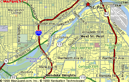
The map above right has an arrow pointing to the confluence of the Mississippi and Minnesota Rivers. They join at the end of Pike Island in Fort Snelling State Park. There is a walking trail around the island (about 2.5 miles) so you may walk to the end and see where the rivers meet. Notice the two yellow bars added to the map. The large area to the northwest of the river junction is the Minneapolis/St. Paul Airport. The Mississippi River is coming in from the top right and the Minnesota River is flowing left to right. The distance across the Minnesota River Valley is much larger than the distance across the Mississippi River Valley. This is because the Minnesota River is in the old bed of Glacier River Warren. When the two rivers joined the River Warren was much larger and under cut the Mississippi creating a falls. This falls has eroded headward to the point we now call St. Anthony Falls. St. Anthony falls has moved since Fr. Hennepin first described it and this headward motion has been used to help determine the age of the erosion and the glaciers that indirectly caused them. (1) The photo at the right shows the same map from a lower view to the east of the junction. Notice the terraces and lakes formed by the river valleys. |
 |
 |
These photos are of the banks of the Mississippi underneath
the Wabasha
Street Bridge across from the red star on the map below. To get
here
drive north on State Highway 13. About 2 blocks after I35E turn
right
onto Lilydale Blvd. It winds underneath Highway 13 and along the
Mississippi River for about 3 miles to the bridge. There is some
parking space across the road from the rock.
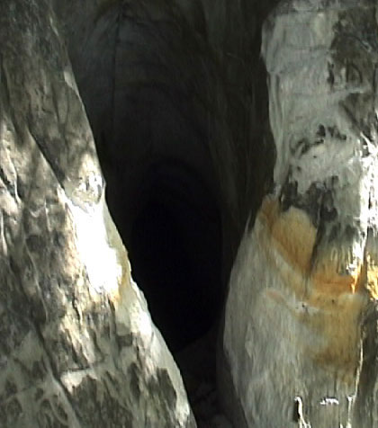
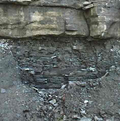
At the top, just under the glacial till is Decorah Shale, followed by Platteville Limestone, Glenwood Shale and St. Peter Sandstone moving down. (2) The photos below show some of the caves that have been washed out of the St. Peter Sandstone. They are easily large enough to walk into, at least at the mouth, being alone I did not want to take any chances by going inside. Someone has tried to block them by putting other rock and soil in front of the caves but it looks like they keep washing open. If you'd like to safely visit some caves there is a Historic Cave Tour Saturdays at 11 am & Thursdays at 5 pm or a St. Paul Gangster Tour Saturdays at noon. Wabasha Street Caves, 215 Wabasha Street South, St. Paul 651-292-1220. |
 |
 |
 |
 |
 |
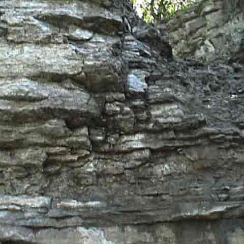 |
| The photo above and above right shows a closer view of some
of the
Decorah Shale. The photo at the right shows the Platteville Limestone
above
the Glenwood Shale.
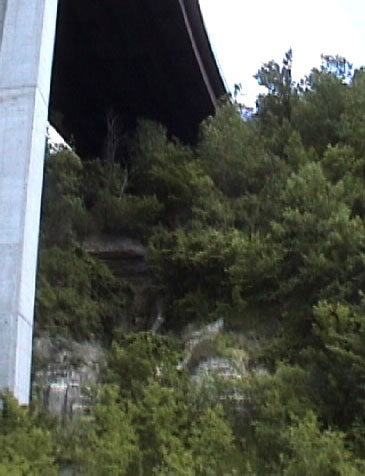
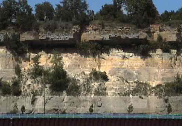
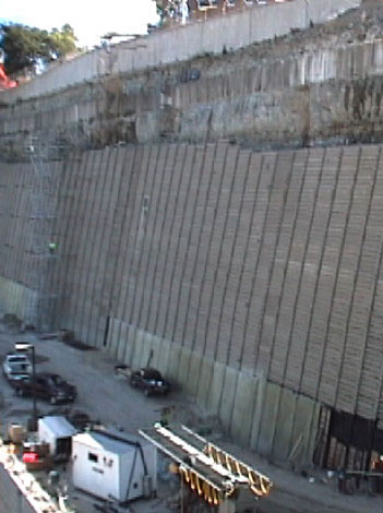
The photo below is a few miles north of this point looking across the river from the St. Paul Airport. Notice how the more weather resistant Glenwood Shale stands out like a roof over the easily eroded St. Peter Sandstone. I saw more of the same formations at Lock & Dam #1, just below Ford Parkway but if you want to see it you might have to hurry. When I was there a concrete wall was being put in place to slow down the erosion of the cliff. See the bottom right photo. |
 |
 |
 |
1. Ojakangas, Richard W. & Matsch, Charles L.; Minnesota's
Geology, 1982, pp 112-114.
2. Ojakangas, Richard W. & Matsch, Charles L.; Minnesota's
Geology, 1982, pp 6-69 and display at Fort Snelling
Park
Visitor Center.


