
 |
The area of land covered by Lake Agassiz is now drained by the Red River of the North that runs into Hudson Bay in northeast Canada. Warren Upham (as in Glacial Lake Upham) wrote a book about Glacial Lake Agassiz that is now being placed on line by the University of North Dakota. In the winter of 1996-97 there was an unusually large amount of snow fall (at least in the recorded times of modern man, which spans only about 125 years) for Minnesota, the Dakotas and Canada. In the April of 1997 unusually warm temperatures and a heavy spring rain caused rapid melting of the snow in northwestern Minnesota and eastern North Dakota. The ice on the Red River in Canada had not melted to allow the meltwater of the snowcap to flow downstream. The result was a great "flood" that has spawned many books and websites as well as renewed interest in the region. |
| This set of photos
was taken
on April 16, 1997, about two weeks after the crest of the flood.
I titled this page "Lake Agassiz Returns" because the water was high
enough
at the south end of old Lake Agassiz
that some of the meltwater started to breach the natural dam near
Wheaton.
Until the water could break through the ice and flow into Lake Winnipeg
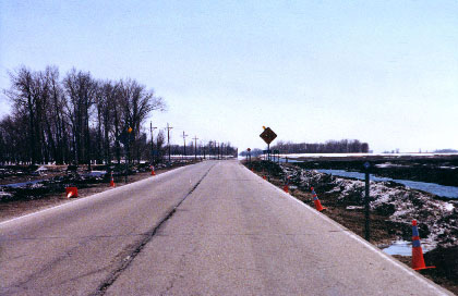
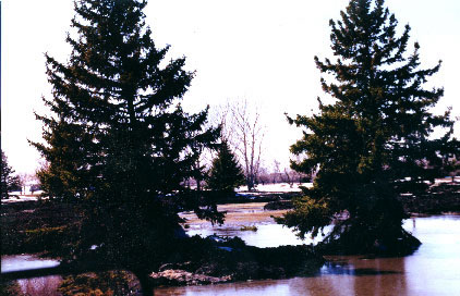
much of the old lake bed was covered with water. All three of these photos were taken from the same location between the towns of Ada and Borup on MN Highway 9. The photo at the right is looking west toward the Red River that is about 23 miles away. The only ground in the 23 miles to the west that is above water are dikes and roadways. The photo below left is looking north on Highway 9. This highway had 3 to 4 feet of water over it. Imagine where the "shore" of this lake must be. The photo below right is looking east toward Detroit Lakes or more correctly Fertile. The red arrow points to the old shore beaches of Lake Agassiz. Some of those beaches are now classified as the Scientific and Natural Area of Lake Agassiz Dunes. |
 |
 |
 |
 |
The photos at the
left are of
the Ada golf course just south of the town of Ada. The structure
at the left is actually a full sized gazebo. The entire golf
course
was covered with about 3 feet of mud and snow. The house in the photo below made the front page of the Minneapolis Star Tribune newspaper. It is in the city of Ada, a city that had not flooded for over 50 years. The water level went from curb height to about halfway up the garage doors in about 30 minutes in the middle of the night. Many people didn't have time to get out much less pack up any possessions. The wood sign at the end of the driveway says "Yard Sale - everything free". |
 |
 |


