
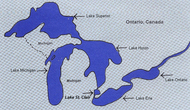
Lake St. Clair is sometimes referred to as the "sixth Great Lake". A vital shared resource between the United States and Canada, it is one of the most heavily used portions of the Great Lakes, providing a wide range of ecological, recreational and commercial benefits to those who live around its shores.
The lake is approximately 26 miles long and 24 miles wide, with a surface area of 430 square miles and 130 miles of shoreline. Yet despite its relatively small size, it accounts for a third of the entire great lakes sport fishing catch each year and nearly half the entire Great Lakes sport fishing effort. More than 150,000 boats are registered on the U.S. side of Lake St. Clair, where boating-related activities pump an estimated $260 million into the local economy each year.
Some five million people receive their drinking water from the lake, which also hosts an impressive array of wildlife. The St. Clair River delta, located at the northern end of the lake, provides an important habitat for fish and migrating waterfowl. The largest coastal delta in the Great Lakes system, it contains the majority of the lake's remaining wetlands.
Lake St. Clair is also a crucial link in the Great Lakes-St. Lawrence transportation system. On average, commercial vessels pass through the lake some 3,000 times a year, using the shipping channel dredged through the center of the lake.
The lake is relatively shallow, with an average depth of about 10 feet. As a result, the lake's water is completely exchanged every five to seven days. About 97 percent of the water entering Lake St. Clair comes from the St. Clair River, with the rest provided by the Clinton River on the U.S. side and the Sydenham and Thames rivers on the Canadian side.
Despite its importance, the lake has not received the same attention as the five larger Great Lakes. Indeed, resource management plans are in place for the five Great Lakes and even for many of their tributary rivers with significant pollution problems, including the St. Clair, Clinton and Detroit rivers. Until recently , though, Lake St. Clair was largely left out of such programs, leading some to consider it the "forgotten lake".
In recent years, severe pollution and other problems have drawn attention to Lake St. Clair, a groundswell of local activism to the threats it faces. Urban sprawl, sewer overflows and invasive species have severely affected the lake. Dangerous levels of bacterial contamination along the shores have resulted in beach closures and other public health concerns, while zebra mussels and other invaders threaten native species and sometimes cause physical damage through their sheer numbers.
Beginning with the 1997 Macomb County Blue Ribbon Commission on Lake St. Clair, local activism has demanded action to address problems affecting the lake. As a result, citizen-led water quality boards have been formed in Macomb and St. Clair counties and numerous other activities are underway to monitor water quality in the lake, identify pollution sources and coordinate government environmental programs.
Responding to local concerns, Congress has authorized the development of a comprehensive management plan for Lake St. Clair and the St. Clair River. The plan will evaluate environmental stresses and develop recommendations to restore and protect the two bodies of water. It is being developed by the U.S. Army Corps of Engineers, the Great Lakes Commission and a binational coalition of U.S. and Canadian agencies, citizens groups and other parties. To be finalized in late 2002, the plan will integrate existing efforts into a cohesive, ecosystem-based framework.
Lake St. Clair has always been a treasured natural resource for the residents of southeast Michigan and southwest Ontario. Efforts at all levels of government are now elevating the lake's profile in the region. As a result, the "sixth Great Lake" is no longer the "forgotten lake"!
- - - - - - - - - - - - - - - - - - - - - - - GENERAL FACTS - - - - - - - - - - - - - - - - - - - - - - -
Size and Dimensions: Approximately 430 sq. miles. Generally heart-shaped with an East-West dimension of 23.4 miles. Average depth is 10 ft; deepest depth is 19 ft. except for shipping channel which is 27-29ft.
Location: On international boundary, between Canada and The United States. Northeast of Detroit and North of Windsor. Between Lake Huron and Lake Erie. Macomb County on west and Province of Ontario on east.
Hydrology: Flow-through lake. 97% of inflow from St. Clair River. Average water residence time nine days but ranges from 2 to 30 days. Water flow favors filter feeders (zebra mussels), and plants that take nutrients out of the bottom sediments.
Water Quality: Generally the water has a cool temperature, oxygen rich with a high PH. Monthly temperatures range from 33 degrees Fahrenheit in Jan-Feb to 75 degrees Farhrenheit in Jul-Aug. Water along shorelines and wetlands is much warmer. Dissolved oxygen near saturation throughout the year.
Nutrient Status: Now believed to be oligotrophic to mesotrophic with small areas slightly eutrophic. Lake St. Clair is very low in nutrients with phosphorus levels being very low also. Nutrient inputs are from St. Clair River, Thames River, Clinton River, as well as CSOs, stormwater drains, and small creeks.
Submersed Aquatic Plants: Aquatic Plants have always been present in Lake St. Clair. Small quantities of plant material on beaches in past, however, in Jul-Aug 1994, rafts of floating Elodea Canadensis (waterweed) were discovered. The most prevalent aquatic plants in Lake St. Clair are Valisneria American (wild celery) and macroalgae (chara) with about a dozen additional species of native vascular plants present. Aquatic plants provide critical spawning habitat.
Zebra Mussels: First reported in Lake St. Clair in 1988, however, probably introduced from ballast water in 1986. When water temperature is at 10 degrees Celsius or above adult zebra mussels can filter 1.46 liters of water per day. Zebra mussel density in the lake has dropped very dramatically in the last five or six years due to a number of things, including very significant predation by fish.
Back to Home Page
