|
PARKS FEATURED:
Angeline Conservation Area, Ozark National Scenic Riverways,
Current River Conservation Area,
Blue Spring Natural Area,
Alley Spring, Watercress Spring,
Rocky Creek,
Sunklands
|
|
Ozark National Scenic Riverways
134 miles, Current and Jacks Fork Rivers
Jacks Fork Natural Area
Prairie Hollow Gorge Natural Area
Van Buren. 573-323-4236
Current River Conservation Area
Blue Springs Natural Area
Angeline Conservation Area
|
Ozark National Scenic Riverways
Shannon/Dent Counties. Van Buren. 573-323-4236
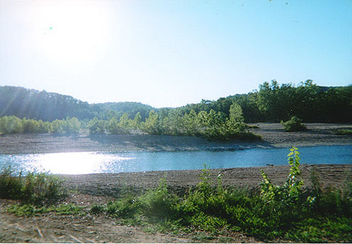 Missouris largest National Park Service area. 134 miles of the Current and Jacks Fork Rivers. Offers fishing, canoeing, hiking, camping, hiking.
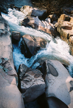
The Current River is the most spring fed of the Ozark rivers. There are numerous springs and caves. The river can be floated year round, three hours to seven days.
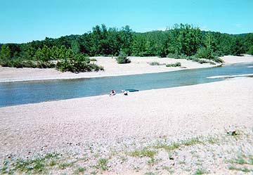
Jacks Fork River is a 44 mile long narrow winding stream flowing through a deep vallley, nearly a canyon in its scenic beauty. The Upper Jack Forks River section is from the Prongs to Alley Spring, and is the most primitive part of the river. The Alley Spring section of the river is floatable until early June, before low water conditions.
Return to Top
Current River Conservation Area
Return to Top
Blue Spring Natural Area
Return to Top
Angeline Conservation Area
North of Eminance to Summersville, accessed by Highway 19 and 106 or Highway D.
The 38,820 acre area consists of the combination of Alley Spring, Flat Rock and Clow conservation areas.
Areas of interest inlcude scenic overlook on highway 19, Flat Rock Lookout Tower and Lick Hog Hollow Nature Trail (.7-mile trail), and Pipestem Hollow, Spurgeon Hollow Natural Areas.
Pipestem Hollow Natural Area is 217 acres and features caves (15), and dolomite cliffs from 50 to 80 feet rising up along both sides fo the narrow hollow. Springs flow through the rocky bed of the stream that is responsible for the formation of the pipestem hollow.
Spurgeon Hollow Natural Area is 96 acres with dolomite glades and woodlands. This area is a fine example of the habitat in the lower ozarks. The plant life and wildlife on the glades or rocky meadows is diverse.
Return to Top
Watercress Spring Natural Area
Blair Creek Raised Fen Natural Area
Overcup Oak Sink Natural Area
Marg Pond Natural Area
Return to Top
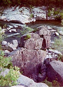
Rocky Creek Natural Area
Powder Mill Cave & Mill Mountain Natural Area
Return to Top
|