

(1920-July 1, 2003)
NORTH End: Green Street, Keota, Keokuk County
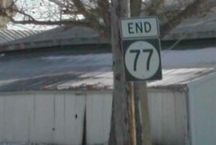
Facing east, but heading north, on 77
Photo by Neil Bratney
The observant may notice that on the Iowa map, 77 appears to continue east from Keota to the Washington County line. This is correct. Neil writes, "Washington Avenue ends a few feet ahead of this, and you can turn left [on the line to get to] Washington County G26."
That road you would turn left on is also the most flagrant violator of the Iowa county road numbering system. For three miles, between IA 92 and G26, one mile east of W15, the north-south county road is labeled V15! Since V61 is five miles west, and W38 six miles east, this designation is completely odd and out of place. The correct number would be W16.
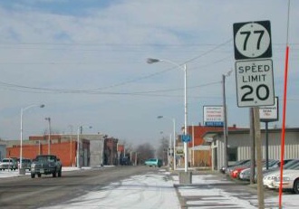
Facing west, but heading south, on 77
Photo by Neil Bratney
Highway 77's east-west portion may be due to the fact that Keota's main street (Washington Avenue) runs east and west. This is the first sign heading "south".
*Original Number, Original End*
SOUTH End: Stop sign, IA 92 and W15, Keokuk County
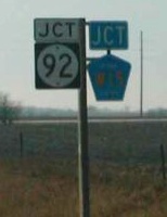
Facing south on 77
Photo by Neil Bratney
Neil reports that there is no "End"sign. Until 1980, 77 met the next road up (78) 11 miles south of here, but someone got carried away; the 1981 map mysteriously removed the highway entirely! This is one of the few, if not the only, routes that started out as a regular highway and ended as a simple spur.

Facing east on 92
Post-decommissioning, "Jct W15 <->" appeared before LGSs in each direction, and the 92 shields (see below) were removed.
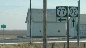
Facing east on 92
Photo by Neil Bratney
In the same direction in 2002, there weren't any signs for W15.
Last seen: 2003

Pictures by Neil Bratney: First-third and fifth, 1/20/02
Fourth picture by me: 10/29/04
Page created 3/22/02; last updated 11/15/04
