

(February 14, 1933-Late 1980)
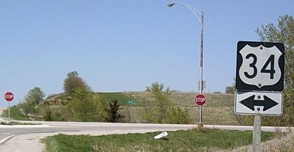
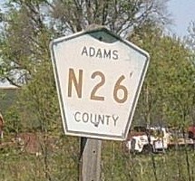
NORTH End: Stop sign, US 34, Adams County
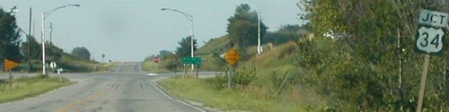
Facing north on 155 - 2002
Photo by Neil Bratney
While IA 155 always ended at US 34, it didn't always end at the same place. When a long new alignment of 34 was completed in 1965, the northern third of the route was lopped off (up to what is now H34).
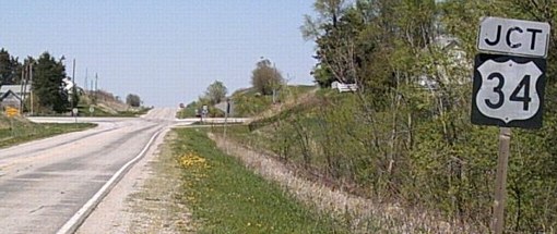
Same view, 2006
Photo by Jason Hancock
Since Neil's pictures here, the mileage sign and mile markers, plus two streetlights, have been removed.
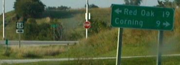
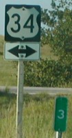
Facing north on 155
Photos by Neil Bratney
Although 155 was supposedly decommissioned in 1980, it shows up on the 1981 map. For the next 20 years, mile markers and DOT-style signage appeared at the north end, including the split of "Jct" and double-arrow assemblies.
Facing north on 155 - 2006
Photo by Jason Hancock
Only one streetlight remains here, which is more typical of county road intersections.

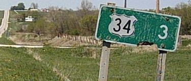
Facing west on 34
On the 1965 stretch of US 34 between Hastings and Corning, there are quite a few three-lane segments, generally approaching hills. At one time, the idea was eventually to make 34 a four-lane road.
Facing west on 34
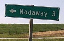
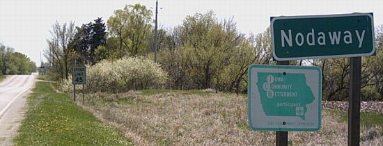
SOUTH End: Nodaway, Adams County
Facing south on 155
Photo by Jason Hancock
The speed limit sign in the background dates back to 155's time as a state highway, though the city sign in the foreground may not.

Photo by Neil Bratney
Small towns. Gotta love 'em.
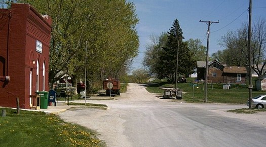
Facing west, but headling south, on 155
Photo by Jason Hancock
Jacon writes, "I followed the remaining mile markers into Nodaway, but noticed a pavement change one block north of where the mile markers count down to. Thus, the south end was most likely here, in what passes for Nodaway's business district. IA 155 followed 8th Avenue for one block to end here at '3rd Street and Byerley.'" The post office is the brick building at left.
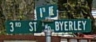
Sign at intersection
Photo by Jason Hancock
When Jason said the intersection was "3rd Street and Byerley," he wasn't kidding.
Facing north on 155
Photos by Jason Hancock
Last seen: 1980 (1981 map)

This map shows three things: 1) IA 95; 2) IA 155, decommissioned in 1980 but still on the map; and 3) the break in US 34's mileage, incorrect for the first time, at old IA 186 to Prescott, still there through the 2002 map. The presence of 155 here, like about 10 other highways, may indicate the transfer of jurisdiction occurred after October 1980.
Pictures by Neil Bratney: First, third, fourth, and ninth, 9/2/02
Pictures by Jason Hancock: Second, fifth-eighth, and tenth-thirteenth, 4/23/06
Page created 11/28/02; last updated 3/25/07
