

(1938-July 1, 2003)
NORTH End: 4-way stop, Main St., Spragueville, Jackson County
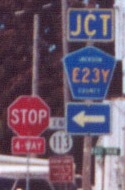
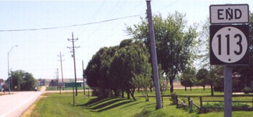
Facing north on 113
Photos by Jason Hancock
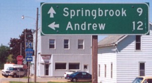
Both towns listed on the LGS are reached only by gravel roads from here. In fact, the road to Springbrook (Z20, also see below) isn't even on the Iowa map, but that became 113's new designation. County Road E23Y - a very rare four-character highway - becomes paved halfway to Andrew at the Maquoketa River.
Street Atlas and DeLorme seem to indicate that these two streets are the only ones in Spragueville at all. That makes sense when you find out that the population of Spragueville is 89 - or about 7 and a half people per letter. ;-)
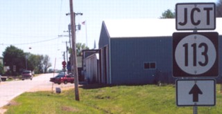
Facing south on Z20
Photo by Jason Hancock
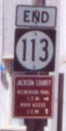
SOUTH End: Stop sign, IA 64, Jackson County
Facing south on 113
Photo by Jason Hancock
Highway 113 was the easternmost spur in Iowa.
Last seen: 2003

All pictures by Jason Hancock: 5/21/02
Page created 7/21/02; last updated 1/10/04
