
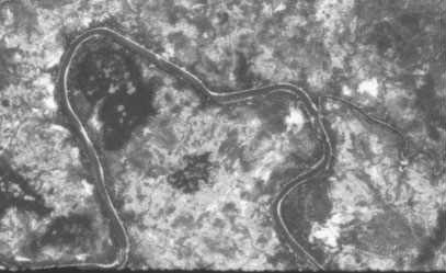
This photo is from declassified US national satellite imagery taken 23 days after the incident. KH-4A, Mission 1049, Pass 119, Aft Camera fortuituously took this photo from 100 miles altitude. The weather was unusually clear over South Laos. This photo allowed me to orient the low level hand held photos that I took on 27 November from the CASI Baron. In doing so I determined the correct the crash site coordinates. I enhanced the original image for better viewing. (Copyright Thomas E. Lee 1999-2004)
|
