
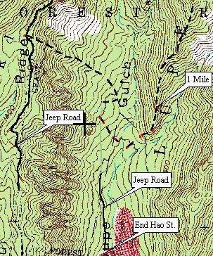
These two maps show the route I took with the larger group. We went in the counter clock-wise direction, up the old jeep road from Hao St. At one point the road color changes from black to green. The green portion is a guess as I took no readings until we turned right off the road where the dashed line begins. The mile reading are ATCF (as the crow flies) as the GPS can not measure miles traveled up and down hills.
 |
 |
